Plan your visit
Getting here
51.05325, -1.56137
Visiting this summer
Seasonal nature notes and what to look for now
Visiting this summer
Seasonal nature notes and what to look for now
- ☀️June — canopy now fully closed, creating cool dappled shade even on warm days
- 🐕Early mornings are best for dog walks in summer — visit before 9am to avoid the heat and find quieter trails
- 🅿️Spearywell 331m away — 8 car parks within reach
🌤️ Visiting this summer
- ☀️June — canopy now fully closed, creating cool dappled shade even on warm days
- 🐕Early mornings are best for dog walks in summer — visit before 9am to avoid the heat and find quieter trails
- 🅿️Spearywell 331m away — 8 car parks within reach
Good to know
- £Free to visit — no entry charge
- 🐕Dogs welcome
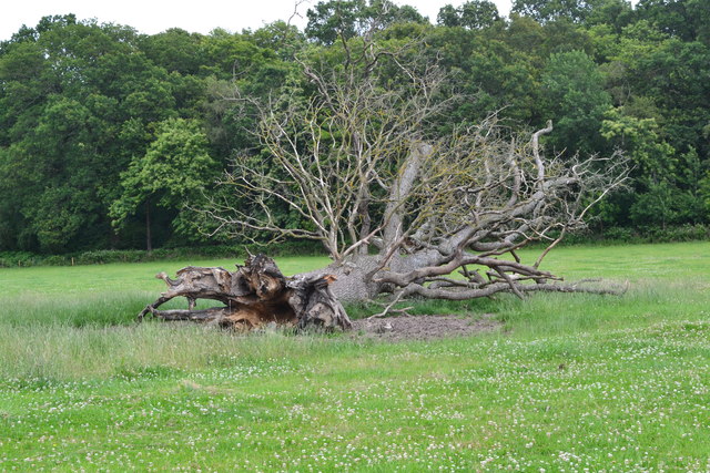
- 🌿Ancient woodland — rare wildlife habitat
- 🌳Large woodland — room to roam
Best for
Wildlife
Very strong match
Multi-group wildlife — Birds, Mammals, Reptiles; Multi-group wildlife — Birds, Mammals, Reptiles
Bird watching
Very strong match
Birds — Chaffinch, Blackbird, Wren +64 more · last seen 2025; Birds — Chaffinch, Blackbird, Wren +64 more · last seen 2025
Seasonal nature
Strong match
Ancient woodland — bluebells, fungi and autumn colour
Insect spotting
Strong match
Lowland meadows — marbled white, meadow brown and pollinating insects; Insects — Meadow Brown, Speckled Wood, Gatekeeper +32 more · last seen 2025
Dog walks
Strong match
Dogs allowed — public woodland
Foraging
Good match
Deciduous woodland — fungi, berries and wild garlic
Trails nearby
Within roughly 5 km🚶Walking
5 signed routes nearby · 46 public paths nearby
Signed route nearbyPublic paths
Walking
Test WayWalking route
Monarch's WayWalking route990 km
approximate route of Charles II's escape
Clarendon WayWalking route
Winchester to Salisbury
Mottisfont Estate Walk, MottisfontWalking route9.1 km
A varied walk through ancient woodlands & historic farmland & part of the Test Way. The route is designed to be walked anti-clockwise, but is waymarked in both directions. Some uneven terrain & country roads with potential livestock in places.
PAWS Woodland Walk, MottisfontWalking route1.8 km
Water Lanepublic footpath · 134 m
Keepers Lanepublic footpath · 174 m
Ruts (unavoidable, 0.21) and camber present.
Keepers Lanepublic footpath · 104 m
🚴Cycling
42 signed routes nearby
Signed route nearby
Cycling
Route 24Cycling route
National BywayCycling route
Mottisfont Estate Cycle Paths Loop ShortCycling route
Mottisfont Estate Cycle Loop Easy LinkCycling route
Route 246Cycling route
Test Way Cycle routeCycling route
https://www.hants.gov.uk/thingstodo/countryside/cycling/testway
🚵Mountain biking
3 signed routes nearby
Signed route nearby
Mountain biking
Danebury Off-Road Cycle TrailMountain bike route
A strenuous 24 miles that takes in some of Hampshire’s finest scenery. This cycle route joins easy sections of the Test Way with the steeper gradients of the Broughton Downs.
King Alfred's WayMountain bike route
King Alfreds Way is 350km (220 miles) off road route designed to be ridden clockwise. It starts & ends in Winchester. It is suitable for gravel or cross-country bikes.
Mottisfont Estate Cycle Paths Loop LongMountain bike route
Wildlife to spot
Photos
Weather for this location
Loading local forecast…
Nearby places
Useful places within 5 km
How was your visit?
How useful was the information on this page?
id: af109617-940f-43fe-a33f-021c3f5346a8