Plan your visit
🦉 Wildlife🦅 Birds🦋 Insects
Public access Free entry Dogs welcome
Places › England › East Midlands › Lincoln Getting here
53.23722, -0.53125
Open directionsv Visiting this summer
Seasonal nature notes and what to look for now
▾ 🌞 Midsummer — early morning visits most comfortable; look for deer fawns in quieter clearings 🐕 Early mornings are best for dog walks in summer — visit before 9am to avoid the heat and find quieter trails 🅿️ Parking 100m away — 20 car parks within reach 🌤️ Visiting this summer
🌞 Midsummer — early morning visits most comfortable; look for deer fawns in quieter clearings 🐕 Early mornings are best for dog walks in summer — visit before 9am to avoid the heat and find quieter trails 🅿️ Parking 100m away — 20 car parks within reach £ Free to visit — no entry charge🐕 Dogs welcome🦉 Wildlife
Very strong match
Multi-group wildlife — Amphibians, Birds, Mammals; Multi-group wildlife — Amphibians, Birds, Mammals
Free
🦅 Bird watching
Very strong match
Birds — Mute Swan, Woodpigeon, Blackbird +58 more · last seen 2026; Birds — Mute Swan, Woodpigeon, Blackbird +58 more · last seen 2026
Free
🦋 Insect spotting
Strong match
Insects — 7-spot Ladybird, 14-spot Ladybird, Dark-edged Bee-fly +78 more · last seen 2026; Insects — 7-spot Ladybird, 14-spot Ladybird, Dark-edged Bee-fly +78 more · last seen 2026
Free
🍂 Seasonal nature
Strong match
Plants — Red Valerian, Floating Pennywort, Yellow Corydalis +73 more · last seen 2026; Plants — Red Valerian, Floating Pennywort, Yellow Corydalis +73 more · last seen 2026
Free
Dogs allowed with public access
Free
Named cycling route nearby: Route 1
Varies
Trails nearby Within roughly 5 km 5 signed routes nearby · 7 public paths nearby
Signed route nearby Public paths
Viking Way (Barnetby to Whitwell) Walking route ▾
Named route Regional walking route
Show on map Stephen Langton Trail Walking route ▾
Named route Regional walking route
Show on map Steep Hill Walking route ▾
Named route Incline 14%
Show on map Fossdyke Canal Trail Walking route ▾
Named route Regional walking route
Show on map Spires and Steeples Trail Walking route ▾
Named route Regional walking route
Show on map Greestone Stairs public footpath · 2 m ▾
Public path public footpath Length 2 m Surface paving_stones Path type: footway
Show on map Greestone Stairs public footpath · 8 m ▾
Public path public footpath Length 8 m Surface paving_stones Path type: steps
Show on map The Cinder Track public footpath · 414 m ▾
Public path public footpath Length 414 m Surface asphalt Path type: footway
Show on map 69 signed routes nearby
Signed route nearby
Lincoln - Saxilby Cycle Path Cycling route ▾
Named route Local cycle route
Show on map Lincoln Eastern Bypass NMU path Cycling route ▾
Named route Local cycle route
Show on map Route 1 Cycling route ▾
NCN 1 Lincoln to Humber
Named route Ref 1 National Cycle Network
Show on map North Hykeham Relief Road / Lincoln Southern Bypass NMU Route Cycling route ▾
Named route National Cycle Network
Show on map Lincoln to Branston cycle path Cycling route ▾
Named route Local cycle route
Show on map Hawthorn Road Cycle Path Cycling route ▾
Named route Local cycle route
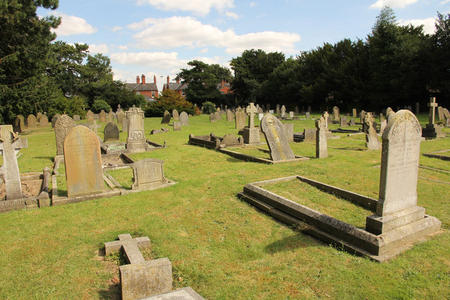
Show on map Photos St.Peter-in-Eastgate cemetery
‹ ›
Weather for this location Next 14 days Nearby places Useful places within 5 km
All Historic
Own or manage this place?
Claim this listing to keep details accurate, add photos, and highlight what makes it special — free.
Claim this page→ How useful was the information on this page?
id: 3de7f5c7-152e-40a6-9620-b3f332f3d245
UK green spaces mapped from open public data — so anyone can find the woodland, trail, or nature reserve closest to them.
© 2026 Glade · Made with care for UK green spaces
Wildlife to spot
19,944 records · National Biodiversity Network
▾
Wildlife to spot 19,944 records · National Biodiversity Network 🐦 Birds 45 species
summer autumn
2026 ▾
Grey Heron · Magpie · Moorhen · Mute Swan · Blackbird +40
Grey Heron Ardea cinerea Magpie Pica pica2025 Moorhen Gallinula chloropus Mute Swan Cygnus olor Blackbird Turdus merula2025 Black-headed Gull Chroicocephalus ridibundus2025 Mallard Anas platyrhynchos Woodpigeon Columba palumbus2025 Rock Dove Columba livia2025 Great Tit Parus major2025 Starling Sturnus vulgaris2025 Blue Tit Cyanistes caeruleus Canada Goose Branta canadensis Greenfinch Chloris chloris Long-tailed Tit Aegithalos caudatus2025 Goldfinch Carduelis carduelis2025 Collared Dove Streptopelia decaocto2025 Carrion Crow Corvus corone2025 Pied Wagtail Motacilla alba yarrellii2025 Cormorant Phalacrocorax carbo2025 Swallow Hirundo rustica2025 Blackcap Sylvia atricapilla Tawny Owl Strix aluco2025 Herring Gull Larus argentatus2025 Dunnock Prunella modularis2025 Jackdaw Coloeus monedula2025 Common Gull Larus canus2025 Jay Garrulus glandarius2025 Little Egret Egretta garzetta2025 Robin Erithacus rubecula2025 Pink-footed Goose Anser brachyrhynchus2025 Grey Wagtail Motacilla cinerea2025 Coal Tit Periparus ater2025 Sand Martin Riparia riparia2025 Treecreeper Certhia familiaris2025 Swift Apus apus2025 Bullfinch Pyrrhula pyrrhula2025 House Sparrow Passer domesticus2025 Chiffchaff Phylloscopus collybita2025 Lesser Black-backed Gull Larus fuscus2025 Whitethroat Curruca communis2025 Linnet Linaria cannabina2025 Pheasant Phasianus colchicus2025 Wren Troglodytes troglodytes2025 Reed Bunting Emberiza schoeniclus2025 🐸 Amphibians 2 species
winter autumn
2026 ▾
Common Frog · Smooth Newt
Common Frog Rana temporaria Smooth Newt Lissotriton vulgaris 7-spot Ladybird · Dark-edged Bee-fly · Eristalis tenax · Green Shieldbug · Xanthogramma pedissequum +28
7-spot Ladybird Coccinella septempunctata Dark-edged Bee-fly Bombylius major Eristalis tenax Eristalis tenax Green Shieldbug Palomena prasina2025 Xanthogramma pedissequum Xanthogramma pedissequum2025 Syritta pipiens Syritta pipiens2025 Traveller's-joy · Butterfly-bush · Primrose · Garden Grape-hyacinth · Alexanders +35
Traveller's-joy Clematis vitalba2025 Butterfly-bush Buddleja davidii2025 Primrose Primula vulgaris Garden Grape-hyacinth Muscari armeniacum Alexanders Smyrnium olusatrum Lungwort Pulmonaria officinalis Species observations from the last 10 years via NBN Atlas
14-spot Ladybird Propylea quattuordecimpunctata2025
14-spot Ladybird Propylea quattuordecimpunctata2025
Helophilus pendulus Helophilus pendulus2025
Helophilus pendulus Helophilus pendulus2025
Sphaerophoria Sphaerophoria2025
Sphaerophoria Sphaerophoria2025
Scaeva pyrastri Scaeva pyrastri2025
Scaeva pyrastri Scaeva pyrastri2025
Marmalade Hoverfly Episyrphus balteatus2025
Marmalade Hoverfly Episyrphus balteatus2025
Syrphus Syrphus2025
Syrphus Syrphus2025
Blue-tailed Damselfly Ischnura elegans2025
Blue-tailed Damselfly Ischnura elegans2025
Cytilus sericeus Cytilus sericeus
Cytilus sericeus Cytilus sericeus
Cartodere bifasciata Cartodere bifasciata
Cartodere bifasciata Cartodere bifasciata
Varied Carpet Beetle Anthrenus verbasci
Varied Carpet Beetle Anthrenus verbasci
Cabbage Stem Weevil Ceutorhynchus pallidactylus
Cabbage Stem Weevil Ceutorhynchus pallidactylus
Sylvicola Sylvicola
Sylvicola Sylvicola
Meliscaeva auricollis Meliscaeva auricollis2025
Meliscaeva auricollis Meliscaeva auricollis2025
Box Bug Gonocerus acuteangulatus2025
Box Bug Gonocerus acuteangulatus2025
24-spot Ladybird Subcoccinella vigintiquattuorpunctata2025
24-spot Ladybird Subcoccinella vigintiquattuorpunctata2025
Hawthorn Shieldbug Acanthosoma haemorrhoidale2025
Hawthorn Shieldbug Acanthosoma haemorrhoidale2025
Field Grasshopper Chorthippus brunneus2025
Field Grasshopper Chorthippus brunneus2025
Hornet Hoverfly Volucella zonaria2025
Hornet Hoverfly Volucella zonaria2025
Cerobasis guestfalica Cerobasis guestfalica2025
Cerobasis guestfalica Cerobasis guestfalica2025
Coenosia tigrina Coenosia tigrina2025
Coenosia tigrina Coenosia tigrina2025
Barberry Fusehorn Arge berberidis2025
Barberry Fusehorn Arge berberidis2025
Adonis' Ladybird Hippodamia variegata2025
Adonis' Ladybird Hippodamia variegata2025
Cream-streaked Ladybird Harmonia quadripunctata2025
Cream-streaked Ladybird Harmonia quadripunctata2025
16-spot Ladybird Tytthaspis sedecimpunctata2025
16-spot Ladybird Tytthaspis sedecimpunctata2025
Turnip Tigress Athalia rosae2025
Turnip Tigress Athalia rosae2025
Polydrusus formosus Polydrusus formosus2025
Polydrusus formosus Polydrusus formosus2025
Water Scorpion Nepa cinerea2025
Water Scorpion Nepa cinerea2025 Cleavers
Cleavers
Galium aparine
Galium aparine
Lesser Celandine Ficaria verna
Lesser Celandine Ficaria verna
Dune Thread-moss Bryum dichotomum
Dune Thread-moss Bryum dichotomum
Whitish Feather-moss Brachythecium albicans
Whitish Feather-moss Brachythecium albicans
Field Forklet-moss Dicranella staphylina
Field Forklet-moss Dicranella staphylina
Crescent-cup Liverwort Lunularia cruciata
Crescent-cup Liverwort Lunularia cruciata
Yellow Feather-moss Homalothecium lutescens
Yellow Feather-moss Homalothecium lutescens
Redshank Ceratodon purpureus
Redshank Ceratodon purpureus
Streblotrichum convolutum var. commutatum Streblotrichum convolutum var. commutatum
Streblotrichum convolutum var. commutatum Streblotrichum convolutum var. commutatum
Heath Star Moss Campylopus introflexus
Heath Star Moss Campylopus introflexus
Bird's-claw Beard-moss Barbula unguiculata
Bird's-claw Beard-moss Barbula unguiculata
White-tipped Bristle-moss Orthotrichum diaphanum
White-tipped Bristle-moss Orthotrichum diaphanum
Cylindric Beard-moss Didymodon insulanus
Cylindric Beard-moss Didymodon insulanus
Sand-hill Screw-moss Syntrichia ruraliformis
Sand-hill Screw-moss Syntrichia ruraliformis
Sand Feather-moss Brachythecium mildeanum
Sand Feather-moss Brachythecium mildeanum
Springy Turf-moss Rhytidiadelphus squarrosus
Springy Turf-moss Rhytidiadelphus squarrosus
Hornschuch's Beard-moss Pseudocrossidium hornschuchianum
Hornschuch's Beard-moss Pseudocrossidium hornschuchianum
Fern-leaved Hook-moss Cratoneuron filicinum
Fern-leaved Hook-moss Cratoneuron filicinum
Rough-stalked Feather-moss Brachythecium rutabulum
Rough-stalked Feather-moss Brachythecium rutabulum
Winter Heliotrope Petasites pyrenaicus2025
Winter Heliotrope Petasites pyrenaicus2025
Red Clover Trifolium pratense2025
Red Clover Trifolium pratense2025
Spindle Euonymus europaeus2025
Spindle Euonymus europaeus2025
Yellow-flowered Strawberry Potentilla indica2025
Yellow-flowered Strawberry Potentilla indica2025
White Ramping-fumitory Fumaria capreolata2025
White Ramping-fumitory Fumaria capreolata2025
Yellow Corydalis Pseudofumaria lutea2025
Yellow Corydalis Pseudofumaria lutea2025
Yarrow Achillea millefolium2025
Yarrow Achillea millefolium2025
Mugwort Artemisia vulgaris2025
Mugwort Artemisia vulgaris2025
Common Ragwort Jacobaea vulgaris2025
Common Ragwort Jacobaea vulgaris2025
Field Maple Acer campestre2025
Field Maple Acer campestre2025
Wood Avens Geum urbanum2025
Wood Avens Geum urbanum2025
Greater Plantain Plantago major2025
Greater Plantain Plantago major2025
Wild Cherry Prunus avium2025
Wild Cherry Prunus avium2025
Purple Toadflax Linaria purpurea2025
Purple Toadflax Linaria purpurea2025
Herb-Robert Geranium robertianum2025
Herb-Robert Geranium robertianum2025 Events & activities nearby Switch provider to compare local events, tours and bookable activities.
Bookable tours GetYourGuide Promote here