🦉 Wildlife🍄 Fungi✦ Heritage
↑ Share
Public access Free entry Dogs welcome 0 ha
Places › England › West Midlands › Staffordshire Moorlands Getting here
53.08350, -1.99297
Open directionsv ✦ Scheduled Ancient Monument — Nationally protected archaeological site on the National Heritage List for England (NHLE). Scheduled monuments represent the best surviving examples of England's irreplaceable archaeological heritage.
Water well scheduled monument
Visiting this summer
Seasonal nature notes and what to look for now
▾ 🌞 Midsummer — early morning visits most comfortable; look for deer fawns in quieter clearings 🍄 Mushroom foraging is at its best in summer here 🐕 Dogs welcome — bring water in summer; the site has enough space to find shade on hot days 🌤️ Visiting this summer
🌞 Midsummer — early morning visits most comfortable; look for deer fawns in quieter clearings 🍄 Mushroom foraging is at its best in summer here 🐕 Dogs welcome — bring water in summer; the site has enough space to find shade on hot days £ Free to visit — no entry charge🐕 Dogs welcome🦉 Wildlife
Very strong match
Multi-group wildlife — Birds, Mammals; Multi-group wildlife — Birds, Mammals
Free
🍄 Mushroom foraging
Strong match
Fungi — Candlesnuff Fungus, Amanita Wridog, Spangle Waxcap +148 more · last seen 2025; Fungi — Candlesnuff Fungus, Amanita Wridog, Spangle Waxcap +148 more · last seen 2025
Varies
Historic site with public access
Free
🦅 Bird watching
Strong match
Birds — Great Tit, Blue Tit, Chaffinch +23 more · last seen 2025; Birds — Great Tit, Blue Tit, Chaffinch +23 more · last seen 2025
Free
Fungi — Oyster Mushroom, Jelly Ear, Wood Blewits +8 more foraging species; Deciduous woodland — fungi, berries and wild garlic
Varies
Dogs allowed with public access
Free
Trails nearby Within roughly 5 km 11 signed routes nearby · 12 public paths nearby
Signed route nearby Public paths
Habitat Walk Ladderedge Country Park (Green Arrows) Walking route ▾
Includes some hills
Named route Duration 45min
Show on map Young Woodland Loop Walking route ▾
Named route Local walking route
Show on map Churnet Way Walking route ▾
Valley Woodland Trail Walking route ▾
Named route Local walking route
Show on map Peak District Boundary Walk Stage 16 Walking route 18.1 km ▾
Named route Length 18.1 km Regional walking route
Show on map Bradnop and Cawdry 30 public footpath · 262 m ▾
Public path public footpath Length 262 m Surface compacted Path type: service
Show on map Bradnop and Cawdry 30 public footpath · 100 m ▾
Public path public footpath Length 100 m Surface compacted Path type: track
Show on map Bradnop and Cawdry 30 public footpath · 32 m ▾
Public path public footpath Length 32 m Surface grass Path type: service
Show on map 10 signed routes nearby
Signed route nearby
Route 559 Cycling route ▾
Named route Ref 559 National Cycle Network
Show on map National Route 550 Cycling route ▾
Named route Ref 550 National Cycle Network
Show on map Main Route Cycling route 170 m ▾
Named route Ref 559 Length 170 m National Cycle Network On-road Surface asphalt
Show on map Main Route Cycling route 3.7 km ▾
Named route Ref 559 Length 3.7 km National Cycle Network Traffic-free Surface unsealedfirm
Show on map Main Route Cycling route 1.2 km ▾
Named route Ref 559 Length 1.2 km National Cycle Network On-road Surface asphalt
Show on map Main Route Cycling route 302 m ▾
Named route Ref 559 Length 302 m National Cycle Network On-road Surface asphalt
Show on map 4 public paths nearby
Public paths
Bradnop and Cawdy 13(a) bridleway · 442 m ▾
Public path bridleway Length 442 m Path type: track
Show on map Bradnop and Cawdy 13(a) bridleway · 70 m ▾
Public path bridleway Length 70 m Path type: service
Show on map Bradnop and Cawdy 13(a) bridleway · 38 m ▾
Public path bridleway Length 38 m Surface grass Path type: service
Show on map Ashenhurst Lane bridleway · 424 m ▾
Public path bridleway Length 424 m Surface asphalt Path type: unclassified
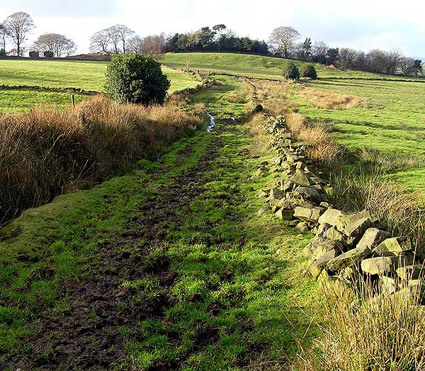
Show on map Photos Green Lane towards Egg Well
‹ ›
Weather for this location Next 14 days Nearby places Useful places within 5 km
Own or manage this place?
Claim this listing to keep details accurate, add photos, and highlight what makes it special — free.
Claim this page→ How useful was the information on this page?
Something wrong on this page?
id: 0f479007-9994-460f-bb9e-05b506caeb41
UK green spaces mapped from open public data — so anyone can find the woodland, trail, or nature reserve closest to them.
© 2026 Glade · Made with care for UK green spaces
Wildlife to spot
26,231 records · National Biodiversity Network
▾
Wildlife to spot 26,231 records · National Biodiversity Network Great Tit · Blue Tit · Chaffinch · Wren · Long-tailed Tit +21
Great Tit Parus major Blue Tit Cyanistes caeruleus Chaffinch Fringilla coelebs Wren Troglodytes troglodytes Long-tailed Tit Aegithalos caudatus House Sparrow Passer domesticus Robin Erithacus rubecula Blackbird Turdus merula Nuthatch Sitta europaea Carrion Crow Corvus corone Meadow Pipit Anthus pratensis Jay Garrulus glandarius Kestrel Falco tinnunculus Woodpigeon Columba palumbus Spotted Flycatcher Muscicapa striata Blackcap Sylvia atricapilla Chiffchaff Phylloscopus collybita Treecreeper Certhia familiaris Bullfinch Pyrrhula pyrrhula Magpie Pica pica Goldcrest Regulus regulus Jackdaw Coloeus monedula Goldfinch Carduelis carduelis Great Spotted Woodpecker Dendrocopos major Pied Flycatcher Ficedula hypoleuca Coal Tit Periparus ater Badger
Red-legged Shieldbug · Red Ant · Sericomyia superbiens
Red-legged Shieldbug Pentatoma rufipes Red Ant Myrmica rubra Sericomyia superbiens Sericomyia superbiens Candlesnuff Fungus · Amanita Wridog · Spangle Waxcap · Silver Leaf Disease · Oyster Mushroom +146
Candlesnuff Fungus Xylaria hypoxylon Amanita Wridog Amanita rubescens Spangle Waxcap Hygrocybe insipida Silver Leaf Disease Chondrostereum purpureum Oyster Mushroom Pleurotus ostreatus Yellowing Curtain Crust Stereum subtomentosum Fairy Inkcap Horsetail · Sneezewort · Rosebay Willowherb
Horsetail Equisetum Sneezewort Achillea ptarmica Rosebay Willowherb Chamaenerion angustifolium Species observations from the last 10 years via NBN Atlas
Coprinellus disseminatus
Coprinellus disseminatus
Yellowleg Bonnet Mycena epipterygia
Yellowleg Bonnet Mycena epipterygia
Sepia Pinkgill Entoloma jubatum
Sepia Pinkgill Entoloma jubatum
Wood Oysterling Deconica horizontalis
Wood Oysterling Deconica horizontalis
Common Grey Disco Mollisia cinerea
Common Grey Disco Mollisia cinerea
Meadow Waxcap Cuphophyllus pratensis var. pratensis
Meadow Waxcap Cuphophyllus pratensis var. pratensis
Puccinia ribis-pendulae Puccinia ribis-pendulae
Puccinia ribis-pendulae Puccinia ribis-pendulae
Torth Felen Hypholoma fasciculare
Torth Felen Hypholoma fasciculare
Warlock's Butter Exidia plana
Warlock's Butter Exidia plana
Jelly Ear Auricularia auricula-judae
Jelly Ear Auricularia auricula-judae
Crested Coral Clavulina coralloides
Crested Coral Clavulina coralloides
Bonet Odro Mycena galopus
Bonet Odro Mycena galopus
Glistening Inkcap Coprinellus micaceus
Glistening Inkcap Coprinellus micaceus
Scurfy Twiglet Tubaria furfuracea
Scurfy Twiglet Tubaria furfuracea
Orange Bonnet Mycena acicula
Orange Bonnet Mycena acicula
Wood Blewits Lepista nuda
Wood Blewits Lepista nuda
Waxy Crust Vuilleminia comedens
Waxy Crust Vuilleminia comedens
Shaggy Inkcap Coprinus comatus
Shaggy Inkcap Coprinus comatus
Mauve Bonnet Mycena meliigena
Mauve Bonnet Mycena meliigena
Hymenoscyphus vernus Hymenoscyphus vernus
Hymenoscyphus vernus Hymenoscyphus vernus
Wrinkled Crust Phlebia radiata
Wrinkled Crust Phlebia radiata
Yellowing Oysterling Crepidotus luteolus
Yellowing Oysterling Crepidotus luteolus
Wood Pinkgill Entoloma rhodopolium
Wood Pinkgill Entoloma rhodopolium
Parrot Waxcap Gliophorus psittacinus
Parrot Waxcap Gliophorus psittacinus
Herald Of Winter Hygrophorus hypothejus
Herald Of Winter Hygrophorus hypothejus
Trooping Funnel Infundibulicybe geotropa
Trooping Funnel Infundibulicybe geotropa
Flagelloscypha minutissima Flagelloscypha minutissima
Flagelloscypha minutissima Flagelloscypha minutissima
Brownedge Bonnet Mycena olivaceomarginata
Brownedge Bonnet Mycena olivaceomarginata
Blushing Rosette Abortiporus biennis
Blushing Rosette Abortiporus biennis
Deceiver Laccaria laccata
Deceiver Laccaria laccata
Violet Bramble Rust Phragmidium violaceum
Violet Bramble Rust Phragmidium violaceum
Coesyn Melfed Flammulina velutipes
Coesyn Melfed Flammulina velutipes
Scurfy Deceiver Laccaria proxima
Scurfy Deceiver Laccaria proxima
Pleated Inkcap Parasola plicatilis
Pleated Inkcap Parasola plicatilis
Ivory Bonnet Atheniella flavoalba
Ivory Bonnet Atheniella flavoalba
Mycoacia aurea Mycoacia aurea
Mycoacia aurea Mycoacia aurea
Phyllactinia mali Phyllactinia mali
Phyllactinia mali Phyllactinia mali
Larch Bolete Suillus grevillei
Larch Bolete Suillus grevillei
Microthyrium ciliatum Microthyrium ciliatum
Microthyrium ciliatum Microthyrium ciliatum
Diaporthe samaricola Diaporthe samaricola
Diaporthe samaricola Diaporthe samaricola
Artist's Bracket Ganoderma applanatum
Artist's Bracket Ganoderma applanatum
Hypoxylon intermedium Hypoxylon intermedium
Hypoxylon intermedium Hypoxylon intermedium
Bleeding Broadleaf Crust Stereum rugosum
Bleeding Broadleaf Crust Stereum rugosum
Orange Grisette Amanita crocea
Orange Grisette Amanita crocea
Birch Woodwart Jackrogersella multiformis
Birch Woodwart Jackrogersella multiformis
Yellow Mascara Disco Trichopeziza sulphurea
Yellow Mascara Disco Trichopeziza sulphurea
Blackfoot Polypore Polyporus leptocephalus
Blackfoot Polypore Polyporus leptocephalus
Amanita'r Gwybed Amanita muscaria
Amanita'r Gwybed Amanita muscaria
Rancid Bonnet Mycena olida
Rancid Bonnet Mycena olida
Oakbug Milkcap Lactarius quietus
Oakbug Milkcap Lactarius quietus
Peeling Oysterling Crepidotus mollis
Peeling Oysterling Crepidotus mollis
Chalara pteridina Chalara pteridina
Chalara pteridina Chalara pteridina
Ballerina Porpolomopsis calyptriformis
Ballerina Porpolomopsis calyptriformis
Hairy Curtain Crust Stereum hirsutum
Hairy Curtain Crust Stereum hirsutum
Frosty Bonnet Mycena tenerrima
Frosty Bonnet Mycena tenerrima
Chemical Knight Tricholoma stiparophyllum
Chemical Knight Tricholoma stiparophyllum
Arrhenia rickenii Arrhenia rickenii
Arrhenia rickenii Arrhenia rickenii
Pezicula acericola Pezicula acericola
Pezicula acericola Pezicula acericola
Common Earthball Scleroderma citrinum
Common Earthball Scleroderma citrinum
Small Stagshorn Calocera cornea
Small Stagshorn Calocera cornea
Hymenoscyphus scutula Hymenoscyphus scutula
Hymenoscyphus scutula Hymenoscyphus scutula
Crystal Brain Exidia nucleata
Crystal Brain Exidia nucleata
Lachnella villosa Lachnella villosa
Lachnella villosa Lachnella villosa
Birch Besom Taphrina betulina
Birch Besom Taphrina betulina
Tawny Funnel Paralepista flaccida
Tawny Funnel Paralepista flaccida
Blueing Bracket Postia subcaesia
Blueing Bracket Postia subcaesia
Elder Whitewash Xylodon sambuci
Elder Whitewash Xylodon sambuci
Drab Bonnet Mycena aetites
Drab Bonnet Mycena aetites
Fiery Milkcap Lactarius pyrogalus
Fiery Milkcap Lactarius pyrogalus
Ribbed Bell Galerina clavata
Ribbed Bell Galerina clavata
Inocybe obscuroides Inocybe obscuroides
Inocybe obscuroides Inocybe obscuroides
Blackening Waxcap Hygrocybe conica
Blackening Waxcap Hygrocybe conica
Coleosporium tussilaginis s. lat. Coleosporium tussilaginis s. lat.
Coleosporium tussilaginis s. lat. Coleosporium tussilaginis s. lat.
Coral Spot Nectria cinnabarina
Coral Spot Nectria cinnabarina
Wrinkled Club Clavulina rugosa
Wrinkled Club Clavulina rugosa
Hymenoscyphus menthae Hymenoscyphus menthae
Hymenoscyphus menthae Hymenoscyphus menthae
Brown Cup Rutstroemia firma
Brown Cup Rutstroemia firma
Willow Mildew Erysiphe adunca
Willow Mildew Erysiphe adunca
Common Cavalier Melanoleuca polioleuca
Common Cavalier Melanoleuca polioleuca
Earpick Fungus Auriscalpium vulgare
Earpick Fungus Auriscalpium vulgare
Mycena pseudocorticola Mycena pseudocorticola
Mycena pseudocorticola Mycena pseudocorticola
Bleeding Conifer Crust Stereum sanguinolentum
Bleeding Conifer Crust Stereum sanguinolentum
Birch Milkcap Lactarius tabidus
Birch Milkcap Lactarius tabidus
Frosty Funnel Clitocybe phyllophila
Frosty Funnel Clitocybe phyllophila
Eutypa maura Eutypa maura
Eutypa maura Eutypa maura
Dendryphion comosum Dendryphion comosum
Dendryphion comosum Dendryphion comosum
Purplepore Bracket Trichaptum abietinum
Purplepore Bracket Trichaptum abietinum
Root Rot Heterobasidion annosum
Root Rot Heterobasidion annosum
Grisette Amanita vaginata
Grisette Amanita vaginata
Butter Cap Rhodocollybia butyracea
Butter Cap Rhodocollybia butyracea
Amber Jelly Exidia recisa
Amber Jelly Exidia recisa
Ganoderma adspersum Ganoderma adspersum
Ganoderma adspersum Ganoderma adspersum
Razor Strop Fungus Fomitopsis betulina
Razor Strop Fungus Fomitopsis betulina
Alder Bracket Mensularia radiata
Alder Bracket Mensularia radiata
White Saddle Helvella crispa
White Saddle Helvella crispa
Bark Bonnet Phloeomana speirea
Bark Bonnet Phloeomana speirea
Fragrant Funnel Clitocybe fragrans
Fragrant Funnel Clitocybe fragrans
Lachnum impudicum Lachnum impudicum
Lachnum impudicum Lachnum impudicum
Psathyrella pseudogracilis Psathyrella pseudogracilis
Psathyrella pseudogracilis Psathyrella pseudogracilis
Common Jelly Spot Dacrymyces stillatus
Common Jelly Spot Dacrymyces stillatus
Meadow Coral Clavulinopsis corniculata
Meadow Coral Clavulinopsis corniculata
Roundspored Oysterling Crepidotus cesatii
Roundspored Oysterling Crepidotus cesatii
Clouded Funnel Clitocybe nebularis
Clouded Funnel Clitocybe nebularis
Hypoxylon petriniae Hypoxylon petriniae
Hypoxylon petriniae Hypoxylon petriniae
Iodine Bonnet Mycena filopes
Iodine Bonnet Mycena filopes
Sclerophomella complanata Sclerophomella complanata
Sclerophomella complanata Sclerophomella complanata
Neosetophoma samarorum Neosetophoma samarorum
Neosetophoma samarorum Neosetophoma samarorum
Sycamore Tarspot Rhytisma acerinum
Sycamore Tarspot Rhytisma acerinum
Ferny Bonnet Mycena pterigena
Ferny Bonnet Mycena pterigena
Moss Ear Chromocyphella muscicola
Moss Ear Chromocyphella muscicola
Snowy Waxcap Cuphophyllus virgineus var. virgineus
Snowy Waxcap Cuphophyllus virgineus var. virgineus
Bracken Map Rhopographus filicinus
Bracken Map Rhopographus filicinus
Phragmocephala atra Phragmocephala atra
Phragmocephala atra Phragmocephala atra
Conifercone Cap Baeospora myosura
Conifercone Cap Baeospora myosura
Meadow Puffball Lycoperdon pratense
Meadow Puffball Lycoperdon pratense
Stictis stellata Stictis stellata
Stictis stellata Stictis stellata
Mycoacia uda Mycoacia uda
Mycoacia uda Mycoacia uda
Ochre Brittlegill Russula ochroleuca
Ochre Brittlegill Russula ochroleuca
Common Bonnet Mycena galericulata
Common Bonnet Mycena galericulata
Puccinia arenariae Puccinia arenariae
Puccinia arenariae Puccinia arenariae
Ascodichaena rugosa Ascodichaena rugosa
Ascodichaena rugosa Ascodichaena rugosa
Scarlet Waxcap Hygrocybe coccinea
Scarlet Waxcap Hygrocybe coccinea
Bulbous Honey Fungus Armillaria gallica
Bulbous Honey Fungus Armillaria gallica
False Chanterelle Hygrophoropsis aurantiaca
False Chanterelle Hygrophoropsis aurantiaca
Oak Crust Peniophora quercina
Oak Crust Peniophora quercina
Rusty Crust Skeletocutis amorpha
Rusty Crust Skeletocutis amorpha
Purple Jellydisc Ascocoryne sarcoides
Purple Jellydisc Ascocoryne sarcoides
Spotted Toughshank Rhodocollybia maculata
Spotted Toughshank Rhodocollybia maculata
Yellow Brain Tremella mesenterica
Yellow Brain Tremella mesenterica
Oak Mildew Erysiphe alphitoides
Oak Mildew Erysiphe alphitoides
King Alfred's Cakes Daldinia concentrica
King Alfred's Cakes Daldinia concentrica
Smoky Bracket Bjerkandera adusta
Smoky Bracket Bjerkandera adusta
Calycina herbarum Calycina herbarum
Calycina herbarum Calycina herbarum
Bowl Hoodie Calyptella capula
Bowl Hoodie Calyptella capula
Beechleaf Parachute Rhizomarasmius setosus
Beechleaf Parachute Rhizomarasmius setosus
Stump Puffball Apioperdon pyriforme
Stump Puffball Apioperdon pyriforme
Leptosphaeria doliolum Leptosphaeria doliolum
Leptosphaeria doliolum Leptosphaeria doliolum
Psilachnum chrysostigmum Psilachnum chrysostigmum
Psilachnum chrysostigmum Psilachnum chrysostigmum
Bloody Brittlegill Russula sanguinaria
Bloody Brittlegill Russula sanguinaria
Turkeytail Trametes versicolor
Turkeytail Trametes versicolor
Sulphur Disco Calycina claroflava
Sulphur Disco Calycina claroflava
Holly Speckle Trochila ilicina
Holly Speckle Trochila ilicina
Dead Moll's Fingers Xylaria longipes
Dead Moll's Fingers Xylaria longipes
Lavender Waxcap Mould Metarhizium marquandii
Lavender Waxcap Mould Metarhizium marquandii
Hoof Fungus Fomes fomentarius
Hoof Fungus Fomes fomentarius Events & activities nearby Switch provider to compare local events, tours and bookable activities.
Bookable tours GetYourGuide Promote here