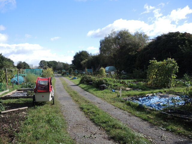
Engine Lane Allotments
Plan your visit
Getting here
51.42586, -2.77854
Visiting this summer
Seasonal nature notes and what to look for now
Visiting this summer
Seasonal nature notes and what to look for now
- 🐦72+ species recorded in this area — summer evenings are best for activity; watch for Woodpigeon and Carrion Crow
- ☀️Summer family visits work well here — arrive early and plan for a longer stay
- 🛝Playground 108m away — built-in entertainment for younger visitors alongside the wider site
🌤️ Visiting this summer
- 🐦72+ species recorded in this area — summer evenings are best for activity; watch for Woodpigeon and Carrion Crow
- ☀️Summer family visits work well here — arrive early and plan for a longer stay
- 🛝Playground 108m away — built-in entertainment for younger visitors alongside the wider site
Good to know
- 🐕Dogs welcome
Best for
Bird watching
Very strong match
Birds — Woodpigeon, Carrion Crow, Robin +69 more · last seen 2026; Birds — Woodpigeon, Carrion Crow, Robin +69 more · last seen 2026
Wildlife
Very strong match
Multi-group wildlife — Birds, Mammals; Multi-group wildlife — Birds, Mammals
Playgrounds
Strong match
playground
Family friendly
Strong match
playground; Allotments
Dog walks
Good match
Dogs allowed with public access
Insect spotting
Good match
Insects — Harlequin Ladybird, Violet Oil-beetle · last seen 2025; Insects — Harlequin Ladybird, Violet Oil-beetle · last seen 2025
Trails nearby
Within roughly 5 km🚶Walking
15 signed routes nearby · 42 public paths nearby
Signed route nearbyPublic paths
Walking
Prior's WoodWalking route
Gordano RoundWalking route42 km
Nailsea RoundWalking route
Step Free Route, TyntesfieldWalking route2 km
This route avoids steps across the estate, and loops around the house, the lower front terraces and up the Holly Walk. You are welcome to roam freely in the garden.
Tyntesfield Tynings Walk, TyntesfieldWalking route1.6 km
This gentle walk passes through ancient woodland, where there are plenty of flowers to see in the spring and meanders into a hay field full of oxeye daisies in May and June. The terrain can be uneven under foot in places and muddy when wet.
North Lanepublic footpath · 11 m
The Bramleyspublic footpath · 57 m
Blackfriars Roadpublic footpath · 273 m
🚴Cycling
38 signed routes nearby
Signed route nearby
Cycling
National Cycle Network Route 26 (Proposed)Cycling route
Avon CyclewayCycling route
Route 26Cycling route
Festival WayCycling route
Kennaway PathCycling route
Route 33Cycling route
🐴Horse riding
2 public paths nearby
Public paths
Horse riding
No named routes yet. Public paths are shown on the map.
Wildlife to spot
Photos
Weather for this location
Loading local forecast…
Nearby places
Useful places within 5 km
Own or manage this place?
Claim this listing to keep details accurate, add photos, and highlight what makes it special — free.
Claim this pageHow was your visit?
How useful was the information on this page?
id: 876edd92-b3f0-4efd-b559-bbcb6d1defac