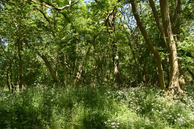
Free Wood
✦ Ancient woodland39 ha
🦉Wildlife🦅Birds🍂Seasonal
Public accessFree entryDogs welcome39 ha
Getting here
52.03489, 0.15389
Open directionsv
Visiting this summer
Seasonal nature notes and what to look for now
- 🌞Midsummer — early morning visits most comfortable; look for deer fawns in quieter clearings
- 🐕Early mornings are best for dog walks in summer — visit before 9am to avoid the heat and find quieter trails
- 📍Open access throughout summer — no booking required
🌤️ Visiting this summer
- 🌞Midsummer — early morning visits most comfortable; look for deer fawns in quieter clearings
- 🐕Early mornings are best for dog walks in summer — visit before 9am to avoid the heat and find quieter trails
- 📍Open access throughout summer — no booking required
- £Free to visit — no entry charge
- 🐕Dogs welcome
- 🌿Ancient woodland — rare wildlife habitat
🦉Wildlife
Very strong match
Multi-group wildlife — Amphibians, Birds, Mammals; Multi-group wildlife — Amphibians, Birds, Mammals
Free
🦅Bird watching
Very strong match
Birds — Great Tit, Blue Tit, Blackbird +50 more · last seen 2025; Birds — Great Tit, Blue Tit, Blackbird +50 more · last seen 2025
Free
🍂Seasonal nature
Strong match
Ancient woodland — bluebells, fungi and autumn colour; Plants — Bluebell, Common Nettle, Dog's Mercury +31 more · last seen 2020
Free
🦋Insect spotting
Strong match
Insects — Large White, Peacock, Meadow Brown +95 more · last seen 2026; Insects — Large White, Peacock, Meadow Brown +95 more · last seen 2026
Free
Dogs allowed — public woodland
Free
Plants — Common Nettle, Hazel, Bramble +5 more foraging species; Deciduous woodland — fungi, berries and wild garlic
Varies
Trails nearby
Within roughly 5 km5 signed routes nearby · 5 public paths nearby
Signed route nearbyPublic paths
Icknield Way PathWalking route169 km▾
long distance footpath 169 km
Named routeLength 169 kmRegional walking route
Harcamlow WayWalking route▾
Named routeRef HARRegional walking route
Lime Tree WalkWalking route▾
Kitchen Garden WalkWalking route▾
Temple WalkWalking route▾
Pipers Lanepublic footpath · 86 m▾
Public pathpublic footpathLength 86 mSurface groundPath type: residential
16 signed routes nearby
Signed route nearby
National Byway (Cambridgeshire)Cycling route▾
National Byway route through Cambridgeshire
Named routeRef NBRegional cycle route
NCN National Route 11Cycling route▾
Named routeRef 11National Cycle Network
Main RouteCycling route2.9 km▾
Named routeRef 11Length 2.9 kmNational Cycle NetworkOn-roadSurface asphalt
Main RouteCycling route40 m▾
Named routeRef 11Length 40 mNational Cycle NetworkOn-roadSurface asphalt
Main RouteCycling route789 m▾
Named routeRef 11Length 789 mNational Cycle NetworkOn-roadSurface asphalt
Main RouteCycling route24 m▾
Named routeRef 11Length 24 mNational Cycle NetworkOn-roadSurface asphalt
1 signed route nearby
Signed route nearby
Icknield Way Cycle TrailMountain bike route226 km▾
This is the off-road or mountain cycling route of the Icknield Way Trail.
Named routeLength 226 kmRegional cycle route
15 public paths nearby
Public paths
Freewood Lanebridleway · 890 m▾
Public pathbridlewayLength 890 mSurface asphaltPath type: service
Icknield Way Trailbyway open to all traffic · 489 m▾
Public pathbyway open to all trafficLength 489 mSurface compactedPath type: track
Icknield Way Trailbyway open to all traffic · 688 m▾
Public pathbyway open to all trafficLength 688 mSurface compactedPath type: track
Weather for this location
Next 14 daysNearby places
Useful places within 5 km
Own or manage this place?
Claim this listing to keep details accurate, add photos, and highlight what makes it special — free.
Claim this page→How useful was the information on this page?
id: 4ad5db29-05be-43fe-b004-21d05de1f6dc
Wildlife to spot
2,754 records · National Biodiversity Network
Wildlife to spot
2,754 records · National Biodiversity NetworkBlue Tit · Woodpigeon · Magpie · Blackbird · Goldcrest +25
- Blue TitCyanistes caeruleus2024
- WoodpigeonColumba palumbus2023
- MagpiePica pica
- BlackbirdTurdus merula2023
- GoldcrestRegulus regulus2023
- StarlingSturnus vulgaris2023
- BlackcapSylvia atricapilla2023
- RobinErithacus rubecula2023
- FieldfareTurdus pilaris2024
- RookCorvus frugilegus2023
- GreenfinchChloris chloris2023
- Great TitParus major2023
- Long-tailed TitAegithalos caudatus2023
- Pied WagtailMotacilla alba yarrellii2023
- GoldfinchCarduelis carduelis2023
- KestrelFalco tinnunculus2023
- NuthatchSitta europaea2023
- Song ThrushTurdus philomelos2023
- WrenTroglodytes troglodytes2023
- BullfinchPyrrhula pyrrhula2023
- Coal TitPeriparus ater2023
- Mute SwanCygnus olor2023
- DunnockPrunella modularis2023
- SiskinSpinus spinus2023
- Collared DoveStreptopelia decaocto2023
- Grey PartridgePerdix perdix2023
- PheasantPhasianus colchicus2023
- Carrion CrowCorvus corone2023
- Anas platyrhynchos xAnas platyrhynchos x2023
- SwallowHirundo rustica2023
🦌Mammals2 species
winterspringautumn
2026▾
Fallow Deer · Field Vole
- Fallow DeerDama dama
- Field VoleMicrotus agrestis2023
🐸Amphibians3 species
winter
2025▾
Common Frog · Smooth Newt · Common Toad
- Common FrogRana temporaria
- Smooth NewtLissotriton vulgaris
- Common ToadBufo bufo
Red Admiral · Gatekeeper · Large White · Peacock · Meadow Brown +64
- Red AdmiralVanessa atalanta2025
- GatekeeperPyronia tithonus2025
- Large WhitePieris brassicae2025
- PeacockAglais io2025
- Meadow BrownManiola jurtina2025
- Green-veined WhitePieris napi
Species observations from the last 10 years via NBN Atlas
2025
2025
Holly BlueCelastrina argiolus2025Holly BlueCelastrina argiolus2025CommaPolygonia c-album2025CommaPolygonia c-album2025Red-legged ShieldbugPentatoma rufipes2025Red-legged ShieldbugPentatoma rufipes2025Small WhitePieris rapae2025Small WhitePieris rapae2025Cramp-Ball Fungus WeevilPlatyrhinus resinosusCramp-Ball Fungus WeevilPlatyrhinus resinosusWestern Conifer Seed BugLeptoglossus occidentalis2023Western Conifer Seed BugLeptoglossus occidentalis2023Small CopperLycaena phlaeas2025Small CopperLycaena phlaeas2025Hawthorn ShieldbugAcanthosoma haemorrhoidale2025Hawthorn ShieldbugAcanthosoma haemorrhoidale2025Small TortoiseshellAglais urticae2025Small TortoiseshellAglais urticae2025Humming-bird Hawk-mothMacroglossum stellatarum2025Humming-bird Hawk-mothMacroglossum stellatarum2025Speckled WoodPararge aegeria2025Speckled WoodPararge aegeria2025Silver-washed FritillaryArgynnis paphia2025Silver-washed FritillaryArgynnis paphia2025Large SkipperOchlodes sylvanus2025Large SkipperOchlodes sylvanus2025Hornet HoverflyVolucella zonaria2025Hornet HoverflyVolucella zonaria2025Lesser Stag BeetleDorcus parallelipipedus2025Lesser Stag BeetleDorcus parallelipipedus2025Red-headed Cardinal BeetlePyrochroa serraticornis2025Red-headed Cardinal BeetlePyrochroa serraticornis2025Hairy ShieldbugDolycoris baccarum2025Hairy ShieldbugDolycoris baccarum2025Green ShieldbugPalomena prasina2024Green ShieldbugPalomena prasina2024Eristalis tenaxEristalis tenax2024Eristalis tenaxEristalis tenax2024Dark Bush-cricketPholidoptera griseoaptera2024Dark Bush-cricketPholidoptera griseoaptera2024Cuckoo-Spit InsectPhilaenus spumarius2024Cuckoo-Spit InsectPhilaenus spumarius2024Orange LadybirdHalyzia sedecimguttata2024Orange LadybirdHalyzia sedecimguttata2024Marmalade HoverflyEpisyrphus balteatus2024Marmalade HoverflyEpisyrphus balteatus2024Dark-edged Bee-flyBombylius major2024Dark-edged Bee-flyBombylius major2024SyrphusSyrphus2023SyrphusSyrphus20237-spot LadybirdCoccinella septempunctata20237-spot LadybirdCoccinella septempunctata2023Ivy BeeColletes hederae2023Ivy BeeColletes hederae2023Back-SwimmerNotonecta2023Back-SwimmerNotonecta2023Small Elm Bark BeetleScolytus multistriatusSmall Elm Bark BeetleScolytus multistriatusLimnephilus lunatusLimnephilus lunatus2025Limnephilus lunatusLimnephilus lunatus2025Birch ShieldbugElasmostethus interstinctus2025Birch ShieldbugElasmostethus interstinctus2025Painted LadyVanessa cardui2025Painted LadyVanessa cardui2025Brown ArgusAricia agestis2025Brown ArgusAricia agestis2025BrimstoneGonepteryx rhamni2025BrimstoneGonepteryx rhamni2025Purple HairstreakFavonius quercus2025Purple HairstreakFavonius quercus2025Common BluePolyommatus icarus2025Common BluePolyommatus icarus2025Sphaerophoria scriptaSphaerophoria scripta2025Sphaerophoria scriptaSphaerophoria scripta2025Ruby TigerPhragmatobia fuliginosa2025Ruby TigerPhragmatobia fuliginosa2025RingletAphantopus hyperantus2025RingletAphantopus hyperantus2025Volucella inflataVolucella inflata2025Volucella inflataVolucella inflata2025Glyphotaelius pellucidusGlyphotaelius pellucidus2025Glyphotaelius pellucidusGlyphotaelius pellucidus2025Cabbage BugEurydema (Eurydema) oleracea2025Cabbage BugEurydema (Eurydema) oleracea2025Syrphus ribesiiSyrphus ribesii2024Syrphus ribesiiSyrphus ribesii2024Rosemary BeetleChrysolina americana2024Rosemary BeetleChrysolina americana2024Oak Bush-cricketMeconema thalassinum2024Oak Bush-cricketMeconema thalassinum2024Common Red Soldier BeetleRhagonycha fulva2024Common Red Soldier BeetleRhagonycha fulva2024Roesel's Bush-cricketRoeseliana roeselii2024Roesel's Bush-cricketRoeseliana roeselii2024SphaerophoriaSphaerophoria2024SphaerophoriaSphaerophoria2024Rhingia rostrataRhingia rostrata2024Rhingia rostrataRhingia rostrata2024Sicus ferrugineusSicus ferrugineus2024Sicus ferrugineusSicus ferrugineus2024Rhinoceros BeetleSinodendron cylindricum2024Rhinoceros BeetleSinodendron cylindricum2024Demetrias atricapillusDemetrias atricapillus2024Demetrias atricapillusDemetrias atricapillus2024Eupeodes lunigerEupeodes luniger2024Eupeodes lunigerEupeodes luniger2024EupeodesEupeodes2024EupeodesEupeodes2024Helophilus pendulusHelophilus pendulus2024Helophilus pendulusHelophilus pendulus2024Epistrophe eligansEpistrophe eligans2024Epistrophe eligansEpistrophe eligans2024Black ClockPterostichus madidus2023Black ClockPterostichus madidus2023Aspidapion aeneumAspidapion aeneum2023Aspidapion aeneumAspidapion aeneum2023Platycheirus manicatusPlatycheirus manicatus2023Platycheirus manicatusPlatycheirus manicatus2023Platycheirus scutatusPlatycheirus scutatus2023Platycheirus scutatusPlatycheirus scutatus2023Pied ShieldbugTritomegas bicolor2023Pied ShieldbugTritomegas bicolor2023Bishop's MitreAelia acuminata2023Bishop's MitreAelia acuminata2023Asiraca clavicornisAsiraca clavicornis2023Asiraca clavicornisAsiraca clavicornis2023Events & activities nearby
Switch provider to compare local events, tours and bookable activities.