Furze Field ✦ Ancient woodland 84 ha
Plan your visit
🦉 Wildlife🦅 Birds🍂 Seasonal
Public access Free entry Dogs welcome 84 ha
Places › England › South East › Horsham Getting here
51.05182, -0.44590
Open directionsv Visiting this summer
Seasonal nature notes and what to look for now
▾ ☀️ June — canopy now fully closed, creating cool dappled shade even on warm days 🌿 Foraging is at its best in summer here 🐕 Dogs welcome — bring water in summer; the site has enough space to find shade on hot days 🌤️ Visiting this summer
☀️ June — canopy now fully closed, creating cool dappled shade even on warm days 🌿 Foraging is at its best in summer here 🐕 Dogs welcome — bring water in summer; the site has enough space to find shade on hot days £ Free to visit — no entry charge🐕 Dogs welcome🌿 Ancient woodland — rare wildlife habitat🦉 Wildlife
Very strong match
Multi-group wildlife — Amphibians, Birds, Mammals; Multi-group wildlife — Amphibians, Birds, Mammals
Free
🦅 Bird watching
Very strong match
Birds — Blackbird, Starling, Song Thrush +55 more · last seen 2026; Birds — Blackbird, Starling, Song Thrush +55 more · last seen 2026
Free
🍂 Seasonal nature
Strong match
Ancient woodland — bluebells, fungi and autumn colour; Plants — Bluebell, Wood Avens, Herb-Robert +187 more · last seen 2025
Free
Plants — Barren Strawberry, Elder, Hazel +27 more foraging species; Deciduous woodland — fungi, berries and wild garlic
Varies
Dogs allowed — public woodland
Free
🦋 Insect spotting
Good match
Insects — Southern Hawker, Glow-worm, Pseudovadonia livida +8 more · last seen 2025; Insects — Southern Hawker, Glow-worm, Pseudovadonia livida +8 more · last seen 2025
Free
Trails nearby Within roughly 5 km 5 signed routes nearby · 1 public path nearby
Signed route nearby Public paths
West Sussex Literary Trail Walking route ▾
Named route Regional walking route
Show on map Wey-South Path Walking route ▾
follows the river Wey and the (partly disused) Wey & Arun canal
Named route Regional walking route
Show on map Sussex Border Path Walking route 220 km ▾
Named route Length 220 km Regional walking route
Show on map Downs Link Walking route 59 km ▾
A 37 mile shared route for walkers, horse riders and cyclists linking the North Downs Way with the South Downs Way
Named route Length 59 km Regional walking route
Show on map Sussex Diamond Way Walking route 97 km ▾
Named route Length 97 km Regional walking route
Show on map 7 signed routes nearby
Signed route nearby
National Cycle Route 228 Crawley to Pulborough (proposed) Cycling route ▾
Named route Ref 228 National Cycle Network
Show on map Route 223 Cycling route ▾
Named route Ref 223 National Cycle Network
Show on map Main Route Cycling route 1.1 km ▾
Named route Ref 223 Length 1.1 km National Cycle Network Traffic-free Surface unsealedfirm
Show on map Main Route Cycling route 1.8 km ▾
Named route Ref 223 Length 1.8 km National Cycle Network Traffic-free Surface unsealedfirm
Show on map Main Route Cycling route 466 m ▾
Named route Ref 223 Length 466 m National Cycle Network Traffic-free Surface unsealedfirm
Show on map Main Route Cycling route 677 m ▾
Named route Ref 223 Length 677 m National Cycle Network Traffic-free Surface bareearth
Show on map 3 public paths nearby
Public paths
No named routes yet. Public paths are shown on the map.
✦ Ancient woodland — continuously wooded since at least 1600 AD. A rare and irreplaceable habitat, rich in biodiversity and historical character.
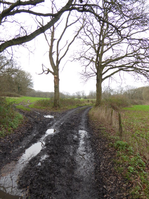
Photos Bridleway bends right at field corner
‹ ›
Weather for this location Next 14 days Nearby places Useful places within 5 km
All Historic
How useful was the information on this page?
id: 5055803d-79d7-4648-adc9-f4b6d55de36b
UK green spaces mapped from open public data — so anyone can find the woodland, trail, or nature reserve closest to them.
© 2026 Glade · Made with care for UK green spaces
Events & activities nearby Switch provider to compare local events, tours and bookable activities.
Bookable tours Wildlife to spot
851 records · National Biodiversity Network
▾
Wildlife to spot 851 records · National Biodiversity Network Long-tailed Tit · Wren · Nuthatch · Marsh Tit
Long-tailed Tit Aegithalos caudatus Wren Troglodytes troglodytes Nuthatch Sitta europaea Marsh Tit Poecile palustris 🐸 Amphibians 1 species
winter
2026 ▾
Great Crested Newt
Great Crested Newt Triturus cristatus Barren Strawberry · Herb-Robert · Great Willowherb · Soft Shield-fern · False-brome +141
Barren Strawberry Potentilla sterilis Herb-Robert Geranium robertianum Great Willowherb Epilobium hirsutum Soft Shield-fern Polystichum setiferum False-brome Brachypodium sylvaticum Devil's-bit Scabious Succisa pratensis Elder Species observations from the last 10 years via NBN Atlas
Sambucus nigra
Sambucus nigra
Creeping Thistle Cirsium arvense
Creeping Thistle Cirsium arvense
Hazel Corylus avellana
Hazel Corylus avellana
Creeping Buttercup Ranunculus repens
Creeping Buttercup Ranunculus repens
Pendulous Sedge Carex pendula
Pendulous Sedge Carex pendula
Spindle Euonymus europaeus
Spindle Euonymus europaeus
Yarrow Achillea millefolium
Yarrow Achillea millefolium
Bracken Pteridium aquilinum
Bracken Pteridium aquilinum
Cock's-foot Dactylis glomerata
Cock's-foot Dactylis glomerata
Bramble Rubus fruticosus
Bramble Rubus fruticosus
Hairy-brome Bromopsis ramosa
Hairy-brome Bromopsis ramosa
Bugle Ajuga reptans
Bugle Ajuga reptans
Common Dog-violet Viola riviniana
Common Dog-violet Viola riviniana
Wood Dock Rumex sanguineus
Wood Dock Rumex sanguineus
Hart's-Tongue Asplenium scolopendrium
Hart's-Tongue Asplenium scolopendrium
Honeysuckle Lonicera periclymenum
Honeysuckle Lonicera periclymenum
Pedunculate Oak Quercus robur
Pedunculate Oak Quercus robur
Field Maple Acer campestre
Field Maple Acer campestre
Hogweed Heracleum sphondylium
Hogweed Heracleum sphondylium
Wood-sedge Carex sylvatica
Wood-sedge Carex sylvatica
Nipplewort Lapsana communis
Nipplewort Lapsana communis
Wood Melick Melica uniflora
Wood Melick Melica uniflora
Ivy Hedera helix
Ivy Hedera helix
Broad-leaved Dock Rumex obtusifolius
Broad-leaved Dock Rumex obtusifolius
Greater Stitchwort Stellaria holostea
Greater Stitchwort Stellaria holostea
Hedge Woundwort Stachys sylvatica
Hedge Woundwort Stachys sylvatica
Wild Service-tree Sorbus torminalis
Wild Service-tree Sorbus torminalis
Dog's Mercury Mercurialis perennis
Dog's Mercury Mercurialis perennis
Red Fescue Festuca rubra
Red Fescue Festuca rubra
Bristly Oxtongue Helminthotheca echioides
Bristly Oxtongue Helminthotheca echioides
Common Nettle Urtica dioica
Common Nettle Urtica dioica
Remote Sedge Carex remota
Remote Sedge Carex remota
Hornbeam Carpinus betulus
Hornbeam Carpinus betulus
Wood Speedwell Veronica montana
Wood Speedwell Veronica montana
Crosswort Cruciata laevipes
Crosswort Cruciata laevipes
Ground-ivy Glechoma hederacea
Ground-ivy Glechoma hederacea
Greater Plantain Plantago major
Greater Plantain Plantago major
Common Bent Agrostis capillaris
Common Bent Agrostis capillaris
Ash Fraxinus excelsior
Ash Fraxinus excelsior
Garlic Mustard Alliaria petiolata
Garlic Mustard Alliaria petiolata
Taraxacum agg. Taraxacum agg.
Taraxacum agg. Taraxacum agg.
Spear Thistle Cirsium vulgare
Spear Thistle Cirsium vulgare
Sharp-flowered Rush Juncus acutiflorus
Sharp-flowered Rush Juncus acutiflorus
Three-nerved Sandwort Moehringia trinervia
Three-nerved Sandwort Moehringia trinervia
Yew Taxus baccata
Yew Taxus baccata
Wood Avens Geum urbanum
Wood Avens Geum urbanum
English Elm Ulmus procera
English Elm Ulmus procera
Bluebell Hyacinthoides non-scripta
Bluebell Hyacinthoides non-scripta
Cleavers Galium aparine
Cleavers Galium aparine
Meadow Buttercup Ranunculus acris
Meadow Buttercup Ranunculus acris
Compact Rush Juncus conglomeratus
Compact Rush Juncus conglomeratus
Water Mint Mentha aquatica
Water Mint Mentha aquatica
Crab Apple Malus sylvestris
Crab Apple Malus sylvestris
White Clover Trifolium repens
White Clover Trifolium repens
Common Sallow Salix cinerea
Common Sallow Salix cinerea
Wild Strawberry Fragaria vesca
Wild Strawberry Fragaria vesca
Sycamore Acer pseudoplatanus
Sycamore Acer pseudoplatanus
Stone Parsley Sison amomum
Stone Parsley Sison amomum
Field-rose Rosa arvensis
Field-rose Rosa arvensis
Lesser Stitchwort Stellaria graminea
Lesser Stitchwort Stellaria graminea
Goat Willow Salix caprea
Goat Willow Salix caprea
Bush Vetch Vicia sepium
Bush Vetch Vicia sepium
Wild Privet Ligustrum vulgare
Wild Privet Ligustrum vulgare
Black Currant Ribes nigrum
Black Currant Ribes nigrum
Silver Birch Betula pendula
Silver Birch Betula pendula
Guelder-rose Viburnum opulus
Guelder-rose Viburnum opulus
Cow Parsley Anthriscus sylvestris
Cow Parsley Anthriscus sylvestris
Polypody Polypodium vulgare
Polypody Polypodium vulgare
Hairy St John's-wort Hypericum hirsutum
Hairy St John's-wort Hypericum hirsutum
Alder Alnus glutinosa
Alder Alnus glutinosa
Broad-leaved Pondweed Potamogeton natans
Broad-leaved Pondweed Potamogeton natans
Hawthorn Crataegus monogyna
Hawthorn Crataegus monogyna
Sweet Chestnut Castanea sativa
Sweet Chestnut Castanea sativa
Soft-rush Juncus effusus
Soft-rush Juncus effusus
Greater Bird's-foot-trefoil Lotus pedunculatus
Greater Bird's-foot-trefoil Lotus pedunculatus
Common Figwort Scrophularia nodosa
Common Figwort Scrophularia nodosa
Fragrant Agrimony Agrimonia procera
Fragrant Agrimony Agrimonia procera
Branched Bur-reed Sparganium erectum
Branched Bur-reed Sparganium erectum
Hairy Wood-rush Luzula pilosa
Hairy Wood-rush Luzula pilosa
Creeping-Jenny Lysimachia nummularia
Creeping-Jenny Lysimachia nummularia
Grey Sedge Carex divulsa subsp. divulsa
Grey Sedge Carex divulsa subsp. divulsa
Broad Buckler-fern Dryopteris dilatata
Broad Buckler-fern Dryopteris dilatata
Common Club-rush Schoenoplectus lacustris
Common Club-rush Schoenoplectus lacustris
Primrose Primula vulgaris
Primrose Primula vulgaris
Hard Rush Juncus inflexus
Hard Rush Juncus inflexus
Meadow Foxtail Alopecurus pratensis
Meadow Foxtail Alopecurus pratensis
Foxglove Digitalis purpurea
Foxglove Digitalis purpurea
Holly Ilex aquifolium
Holly Ilex aquifolium
Horse-chestnut Aesculus hippocastanum
Horse-chestnut Aesculus hippocastanum
Lesser Periwinkle Vinca minor
Lesser Periwinkle Vinca minor
Male-fern Dryopteris filix-mas
Male-fern Dryopteris filix-mas
Selfheal Prunella vulgaris
Selfheal Prunella vulgaris
Bittersweet Solanum dulcamara
Bittersweet Solanum dulcamara
Black Bryony Tamus communis
Black Bryony Tamus communis
Blackthorn Prunus spinosa
Blackthorn Prunus spinosa
Bulrush Typha latifolia
Bulrush Typha latifolia
Marsh-bedstraw Galium palustre
Marsh-bedstraw Galium palustre
Giant Fescue Schedonorus giganteus
Giant Fescue Schedonorus giganteus
Wood Sage Teucrium scorodonia
Wood Sage Teucrium scorodonia
Hedge Bindweed Calystegia sepium
Hedge Bindweed Calystegia sepium
Ribwort Plantain Plantago lanceolata
Ribwort Plantain Plantago lanceolata
Common Couch Elymus repens
Common Couch Elymus repens
Hedge Bedstraw Galium album
Hedge Bedstraw Galium album
Oxeye Daisy Leucanthemum vulgare
Oxeye Daisy Leucanthemum vulgare
Upright Hedge Bedstraw Galium album subsp. erectum
Upright Hedge Bedstraw Galium album subsp. erectum
Tufted Hair-grass Deschampsia cespitosa
Tufted Hair-grass Deschampsia cespitosa
Perennial Rye-grass Lolium perenne
Perennial Rye-grass Lolium perenne
Great Horsetail Equisetum telmateia
Great Horsetail Equisetum telmateia
Water-pepper Persicaria hydropiper
Water-pepper Persicaria hydropiper
Yellow Archangel Lamiastrum galeobdolon
Yellow Archangel Lamiastrum galeobdolon
Common Fleabane Pulicaria dysenterica
Common Fleabane Pulicaria dysenterica
False Oat-grass Arrhenatherum elatius
False Oat-grass Arrhenatherum elatius
Common Field-speedwell Veronica persica
Common Field-speedwell Veronica persica
Common Chickweed Stellaria media
Common Chickweed Stellaria media
Shepherd's-purse Capsella bursa-pastoris
Shepherd's-purse Capsella bursa-pastoris
Red Campion Silene dioica
Red Campion Silene dioica
Knotgrass Polygonum aviculare
Knotgrass Polygonum aviculare
Scarlet Pimpernel Lysimachia arvensis
Scarlet Pimpernel Lysimachia arvensis
Water-plantain Alisma plantago-aquatica
Water-plantain Alisma plantago-aquatica
Marsh Thistle Cirsium palustre
Marsh Thistle Cirsium palustre
Yellow Iris Iris pseudacorus
Yellow Iris Iris pseudacorus
Crack-willow Salix alba x euxina = S. x fragilis
Crack-willow Salix alba x euxina = S. x fragilis
Autumn Hawkbit Scorzoneroides autumnalis
Autumn Hawkbit Scorzoneroides autumnalis
Cut-leaved Crane's-bill Geranium dissectum
Cut-leaved Crane's-bill Geranium dissectum
Early Dog-violet Viola reichenbachiana
Early Dog-violet Viola reichenbachiana
Hop Humulus lupulus
Hop Humulus lupulus
Common Mouse-ear Cerastium fontanum
Common Mouse-ear Cerastium fontanum
Red Clover Trifolium pratense
Red Clover Trifolium pratense
Equal-leaved Knotgrass Polygonum arenastrum
Equal-leaved Knotgrass Polygonum arenastrum
Crested Dog's-tail Cynosurus cristatus
Crested Dog's-tail Cynosurus cristatus
Floating Sweet-grass Glyceria fluitans
Floating Sweet-grass Glyceria fluitans
Midland Hawthorn Crataegus laevigata
Midland Hawthorn Crataegus laevigata
Thin-spiked Wood-sedge Carex strigosa
Thin-spiked Wood-sedge Carex strigosa
Spurge-laurel Daphne laureola
Spurge-laurel Daphne laureola
Scentless Mayweed Tripleurospermum inodorum
Scentless Mayweed Tripleurospermum inodorum
Meadowsweet Filipendula ulmaria
Meadowsweet Filipendula ulmaria
Annual Meadow-grass Poa annua
Annual Meadow-grass Poa annua
Germander Speedwell Veronica chamaedrys
Germander Speedwell Veronica chamaedrys
Betony Betonica officinalis
Betony Betonica officinalis
Barren Brome Anisantha sterilis
Barren Brome Anisantha sterilis