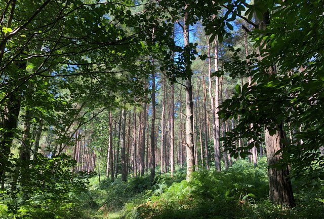
Furze Field Copse ✦ Ancient woodland 42 ha
Plan your visit
🦉 Wildlife🦅 Birds🍂 Seasonal
Public access Free entry Dogs welcome 42 ha
Places › England › South East › Chichester Getting here
51.05754, -0.76921
Open directionsv Visiting this summer
Seasonal nature notes and what to look for now
▾ 🌞 Midsummer — early morning visits most comfortable; look for deer fawns in quieter clearings 🐕 Early mornings are best for dog walks in summer — visit before 9am to avoid the heat and find quieter trails 📍 Open access throughout summer — no booking required 🌤️ Visiting this summer
🌞 Midsummer — early morning visits most comfortable; look for deer fawns in quieter clearings 🐕 Early mornings are best for dog walks in summer — visit before 9am to avoid the heat and find quieter trails 📍 Open access throughout summer — no booking required £ Free to visit — no entry charge🐕 Dogs welcome🌿 Ancient woodland — rare wildlife habitat🦉 Wildlife
Very strong match
Multi-group wildlife — Amphibians, Birds, Mammals, Reptiles; Multi-group wildlife — Amphibians, Birds, Mammals, Reptiles
Free
🦅 Bird watching
Very strong match
Birds — Mandarin Duck, Grey Heron, Blackbird +61 more · last seen 2025; Birds — Mandarin Duck, Grey Heron, Blackbird +61 more · last seen 2025
Free
🍂 Seasonal nature
Strong match
Ancient woodland — bluebells, fungi and autumn colour; Plants — Himalayan Balsam, Rhododendron, Wood Avens +63 more · last seen 2026
Free
Dogs allowed — public woodland
Free
🦋 Insect spotting
Strong match
Insects — Meadow Brown, Brimstone, Ringlet +39 more · last seen 2024; Insects — Meadow Brown, Brimstone, Ringlet +39 more · last seen 2024
Free
Plants — Common Nettle, Beech, Garlic Mustard +5 more foraging species; Deciduous woodland — fungi, berries and wild garlic
Varies
Trails nearby Within roughly 5 km 9 signed routes nearby · 18 public paths nearby
Signed route nearby Public paths
The Shipwrights Way Walking route ▾
A long distance route which links villages and towns in east Hampshire. The name reflects the use of oak grown at Alice Holt Forest for Tudor shipbuilding.
Named route Regional walking route
Show on map New Lipchis Way Walking route ▾
Named route Regional walking route
Show on map Greensand Way Walking route ▾
Named route Ref GW Regional walking route
Show on map Sussex Border Path Walking route 220 km ▾
Named route Length 220 km Regional walking route
Show on map Woolbeding Landscapes Walk, Sussex West Walking route 8.8 km ▾
This is a gentle circular walk taking in wildlife, riverside views, and wide open landscapes. Easy going underfoot, some stiles and slopes.
Named route Length 8.8 km Duration 02:30 Round trip Local walking route
Show on map 3 signed routes nearby
Signed route nearby
A3 Cycle Route Cycling route ▾
Named route Ref A3 Local cycle route
Show on map Surrey Cycleway Cycling route ▾
Haslemere link
Named route Regional cycle route
Show on map NCN 22 - Liphook Link Cycling route ▾
National Cycle Network link route
Named route Local cycle route
Show on map 2 signed routes nearby
Signed route nearby
King Alfred's Way Mountain bike route ▾
King Alfreds Way is 350km (220 miles) off road route designed to be ridden clockwise. It starts & ends in Winchester. It is suitable for gravel or cross-country bikes.
Named route Regional cycle route
Show on map Shipwrights Way (Liphook Spur) Mountain bike route ▾
7 public paths nearby
Public paths
Iron Down Bridleway bridleway · 1.1 km ▾
Public path bridleway Length 1.1 km Surface dirt Incline 10% Path type: bridleway
Show on map ✦ Ancient woodland — continuously wooded since at least 1600 AD. A rare and irreplaceable habitat, rich in biodiversity and historical character.
Weather for this location Next 14 days Nearby places Useful places within 5 km
All Historic
Own or manage this place?
Claim this listing to keep details accurate, add photos, and highlight what makes it special — free.
Claim this page→ How useful was the information on this page?
id: 1a4713b1-e1c7-4279-af33-4f9617678218
UK green spaces mapped from open public data — so anyone can find the woodland, trail, or nature reserve closest to them.
© 2026 Glade · Made with care for UK green spaces
Wildlife to spot
6,019 records · National Biodiversity Network
▾
Wildlife to spot 6,019 records · National Biodiversity Network Dunnock · Chaffinch · Blue Tit · Jackdaw · Blackbird +40
Dunnock Prunella modularis2024 Chaffinch Fringilla coelebs2024 Blue Tit Cyanistes caeruleus2024 Jackdaw Coloeus monedula Blackbird Turdus merula Magpie Pica pica Mandarin Duck Aix galericulata2024 Goldfinch Carduelis carduelis2024 Woodpigeon Columba palumbus2024 Great Tit Parus major2024 Robin Erithacus rubecula2024 Great Spotted Woodpecker Dendrocopos major2024 Siskin Spinus spinus2024 Pied Wagtail Motacilla alba2024 Swift Apus apus Tree Pipit Anthus trivialis Spotted Flycatcher Muscicapa striata Redstart Phoenicurus phoenicurus Redwing Turdus iliacus2024 Goldcrest Regulus regulus2024 Grey Heron Ardea cinerea2024 Kestrel Falco tinnunculus2024 Marsh Tit Poecile palustris2024 Teal Anas crecca2024 Cormorant Phalacrocorax carbo2024 Linnet Linaria cannabina2024 Grey Wagtail Motacilla cinerea2024 Wren Troglodytes troglodytes2024 Carrion Crow Corvus corone2024 Mallard Anas platyrhynchos2024 Nuthatch Sitta europaea2024 Song Thrush Turdus philomelos2024 House Sparrow Passer domesticus2024 Pheasant Phasianus colchicus2024 Long-tailed Tit Aegithalos caudatus2024 Treecreeper Certhia familiaris2024 Starling Sturnus vulgaris2024 Coal Tit Periparus ater2024 Bullfinch Pyrrhula pyrrhula2024 Stock Dove Columba oenas2024 Raven Corvus corax2024 Firecrest Regulus ignicapilla2024 Crossbill Loxia curvirostra2024 Lesser Redpoll Acanthis flammea cabaret2024 Brambling Fringilla montifringilla2024 🦌 Mammals 3 species
spring summer autumn
2025 ▾
Hazel Dormouse · Badger · Roe Deer
Hazel Dormouse Muscardinus avellanarius Badger Meles meles Roe Deer Capreolus capreolus2024 Slow-worm
🐸 Amphibians 1 species
summer
2025 ▾
Common Toad
🐝 Insects 19 species
spring summer
2024 ▾
Meadow Brown · Brimstone · Ringlet · Speckled Wood · Orange-tip +14
Meadow Brown Maniola jurtina Brimstone Gonepteryx rhamni Ringlet Aphantopus hyperantus Speckled Wood Pararge aegeria Orange-tip Anthocharis cardamines Marbled White Melanargia galathea 🌿 Plants 24 species
winter spring summer autumn
2026 ▾
Foxglove · Oblong-leaved Sundew · Bluebell · Yarrow · Wood Avens +19
Foxglove Digitalis purpurea2025 Oblong-leaved Sundew Drosera intermedia2024 Bluebell Hyacinthoides non-scripta2024 Yarrow Achillea millefolium Wood Avens Species observations from the last 10 years via NBN Atlas
Peacock
Peacock
Aglais io
Aglais io
Green-veined White Pieris napi
Green-veined White Pieris napi
Anoplotrupes stercorosus Anoplotrupes stercorosus
Anoplotrupes stercorosus Anoplotrupes stercorosus
Large White Pieris brassicae
Large White Pieris brassicae
Small White Pieris rapae
Small White Pieris rapae
Dark Green Fritillary Speyeria aglaja
Dark Green Fritillary Speyeria aglaja
Small Copper Lycaena phlaeas
Small Copper Lycaena phlaeas
Large Skipper Ochlodes sylvanus
Large Skipper Ochlodes sylvanus
Small Skipper Thymelicus sylvestris
Small Skipper Thymelicus sylvestris
Silver-washed Fritillary Argynnis paphia
Silver-washed Fritillary Argynnis paphia
White Admiral Limenitis camilla
White Admiral Limenitis camilla
Red Admiral Vanessa atalanta
Red Admiral Vanessa atalanta
Green Hairstreak Callophrys rubi
Green Hairstreak Callophrys rubi Geum urbanum
Geum urbanum
Common Nettle Urtica dioica
Common Nettle Urtica dioica
Ground-ivy Glechoma hederacea
Ground-ivy Glechoma hederacea
Neat Feather-moss Pseudoscleropodium purum2025
Neat Feather-moss Pseudoscleropodium purum2025
Waved Silk-moss Plagiothecium undulatum2025
Waved Silk-moss Plagiothecium undulatum2025
Swan's-neck Thyme-moss Mnium hornum2025
Swan's-neck Thyme-moss Mnium hornum2025
Common Tamarisk-moss Thuidium tamariscinum2025
Common Tamarisk-moss Thuidium tamariscinum2025
Yellow Iris Iris pseudacorus2025
Yellow Iris Iris pseudacorus2025
Bittersweet Solanum dulcamara2025
Bittersweet Solanum dulcamara2025
Garlic Mustard Alliaria petiolata2025
Garlic Mustard Alliaria petiolata2025
Beech Fagus sylvatica2025
Beech Fagus sylvatica2025
Butterfly-bush Buddleja davidii2025
Butterfly-bush Buddleja davidii2025
Black Bryony Tamus communis2025
Black Bryony Tamus communis2025
Argentinian Vervain Verbena bonariensis2025
Argentinian Vervain Verbena bonariensis2025
Welsh Poppy Papaver cambricum2025
Welsh Poppy Papaver cambricum2025
Cuckooflower Cardamine pratensis2024
Cuckooflower Cardamine pratensis2024
Bog Stitchwort Stellaria alsine2024
Bog Stitchwort Stellaria alsine2024
Herb-Robert Geranium robertianum2024
Herb-Robert Geranium robertianum2024
Daffodil Narcissus pseudonarcissus2024
Daffodil Narcissus pseudonarcissus2024
Bulrush Typha latifolia2024
Bulrush Typha latifolia2024 Events & activities nearby Switch provider to compare local events, tours and bookable activities.
Bookable tours GetYourGuide Promote here