🐦35+ species recorded in this area — summer evenings are best for activity; watch for Woodpigeon and Magpie
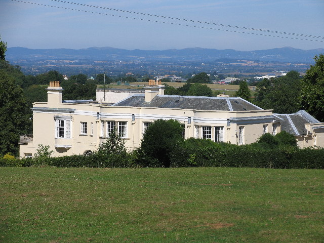
✦Historic character is a year-round quality here — summer brings its own atmosphere to the setting
🐕Dogs welcome — bring water in summer; the site has enough space to find shade on hot days
🌤️ Visiting this summer
🐦35+ species recorded in this area — summer evenings are best for activity; watch for Woodpigeon and Magpie
✦Historic character is a year-round quality here — summer brings its own atmosphere to the setting
🐕Dogs welcome — bring water in summer; the site has enough space to find shade on hot days
Good to know
🐕Dogs welcome
Best for
7 activities
🦅
Bird watching
Very strong match
Birds — Woodpigeon, Magpie, Blackbird +32 more · last seen 2026; Deciduous woodland — woodpeckers, warblers and woodland birds
Free
🦉
Wildlife
Strong match
Birds — Woodpigeon, Magpie, Blackbird +32 more · last seen 2026; Deciduous woodland priority habitat
Free
✦
Heritage
Strong match
Historic site with public access
Free
🦋
Insect spotting
Strong match
Insects — Common Cockchafer, Harlequin Ladybird, Red-legged Shieldbug +52 more · last seen 2026; Traditional orchard — specialist orchard insects and lichens
Free
🌿
Foraging
Strong match
Traditional orchard — seasonal fruit, fungi and wild plants
Varies
🐶
Dog walks
Good match
Dogs allowed with public access
Free
Trails nearby
Within roughly 5 km
🚶
Walking
▾
8 signed routes nearby · 31 public paths nearby
Signed route nearbyPublic paths
Gloucestershire WayWalking route161 km▾
Named routeLength 161 kmRegional walking route
Winchcombe Way (West)Walking route▾
The Winchcombe Way is a 42-mile figure-of-eight trail centred on Winchcombe
Named routeRef wiwRegional walking route
Gustav Holst Way (Corndean Lane to Guiting Power)Walking route6.9 km▾
Named routeLength 6.9 kmRegional walking route
Gustav Holst Way (Crickley Hill to Holst Birthplace Museum)Walking route7.2 km▾
Named routeLength 7.2 kmRegional walking route
Cotswold WayWalking route164 km▾
Named routeRef CWLength 164 kmNational walking route
Ham Squarepublic footpath · 38 m▾
Public pathpublic footpathLength 38 mPath type: residential
Mill Lanepublic footpath · 59 m▾
Public pathpublic footpathLength 59 mPath type: unclassified
Ham Squarepublic footpath · 8 m▾
Public pathpublic footpathLength 8 mPath type: residential
🚴
Cycling
▾
17 signed routes nearby
Signed route nearby
Route 41Cycling route▾
Named routeRef 41National Cycle Network
Gloucestershire Cycle SpineCycling route▾
Named routeLocal cycle route
National Byway (Oxon and Glos)Cycling route▾
Named routeRef NBRegional cycle route
Cotswold CyclewayCycling route▾
Named routeRef CCRegional cycle route
National BywayCycling route▾
Named routeRef NBRegional cycle route
Bishops Cleeve Bypass Cycle RouteCycling route▾
Named routeLocal cycle route
🐴
Horse riding
▾
2 public paths nearby
Public paths
No named routes yet. Public paths are shown on the map.