Getting here
53.76110, -2.01689
Visiting this summer
Seasonal nature notes and what to look for now
Visiting this summer
Seasonal nature notes and what to look for now
- 🌞Midsummer — early morning visits most comfortable; look for deer fawns in quieter clearings
- 🧺Good picnic destination in summer — open space and facilities for a relaxed day out
- 🐕Dogs welcome — bring water in summer; the site has enough space to find shade on hot days
🌤️ Visiting this summer
- 🌞Midsummer — early morning visits most comfortable; look for deer fawns in quieter clearings
- 🧺Good picnic destination in summer — open space and facilities for a relaxed day out
- 🐕Dogs welcome — bring water in summer; the site has enough space to find shade on hot days
Good to know
- £Free to visit — no entry charge
- 🐕Dogs welcome
Best for
Picnic day out
Very strong match
picnic area, toilets, car park
Wildlife
Strong match
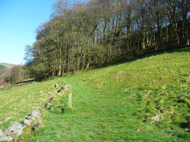
Deciduous woodland priority habitat; Ancient woodland
Seasonal nature
Strong match
Ancient woodland — bluebells, fungi and autumn colour
Family friendly
Strong match
toilets, picnic area
Bird watching
Strong match
Deciduous woodland — woodpeckers, warblers and woodland birds
Insect spotting
Good match
Acid grassland — heathland butterflies and rare invertebrates
Trails nearby
Within roughly 5 km🚶Walking
20 signed routes nearby · 22 public paths nearby
Signed route nearbyPublic paths
Walking
Mary Towneley LoopWalking route
Forms part of Pennine Bridleway National Trail
Todmorden Centenary WayWalking route
Pennine Way (Warland Reservoir to Calder Valley)Walking route
Todmorden Centenary Way LinkWalking route
Crags Walk, Hardcastle CragsWalking route1.3 km
Estate Trackpublic footpath · 1.6 km
🚴Cycling
65 signed routes nearby
Signed route nearby
Cycling
Pennine CyclewayCycling route
Route 66Cycling route
West Yorkshire Cycle RouteCycling route
Route 68Cycling route
Main RouteCycling route113 m
Main RouteCycling route45 m
🚵Mountain biking
3 signed routes nearby
Signed route nearby
Mountain biking
Calder Aire LinkMountain bike route
Great North Trail (Yorkshire Dales)Mountain bike route172.2 km
Great North Trail (Peak District and South Pennines)Mountain bike route130.4 km
🐴Horse riding
9 public paths nearby
Public paths
Horse riding
Cow Lanebridleway · 127 m
Midgehole Lanebridleway · 438 m
Wildlife to spot
Photos
Weather for this location
Loading local forecast…
Nearby places
Useful places within 5 km
Own or manage this place?
Claim this listing to keep details accurate, add photos, and highlight what makes it special — free.
Claim this pageHow was your visit?
How useful was the information on this page?
id: 16fd929d-5030-4dcc-b64a-d4b276a96290