Gravelhill Plantation 12 ha
🦉 Wildlife🦅 Birds🦋 Insects
↑ Share
Public access Free entry Dogs welcome 12 ha
Places › England › East Midlands › Mansfield Getting here
53.18368, -1.15581
Open directionsv Visiting this summer
Seasonal nature notes and what to look for now
▾ 🌞 Midsummer — early morning visits most comfortable; look for deer fawns in quieter clearings 🐕 Early mornings are best for dog walks in summer — visit before 9am to avoid the heat and find quieter trails 🅿️ Parking 329m away — 2 car parks within reach 🌤️ Visiting this summer
🌞 Midsummer — early morning visits most comfortable; look for deer fawns in quieter clearings 🐕 Early mornings are best for dog walks in summer — visit before 9am to avoid the heat and find quieter trails 🅿️ Parking 329m away — 2 car parks within reach £ Free to visit — no entry charge🐕 Dogs welcome🦉 Wildlife
Very strong match
Multi-group wildlife — Amphibians, Birds, Mammals, Reptiles; Multi-group wildlife — Amphibians, Birds, Mammals, Reptiles
Free
🦅 Bird watching
Very strong match
Birds — Siskin, Goldfinch, Blackbird +67 more · last seen 2025; Birds — Siskin, Goldfinch, Blackbird +67 more · last seen 2025
Free
🦋 Insect spotting
Strong match
Insects — Small White, Red Admiral, Painted Lady +171 more · last seen 2025; Insects — Small White, Red Admiral, Painted Lady +171 more · last seen 2025
Free
Dogs allowed — public woodland
Free
Deciduous woodland — fungi, berries and wild garlic
Varies
Trails nearby Within roughly 5 km 5 signed routes nearby · 4 public paths nearby
Signed route nearby Public paths
Archaeological Way (old route) Walking route ▾
Dukeries Trail Walking route ▾
Robin Hood Way Walking route ▾
Named route Regional walking route
Show on map Maun Valley Trail Walking route ▾
Wildwood Trail Walking route ▾
Named route Local walking route
Show on map 52 signed routes nearby
Signed route nearby
Route 645 Cycling route ▾
Named route Ref 645 National Cycle Network
Show on map Route 6 Cycling route ▾
Named route Ref 6 National Cycle Network
Show on map NCN National Route 648 Cycling route ▾
Named route Ref 648 National Cycle Network
Show on map Main Route Cycling route 984 m ▾
Named route Ref 648 Length 984 m National Cycle Network On-road Surface asphalt
Show on map Main Route Cycling route 661 m ▾
Named route Ref 648 Length 661 m National Cycle Network Traffic-free Surface unsealedfirm
Show on map Main Route Cycling route 993 m ▾
Named route Ref 6 Length 993 m National Cycle Network Traffic-free Surface unsealedloose
Show on map 4 signed routes nearby
Signed route nearby
Family Cycle Route Mountain bike route ▾
Named route Ref Green Route
Show on map Outlaw Trail Mountain bike route ▾
Named route Ref Red Route
Show on map Viking Trail Mountain bike route ▾
Named route Ref Blue Route
Show on map Bike Park & Downhill Route Mountain bike route ▾
4 public paths nearby
Public paths
Oakfield Lane byway open to all traffic · 1.7 km ▾
Public path byway open to all traffic Length 1.7 km Surface dirt Path type: unclassified
Show on map Packman's Road bridleway · 810 m ▾
Public path bridleway Length 810 m Path type: bridleway
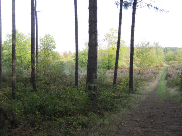
Show on map Photos Peafield Plantation - Footpath leaving the pines
‹ ›
Weather for this location Next 14 days Nearby places Useful places within 5 km
Own or manage this place?
Claim this listing to keep details accurate, add photos, and highlight what makes it special — free.
Claim this page→ How useful was the information on this page?
Something wrong on this page?
id: 6c883ceb-6603-4b0d-9aeb-0eb3be7c4bc8
UK green spaces mapped from open public data — so anyone can find the woodland, trail, or nature reserve closest to them.
© 2026 Glade · Made with care for UK green spaces
Wildlife to spot
18,107 records · National Biodiversity Network
▾
Wildlife to spot 18,107 records · National Biodiversity Network Raven · Peregrine · Robin · Woodlark · Wren +18
Raven Corvus corax Peregrine Falco peregrinus Robin Erithacus rubecula Woodlark Lullula arborea Wren Troglodytes troglodytes Goldcrest Regulus regulus Blackcap Sylvia atricapilla Great Tit Parus major Coal Tit Periparus ater Carrion Crow Corvus corone Song Thrush Turdus philomelos Blue Tit Cyanistes caeruleus Blackbird Turdus merula Skylark Alauda arvensis Chiffchaff Phylloscopus collybita Whitethroat Curruca communis Little Ringed Plover Charadrius dubius Willow Warbler Phylloscopus trochilus Woodpigeon Columba palumbus Jay Garrulus glandarius Dartford Warbler Curruca undata Rook Corvus frugilegus Swallow Hirundo rustica2024 Muntjac
🐸 Amphibians 1 species
summer
2024 ▾
Common Toad
Small White · Comma · Blue Shieldbug · Peacock · Red Admiral +2
Small White Pieris rapae2024 Comma Polygonia c-album2024 Blue Shieldbug Zicrona caerulea Peacock Aglais io2024 Red Admiral Vanessa atalanta2024 Common Blue Polyommatus icarus2024 🌿 Plants 105 species
summer autumn
2025 ▾
Bracken · Lesser Burdock · Canadian Fleabane · Reflexed Saltmarsh-Grass · Holly +100
Bracken Pteridium aquilinum Lesser Burdock Arctium minus Canadian Fleabane Erigeron canadensis Reflexed Saltmarsh-Grass Puccinellia distans Holly Ilex aquifolium Spear-leaved Orache Atriplex prostrata Species observations from the last 10 years via NBN Atlas
Hornet Hoverfly Volucella zonaria2024
Hornet Hoverfly Volucella zonaria2024 Broom
Broom
Cytisus scoparius
Cytisus scoparius
Guernsey Fleabane Erigeron sumatrensis
Guernsey Fleabane Erigeron sumatrensis
Hemlock Conium maculatum
Hemlock Conium maculatum
Wavy Hair-Grass Avenella flexuosa
Wavy Hair-Grass Avenella flexuosa
Water Bent Polypogon viridis
Water Bent Polypogon viridis
Black Nightshade Solanum nigrum
Black Nightshade Solanum nigrum
Mugwort Artemisia vulgaris
Mugwort Artemisia vulgaris
Grass-leaved Orache Atriplex littoralis
Grass-leaved Orache Atriplex littoralis
Wild Cherry Prunus avium
Wild Cherry Prunus avium
Hawthorn Crataegus monogyna
Hawthorn Crataegus monogyna
Bramble Rubus fruticosus
Bramble Rubus fruticosus
Honeysuckle Lonicera periclymenum
Honeysuckle Lonicera periclymenum
Buck's-horn Plantain Plantago coronopus
Buck's-horn Plantain Plantago coronopus
Rosebay Willowherb Chamaenerion angustifolium
Rosebay Willowherb Chamaenerion angustifolium
Field Horsetail Equisetum arvense
Field Horsetail Equisetum arvense
Bluebell Hyacinthoides non-scripta
Bluebell Hyacinthoides non-scripta
Heather Calluna vulgaris
Heather Calluna vulgaris
Rhododendron Rhododendron ponticum
Rhododendron Rhododendron ponticum
Foxglove Digitalis purpurea
Foxglove Digitalis purpurea
Rowan Sorbus aucuparia
Rowan Sorbus aucuparia
Wall Barley Hordeum murinum2024
Wall Barley Hordeum murinum2024
Lesser Sea-spurrey Spergularia marina2024
Lesser Sea-spurrey Spergularia marina2024
Garlic Mustard Alliaria petiolata2024
Garlic Mustard Alliaria petiolata2024
Wild Carrot Daucus carota
Wild Carrot Daucus carota
Sweet Violet Viola odorata
Sweet Violet Viola odorata
Fodder Vetch Vicia villosa
Fodder Vetch Vicia villosa
Spanish-dagger Yucca gloriosa
Spanish-dagger Yucca gloriosa
Snowberry Symphoricarpos albus
Snowberry Symphoricarpos albus
Thyme-leaved Speedwell Veronica serpyllifolia
Thyme-leaved Speedwell Veronica serpyllifolia
Yarrow Achillea millefolium
Yarrow Achillea millefolium
Tansy Tanacetum vulgare
Tansy Tanacetum vulgare
Great Lettuce Lactuca virosa
Great Lettuce Lactuca virosa
American Winter-cress Barbarea verna
American Winter-cress Barbarea verna
Yew Taxus baccata
Yew Taxus baccata
Long-headed Poppy Papaver dubium
Long-headed Poppy Papaver dubium
Black-bindweed Fallopia convolvulus
Black-bindweed Fallopia convolvulus
Musk Thistle Carduus nutans
Musk Thistle Carduus nutans
Tufted Vetch Vicia cracca
Tufted Vetch Vicia cracca
Caper Spurge Euphorbia lathyris
Caper Spurge Euphorbia lathyris
Meadow Crane's-bill Geranium pratense
Meadow Crane's-bill Geranium pratense
Atlantic Ivy Hedera hibernica
Atlantic Ivy Hedera hibernica
Curled Dock Rumex crispus
Curled Dock Rumex crispus
Pedunculate Oak Quercus robur
Pedunculate Oak Quercus robur
Hoary Willowherb Epilobium parviflorum
Hoary Willowherb Epilobium parviflorum
Yellow Corydalis Pseudofumaria lutea
Yellow Corydalis Pseudofumaria lutea
Green Alkanet Pentaglottis sempervirens
Green Alkanet Pentaglottis sempervirens
Thale Cress Arabidopsis thaliana
Thale Cress Arabidopsis thaliana
Rusty-Back Fern Asplenium ceterach
Rusty-Back Fern Asplenium ceterach
Wall-rue Asplenium ruta-muraria
Wall-rue Asplenium ruta-muraria
Fox-and-cubs Pilosella aurantiaca
Fox-and-cubs Pilosella aurantiaca
Ivy-leaved Speedwell Veronica hederifolia
Ivy-leaved Speedwell Veronica hederifolia
Austrian Pine Pinus nigra
Austrian Pine Pinus nigra
Japanese Rose Rosa rugosa
Japanese Rose Rosa rugosa
Norway Spruce Picea abies
Norway Spruce Picea abies
Petty Spurge Euphorbia peplus2024
Petty Spurge Euphorbia peplus2024
Common Mallow Malva sylvestris2024
Common Mallow Malva sylvestris2024
Autumn Hawkbit Scorzoneroides autumnalis2024
Autumn Hawkbit Scorzoneroides autumnalis2024
Black Medick Medicago lupulina2024
Black Medick Medicago lupulina2024
Pellitory-of-the-wall Parietaria judaica2024
Pellitory-of-the-wall Parietaria judaica2024
Barren Brome Anisantha sterilis2024
Barren Brome Anisantha sterilis2024
Pineappleweed Matricaria discoidea2024
Pineappleweed Matricaria discoidea2024
Greater Celandine Chelidonium majus2024
Greater Celandine Chelidonium majus2024
Scentless Mayweed Tripleurospermum inodorum2024
Scentless Mayweed Tripleurospermum inodorum2024
Black Bryony Tamus communis2024
Black Bryony Tamus communis2024
Argentinian Vervain Verbena bonariensis2024
Argentinian Vervain Verbena bonariensis2024
Purple Toadflax Linaria purpurea2024
Purple Toadflax Linaria purpurea2024
Butterfly-bush Buddleja davidii2024
Butterfly-bush Buddleja davidii2024
Large-flowered Evening-primrose Oenothera glazioviana2024
Large-flowered Evening-primrose Oenothera glazioviana2024
White Campion Silene latifolia2024
White Campion Silene latifolia2024
Garden Privet Ligustrum ovalifolium2024
Garden Privet Ligustrum ovalifolium2024
Red Valerian Centranthus ruber2024
Red Valerian Centranthus ruber2024
Common Cudweed Filago germanica2024
Common Cudweed Filago germanica2024
Beech Fagus sylvatica2024
Beech Fagus sylvatica2024
Alder Alnus glutinosa2024
Alder Alnus glutinosa2024
Greater Plantain Plantago major2024
Greater Plantain Plantago major2024
Water Cress Nasturtium officinale2024
Water Cress Nasturtium officinale2024
Common Water-starwort Callitriche stagnalis2024
Common Water-starwort Callitriche stagnalis2024
Bearded Couch Elymus caninus2024
Bearded Couch Elymus caninus2024
Male-fern Dryopteris filix-mas2024
Male-fern Dryopteris filix-mas2024
Ivy Hedera helix2024
Ivy Hedera helix2024
Black Currant Ribes nigrum2024
Black Currant Ribes nigrum2024
Perforate St John's-wort Hypericum perforatum2024
Perforate St John's-wort Hypericum perforatum2024
Cock's-foot Dactylis glomerata2024
Cock's-foot Dactylis glomerata2024
Himalayan Balsam Impatiens glandulifera2024
Himalayan Balsam Impatiens glandulifera2024
Nipplewort Lapsana communis2024
Nipplewort Lapsana communis2024
Broad Buckler-fern Dryopteris dilatata2024
Broad Buckler-fern Dryopteris dilatata2024
Common Nettle Urtica dioica2024
Common Nettle Urtica dioica2024
Red Campion Silene dioica2024
Red Campion Silene dioica2024
Raspberry Rubus idaeus2024
Raspberry Rubus idaeus2024
Pendulous Sedge Carex pendula2024
Pendulous Sedge Carex pendula2024
Hieracium sect. Sabauda Hieracium sect. Sabauda2024
Hieracium sect. Sabauda Hieracium sect. Sabauda2024
Common Bent Agrostis capillaris2024
Common Bent Agrostis capillaris2024
Brooklime Veronica beccabunga2024
Brooklime Veronica beccabunga2024
Yorkshire-fog Holcus lanatus2024
Yorkshire-fog Holcus lanatus2024
Herb-Robert Geranium robertianum2024
Herb-Robert Geranium robertianum2024
Silver Birch Betula pendula2024
Silver Birch Betula pendula2024
Dog-rose Rosa canina2024
Dog-rose Rosa canina2024
Wavy Bitter-cress Cardamine flexuosa2024
Wavy Bitter-cress Cardamine flexuosa2024
Hogweed Heracleum sphondylium2024
Hogweed Heracleum sphondylium2024 Events & activities nearby Switch provider to compare local events, tours and bookable activities.
Bookable tours GetYourGuide Promote here