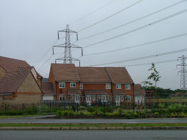
Great Ashby District Park
✦ Ancient woodland16 ha
Plan your visit
🦉Wildlife🦅Birds🍂Seasonal
Public accessFree entryDogs welcome16 ha
Getting here
51.93357, -0.17040
Open directionsv
Visiting this summer
Seasonal nature notes and what to look for now
- 🌞Midsummer — early morning visits most comfortable; look for deer fawns in quieter clearings
- ☀️Summer family visits work well here — arrive early and plan for a longer stay
- 🛝Playground 105m away — built-in entertainment for younger visitors alongside the wider site
🌤️ Visiting this summer
- 🌞Midsummer — early morning visits most comfortable; look for deer fawns in quieter clearings
- ☀️Summer family visits work well here — arrive early and plan for a longer stay
- 🛝Playground 105m away — built-in entertainment for younger visitors alongside the wider site
- £Free to visit — no entry charge
- 🐕Dogs welcome
- 🌿Ancient woodland — rare wildlife habitat
🦉Wildlife
Very strong match
Multi-group wildlife — Amphibians, Birds, Mammals; Multi-group wildlife — Amphibians, Birds, Mammals
Free
🦅Bird watching
Very strong match
Birds — Woodpigeon, Carrion Crow, Robin +61 more · last seen 2026; Birds — Woodpigeon, Carrion Crow, Robin +61 more · last seen 2026
Free
🍂Seasonal nature
Strong match
Ancient woodland — bluebells, fungi and autumn colour; Plants — Ash, Hazel, Hornbeam +37 more · last seen 2026
Free
🦋Insect spotting
Strong match
Insects — Meadow Brown, Peacock, Ringlet +66 more · last seen 2025; Insects — Meadow Brown, Peacock, Ringlet +66 more · last seen 2025
Free
Dogs allowed — public woodland
Free
Trails nearby
Within roughly 5 km21 signed routes nearby · 28 public paths nearby
Signed route nearbyPublic paths
STOOP Link Path 2 - Stevenage Outer Orbital Path LinkWalking route▾
A link from Stevenage to the STOOP path (at approx 3 o'clock on clockface)
Named route
STOOP Link Path 3 - Stevenage Outer Orbital Path LinkWalking route▾
A link from Stevenage to the STOOP path (at approx 4 o'clock on clockface)
Named route
STOOP Link Path 1 - Stevenage Outer Orbital Path LinkWalking route▾
A link from Stevenage to the STOOP path (at approx 2 o'clock on clockface)
Named route
STOOP Link Path 8 - Stevenage Outer Orbital Path LinkWalking route▾
Link from Stevenage to the STOOP path (at approx 11 o'clock on clockface)
Named routeLocal walking route
Icknield Way PathWalking route169 km▾
long distance footpath 169 km
Named routeLength 169 kmRegional walking route
57 signed routes nearby
Signed route nearby
Route 12Cycling route▾
Named routeRef 12National Cycle Network
recreational cycle route 10Cycling route▾
Named routeLocal cycle route
Main RouteCycling route337 m▾
Named routeRef 12Length 337 mNational Cycle NetworkTraffic-freeSurface asphalt
Main RouteCycling route719 m▾
Named routeRef 12Length 719 mNational Cycle NetworkTraffic-freeSurface asphalt
Main RouteCycling route410 m▾
Named routeRef 12Length 410 mNational Cycle NetworkTraffic-freeSurface asphalt
Main RouteCycling route201 m▾
Named routeRef 12Length 201 mNational Cycle NetworkOn-roadSurface asphalt
1 signed route nearby
Signed route nearby
Icknield Way Cycle TrailMountain bike route226 km▾
This is the off-road or mountain cycling route of the Icknield Way Trail.
Named routeLength 226 kmRegional cycle route
10 public paths nearby
Public paths
No named routes yet. Public paths are shown on the map.
Weather for this location
Next 14 daysNearby places
Useful places within 5 km
Own or manage this place?
Claim this listing to keep details accurate, add photos, and highlight what makes it special — free.
Claim this page→How useful was the information on this page?
id: 43865847-f2a7-4c53-bf77-d2164ee5fc24
Wildlife to spot
16,323 records · National Biodiversity Network
Wildlife to spot
16,323 records · National Biodiversity Network🐦Birds35 species
winterspring
2026▾
Woodpigeon · Robin · Carrion Crow · Great Tit · Starling +30
- WoodpigeonColumba palumbus2025
- RobinErithacus rubecula
- Carrion CrowCorvus corone2025
- Great TitParus major2025
- StarlingSturnus vulgaris2025
- Blue TitCyanistes caeruleus2025
- JayGarrulus glandarius
- MagpiePica pica2025
- BlackbirdTurdus merula2025
- GoldfinchCarduelis carduelis2025
- JackdawColoeus monedula2025
- Black-headed GullChroicocephalus ridibundus2025
- Rock DoveColumba livia2025
- MallardAnas platyrhynchos2025
- Lesser Black-backed GullLarus fuscus2024
- BlackcapSylvia atricapilla2024
- TreecreeperCerthia familiaris2024
- House SparrowPasser domesticus2024
- FieldfareTurdus pilaris2024
- WaxwingBombycilla garrulus2024
- Corn BuntingEmberiza calandra2025
- Great Spotted WoodpeckerDendrocopos major2025
- Pied WagtailMotacilla alba2025
- RedwingTurdus iliacus2025
- MoorhenGallinula chloropus2025
- RavenCorvus corax2024
- SwallowHirundo rustica2024
- GoldcrestRegulus regulus2024
- SwiftApus apus2024
- GreenfinchChloris chloris2024
- Green WoodpeckerPicus viridis2024
- Spotted FlycatcherMuscicapa striata2024
- ChaffinchFringilla coelebs2024
- PheasantPhasianus colchicus2024
- YellowhammerEmberiza citrinella2024
Common Pipistrelle · Red Fox · Grey Squirrel
- Common PipistrellePipistrellus pipistrellus
- Red FoxVulpes vulpes2024
- Grey SquirrelSciurus carolinensis2024
Meadow Brown · Peacock · Ringlet · Large White · Marbled White +27
- Meadow BrownManiola jurtina2024
- PeacockAglais io2024
- RingletAphantopus hyperantus2024
- Large WhitePieris brassicae2024
- Marbled WhiteMelanargia galathea2024
- Speckled WoodPararge aegeria
🌿Plants18 species
springsummer
2026▾
Giant Butterbur · Common Pincushion · Early Dog-violet · Red Dead-nettle · Lesser Celandine +13
- Giant ButterburPetasites japonicus
- Common PincushionDicranoweisia cirrata
- Early Dog-violetViola reichenbachiana2025
- Red Dead-nettleLamium purpureum2025
- Lesser CelandineFicaria verna2025
- Ash
Species observations from the last 10 years via NBN Atlas
2024
2024
7-spot LadybirdCoccinella septempunctata7-spot LadybirdCoccinella septempunctataGreen-veined WhitePieris napi2024Green-veined WhitePieris napi202416-spot LadybirdTytthaspis sedecimpunctata16-spot LadybirdTytthaspis sedecimpunctataBuff-tailed BumblebeeBombus terrestrisBuff-tailed BumblebeeBombus terrestrisHarmonia axyridis form succineaHarmonia axyridis form succinea2024Harmonia axyridis form succineaHarmonia axyridis form succinea2024Western Conifer Seed BugLeptoglossus occidentalisWestern Conifer Seed BugLeptoglossus occidentalisLesser Stag BeetleDorcus parallelipipedusLesser Stag BeetleDorcus parallelipipedusMeadow GrasshopperPseudochorthippus parallelusMeadow GrasshopperPseudochorthippus parallelusTortoise BugEurygaster testudinariaTortoise BugEurygaster testudinariaElater ferrugineusElater ferrugineusElater ferrugineusElater ferrugineusCommon Red Soldier BeetleRhagonycha fulvaCommon Red Soldier BeetleRhagonycha fulvaRoesel's Bush-cricketRoeseliana roeseliiRoesel's Bush-cricketRoeseliana roeseliiWestern Honey BeeApis melliferaWestern Honey BeeApis melliferaMesembrina meridianaMesembrina meridiana2024Mesembrina meridianaMesembrina meridiana2024Common DarterSympetrum striolatum2024Common DarterSympetrum striolatum2024Harlequin LadybirdHarmonia axyridis2024Harlequin LadybirdHarmonia axyridis2024Scathophaga stercorariaScathophaga stercoraria2024Scathophaga stercorariaScathophaga stercoraria2024Speckled Bush-cricketLeptophyes punctatissima2024Speckled Bush-cricketLeptophyes punctatissima2024GatekeeperPyronia tithonus2024GatekeeperPyronia tithonus2024CommaPolygonia c-album2024CommaPolygonia c-album2024Orange-tipAnthocharis cardamines2024Orange-tipAnthocharis cardamines2024Hairy-footed Flower BeeAnthophora plumipes2024Hairy-footed Flower BeeAnthophora plumipes2024Eristalis pertinaxEristalis pertinax2024Eristalis pertinaxEristalis pertinax2024Common Carder BeeBombus pascuorum2024Common Carder BeeBombus pascuorum2024Epistrophe eligansEpistrophe eligans2024Epistrophe eligansEpistrophe eligans2024Tawny Mining BeeAndrena fulva2024Tawny Mining BeeAndrena fulva2024Fraxinus excelsior2025
Fraxinus excelsior2025
Greater PeriwinkleVinca major2025Greater PeriwinkleVinca major2025Hairy Bitter-cressCardamine hirsuta2025Hairy Bitter-cressCardamine hirsuta2025HazelCorylus avellana2025HazelCorylus avellana2025White Dead-nettleLamium album2025White Dead-nettleLamium album2025Common Field-speedwellVeronica persica2025Common Field-speedwellVeronica persica2025Wild CarrotDaucus carota2024Wild CarrotDaucus carota2024CorncockleAgrostemma githago2024CorncockleAgrostemma githago2024Corn MarigoldGlebionis segetum2024Corn MarigoldGlebionis segetum2024HoneysuckleLonicera periclymenum2024HoneysuckleLonicera periclymenum2024Yellow-rattleRhinanthus minor2024Yellow-rattleRhinanthus minor2024Scentless MayweedTripleurospermum inodorum2024Scentless MayweedTripleurospermum inodorum2024CornflowerCentaurea cyanus2024CornflowerCentaurea cyanus2024Events & activities nearby
Switch provider to compare local events, tours and bookable activities.