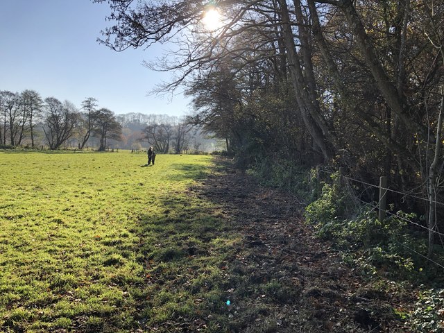
Great Plantation ✦ Ancient woodland 14 ha
🦉 Wildlife🦅 Birds🌿 Foraging
↑ Share
Public access Free entry Dogs welcome 14 ha
Places › England › South East › Chichester Getting here
50.98352, -0.85927
Open directionsv Visiting this summer
Seasonal nature notes and what to look for now
▾ 🌞 Midsummer — early morning visits most comfortable; look for deer fawns in quieter clearings 🌿 Foraging is at its best in summer here 🐕 Dogs welcome — bring water in summer; the site has enough space to find shade on hot days 🌤️ Visiting this summer
🌞 Midsummer — early morning visits most comfortable; look for deer fawns in quieter clearings 🌿 Foraging is at its best in summer here 🐕 Dogs welcome — bring water in summer; the site has enough space to find shade on hot days £ Free to visit — no entry charge🐕 Dogs welcome🌿 Ancient woodland — rare wildlife habitat🦉 Wildlife
Very strong match
Multi-group wildlife — Amphibians, Birds, Mammals, Reptiles; Multi-group wildlife — Amphibians, Birds, Mammals, Reptiles
Free
🦅 Bird watching
Very strong match
Birds — Woodpigeon, Blackbird, Robin +64 more · last seen 2025; Birds — Woodpigeon, Blackbird, Robin +64 more · last seen 2025
Free
Plants — Pedunculate Oak, Hogweed, Garlic Mustard +18 more foraging species; Deciduous woodland — fungi, berries and wild garlic
Varies
🍂 Seasonal nature
Strong match
Ancient woodland — bluebells, fungi and autumn colour; Plants — Himalayan Balsam, Bluebell, Field Maple +167 more · last seen 2025
Free
Dogs allowed — public woodland
Free
🦋 Insect spotting
Good match
Insects — Gatekeeper, Meadow Brown, Rosemary Beetle +7 more · last seen 2020; Insects — Gatekeeper, Meadow Brown, Rosemary Beetle +7 more · last seen 2020
Free
Trails nearby Within roughly 5 km 7 signed routes nearby · 9 public paths nearby
Signed route nearby Public paths
South Downs Way Walking route 160 km ▾
Named route Length 160 km National walking route
Show on map Octagon Way Walking route 29 km ▾
Named route Ref OW Length 29 km Round trip Local walking route
Show on map The Shipwrights Way Walking route ▾
A long distance route which links villages and towns in east Hampshire. The name reflects the use of oak grown at Alice Holt Forest for Tudor shipbuilding.
Named route Regional walking route
Show on map Sussex Border Path Walking route 220 km ▾
Named route Length 220 km Regional walking route
Show on map Harting Down Wildlife Walk, Sussex West Walking route 6.4 km ▾
Moderate walk around Harting Down, one of the largest areas of ancient chalk downland cared for by NT & a SSSI. Enjoy views over the Weald to the North Downs, before descending. Look out for rare wildlife and grazing sheep. Grassy paths & several climbs.
Named route Length 6.4 km Duration 01:20 Round trip Local walking route
Show on map 19 signed routes nearby
Signed route nearby
National Cycle Route 228 Pulborough to Petersfield (proposed) Cycling route ▾
Named route Ref 228 National Cycle Network
Show on map Route 22 Cycling route ▾
Named route Ref 22 National Cycle Network
Show on map Discover the Hampshire South Downs by Bike Cycling route ▾
Named route Ref EH Regional cycle route
Show on map Main Route Cycling route 148 m ▾
Named route Ref 22 Length 148 m National Cycle Network On-road Surface asphalt
Show on map Main Route Cycling route 57 m ▾
Named route Ref 22 Length 57 m National Cycle Network Traffic-free Surface unsealedfirm
Show on map Alternative Route Cycling route 736 m ▾
Named route Ref 22 Length 736 m National Cycle Network Traffic-free Surface asphalt
Show on map 4 signed routes nearby
Signed route nearby
South Downs Way Mountain bike route ▾
Named route Ref 89 National Cycle Network
Show on map King Alfred's Way Mountain bike route ▾
King Alfreds Way is 350km (220 miles) off road route designed to be ridden clockwise. It starts & ends in Winchester. It is suitable for gravel or cross-country bikes.
Named route Regional cycle route
Show on map Queen Elizabeth Off Road Cycle Trail Mountain bike route ▾
Shipwright's Way Mountain bike route ▾
✦ Ancient woodland — continuously wooded since at least 1600 AD. A rare and irreplaceable habitat, rich in biodiversity and historical character.
Weather for this location Next 14 days Nearby places Useful places within 5 km
All Historic
Own or manage this place?
Claim this listing to keep details accurate, add photos, and highlight what makes it special — free.
Claim this page→ How useful was the information on this page?
Something wrong on this page?
id: 723a3ce2-1948-4c6c-92d0-885b7852a65b
UK green spaces mapped from open public data — so anyone can find the woodland, trail, or nature reserve closest to them.
© 2026 Glade · Made with care for UK green spaces
Wildlife to spot
1,586 records · National Biodiversity Network
▾
Wildlife to spot 1,586 records · National Biodiversity Network 🐦 Birds 32 species
spring summer
2025 ▾
Woodpigeon · Chiffchaff · Jackdaw · Wren · Magpie +27
Woodpigeon Columba palumbus Chiffchaff Phylloscopus collybita Jackdaw Coloeus monedula Wren Troglodytes troglodytes Magpie Pica pica Carrion Crow Corvus corone Robin Erithacus rubecula Stock Dove Columba oenas Blackbird Turdus merula Rook Corvus frugilegus Swallow Hirundo rustica Song Thrush Turdus philomelos Blackcap Sylvia atricapilla Pheasant Phasianus colchicus Raven Corvus corax Dunnock Prunella modularis Black-headed Gull Chroicocephalus ridibundus Long-tailed Tit Aegithalos caudatus Green Woodpecker Picus viridis Whitethroat Curruca communis Common Gull Larus canus Blue Tit Cyanistes caeruleus House Martin Delichon urbicum Swift Apus apus Nuthatch Sitta europaea Chaffinch Fringilla coelebs Yellowhammer Emberiza citrinella Mallard Anas platyrhynchos Jay Garrulus glandarius Great Spotted Woodpecker Dendrocopos major Skylark Alauda arvensis Red-legged Partridge Alectoris rufa Bluebell · Bramble · Creeping Bent · Hedgerow Crane's-bill · Common Knapweed +129
Bluebell Hyacinthoides non-scripta x hispanica = H. x massartiana Bramble Rubus fruticosus Creeping Bent Agrostis stolonifera Hedgerow Crane's-bill Geranium pyrenaicum Common Knapweed Centaurea nigra Daisy Bellis perennis Field Maple Species observations from the last 10 years via NBN Atlas
Acer campestre
Acer campestre
Annual Meadow-grass Poa annua
Annual Meadow-grass Poa annua
Bush Vetch Vicia sepium
Bush Vetch Vicia sepium
Yorkshire-fog Holcus lanatus
Yorkshire-fog Holcus lanatus
Wood Anemone Anemone nemorosa
Wood Anemone Anemone nemorosa
Cut-leaved Crane's-bill Geranium dissectum
Cut-leaved Crane's-bill Geranium dissectum
Crosswort Cruciata laevipes
Crosswort Cruciata laevipes
Cleavers Galium aparine
Cleavers Galium aparine
Brooklime Veronica beccabunga
Brooklime Veronica beccabunga
Field Wood-rush Luzula campestris
Field Wood-rush Luzula campestris
Ground-elder Aegopodium podagraria
Ground-elder Aegopodium podagraria
Groundsel Senecio vulgaris
Groundsel Senecio vulgaris
Spear Thistle Cirsium vulgare
Spear Thistle Cirsium vulgare
Blackthorn Prunus spinosa
Blackthorn Prunus spinosa
Ribwort Plantain Plantago lanceolata
Ribwort Plantain Plantago lanceolata
Water Mint Mentha aquatica
Water Mint Mentha aquatica
Hoary Willowherb Epilobium parviflorum
Hoary Willowherb Epilobium parviflorum
Soft Shield-fern Polystichum setiferum
Soft Shield-fern Polystichum setiferum
Nipplewort Lapsana communis
Nipplewort Lapsana communis
Soft-rush Juncus effusus
Soft-rush Juncus effusus
Sweet Vernal-grass Anthoxanthum odoratum
Sweet Vernal-grass Anthoxanthum odoratum
Lamiastrum galeobdolon subsp. argentatum Lamiastrum galeobdolon subsp. argentatum
Lamiastrum galeobdolon subsp. argentatum Lamiastrum galeobdolon subsp. argentatum
Meadow Foxtail Alopecurus pratensis
Meadow Foxtail Alopecurus pratensis
Hogweed Heracleum sphondylium
Hogweed Heracleum sphondylium
Curled Dock Rumex crispus
Curled Dock Rumex crispus
Wild Teasel Dipsacus fullonum
Wild Teasel Dipsacus fullonum
Common Dog-violet Viola riviniana
Common Dog-violet Viola riviniana
Stone Parsley Sison amomum
Stone Parsley Sison amomum
Three-cornered Garlic Allium triquetrum
Three-cornered Garlic Allium triquetrum
Garlic Mustard Alliaria petiolata
Garlic Mustard Alliaria petiolata
Salad Burnet Poterium sanguisorba
Salad Burnet Poterium sanguisorba
Wall Speedwell Veronica arvensis
Wall Speedwell Veronica arvensis
Meadow Vetchling Lathyrus pratensis
Meadow Vetchling Lathyrus pratensis
Columbine Aquilegia vulgaris
Columbine Aquilegia vulgaris
Marsh Thistle Cirsium palustre
Marsh Thistle Cirsium palustre
Wall Cotoneaster Cotoneaster horizontalis
Wall Cotoneaster Cotoneaster horizontalis
Hesgen Lwyd Carex divulsa
Hesgen Lwyd Carex divulsa
Thale Cress Arabidopsis thaliana
Thale Cress Arabidopsis thaliana
Pedunculate Oak Quercus robur
Pedunculate Oak Quercus robur
Field-rose Rosa arvensis
Field-rose Rosa arvensis
Broad-leaved Dock Rumex obtusifolius
Broad-leaved Dock Rumex obtusifolius
Greater Plantain Plantago major
Greater Plantain Plantago major
Cherry Laurel Prunus laurocerasus
Cherry Laurel Prunus laurocerasus
Creeping Thistle Cirsium arvense
Creeping Thistle Cirsium arvense
Red Fescue Festuca rubra
Red Fescue Festuca rubra
Guelder-rose Viburnum opulus
Guelder-rose Viburnum opulus
Creeping Cinquefoil Potentilla reptans
Creeping Cinquefoil Potentilla reptans
Hawthorn Crataegus monogyna
Hawthorn Crataegus monogyna
Tall Fescue Schedonorus arundinaceus
Tall Fescue Schedonorus arundinaceus
Procumbent Pearlwort Sagina procumbens
Procumbent Pearlwort Sagina procumbens
Common Sorrel Rumex acetosa
Common Sorrel Rumex acetosa
Thyme-leaved Speedwell Veronica serpyllifolia
Thyme-leaved Speedwell Veronica serpyllifolia
Common Ragwort Jacobaea vulgaris
Common Ragwort Jacobaea vulgaris
Argentinian Vervain Verbena bonariensis
Argentinian Vervain Verbena bonariensis
Ivy-leaved Speedwell Veronica hederifolia
Ivy-leaved Speedwell Veronica hederifolia
Cuckooflower Cardamine pratensis
Cuckooflower Cardamine pratensis
Ash Fraxinus excelsior
Ash Fraxinus excelsior
Early-purple Orchid Orchis mascula
Early-purple Orchid Orchis mascula
Broad Buckler-fern Dryopteris dilatata
Broad Buckler-fern Dryopteris dilatata
Cow Parsley Anthriscus sylvestris
Cow Parsley Anthriscus sylvestris
Wood-sedge Carex sylvatica
Wood-sedge Carex sylvatica
Holly Ilex aquifolium
Holly Ilex aquifolium
Snowberry Symphoricarpos albus
Snowberry Symphoricarpos albus
Wood Avens Geum urbanum
Wood Avens Geum urbanum
Common Sallow Salix cinerea
Common Sallow Salix cinerea
Ramsons Allium ursinum
Ramsons Allium ursinum
Red Campion Silene dioica
Red Campion Silene dioica
Wilson's Honeysuckle Lonicera nitida
Wilson's Honeysuckle Lonicera nitida
Crack-willow Salix alba x euxina = S. x fragilis
Crack-willow Salix alba x euxina = S. x fragilis
Male-fern Dryopteris filix-mas
Male-fern Dryopteris filix-mas
Common Vetch Vicia sativa
Common Vetch Vicia sativa
Red Clover Trifolium pratense
Red Clover Trifolium pratense
Meadowsweet Filipendula ulmaria
Meadowsweet Filipendula ulmaria
Barren Strawberry Potentilla sterilis
Barren Strawberry Potentilla sterilis
Prickly Sow-thistle Sonchus asper
Prickly Sow-thistle Sonchus asper
Herb-Robert Geranium robertianum
Herb-Robert Geranium robertianum
Elder Sambucus nigra
Elder Sambucus nigra
Heath Speedwell Veronica officinalis
Heath Speedwell Veronica officinalis
Narcissus agg. Narcissus agg.
Narcissus agg. Narcissus agg.
Common Nettle Urtica dioica
Common Nettle Urtica dioica
Common Mouse-ear Cerastium fontanum
Common Mouse-ear Cerastium fontanum
Keeled-fruited Cornsalad Valerianella carinata
Keeled-fruited Cornsalad Valerianella carinata
Hairy Sedge Carex hirta
Hairy Sedge Carex hirta
Oxeye Daisy Leucanthemum vulgare
Oxeye Daisy Leucanthemum vulgare
Hedge Woundwort Stachys sylvatica
Hedge Woundwort Stachys sylvatica
Common Spotted-orchid Dactylorhiza fuchsii
Common Spotted-orchid Dactylorhiza fuchsii
Germander Speedwell Veronica chamaedrys
Germander Speedwell Veronica chamaedrys
Wild Cherry Prunus avium
Wild Cherry Prunus avium
Tufted Hair-grass Deschampsia cespitosa
Tufted Hair-grass Deschampsia cespitosa
Wood Forget-me-not Myosotis sylvatica
Wood Forget-me-not Myosotis sylvatica
Sticky Mouse-ear Cerastium glomeratum
Sticky Mouse-ear Cerastium glomeratum
Silverweed Potentilla anserina
Silverweed Potentilla anserina
Selfheal Prunella vulgaris
Selfheal Prunella vulgaris
Hemlock Water-dropwort Oenanthe crocata
Hemlock Water-dropwort Oenanthe crocata
Petty Spurge Euphorbia peplus
Petty Spurge Euphorbia peplus
Dogwood Cornus sanguinea
Dogwood Cornus sanguinea
Dryopteris affinis Dryopteris affinis
Dryopteris affinis Dryopteris affinis
Lady-fern Athyrium filix-femina
Lady-fern Athyrium filix-femina
Great Willowherb Epilobium hirsutum
Great Willowherb Epilobium hirsutum
Purple Toadflax Linaria purpurea
Purple Toadflax Linaria purpurea
Butcher's-broom Ruscus aculeatus
Butcher's-broom Ruscus aculeatus
Remote Sedge Carex remota
Remote Sedge Carex remota
Honeysuckle Lonicera periclymenum
Honeysuckle Lonicera periclymenum
Hazel Corylus avellana
Hazel Corylus avellana
Cock's-foot Dactylis glomerata
Cock's-foot Dactylis glomerata
Enchanter's-nightshade Circaea lutetiana
Enchanter's-nightshade Circaea lutetiana
Slender Speedwell Veronica filiformis
Slender Speedwell Veronica filiformis
Ivy Hedera helix
Ivy Hedera helix
Three-nerved Sandwort Moehringia trinervia
Three-nerved Sandwort Moehringia trinervia
Winter Heliotrope Petasites pyrenaicus
Winter Heliotrope Petasites pyrenaicus
Greater Bird's-foot-trefoil Lotus pedunculatus
Greater Bird's-foot-trefoil Lotus pedunculatus
Wood Speedwell Veronica montana
Wood Speedwell Veronica montana
Smooth Sow-thistle Sonchus oleraceus
Smooth Sow-thistle Sonchus oleraceus
False-brome Brachypodium sylvaticum
False-brome Brachypodium sylvaticum
Hart's-Tongue Asplenium scolopendrium
Hart's-Tongue Asplenium scolopendrium
Alder Alnus glutinosa
Alder Alnus glutinosa
Foxglove Digitalis purpurea
Foxglove Digitalis purpurea
Hemerocallis Hemerocallis
Hemerocallis Hemerocallis
Hard Rush Juncus inflexus
Hard Rush Juncus inflexus
Lungwort Pulmonaria officinalis
Lungwort Pulmonaria officinalis
Garden Grape-hyacinth Muscari armeniacum
Garden Grape-hyacinth Muscari armeniacum
Field Horsetail Equisetum arvense
Field Horsetail Equisetum arvense
Lesser Burdock Arctium minus
Lesser Burdock Arctium minus
Creeping-Jenny Lysimachia nummularia
Creeping-Jenny Lysimachia nummularia
Wall-rue Asplenium ruta-muraria
Wall-rue Asplenium ruta-muraria
Summer Snowflake Leucojum aestivum
Summer Snowflake Leucojum aestivum
Sycamore Acer pseudoplatanus
Sycamore Acer pseudoplatanus
White Dead-nettle Lamium album
White Dead-nettle Lamium album Events & activities nearby Switch provider to compare local events, tours and bookable activities.
Bookable tours GetYourGuide Promote here