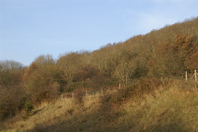
Hale Coppice ✦ Ancient woodland 31 ha
🦉 Wildlife🦅 Birds🦋 Insects
↑ Share
Public access Free entry Dogs welcome 31 ha
Places › England › South West › Somerset Getting here
51.29679, -2.82677
Open directionsv Visiting this summer
Seasonal nature notes and what to look for now
▾ 🌞 Midsummer — early morning visits most comfortable; look for deer fawns in quieter clearings 🐕 Early mornings are best for dog walks in summer — visit before 9am to avoid the heat and find quieter trails 🅿️ Parking on site — 8 car parks within reach 🌤️ Visiting this summer
🌞 Midsummer — early morning visits most comfortable; look for deer fawns in quieter clearings 🐕 Early mornings are best for dog walks in summer — visit before 9am to avoid the heat and find quieter trails 🅿️ Parking on site — 8 car parks within reach £ Free to visit — no entry charge🐕 Dogs welcome🌿 Ancient woodland — rare wildlife habitat🦉 Wildlife
Very strong match
Multi-group wildlife — Amphibians, Birds, Mammals, Reptiles; Multi-group wildlife — Amphibians, Birds, Mammals, Reptiles
Free
🦅 Bird watching
Very strong match
Birds — Robin, Green Woodpecker, Woodpigeon +58 more · last seen 2026; Birds — Robin, Green Woodpecker, Woodpigeon +58 more · last seen 2026
Free
🦋 Insect spotting
Strong match
Chalk and limestone grassland — chalkhill blue, adonis blue and rare moths; Insects — Gatekeeper, Meadow Brown, Speckled Wood +82 more · last seen 2026
Free
🍂 Seasonal nature
Strong match
Ancient woodland — bluebells, fungi and autumn colour
Free
Dogs allowed — public woodland
Free
Named cycling route nearby: Route 26
Varies
Trails nearby Within roughly 5 km 5 signed routes nearby · 25 public paths nearby
Signed route nearby Public paths
Samaritans Way South West Walking route 166 km ▾
Named route Length 166 km Regional walking route
Show on map West Mendip Way Walking route 48 km ▾
Named route Ref WMW Length 48 km Regional walking route
Show on map The Butcombe Trail Walking route 74 km ▾
Named route Ref BUT Length 74 km Regional walking route
Show on map The Mendip Trail Walking route ▾
Named route Ref MT Regional walking route
Show on map Limestone Link Walking route 58 km ▾
Named route Ref LL Length 58 km Regional walking route
Show on map Coffin Lane public footpath · 158 m ▾
Public path public footpath Length 158 m Path type: footway
Show on map Callow Drove public footpath · 795 m ▾
Public path public footpath Length 795 m Path type: track
Show on map Prowse's Lane public footpath · 334 m ▾
Public path public footpath Length 334 m Path type: service
Show on map 36 signed routes nearby
Signed route nearby
National Cycle Network Route 26 (Proposed) Cycling route ▾
Named route Ref 26 National Cycle Network
Show on map Strawberry Line Cycling route ▾
Named route Local cycle route
Show on map Route 26 Cycling route ▾
Named route Ref 26 National Cycle Network
Show on map Main Route Cycling route 66 m ▾
Named route Ref 26 Length 66 m National Cycle Network Traffic-free Surface unsealedloose
Show on map Main Route Cycling route 113 m ▾
Named route Ref 26 Length 113 m National Cycle Network On-road Surface asphalt
Show on map Main Route Cycling route 115 m ▾
Named route Ref 26 Length 115 m National Cycle Network Traffic-free Surface unsealedfirm
Show on map 15 public paths nearby
Public paths
Winscombe Drove bridleway · 1.2 km ▾
Public path bridleway Length 1.2 km Surface dirt Incline up Path type: track
Show on map Yadley Lane bridleway · 488 m ▾
Public path bridleway Length 488 m Surface dirt Path type: bridleway
Show on map ✦ Ancient woodland — continuously wooded since at least 1600 AD. A rare and irreplaceable habitat, rich in biodiversity and historical character.
Weather for this location Next 14 days Nearby places Useful places within 5 km
All Historic
Own or manage this place?
Claim this listing to keep details accurate, add photos, and highlight what makes it special — free.
Claim this page→ How useful was the information on this page?
Something wrong on this page?
id: c9d2c618-5189-45a4-bfa1-e5ea5298e2fe
UK green spaces mapped from open public data — so anyone can find the woodland, trail, or nature reserve closest to them.
© 2026 Glade · Made with care for UK green spaces
Events & activities nearby Switch provider to compare local events, tours and bookable activities.
Bookable tours GetYourGuide Promote here
Wildlife to spot
55,620 records · National Biodiversity Network
▾
Wildlife to spot 55,620 records · National Biodiversity Network 🐦 Birds 42 species
autumn winter
2026 ▾
Redwing · House Sparrow · Great Spotted Woodpecker · Robin · Goldfinch +37
Redwing Turdus iliacus House Sparrow Passer domesticus Great Spotted Woodpecker Dendrocopos major Robin Erithacus rubecula2025 Goldfinch Carduelis carduelis Magpie Pica pica Woodpigeon Columba palumbus2025 Long-tailed Tit Aegithalos caudatus2025 Wren Troglodytes troglodytes2025 Black-headed Gull Chroicocephalus ridibundus2025 Green Woodpecker Picus viridis Great Tit Parus major2025 Dunnock Prunella modularis2025 Chaffinch Fringilla coelebs2025 Collared Dove Streptopelia decaocto Nuthatch Sitta europaea Jackdaw Coloeus monedula2025 Blackbird Turdus merula2025 Herring Gull Larus argentatus2025 Carrion Crow Corvus corone2025 Blue Tit Cyanistes caeruleus2025 Rock Dove Columba livia2025 Starling Sturnus vulgaris2025 Jay Garrulus glandarius2025 Kestrel Falco tinnunculus2025 Coal Tit Periparus ater2025 Rook Corvus frugilegus2025 Common Gull Larus canus2025 Blackcap Sylvia atricapilla2025 Song Thrush Turdus philomelos2025 Goldcrest Regulus regulus2025 Pied Wagtail Motacilla alba2025 Treecreeper Certhia familiaris2025 Mistle Thrush Turdus viscivorus2025 Meadow Pipit Anthus pratensis2025 Mallard Anas platyrhynchos Lesser Black-backed Gull Larus fuscus2025 Bullfinch Pyrrhula pyrrhula2025 Chiffchaff Phylloscopus collybita2025 Stonechat Saxicola rubicola2025 Willow Warbler Phylloscopus trochilus2025 Wheatear Oenanthe oenanthe2025 🦌 Mammals 2 species
summer autumn
2025 ▾
Pine Marten · Hazel Dormouse
Pine Marten Martes martes Hazel Dormouse Muscardinus avellanarius 🐸 Amphibians 2 species
winter spring autumn
2026 ▾
Common Toad · Palmate Newt
Common Toad Bufo bufo Palmate Newt Lissotriton helveticus2025 🐝 Insects 5 species
winter autumn
2026 ▾
Carabus granulatus · Oedemera femoralis · Nebria brevicollis · Rugged Oil-beetle · Great Green Bush-cricket
Carabus granulatus Carabus granulatus2025 Oedemera femoralis Oedemera femoralis Nebria brevicollis Nebria brevicollis Rugged Oil-beetle Meloe rugosus2025 Great Green Bush-cricket Tettigonia viridissima2025 Canadian Fleabane · Lesser Swine-cress · Hoary Willowherb · Burnet-saxifrage · Oxeye Daisy +43
Canadian Fleabane Erigeron canadensis Lesser Swine-cress Lepidium didymum Hoary Willowherb Epilobium parviflorum Burnet-saxifrage Pimpinella saxifraga Oxeye Daisy Leucanthemum vulgare Three-nerved Sandwort Moehringia trinervia Common Figwort Species observations from the last 10 years via NBN Atlas
Scrophularia nodosa
Scrophularia nodosa
Slender St John's-wort Hypericum pulchrum
Slender St John's-wort Hypericum pulchrum
Hedgerow Crane's-bill Geranium pyrenaicum
Hedgerow Crane's-bill Geranium pyrenaicum
Cowslip Primula veris
Cowslip Primula veris
Lesser Stitchwort Stellaria graminea
Lesser Stitchwort Stellaria graminea
Salad Burnet Poterium sanguisorba subsp. sanguisorba
Salad Burnet Poterium sanguisorba subsp. sanguisorba
Bittersweet Solanum dulcamara
Bittersweet Solanum dulcamara
White Dead-nettle Lamium album
White Dead-nettle Lamium album
Black Nightshade Solanum nigrum
Black Nightshade Solanum nigrum
Common Chickweed Stellaria media
Common Chickweed Stellaria media
Square-stalked St John's-wort Hypericum tetrapterum
Square-stalked St John's-wort Hypericum tetrapterum
Meadow Oat Helictochloa pratensis
Meadow Oat Helictochloa pratensis
Sticky Mouse-ear Cerastium glomeratum
Sticky Mouse-ear Cerastium glomeratum
Silver Birch Betula pendula
Silver Birch Betula pendula
Marsh Cudweed Gnaphalium uliginosum
Marsh Cudweed Gnaphalium uliginosum
Rusty-Back Fern Asplenium ceterach
Rusty-Back Fern Asplenium ceterach
Parsley-piert Aphanes arvensis
Parsley-piert Aphanes arvensis
Bog Stitchwort Stellaria alsine
Bog Stitchwort Stellaria alsine
Great Willowherb Epilobium hirsutum
Great Willowherb Epilobium hirsutum
Smooth Sow-thistle Sonchus oleraceus
Smooth Sow-thistle Sonchus oleraceus
English Elm Ulmus procera
English Elm Ulmus procera
Coltsfoot Tussilago farfara
Coltsfoot Tussilago farfara
Greater Stitchwort Stellaria holostea
Greater Stitchwort Stellaria holostea
Agrimony Agrimonia eupatoria
Agrimony Agrimonia eupatoria
Raspberry Rubus idaeus
Raspberry Rubus idaeus
Centaurea nigra Centaurea nigra
Centaurea nigra Centaurea nigra
Hop Humulus lupulus
Hop Humulus lupulus
Procumbent Pearlwort Sagina procumbens
Procumbent Pearlwort Sagina procumbens
Groundsel Senecio vulgaris
Groundsel Senecio vulgaris
Common Ragwort Jacobaea vulgaris
Common Ragwort Jacobaea vulgaris
Prickly Sow-thistle Sonchus asper
Prickly Sow-thistle Sonchus asper
Selfheal Prunella vulgaris
Selfheal Prunella vulgaris
Lady's Bedstraw Galium verum
Lady's Bedstraw Galium verum
Narrow-leaved Everlasting-pea Lathyrus sylvestris
Narrow-leaved Everlasting-pea Lathyrus sylvestris
Dropwort Filipendula vulgaris
Dropwort Filipendula vulgaris
Southern Polypody Polypodium cambricum
Southern Polypody Polypodium cambricum
Common Calamint Clinopodium ascendens
Common Calamint Clinopodium ascendens
Wall Cotoneaster Cotoneaster horizontalis
Wall Cotoneaster Cotoneaster horizontalis
Spring Cinquefoil Potentilla verna
Spring Cinquefoil Potentilla verna
Yew Taxus baccata
Yew Taxus baccata
Hairy-brome Bromopsis ramosa
Hairy-brome Bromopsis ramosa
Pendulous Sedge Carex pendula
Pendulous Sedge Carex pendula