Hall Lands Copse ✦ Ancient woodland 7 ha
🦉 Wildlife🦅 Birds🍂 Seasonal
↑ Share
Public access Free entry Dogs welcome 7 ha
Places › England › South East › Eastleigh Getting here
50.97049, -1.29048
Open directionsv Visiting this summer
Seasonal nature notes and what to look for now
▾ 🌞 Midsummer — early morning visits most comfortable; look for deer fawns in quieter clearings 🌿 Foraging is at its best in summer here 🐕 Dogs welcome — bring water in summer; the site has enough space to find shade on hot days 🌤️ Visiting this summer
🌞 Midsummer — early morning visits most comfortable; look for deer fawns in quieter clearings 🌿 Foraging is at its best in summer here 🐕 Dogs welcome — bring water in summer; the site has enough space to find shade on hot days £ Free to visit — no entry charge🐕 Dogs welcome🌿 Ancient woodland — rare wildlife habitat🦉 Wildlife
Very strong match
Multi-group wildlife — Amphibians, Birds, Mammals, Reptiles; Multi-group wildlife — Amphibians, Birds, Mammals, Reptiles
Free
🦅 Bird watching
Very strong match
Birds — Woodpigeon, Robin, Mallard +59 more · last seen 2026; Birds — Woodpigeon, Robin, Mallard +59 more · last seen 2026
Free
🍂 Seasonal nature
Strong match
Ancient woodland — bluebells, fungi and autumn colour; Plants — Dewberry, Pedunculate Oak, Cowslip +10 more · last seen 2024
Free
🦋 Insect spotting
Strong match
Insects — Stag Beetle, Box Tree Moth, Swollen-thighed Beetle +236 more · last seen 2026; Insects — Stag Beetle, Box Tree Moth, Swollen-thighed Beetle +236 more · last seen 2026
Free
Traditional orchard — seasonal fruit, fungi and wild plants
Varies
Dogs allowed — public woodland
Free
Trails nearby Within roughly 5 km 13 signed routes nearby · 4 public paths nearby
Signed route nearby Public paths
Allan King Way Walking route ▾
Named route Listed length 44 miles Regional walking route
Show on map Monarch's Way Walking route 990 km ▾
approximate route of Charles II's escape
Named route Ref MW Length 990 km Regional walking route
Show on map Itchen Way Walking route ▾
Named route Regional walking route
Show on map Pilgrims' Trail Walking route ▾
Named route Regional walking route
Show on map Otter Trail Walking route ▾
Named route Local walking route
Show on map Hall Lands Lane public footpath · 482 m ▾
Public path public footpath Length 482 m Surface asphalt Path type: service
Show on map Hall Lands Lane public footpath · 601 m ▾
Public path public footpath Length 601 m Surface asphalt Path type: service
Show on map 35 signed routes nearby
Signed route nearby
National Cycle Route 23 Cycling route ▾
Named route Ref 23 National Cycle Network
Show on map Route 24 Cycling route ▾
Named route Ref 24 National Cycle Network
Show on map Eastleigh Cycling route ▾
Named route Local cycle route
Show on map Main Route Cycling route 428 m ▾
Named route Ref 23 Length 428 m National Cycle Network On-road Surface asphalt
Show on map Main Route Cycling route 87 m ▾
Named route Ref 23 Length 87 m National Cycle Network Traffic-free Surface asphalt
Show on map Main Route Cycling route 10 m ▾
Named route Ref 23 Length 10 m National Cycle Network Traffic-free Surface asphalt
Show on map 2 signed routes nearby
Signed route nearby
Itchen Valley Off Road Cycle Route Mountain bike route ▾
Named route Round trip Local cycle route
Show on map Cheesefoot Head Off Road Cycle Trail Mountain bike route ▾
3 public paths nearby
Public paths
No named routes yet. Public paths are shown on the map.
✦ Ancient woodland — continuously wooded since at least 1600 AD. A rare and irreplaceable habitat, rich in biodiversity and historical character.
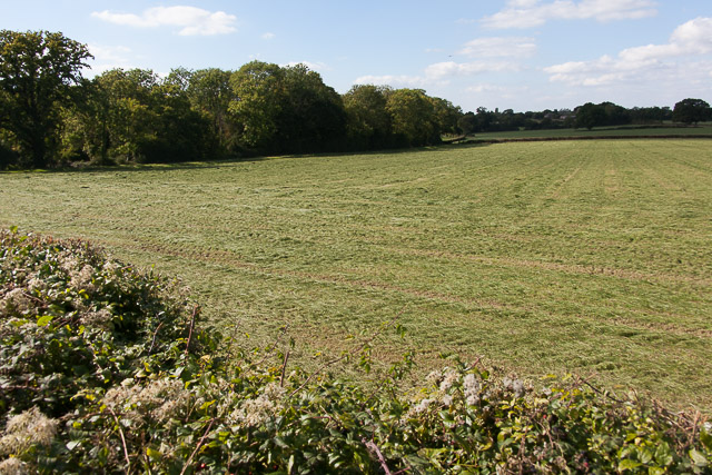
Photos Field and Hall Lands Copse
‹ ›
Weather for this location Next 14 days Nearby places Useful places within 5 km
All Historic
Own or manage this place?
Claim this listing to keep details accurate, add photos, and highlight what makes it special — free.
Claim this page→ How useful was the information on this page?
Something wrong on this page?
id: 96a85679-3108-4179-9201-3e64433e290b
UK green spaces mapped from open public data — so anyone can find the woodland, trail, or nature reserve closest to them.
© 2026 Glade · Made with care for UK green spaces
Events & activities nearby Switch provider to compare local events, tours and bookable activities.
Bookable tours GetYourGuide Promote here
Wildlife to spot
4,884 records · National Biodiversity Network
▾
Wildlife to spot 4,884 records · National Biodiversity Network 🐦 Birds 29 species
winter summer
2026 ▾
Blue Tit · Blackbird · Carrion Crow · Magpie · Robin +24
Blue Tit Cyanistes caeruleus Blackbird Turdus merula2025 Carrion Crow Corvus corone2025 Magpie Pica pica2025 Robin Erithacus rubecula2025 Goldfinch Carduelis carduelis2025 Swallow Hirundo rustica2025 Woodpigeon Columba palumbus2025 Blackcap Sylvia atricapilla2025 Spotted Flycatcher Muscicapa striata2025 Great Tit Parus major2025 Wren Troglodytes troglodytes2025 Chiffchaff Phylloscopus collybita2025 House Sparrow Passer domesticus2025 Tawny Owl Strix aluco2024 Kestrel Falco tinnunculus2024 Egyptian Goose Alopochen aegyptiaca2025 House Martin Delichon urbicum2025 Treecreeper Certhia familiaris2025 Song Thrush Turdus philomelos2025 Great Spotted Woodpecker Dendrocopos major2025 Starling Sturnus vulgaris2025 Mallard Anas platyrhynchos2025 Common Gull Larus canus2025 Barn Owl Tyto alba2025 Little Owl Athene noctua2024 Rock Dove Columba livia2024 Nuthatch Sitta europaea2024 Jay Garrulus glandarius2024 Roe Deer · Muntjac
Roe Deer Capreolus capreolus Muntjac Muntiacus reevesi2024 🦎 Reptiles 1 species
spring autumn
2025 ▾
Slow-worm
🐸 Amphibians 4 species
winter spring summer autumn
2025 ▾
Great Crested Newt · Common Frog · Smooth Newt · Common Toad
Great Crested Newt Triturus cristatus Common Frog Rana temporaria Smooth Newt Lissotriton vulgaris2024 Common Toad Bufo bufo Stag Beetle · Minotaur Beetle · Broad Centurion · Beautiful Demoiselle · Common Darter +70
Stag Beetle Lucanus cervus2024 Minotaur Beetle Typhaeus typhoeus Broad Centurion Chloromyia formosa2025 Beautiful Demoiselle Calopteryx virgo2025 Common Darter Sympetrum striolatum2025 7-spot Ladybird Coccinella septempunctata 🌿 Plants 2 species
spring winter
2024 ▾
Pedunculate Oak · Cowslip
Pedunculate Oak Quercus robur Cowslip Primula veris Species observations from the last 10 years via NBN Atlas
2025
2025
Dark-edged Bee-fly Bombylius major2025
Dark-edged Bee-fly Bombylius major2025
Ctenophora pectinicornis Ctenophora pectinicornis2024
Ctenophora pectinicornis Ctenophora pectinicornis2024
Cantharis rustica Cantharis rustica2024
Cantharis rustica Cantharis rustica2024
Cabbage Bug Eurydema (Eurydema) oleracea2024
Cabbage Bug Eurydema (Eurydema) oleracea2024
Locust Blowfly Stomorhina lunata2023
Locust Blowfly Stomorhina lunata2023
Leptura aurulenta Leptura aurulenta2023
Leptura aurulenta Leptura aurulenta2023
Rutpela maculata Rutpela maculata2023
Rutpela maculata Rutpela maculata2023
Dark Bush-cricket Pholidoptera griseoaptera2025
Dark Bush-cricket Pholidoptera griseoaptera2025
Tachycixius pilosus Tachycixius pilosus2025
Tachycixius pilosus Tachycixius pilosus2025
Roesel's Bush-cricket Roeseliana roeselii2025
Roesel's Bush-cricket Roeseliana roeselii2025
Bishop's Mitre Aelia acuminata2025
Bishop's Mitre Aelia acuminata2025
Black-tailed Skimmer Orthetrum cancellatum2025
Black-tailed Skimmer Orthetrum cancellatum2025
Anoplotrupes stercorosus Anoplotrupes stercorosus2025
Anoplotrupes stercorosus Anoplotrupes stercorosus2025
Caenopsis fissirostris Caenopsis fissirostris2025
Caenopsis fissirostris Caenopsis fissirostris2025
Strawberry-root Weevil Otiorhynchus ovatus2025
Strawberry-root Weevil Otiorhynchus ovatus2025
Red-legged Shieldbug Pentatoma rufipes2025
Red-legged Shieldbug Pentatoma rufipes2025
Conops ceriaeformis Conops ceriaeformis2025
Conops ceriaeformis Conops ceriaeformis2025
Conops quadrifasciatus Conops quadrifasciatus2025
Conops quadrifasciatus Conops quadrifasciatus2025
Bronze Shieldbug Troilus luridus2025
Bronze Shieldbug Troilus luridus2025
Southern Oak Bush-cricket Meconema meridionale2025
Southern Oak Bush-cricket Meconema meridionale2025
Tortoise Bug Eurygaster testudinaria2025
Tortoise Bug Eurygaster testudinaria2025
Broom Carver Rhogogaster genistae2025
Broom Carver Rhogogaster genistae2025
Privet Strider Macrophya punctumalbum2025
Privet Strider Macrophya punctumalbum2025
Small Yellow-legged Robberfly Dioctria linearis2025
Small Yellow-legged Robberfly Dioctria linearis2025
German Wasp Vespula germanica2025
German Wasp Vespula germanica2025
Downlooker Snipefly Rhagio scolopaceus2025
Downlooker Snipefly Rhagio scolopaceus2025
Athous haemorrhoidalis Athous haemorrhoidalis2025
Athous haemorrhoidalis Athous haemorrhoidalis2025
Heath Short-spur Anisodactylus nemorivagus2025
Heath Short-spur Anisodactylus nemorivagus2025
Rhamphomyia crassirostris Rhamphomyia crassirostris2025
Rhamphomyia crassirostris Rhamphomyia crassirostris2025
Bibio lanigerus Bibio lanigerus2025
Bibio lanigerus Bibio lanigerus2025
Broad-bodied Chaser Libellula depressa2024
Broad-bodied Chaser Libellula depressa2024
Issus coleoptratus Issus coleoptratus2024
Issus coleoptratus Issus coleoptratus2024
Ectophasia crassipennis Ectophasia crassipennis2024
Ectophasia crassipennis Ectophasia crassipennis2024
Onthophagus coenobita Onthophagus coenobita2024
Onthophagus coenobita Onthophagus coenobita2024
Symmorphus gracilis Symmorphus gracilis2024
Symmorphus gracilis Symmorphus gracilis2024
Black-headed Cardinal Beetle Pyrochroa coccinea2024
Black-headed Cardinal Beetle Pyrochroa coccinea2024
Marsh Snipefly Rhagio tringarius2024
Marsh Snipefly Rhagio tringarius2024
Solomon's-seal Sawfly Phymatocera aterrima2024
Solomon's-seal Sawfly Phymatocera aterrima2024
Bloody Griever Dolerus haematodes2024
Bloody Griever Dolerus haematodes2024
Limonia nubeculosa Limonia nubeculosa2024
Limonia nubeculosa Limonia nubeculosa2024
White-sided Cleaver Aglaostigma fulvipes2024
White-sided Cleaver Aglaostigma fulvipes2024
10-spot Ladybird Adalia decempunctata2024
10-spot Ladybird Adalia decempunctata2024
Longitarsus dorsalis Longitarsus dorsalis2024
Longitarsus dorsalis Longitarsus dorsalis2024
Red-belted Cleaver Aglaostigma aucupariae2024
Red-belted Cleaver Aglaostigma aucupariae2024
Parent Bug Elasmucha grisea2023
Parent Bug Elasmucha grisea2023
16-spot Ladybird Tytthaspis sedecimpunctata2023
16-spot Ladybird Tytthaspis sedecimpunctata2023
Andrion regensteinense Andrion regensteinense2023
Andrion regensteinense Andrion regensteinense2023
Turtle Bug Podops inuncta2023
Turtle Bug Podops inuncta2023
Acorn Weevil Curculio glandium2023
Acorn Weevil Curculio glandium2023
Dryomyza anilis Dryomyza anilis2023
Dryomyza anilis Dryomyza anilis2023
Spiked Shieldbug Picromerus bidens2023
Spiked Shieldbug Picromerus bidens2023
Band-eyed Brown Horsefly Tabanus bromius2023
Band-eyed Brown Horsefly Tabanus bromius2023
Caliadurgus fasciatellus Caliadurgus fasciatellus2023
Caliadurgus fasciatellus Caliadurgus fasciatellus2023
Stenagostus rhombeus Stenagostus rhombeus2023
Stenagostus rhombeus Stenagostus rhombeus2023
Xylota segnis Xylota segnis2023
Xylota segnis Xylota segnis2023
Blue Shieldbug Zicrona caerulea2023
Blue Shieldbug Zicrona caerulea2023
Nowickia ferox Nowickia ferox2023
Nowickia ferox Nowickia ferox2023
Wasp Beetle Clytus arietis2023
Wasp Beetle Clytus arietis2023
Tanner Beetle Prionus coriarius2023
Tanner Beetle Prionus coriarius2023
Dark Giant Horsefly Tabanus sudeticus2023
Dark Giant Horsefly Tabanus sudeticus2023
Eriothrix rufomaculata Eriothrix rufomaculata2023
Eriothrix rufomaculata Eriothrix rufomaculata2023
Pilemostoma fastuosum Pilemostoma fastuosum2023
Pilemostoma fastuosum Pilemostoma fastuosum2023
Scaeva pyrastri Scaeva pyrastri2023
Scaeva pyrastri Scaeva pyrastri2023
Pseudovadonia livida Pseudovadonia livida2023
Pseudovadonia livida Pseudovadonia livida2023
Leptura quadrifasciata Leptura quadrifasciata2023
Leptura quadrifasciata Leptura quadrifasciata2023
Paracorymbia fulva Paracorymbia fulva2023
Paracorymbia fulva Paracorymbia fulva2023
Eremocoris fenestratus Eremocoris fenestratus2023
Eremocoris fenestratus Eremocoris fenestratus2023
Ditropis pteridis Ditropis pteridis2023
Ditropis pteridis Ditropis pteridis2023
Swollen-thighed Beetle Oedemera nobilis2023
Swollen-thighed Beetle Oedemera nobilis2023