Ham Brake
✦ Ancient woodland34 ha
Plan your visit
🦅Birds🦉Wildlife🍂Seasonal
Public accessFree entryDogs welcome34 ha
Getting here
51.62044, -2.13825
Open directionsv
Visiting this summer
Seasonal nature notes and what to look for now
- 🐦67+ species recorded in this area — summer evenings are best for activity; watch for Woodpigeon and Blackbird
- 🐕Early mornings are best for dog walks in summer — visit before 9am to avoid the heat and find quieter trails
- 📍Open access throughout summer — no booking required
🌤️ Visiting this summer
- 🐦67+ species recorded in this area — summer evenings are best for activity; watch for Woodpigeon and Blackbird
- 🐕Early mornings are best for dog walks in summer — visit before 9am to avoid the heat and find quieter trails
- 📍Open access throughout summer — no booking required
- £Free to visit — no entry charge
- 🐕Dogs welcome
- 🌿Ancient woodland — rare wildlife habitat
🦅Bird watching
Very strong match
Birds — Woodpigeon, Blackbird, Robin +64 more · last seen 2025; Birds — Woodpigeon, Blackbird, Robin +64 more · last seen 2025
Free
🦉Wildlife
Very strong match
Multi-group wildlife — Birds, Mammals; Multi-group wildlife — Birds, Mammals
Free
🍂Seasonal nature
Strong match
Ancient woodland — bluebells, fungi and autumn colour; Plants — Barberry, Common Bird's-foot-trefoil, Ivy +73 more · last seen 2025
Free
Dogs allowed — public woodland
Free
🦋Insect spotting
Strong match
Insects — Large White, Gatekeeper, Ringlet +42 more · last seen 2022; Insects — Large White, Gatekeeper, Ringlet +42 more · last seen 2022
Free
Deciduous woodland — fungi, berries and wild garlic; Plants — Mouse-ear-hawkweed, Common Sorrel, Elder +2 more foraging species
Varies
Trails nearby
Within roughly 5 km3 signed routes nearby · 19 public paths nearby
Signed route nearbyPublic paths
Monarch's WayWalking route990 km▾
approximate route of Charles II's escape
Named routeRef MWLength 990 kmRegional walking route
Macmillan WayWalking route290 km▾
Named routeRef MWALength 290 kmListed length 461Regional walking route
Palladian WayWalking route190 km▾
The Old Goal, Buckingham to Pulteney Bridge, Bath
Named routeLength 190 kmRegional walking route
6 signed routes nearby
Signed route nearby
National BywayCycling route▾
Named routeRef NBRegional cycle route
Wiltshire CyclewayCycling route155 km▾
Named routeRef WCLength 155 kmRound tripRegional cycle route
Fosse2Cycling route▾
Named routeRef 48National Cycle Network
Cotswold CyclewayCycling route▾
Named routeRef CCRegional cycle route
Main RouteCycling route3.5 km▾
Named routeRef 48Length 3.5 kmNational Cycle NetworkTraffic-freeSurface unsealedfirm
Main RouteCycling route1.6 km▾
Named routeRef 48Length 1.6 kmNational Cycle NetworkTraffic-freeSurface unsealedfirm
2 public paths nearby
Public paths
Fosse Wayrestricted byway · 794 m▾
Roman Road
Public pathrestricted bywayLength 794 mSurface unpavedPath type: track
Fosse Waybyway open to all traffic · 867 m▾
Roman Road
Public pathbyway open to all trafficLength 867 mSurface gravelPath type: track
Photos
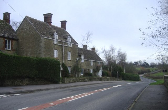
Main road at Long Newnton
Weather for this location
Next 14 daysNearby places
Useful places within 5 km
Own or manage this place?
Claim this listing to keep details accurate, add photos, and highlight what makes it special — free.
Claim this page→How useful was the information on this page?
id: c1bf5943-efdc-44ac-a7a6-909a8a6dbc4c
Events & activities nearby
Switch provider to compare local events, tours and bookable activities.
Wildlife to spot
2,370 records · National Biodiversity Network
Wildlife to spot
2,370 records · National Biodiversity Network🐦Birds52 species
springsummerautumn
2025▾
Woodpigeon · Blackbird · Carrion Crow · Robin · Wren +47
- WoodpigeonColumba palumbus
- BlackbirdTurdus merula
- Carrion CrowCorvus corone
- RobinErithacus rubecula
- WrenTroglodytes troglodytes
- RookCorvus frugilegus
- BlackcapSylvia atricapilla
- MagpiePica pica
- DunnockPrunella modularis
- Blue TitCyanistes caeruleus
- JackdawColoeus monedula
- GoldfinchCarduelis carduelis
- ChiffchaffPhylloscopus collybita
- GoldcrestRegulus regulus2024
- ChaffinchFringilla coelebs2024
- Herring GullLarus argentatus
- Song ThrushTurdus philomelos
- PheasantPhasianus colchicus2024
- Great TitParus major2024
- KestrelFalco tinnunculus2024
- House SparrowPasser domesticus
- LinnetLinaria cannabina
- Lesser Black-backed GullLarus fuscus
- SkylarkAlauda arvensis
- Green WoodpeckerPicus viridis
- Garden WarblerSylvia borin
- Mistle ThrushTurdus viscivorus2024
- Long-tailed TitAegithalos caudatus2024
- Great Spotted WoodpeckerDendrocopos major2024
- NuthatchSitta europaea2024
- Collared DoveStreptopelia decaocto2024
- SwiftApus apus2024
- SwallowHirundo rustica2024
- GreenfinchChloris chloris2021
- Black-headed GullChroicocephalus ridibundus
- FieldfareTurdus pilaris2024
- Grey PartridgePerdix perdix2024
- Rock DoveColumba livia2024
- WhitethroatCurruca communis2024
- KingfisherAlcedo atthis2022
- Meadow PipitAnthus pratensis2022
- SiskinSpinus spinus2022
- Grey HeronArdea cinerea2022
- StarlingSturnus vulgaris2021
- JayGarrulus glandarius2021
- RedwingTurdus iliacus2021
- Pied WagtailMotacilla alba yarrellii2021
- StonechatSaxicola rubicola2021
- House MartinDelichon urbicum2021
- Coal TitPeriparus ater2021
- BullfinchPyrrhula pyrrhula2021
- YellowhammerEmberiza citrinella2021
🦌Mammals3 species
winterautumn
2025▾
Fallow Deer · Muntjac · Roe Deer
- Fallow DeerDama dama
- MuntjacMuntiacus reevesi2022
- Roe DeerCapreolus capreolus2022
Alder Leaf Beetle
- Alder Leaf BeetleAgelastica alni
Great Willowherb · Red Bartsia · Buckwheat · Water Forget-me-not · Monkeyflower Species +32
- Great WillowherbEpilobium hirsutum2023
- Red BartsiaOdontites vernus
- BuckwheatFagopyrum esculentum
- Water Forget-me-notMyosotis scorpioides2023
- Monkeyflower SpeciesErythranthe2023
- Yellow IrisIris pseudacorus2023
Species observations from the last 10 years via NBN Atlas