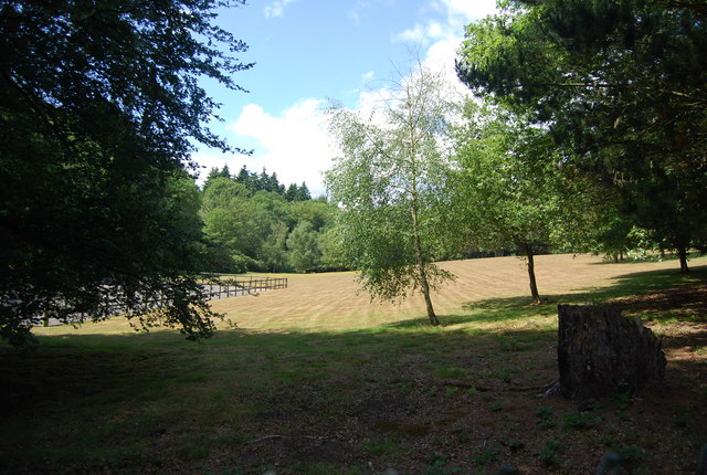
Hammer Moor ✦ Ancient woodland 48 ha
🦉 Wildlife🦅 Birds🍂 Seasonal
↑ Share
Public access Free entry Dogs welcome 48 ha
Places › England › South East › Chichester Getting here
51.08064, -0.76493
Open directionsv Visiting this summer
Seasonal nature notes and what to look for now
▾ 🌞 Midsummer — early morning visits most comfortable; look for deer fawns in quieter clearings 🌿 Foraging is at its best in summer here 🐕 Dogs welcome — bring water in summer; the site has enough space to find shade on hot days 🌤️ Visiting this summer
🌞 Midsummer — early morning visits most comfortable; look for deer fawns in quieter clearings 🌿 Foraging is at its best in summer here 🐕 Dogs welcome — bring water in summer; the site has enough space to find shade on hot days £ Free to visit — no entry charge🐕 Dogs welcome🌿 Ancient woodland — rare wildlife habitat🦉 Wildlife
Very strong match
Multi-group wildlife — Amphibians, Birds, Mammals, Reptiles; Multi-group wildlife — Amphibians, Birds, Mammals, Reptiles
Free
🦅 Bird watching
Very strong match
Birds — Robin, Blue Tit, Blackbird +50 more · last seen 2025; Birds — Robin, Blue Tit, Blackbird +50 more · last seen 2025
Free
🍂 Seasonal nature
Strong match
Ancient woodland — bluebells, fungi and autumn colour; Plants — Honeysuckle, Ramsons, Neat Feather-moss +167 more · last seen 2026
Free
Plants — Ramsons, Hawthorn, Hogweed +21 more foraging species; Deciduous woodland — fungi, berries and wild garlic
Varies
Dogs allowed — public woodland
Free
🦋 Insect spotting
Strong match
Insects — Meadow Brown, Speckled Wood, Gatekeeper +46 more · last seen 2025; Insects — Meadow Brown, Speckled Wood, Gatekeeper +46 more · last seen 2025
Free
Trails nearby Within roughly 5 km 16 signed routes nearby · 18 public paths nearby
Signed route nearby Public paths
The Shipwrights Way Walking route ▾
A long distance route which links villages and towns in east Hampshire. The name reflects the use of oak grown at Alice Holt Forest for Tudor shipbuilding.
Named route Regional walking route
Show on map New Lipchis Way Walking route ▾
Named route Regional walking route
Show on map Greensand Way Walking route ▾
Named route Ref GW Regional walking route
Show on map Sussex Border Path Walking route 220 km ▾
Named route Length 220 km Regional walking route
Show on map Highcombe Hike, Hindhead Walking route 5.1 km ▾
Take a challenging walk through ancient woodland and open heath to find out how the Punch Bowl was formed. On the way learn about the people who lived in the old 'broom-squires' cottages and how they made their living here over the centuries.
Named route Length 5.1 km Duration 01:15-03:00 Round trip Local walking route
Show on map Oak Tree Lane public footpath · 264 m ▾
Public path public footpath Length 264 m Path type: residential
Show on map 3 signed routes nearby
Signed route nearby
A3 Cycle Route Cycling route ▾
Named route Ref A3 Local cycle route
Show on map Surrey Cycleway Cycling route ▾
Haslemere link
Named route Regional cycle route
Show on map NCN 22 - Liphook Link Cycling route ▾
National Cycle Network link route
Named route Local cycle route
Show on map 4 signed routes nearby
Signed route nearby
King Alfred's Way Mountain bike route ▾
King Alfreds Way is 350km (220 miles) off road route designed to be ridden clockwise. It starts & ends in Winchester. It is suitable for gravel or cross-country bikes.
Named route Regional cycle route
Show on map Bordon Off Road Cycle Trail Mountain bike route ▾
Named route Hampshire off Road cycle trails
Show on map Devils PunchBowl Loop Mountain bike route ▾
Named route Cycle surrey hills
Show on map Shipwrights Way (Liphook Spur) Mountain bike route ▾
23 public paths nearby
Public paths
Gillham's Lane bridleway · 1.4 km ▾
Public path bridleway Length 1.4 km Path type: bridleway
Show on map Hammer Lane bridleway · 680 m ▾
Public path bridleway Length 680 m Path type: bridleway
Show on map Chiltley Lane byway open to all traffic · 233 m ▾
Public path byway open to all traffic Length 233 m Path type: track
Show on map ✦ Ancient woodland — continuously wooded since at least 1600 AD. A rare and irreplaceable habitat, rich in biodiversity and historical character.
Weather for this location Next 14 days Nearby places Useful places within 5 km
All Historic
Own or manage this place?
Claim this listing to keep details accurate, add photos, and highlight what makes it special — free.
Claim this page→ How useful was the information on this page?
Something wrong on this page?
id: 79c3e4e2-edd3-43ab-89e7-e19c32df6792
UK green spaces mapped from open public data — so anyone can find the woodland, trail, or nature reserve closest to them.
© 2026 Glade · Made with care for UK green spaces
Events & activities nearby Switch provider to compare local events, tours and bookable activities.
Bookable tours GetYourGuide Promote here
Wildlife to spot
29,608 records · National Biodiversity Network
▾
Wildlife to spot 29,608 records · National Biodiversity Network Robin · Jackdaw · Wren · Goldfinch · Carrion Crow +26
Robin Erithacus rubecula Jackdaw Coloeus monedula Wren Troglodytes troglodytes Goldfinch Carduelis carduelis Carrion Crow Corvus corone Woodpigeon Columba palumbus Blue Tit Cyanistes caeruleus Dunnock Prunella modularis Greenfinch Chloris chloris Blackbird Turdus merula Blackcap Sylvia atricapilla Magpie Pica pica Chiffchaff Phylloscopus collybita Rook Corvus frugilegus Great Tit Parus major Green Woodpecker Picus viridis Song Thrush Turdus philomelos Herring Gull Larus argentatus Rock Dove Columba livia Siskin Spinus spinus Coal Tit Periparus ater Long-tailed Tit Aegithalos caudatus Swift Apus apus Marsh Tit Poecile palustris Crossbill Loxia curvirostra Jay Garrulus glandarius Stock Dove Columba oenas Collared Dove Streptopelia decaocto Little Egret Egretta garzetta Bullfinch Pyrrhula pyrrhula Great Spotted Woodpecker Dendrocopos major 🦌 Mammals 2 species
summer autumn
2025 ▾
Hazel Dormouse · Roe Deer
Hazel Dormouse Muscardinus avellanarius Roe Deer Capreolus capreolus Beautiful Demoiselle · Emperor Dragonfly · Hornet · Glow-worm · Golden-ringed Dragonfly
Beautiful Demoiselle Calopteryx virgo Emperor Dragonfly Anax imperator Hornet Vespa crabro Glow-worm Lampyris noctiluca Golden-ringed Dragonfly Cordulegaster boltonii Neat Feather-moss · Gorse · Honeysuckle · Common Dog-violet · Snowdrop +88
Neat Feather-moss Pseudoscleropodium purum2025 Gorse Ulex europaeus2025 Honeysuckle Lonicera periclymenum2025 Common Dog-violet Viola riviniana2025 Snowdrop Galanthus nivalis Springy Turf-moss Rhytidiadelphus squarrosus Species observations from the last 10 years via NBN Atlas
2025
2025
Woodruff Galium odoratum2025
Woodruff Galium odoratum2025
Wood-sorrel Oxalis acetosella2025
Wood-sorrel Oxalis acetosella2025
Waved Silk-moss Plagiothecium undulatum2025
Waved Silk-moss Plagiothecium undulatum2025
Crescent-cup Liverwort Lunularia cruciata2025
Crescent-cup Liverwort Lunularia cruciata2025
Swan's-neck Thyme-moss Mnium hornum2025
Swan's-neck Thyme-moss Mnium hornum2025
Common Tamarisk-moss Thuidium tamariscinum2025
Common Tamarisk-moss Thuidium tamariscinum2025
Spindle Euonymus europaeus2025
Spindle Euonymus europaeus2025
Solomon's-seal Polygonatum multiflorum2025
Solomon's-seal Polygonatum multiflorum2025
Fine-leaved Sheep's-fescue Festuca filiformis2025
Fine-leaved Sheep's-fescue Festuca filiformis2025
Veronica hederifolia subsp. lucorum Veronica hederifolia subsp. lucorum2025
Veronica hederifolia subsp. lucorum Veronica hederifolia subsp. lucorum2025
Common Mouse-ear Cerastium fontanum2025
Common Mouse-ear Cerastium fontanum2025
Ramsons Allium ursinum2025
Ramsons Allium ursinum2025
Hart's-Tongue Asplenium scolopendrium2025
Hart's-Tongue Asplenium scolopendrium2025
Male-fern Dryopteris filix-mas2025
Male-fern Dryopteris filix-mas2025
Rhododendron Rhododendron ponticum2025
Rhododendron Rhododendron ponticum2025
Dwarf Gorse Ulex minor2025
Dwarf Gorse Ulex minor2025
Water-pepper Persicaria hydropiper2025
Water-pepper Persicaria hydropiper2025
Daisy Bellis perennis2025
Daisy Bellis perennis2025
Common Whitebeam Sorbus aria2025
Common Whitebeam Sorbus aria2025
Wall Lettuce Mycelis muralis2025
Wall Lettuce Mycelis muralis2025
Hawthorn Crataegus monogyna2025
Hawthorn Crataegus monogyna2025
Sheep's Sorrel Rumex acetosella2025
Sheep's Sorrel Rumex acetosella2025
Cat's-ear Hypochaeris radicata2025
Cat's-ear Hypochaeris radicata2025
Sanicle Sanicula europaea2025
Sanicle Sanicula europaea2025
Bell Heather Erica cinerea2025
Bell Heather Erica cinerea2025
Soft-rush Juncus effusus2025
Soft-rush Juncus effusus2025
Pill Sedge Carex pilulifera2025
Pill Sedge Carex pilulifera2025
Yorkshire-fog Holcus lanatus2025
Yorkshire-fog Holcus lanatus2025
Shining Crane's-bill Geranium lucidum2025
Shining Crane's-bill Geranium lucidum2025
Lesser Celandine Ficaria verna2025
Lesser Celandine Ficaria verna2025
Heather Calluna vulgaris2025
Heather Calluna vulgaris2025
Creeping Soft-grass Holcus mollis2025
Creeping Soft-grass Holcus mollis2025
Pendulous Sedge Carex pendula2025
Pendulous Sedge Carex pendula2025
Enchanter's-nightshade Circaea lutetiana2025
Enchanter's-nightshade Circaea lutetiana2025
Holly Ilex aquifolium2025
Holly Ilex aquifolium2025
Heath Bedstraw Galium saxatile2025
Heath Bedstraw Galium saxatile2025
Broad Buckler-fern Dryopteris dilatata2025
Broad Buckler-fern Dryopteris dilatata2025
Himalayan Balsam Impatiens glandulifera2025
Himalayan Balsam Impatiens glandulifera2025
Tutsan Hypericum androsaemum2025
Tutsan Hypericum androsaemum2025
Broad-leaved Dock Rumex obtusifolius2025
Broad-leaved Dock Rumex obtusifolius2025
Herb-Robert Geranium robertianum2025
Herb-Robert Geranium robertianum2025
Hogweed Heracleum sphondylium2025
Hogweed Heracleum sphondylium2025
Tormentil Potentilla erecta2025
Tormentil Potentilla erecta2025
Greater Stitchwort Stellaria holostea2025
Greater Stitchwort Stellaria holostea2025
Primrose Primula vulgaris2025
Primrose Primula vulgaris2025
Raspberry Rubus idaeus2025
Raspberry Rubus idaeus2025
Common Sorrel Rumex acetosa2025
Common Sorrel Rumex acetosa2025
Cleavers Galium aparine2025
Cleavers Galium aparine2025
Taraxacum agg. Taraxacum agg.2025
Taraxacum agg. Taraxacum agg.2025
Common Nettle Urtica dioica2025
Common Nettle Urtica dioica2025
Rowan Sorbus aucuparia2025
Rowan Sorbus aucuparia2025
Purple Moor-grass Molinia caerulea2025
Purple Moor-grass Molinia caerulea2025
Alder Buckthorn Frangula alnus2025
Alder Buckthorn Frangula alnus2025
Germander Speedwell Veronica chamaedrys2025
Germander Speedwell Veronica chamaedrys2025
Wavy Hair-Grass Avenella flexuosa2025
Wavy Hair-Grass Avenella flexuosa2025
Bramble Rubus fruticosus2025
Bramble Rubus fruticosus2025
Annual Meadow-grass Poa annua2025
Annual Meadow-grass Poa annua2025
Wood Sage Teucrium scorodonia2025
Wood Sage Teucrium scorodonia2025
Pedunculate Oak Quercus robur2025
Pedunculate Oak Quercus robur2025
Garlic Mustard Alliaria petiolata2025
Garlic Mustard Alliaria petiolata2025
Bilberry Vaccinium myrtillus2025
Bilberry Vaccinium myrtillus2025
Sweet Vernal-grass Anthoxanthum odoratum2025
Sweet Vernal-grass Anthoxanthum odoratum2025
Heath Wood-rush Luzula multiflora2025
Heath Wood-rush Luzula multiflora2025
Wood Dock Rumex sanguineus2025
Wood Dock Rumex sanguineus2025
Broad-leaved Willowherb Epilobium montanum2025
Broad-leaved Willowherb Epilobium montanum2025
False-brome Brachypodium sylvaticum2025
False-brome Brachypodium sylvaticum2025
Cow Parsley Anthriscus sylvestris2025
Cow Parsley Anthriscus sylvestris2025
Bluebell Hyacinthoides non-scripta2025
Bluebell Hyacinthoides non-scripta2025
Silver Birch Betula pendula2025
Silver Birch Betula pendula2025
Fringecups Tellima grandiflora2025
Fringecups Tellima grandiflora2025
Hazel Corylus avellana2025
Hazel Corylus avellana2025
Pignut Conopodium majus2025
Pignut Conopodium majus2025
Cock's-foot Dactylis glomerata2025
Cock's-foot Dactylis glomerata2025
Beech Fagus sylvatica2025
Beech Fagus sylvatica2025
Wavy Bitter-cress Cardamine flexuosa2025
Wavy Bitter-cress Cardamine flexuosa2025
Bugle Ajuga reptans2025
Bugle Ajuga reptans2025
Scentless Mayweed Tripleurospermum inodorum2025
Scentless Mayweed Tripleurospermum inodorum2025
Downy Birch Betula pubescens2025
Downy Birch Betula pubescens2025
Hedge Woundwort Stachys sylvatica2025
Hedge Woundwort Stachys sylvatica2025
Bracken Pteridium aquilinum2025
Bracken Pteridium aquilinum2025
Wood Avens Geum urbanum2025
Wood Avens Geum urbanum2025
Wood-sedge Carex sylvatica2025
Wood-sedge Carex sylvatica2025
Wood Speedwell Veronica montana2025
Wood Speedwell Veronica montana2025
Rough Meadow-grass Poa trivialis2025
Rough Meadow-grass Poa trivialis2025
Sweet Chestnut Castanea sativa2025
Sweet Chestnut Castanea sativa2025
Remote Sedge Carex remota2025
Remote Sedge Carex remota2025
Creeping Thistle Cirsium arvense2025
Creeping Thistle Cirsium arvense2025