Hangman's Acre ✦ Ancient woodland 23 ha
Plan your visit
🦉 Wildlife🦅 Birds🍄 Fungi
Public access Free entry Dogs welcome 23 ha
Places › England › West Midlands › Herefordshire, County of Getting here
52.29116, -2.98802
Open directionsv Visiting this summer
Seasonal nature notes and what to look for now
▾ 🌞 Midsummer — early morning visits most comfortable; look for deer fawns in quieter clearings 🍄 Mushroom foraging is at its best in summer here 🐕 Dogs welcome — bring water in summer; the site has enough space to find shade on hot days 🌤️ Visiting this summer
🌞 Midsummer — early morning visits most comfortable; look for deer fawns in quieter clearings 🍄 Mushroom foraging is at its best in summer here 🐕 Dogs welcome — bring water in summer; the site has enough space to find shade on hot days £ Free to visit — no entry charge🐕 Dogs welcome🌿 Ancient woodland — rare wildlife habitat🦉 Wildlife
Very strong match
Multi-group wildlife — Birds, Mammals, Reptiles; Multi-group wildlife — Birds, Mammals, Reptiles
Free
🦅 Bird watching
Very strong match
Birds — Robin, Blue Tit, Wren +51 more · last seen 2025; Birds — Robin, Blue Tit, Wren +51 more · last seen 2025
Free
🍄 Mushroom foraging
Strong match
Fungi — Ochre Brittlegill, Yellow Stagshorn, Common Rustgill +127 more · last seen 2019; Fungi — Ochre Brittlegill, Yellow Stagshorn, Common Rustgill +127 more · last seen 2019
Varies
🍂 Seasonal nature
Strong match
Ancient woodland — bluebells, fungi and autumn colour; Plants — Bluebell, Squirreltail Fescue, Bristle Club-rush +9 more · last seen 2025
Free
🦋 Insect spotting
Strong match
Insects — Large Yellow Underwing, Common Footman, Willow Beauty +183 more · last seen 2021; Insects — Large Yellow Underwing, Common Footman, Willow Beauty +183 more · last seen 2021
Free
Dogs allowed — public woodland
Free
Trails nearby Within roughly 5 km 3 signed routes nearby · 1 public path nearby
Signed route nearby Public paths
Offa's Dyke Path Walking route 285 km ▾
Named route Ref ODP Length 285 km National walking route
Show on map Mortimer Trail Walking route 48 km ▾
Named route Length 48 km Regional walking route
Show on map Herefordshire Trail Walking route 246.5 km ▾
Named route Length 246.5 km Regional walking route
Show on map 9 signed routes nearby
Signed route nearby
National Byway (Wales & border) Cycling route ▾
Named route Ref NB Regional cycle route
Show on map Radnor Ring Cycling route ▾
Named route Ref 825 National Cycle Network
Show on map Main Route Cycling route 660 m ▾
Named route Ref 825 Length 660 m National Cycle Network On-road Surface asphalt
Show on map Main Route Cycling route 2.1 km ▾
Named route Ref 825 Length 2.1 km National Cycle Network On-road Surface asphalt
Show on map Main Route Cycling route 828 m ▾
Named route Ref 825 Length 828 m National Cycle Network On-road Surface asphalt
Show on map Main Route Cycling route 267 m ▾
Named route Ref 825 Length 267 m National Cycle Network On-road Surface asphalt
Show on map 1 public path nearby
Public paths
No named routes yet. Public paths are shown on the map.
✦ Ancient woodland — continuously wooded since at least 1600 AD. A rare and irreplaceable habitat, rich in biodiversity and historical character.
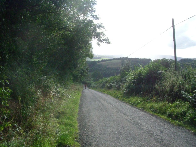
Photos The lane between Stapleton Hill and Stapleton
‹ ›
Weather for this location Next 14 days Nearby places Useful places within 5 km
All Historic
Own or manage this place?
Claim this listing to keep details accurate, add photos, and highlight what makes it special — free.
Claim this page→ How useful was the information on this page?
id: 58522cce-869f-4dad-b5eb-008b12cc6082
UK green spaces mapped from open public data — so anyone can find the woodland, trail, or nature reserve closest to them.
© 2026 Glade · Made with care for UK green spaces
Events & activities nearby Switch provider to compare local events, tours and bookable activities.
Bookable tours GetYourGuide Promote here
Wildlife to spot
9,060 records · National Biodiversity Network
▾
Wildlife to spot 9,060 records · National Biodiversity Network 🐦 Birds 39 species
winter summer autumn
2025 ▾
Siskin · Robin · Blue Tit · Great Spotted Woodpecker · Wren +34
Siskin Spinus spinus Robin Erithacus rubecula Blue Tit Cyanistes caeruleus Great Spotted Woodpecker Dendrocopos major Wren Troglodytes troglodytes Great Tit Parus major Marsh Tit Poecile palustris Blackbird Turdus merula Treecreeper Certhia familiaris Raven Corvus corax Chiffchaff Phylloscopus collybita Bullfinch Pyrrhula pyrrhula Woodpigeon Columba palumbus Goldcrest Regulus regulus Coal Tit Periparus ater Song Thrush Turdus philomelos Chaffinch Fringilla coelebs Blackcap Sylvia atricapilla Mistle Thrush Turdus viscivorus Redwing Turdus iliacus2024 Jackdaw Coloeus monedula2024 Carrion Crow Corvus corone2022 Linnet Linaria cannabina Nuthatch Sitta europaea Swallow Hirundo rustica Crossbill Loxia curvirostra Magpie Pica pica2024 Long-tailed Tit Aegithalos caudatus2024 Grey Wagtail Motacilla cinerea2024 Tree Pipit Anthus trivialis2024 Pied Flycatcher Ficedula hypoleuca2024 Garden Warbler Sylvia borin2024 Redstart Phoenicurus phoenicurus2024 Spotted Flycatcher Muscicapa striata2024 Fieldfare Turdus pilaris2023 Jay Garrulus glandarius2022 House Sparrow Passer domesticus2021 Woodcock Scolopax rusticola2021 Greenfinch Chloris chloris2021 Brown Hare
Brown Hare Lepus europaeus Baetis rhodani/atlanticus · Ecdyonurus · Leuctra · Limnius volckmari · Dicranota +44
Baetis rhodani/atlanticus Baetis rhodani/atlanticus Ecdyonurus Ecdyonurus Leuctra Leuctra Limnius volckmari Limnius volckmari Dicranota Dicranota Green Drake Ephemera danica Rhyacophila dorsalis Rhyacophila dorsalis Squirreltail Fescue · Bristle Club-rush
Squirreltail Fescue Vulpia bromoides Bristle Club-rush Isolepis setacea Species observations from the last 10 years via NBN Atlas
Sericostoma personatum Sericostoma personatum
Sericostoma personatum Sericostoma personatum
Black flies Simuliidae
Black flies Simuliidae
Paraleptophlebia Paraleptophlebia
Paraleptophlebia Paraleptophlebia
Tanytarsini Tanytarsini
Tanytarsini Tanytarsini
Elmis aenea Elmis aenea
Elmis aenea Elmis aenea
Oulimnius Oulimnius
Oulimnius Oulimnius
Cranefly Tipulidae
Cranefly Tipulidae
Perlodidae Perlodidae
Perlodidae Perlodidae
Brachyptera Brachyptera
Brachyptera Brachyptera
Nemoura Nemoura
Nemoura Nemoura
Ephemera Ephemera
Ephemera Ephemera
Glossosomatidae Glossosomatidae
Glossosomatidae Glossosomatidae
Muscidae Muscidae
Muscidae Muscidae
Limnephilidae Limnephilidae
Limnephilidae Limnephilidae
Sericostomatidae Sericostomatidae
Sericostomatidae Sericostomatidae
Silo pallipes Silo pallipes
Silo pallipes Silo pallipes
Orthocladiinae Orthocladiinae
Orthocladiinae Orthocladiinae
Hydropsyche siltalai Hydropsyche siltalai
Hydropsyche siltalai Hydropsyche siltalai
Rhithrogena semicolorata Rhithrogena semicolorata
Rhithrogena semicolorata Rhithrogena semicolorata
Nemoura avicularis Nemoura avicularis
Nemoura avicularis Nemoura avicularis
Plectrocnemia Plectrocnemia
Plectrocnemia Plectrocnemia
Isoperla grammatica Isoperla grammatica
Isoperla grammatica Isoperla grammatica
Rhyacophila Rhyacophila
Rhyacophila Rhyacophila
Agapetus fuscipes Agapetus fuscipes
Agapetus fuscipes Agapetus fuscipes
Indet. Mothfly Psychodidae
Indet. Mothfly Psychodidae
Philopotamus montanus Philopotamus montanus
Philopotamus montanus Philopotamus montanus
Baetis Baetis
Baetis Baetis
Leuctra fusca Leuctra fusca
Leuctra fusca Leuctra fusca
Leptophlebiidae Leptophlebiidae
Leptophlebiidae Leptophlebiidae
Oulimnius tuberculatus Oulimnius tuberculatus
Oulimnius tuberculatus Oulimnius tuberculatus
Potamophylax latipennis Potamophylax latipennis
Potamophylax latipennis Potamophylax latipennis
Scirtidae Scirtidae
Scirtidae Scirtidae
Hairy Whirligig Beetle Orectochilus villosus
Hairy Whirligig Beetle Orectochilus villosus
Chaetopteryx villosa Chaetopteryx villosa
Chaetopteryx villosa Chaetopteryx villosa
Non-biting midges Chironomidae
Non-biting midges Chironomidae
Halesus digitatus Halesus digitatus
Halesus digitatus Halesus digitatus
Chironomini Chironomini
Chironomini Chironomini
Agapetus Agapetus
Agapetus Agapetus
Empididae Empididae
Empididae Empididae
Brachyptera risi Brachyptera risi
Brachyptera risi Brachyptera risi
Hydropsyche instabilis Hydropsyche instabilis
Hydropsyche instabilis Hydropsyche instabilis
Simulium Simulium
Simulium Simulium