Harley Hill Wood ✦ Ancient woodland 14 ha
Plan your visit
🦉 Wildlife🦋 Insects🐶 Dogs
Public access Free entry Dogs welcome 14 ha
Places › England › South East › West Berkshire Getting here
51.49890, -1.13937
Open directionsv Visiting this summer
Seasonal nature notes and what to look for now
▾ 🌞 Midsummer — early morning visits most comfortable; look for deer fawns in quieter clearings 🐕 Early mornings are best for dog walks in summer — visit before 9am to avoid the heat and find quieter trails 🅿️ Parking 402m away — 2 car parks within reach 🌤️ Visiting this summer
🌞 Midsummer — early morning visits most comfortable; look for deer fawns in quieter clearings 🐕 Early mornings are best for dog walks in summer — visit before 9am to avoid the heat and find quieter trails 🅿️ Parking 402m away — 2 car parks within reach £ Free to visit — no entry charge🐕 Dogs welcome🌿 Ancient woodland — rare wildlife habitatDeciduous woodland priority habitat; Ancient woodland
Free
🦋 Insect spotting
Strong match
Chalk and limestone grassland — chalkhill blue, adonis blue and rare moths
Free
Dogs allowed — public woodland
Free
🍂 Seasonal nature
Strong match
Ancient woodland — bluebells, fungi and autumn colour
Free
🦅 Bird watching
Strong match
Deciduous woodland — woodpeckers, warblers and woodland birds
Free
Deciduous woodland — fungi, berries and wild garlic
Varies
Trails nearby Within roughly 5 km 13 signed routes nearby
Signed route nearby
The Ridgeway Walking route 140 km ▾
Named route Ref RW Length 140 km National walking route
Show on map The Chiltern Way Southern Extension Walking route ▾
Long distance path
Named route Ref CWS Regional walking route
Show on map The Roman Way Walking route 274.5 km ▾
Named route Length 274.5 km Regional walking route
Show on map European walking route E2 west, UK, South East England Walking route ▾
Westroute: Stranraer (UK) - Birminhgham (UK) - Calais (FR) - Zoersel (BE) / Eastroute: Stranraer (UK) - Harwich (UK) - Rotterdam (NL) - Zoersel (BE) / Both Routes: Zoersel (BE) - Maastrich (NL) - Luxembourg (LUX) - Lake Geneva (CH) - Nice (FR)
Named route Ref E2 International walking route
Show on map Woodland Walk, Basildon Park Walking route 2.4 km ▾
This route goes through the woodland and across our landscape parkland. Suitable for all terrain pushchairs. Potential for livestock on route.
Named route Length 2.4 km Duration 00:45 Round trip Local walking route
Show on map 1 signed route nearby
Signed route nearby
Round Berkshire Cycle Route Cycling route ▾
Named route Regional cycle route
Show on map 1 signed route nearby
Signed route nearby
King Alfred's Way Mountain bike route ▾
King Alfreds Way is 350km (220 miles) off road route designed to be ridden clockwise. It starts & ends in Winchester. It is suitable for gravel or cross-country bikes.
Named route Regional cycle route
Show on map 1 public path nearby
Public paths
No named routes yet. Public paths are shown on the map.
✦ Ancient woodland — continuously wooded since at least 1600 AD. A rare and irreplaceable habitat, rich in biodiversity and historical character.
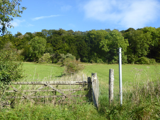
Photos Footpath towards Harley Hill Wood
‹ ›
Weather for this location Next 14 days Nearby places Useful places within 5 km
All Historic
Own or manage this place?
Claim this listing to keep details accurate, add photos, and highlight what makes it special — free.
Claim this page→ How useful was the information on this page?
id: fa0fc211-a5bf-4d04-bb5b-1dc3499d695b
UK green spaces mapped from open public data — so anyone can find the woodland, trail, or nature reserve closest to them.
© 2026 Glade · Made with care for UK green spaces
Events & activities nearby Switch provider to compare local events, tours and bookable activities.
Bookable tours GetYourGuide Promote here
Wildlife to spot
32,168 records · National Biodiversity Network
▾
Wildlife to spot 32,168 records · National Biodiversity Network Woodpigeon · Jackdaw · Magpie · Robin · Blackbird +42
Woodpigeon Columba palumbus Jackdaw Coloeus monedula Magpie Pica pica Robin Erithacus rubecula Blackbird Turdus merula Rook Corvus frugilegus Carrion Crow Corvus corone Wren Troglodytes troglodytes Canada Goose Branta canadensis Blackcap Sylvia atricapilla Black-headed Gull Chroicocephalus ridibundus Goldfinch Carduelis carduelis House Martin Delichon urbicum Whitethroat Curruca communis Blue Tit Cyanistes caeruleus Mistle Thrush Turdus viscivorus Yellowhammer Emberiza citrinella Starling Sturnus vulgaris Swallow Hirundo rustica Chaffinch Fringilla coelebs Chiffchaff Phylloscopus collybita Great Tit Parus major Firecrest Regulus ignicapilla Nuthatch Sitta europaea Goldcrest Regulus regulus Mallard Anas platyrhynchos Kingfisher Alcedo atthis Song Thrush Turdus philomelos Kestrel Falco tinnunculus Corn Bunting Emberiza calandra Linnet Linaria cannabina Garden Warbler Sylvia borin Skylark Alauda arvensis Reed Warbler Acrocephalus scirpaceus Red-legged Partridge Alectoris rufa Jay Garrulus glandarius Stock Dove Columba oenas Sedge Warbler Acrocephalus schoenobaenus Reed Bunting Emberiza schoeniclus Long-tailed Tit Aegithalos caudatus Cuculus canorus canorus Cuculus canorus canorus Tawny Owl Strix aluco Pied Wagtail Motacilla alba yarrellii Dunnock Prunella modularis Treecreeper Certhia familiaris Greenfinch Chloris chloris Pheasant Phasianus colchicus Hazel Dormouse · Grey Squirrel · Rabbit · Badger
Hazel Dormouse Muscardinus avellanarius Grey Squirrel Sciurus carolinensis Rabbit Oryctolagus cuniculus Badger Meles meles Grass Snake
Grass Snake Natrix helvetica 🐝 Insects 24 species
spring summer
2025 ▾
Common Club-tail · Banded Demoiselle · White-legged Damselfly · Common Blue Damselfly · Beautiful Demoiselle +19
Common Club-tail Gomphus vulgatissimus Banded Demoiselle Calopteryx splendens White-legged Damselfly Platycnemis pennipes Common Blue Damselfly Enallagma cyathigerum Beautiful Demoiselle Calopteryx virgo Blue-tailed Damselfly Ischnura elegans Species observations from the last 10 years via NBN Atlas
Red-eyed Damselfly Erythromma najas
Red-eyed Damselfly Erythromma najas
Green Dock Beetle Gastrophysa viridula
Green Dock Beetle Gastrophysa viridula
Burnet Companion Euclidia glyphica
Burnet Companion Euclidia glyphica
Humming-bird Hawk-moth Macroglossum stellatarum
Humming-bird Hawk-moth Macroglossum stellatarum
Birch Shieldbug Elasmostethus interstinctus
Birch Shieldbug Elasmostethus interstinctus
Hornet Robberfly Asilus crabroniformis
Hornet Robberfly Asilus crabroniformis
Herina lugubris Herina lugubris
Herina lugubris Herina lugubris
Glow-worm Lampyris noctiluca
Glow-worm Lampyris noctiluca
Emperor Dragonfly Anax imperator
Emperor Dragonfly Anax imperator
Brown Hawker Aeshna grandis
Brown Hawker Aeshna grandis
Black-tailed Skimmer Orthetrum cancellatum
Black-tailed Skimmer Orthetrum cancellatum
Lesser Emperor Anax parthenope
Lesser Emperor Anax parthenope
Stag Beetle Lucanus cervus
Stag Beetle Lucanus cervus
Swollen-thighed Beetle Oedemera nobilis
Swollen-thighed Beetle Oedemera nobilis
Red-tailed Bumblebee Bombus lapidarius
Red-tailed Bumblebee Bombus lapidarius
Zygaena lonicerae/trifolii Zygaena lonicerae/trifolii
Zygaena lonicerae/trifolii Zygaena lonicerae/trifolii
Mint Moth Pyrausta aurata
Mint Moth Pyrausta aurata
Cinerous Pearl Anania fuscalis
Cinerous Pearl Anania fuscalis