Getting here
53.98587, -1.57814
Visiting this summer
Seasonal nature notes and what to look for now
Visiting this summer
Seasonal nature notes and what to look for now
- 🐦63+ species recorded in this area — summer evenings are best for activity; watch for Robin and Woodpigeon
- 🐕Early mornings are best for dog walks in summer — visit before 9am to avoid the heat and find quieter trails
- 🅿️Parking on site — 20 car parks within reach, toilets nearby
🌤️ Visiting this summer
- 🐦63+ species recorded in this area — summer evenings are best for activity; watch for Robin and Woodpigeon
- 🐕Early mornings are best for dog walks in summer — visit before 9am to avoid the heat and find quieter trails
- 🅿️Parking on site — 20 car parks within reach, toilets nearby
Good to know
- £Free to visit — no entry charge
- 🐕Dogs welcome
Best for
Bird watching
Very strong match
Birds — Robin, Woodpigeon, Blue Tit +60 more · last seen 2026; Birds — Robin, Woodpigeon, Blue Tit +60 more · last seen 2026
Wildlife
Very strong match
Multi-group wildlife — Birds, Mammals; Multi-group wildlife — Birds, Mammals
Insect spotting
Strong match
Insects — 7-spot Ladybird, Syrphus, Platycheirus albimanus +54 more · last seen 2025; Insects — 7-spot Ladybird, Syrphus, Platycheirus albimanus +54 more · last seen 2025
Dog walks
Strong match
Dogs allowed — public woodland
Family friendly
Good match
toilets
Foraging
Good match
Deciduous woodland — fungi, berries and wild garlic
Trails nearby
Within roughly 5 km🚶Walking
5 signed routes nearby · 34 public paths nearby
Signed route nearbyPublic paths
Walking
Nidderdale WayWalking route85 km
Harrogate RingwayWalking route
Knaresborough RoundWalking route32 km
Dales Way - Harrogate Link PathWalking route
Harrogate and Knaresborough Heritage TrailWalking route
35 km trail passing many historic buildings and sites. Not waymarked. Easy walking.
Panorama Waypublic footpath · 536 m
🚴Cycling
43 signed routes nearby
Signed route nearby
Cycling
Route 67Cycling route
Route 636Cycling route
Main RouteCycling route179 m
Main RouteCycling route131 m
Main RouteCycling route51 m
Main RouteCycling route674 m
🚵Mountain biking
1 signed route nearby
Signed route nearby
Mountain biking
The KestrelMountain bike route
🐴Horse riding
9 public paths nearby
Public paths
Horse riding
No named routes yet. Public paths are shown on the map.
Wildlife to spot
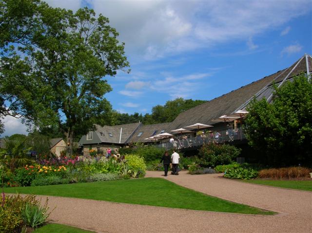
Photos
Weather for this location
Loading local forecast…
Nearby places
Useful places within 5 km
Own or manage this place?
Claim this listing to keep details accurate, add photos, and highlight what makes it special — free.
Claim this pageHow was your visit?
How useful was the information on this page?
id: 7736c560-572d-4808-a8cb-f53ed134dc34