Plan your visit
Getting here
53.21030, -0.59013
Visiting this summer
Seasonal nature notes and what to look for now
Visiting this summer
Seasonal nature notes and what to look for now
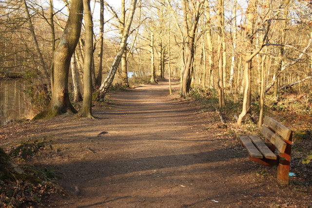
- ☀️June — canopy now fully closed, creating cool dappled shade even on warm days
- 🐕Early mornings are best for dog walks in summer — visit before 9am to avoid the heat and find quieter trails
- 🅿️Hartsholme Carpark 65m away — 14 car parks within reach
🌤️ Visiting this summer
- ☀️June — canopy now fully closed, creating cool dappled shade even on warm days
- 🐕Early mornings are best for dog walks in summer — visit before 9am to avoid the heat and find quieter trails
- 🅿️Hartsholme Carpark 65m away — 14 car parks within reach
Good to know
- £Free to visit — no entry charge
- 🐕Dogs welcome
Best for
Wildlife
Very strong match
Multi-group wildlife — Amphibians, Birds, Reptiles; Multi-group wildlife — Amphibians, Birds, Reptiles
Bird watching
Very strong match
Birds — Woodpigeon, Rock Dove, Carrion Crow +51 more · last seen 2026; Birds — Woodpigeon, Rock Dove, Carrion Crow +51 more · last seen 2026
Insect spotting
Strong match
Lowland heathland — silver-studded blue and heath fritillary butterflies; Insects — Meliscaeva auricollis, Triplax aenea, 2-spot Ladybird +1 more · last seen 2026
Dog walks
Strong match
Dogs allowed — public woodland
Foraging
Good match
Deciduous woodland — fungi, berries and wild garlic
Forest walks
Good match
Public woodland
Trails nearby
Within roughly 5 km🚶Walking
5 signed routes nearby · 23 public paths nearby
Signed route nearbyPublic paths
Walking
Viking Way (Barnetby to Whitwell)Walking route
Steep HillWalking route
Fossdyke Canal TrailWalking route
Plossland RoundWalking route
Spires and Steeples TrailWalking route
Richmond Lakes Pathpublic footpath · 523 m
White Bridgepublic footpath · 37 m
Moorland Waypublic footpath · 263 m
🚴Cycling
59 signed routes nearby
Signed route nearby
Cycling
Lincoln - Saxilby Cycle PathCycling route
Lincoln Eastern Bypass NMU pathCycling route
Route 1Cycling route
NCN 1 Lincoln to Humber
North Hykeham Relief Road / Lincoln Southern Bypass NMU RouteCycling route
Lincoln to Branston cycle pathCycling route
Wragby Road & Bunkers Hill Cycle TrackCycling route
🐴Horse riding
4 public paths nearby
Public paths
Horse riding
Tritton Roadbridleway · 279 m
Tritton Roadbridleway · 38 m
Tritton Roadbridleway · 107 m
Tritton Roadbridleway · 40 m
Wildlife to spot
Photos
Weather for this location
Loading local forecast…
Nearby places
Useful places within 5 km
How was your visit?
How useful was the information on this page?
id: d0ee596c-35bf-4706-8a78-e320ecdf7aa5