⛳ Golf🦉 Wildlife🦅 Birds
↑ Share
Public access Paid entry Dogs welcome
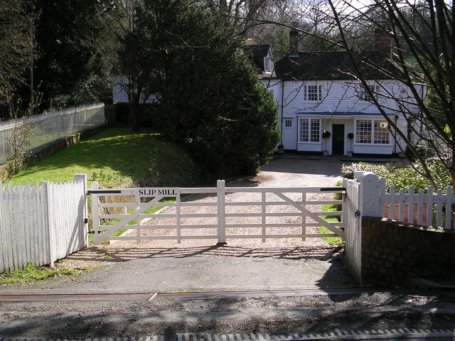
Places › England › South East › Tunbridge Wells Getting here
51.05345, 0.50459
Open directionsv Visiting this summer
Seasonal nature notes and what to look for now
▾ 🌞 Midsummer — early morning visits most comfortable; look for deer fawns in quieter clearings ⛳ Golf is at its best in summer here 🐕 Dogs welcome — bring water in summer; the site has enough space to find shade on hot days 🌤️ Visiting this summer
🌞 Midsummer — early morning visits most comfortable; look for deer fawns in quieter clearings ⛳ Golf is at its best in summer here 🐕 Dogs welcome — bring water in summer; the site has enough space to find shade on hot days 🦉 Wildlife
Very strong match
Multi-group wildlife — Amphibians, Birds, Mammals, Reptiles; Multi-group wildlife — Amphibians, Birds, Mammals, Reptiles
Free
🦅 Bird watching
Very strong match
Birds — Swift, Woodpigeon, Blue Tit +59 more · last seen 2025; Birds — Swift, Woodpigeon, Blue Tit +59 more · last seen 2025
Free
🦋 Insect spotting
Strong match
Insects — Glow-worm, Brimstone, Dark-edged Bee-fly +74 more · last seen 2025; Insects — Glow-worm, Brimstone, Dark-edged Bee-fly +74 more · last seen 2025
Free
🍂 Seasonal nature
Strong match
Plants — Flagellate Feather-moss, Shining Hookeria, Swan's-neck Thyme-moss +73 more · last seen 2025; Plants — Flagellate Feather-moss, Shining Hookeria, Swan's-neck Thyme-moss +73 more · last seen 2025
Free
Deciduous woodland — fungi, berries and wild garlic; Plants — Conocephalum conicum, Two-horned Pincerwort, Hazel
Varies
Trails nearby Within roughly 5 km 3 signed routes nearby · 17 public paths nearby
Signed route nearby Public paths
Play Trail Walking route 2 km ▾
Named route Length 2 km Round trip Local walking route
Show on map Sussex Border Path Walking route 220 km ▾
Named route Length 220 km Regional walking route
Show on map High Weald Landscape Trail Walking route ▾
Named route Ref HWLT Listed length 145km Regional walking route
Show on map 13 signed routes nearby
Signed route nearby
NCN National Route 18 Cycling route ▾
Named route Ref 18 National Cycle Network
Show on map Main Route Cycling route 4.9 km ▾
Named route Ref 18 Length 4.9 km National Cycle Network On-road Surface asphalt
Show on map Main Route Cycling route 1.1 km ▾
Named route Ref 18 Length 1.1 km National Cycle Network On-road Surface asphalt
Show on map Main Route Cycling route 431 m ▾
Named route Ref 18 Length 431 m National Cycle Network On-road Surface asphalt
Show on map Main Route Cycling route 628 m ▾
Named route Ref 18 Length 628 m National Cycle Network On-road Surface asphalt
Show on map Main Route Cycling route 29 m ▾
Named route Ref 18 Length 29 m National Cycle Network On-road Surface asphalt
Show on map 2 signed routes nearby
Signed route nearby
Singletrack Mountain Bike Trail Mountain bike route ▾
Family Cycle Route Mountain bike route ▾
5 public paths nearby
Public paths
Soper's Lane bridleway · 898 m ▾
Public path bridleway Length 898 m Path type: service
Show on map Soper's Lane bridleway · 6 m ▾
Public path bridleway Length 6 m Path type: track
Show on map Soper's Lane bridleway · 14 m ▾
Public path bridleway Length 14 m Path type: track
Show on map Soper's Lane bridleway · 579 m ▾
Public path bridleway Length 579 m Path type: track
Show on map
Weather for this location Next 14 days Nearby places Useful places within 5 km
All Historic
Own or manage this place?
Claim this listing to keep details accurate, add photos, and highlight what makes it special — free.
Claim this page→ How useful was the information on this page?
Something wrong on this page?
id: 37960411-f3d7-420d-a8bb-188d6b38c4f8
UK green spaces mapped from open public data — so anyone can find the woodland, trail, or nature reserve closest to them.
© 2026 Glade · Made with care for UK green spaces
Wildlife to spot
1,406 records · National Biodiversity Network
▾
Wildlife to spot 1,406 records · National Biodiversity Network Swift · Woodpigeon · Blue Tit · Starling · Goldfinch +25
Swift Apus apus Woodpigeon Columba palumbus Blue Tit Cyanistes caeruleus Starling Sturnus vulgaris Goldfinch Carduelis carduelis Jackdaw Coloeus monedula Great Tit Parus major Carrion Crow Corvus corone House Sparrow Passer domesticus Herring Gull Larus argentatus Blackbird Turdus merula Magpie Pica pica Robin Erithacus rubecula Swallow Hirundo rustica2024 Long-tailed Tit Aegithalos caudatus Wren Troglodytes troglodytes Treecreeper Certhia familiaris Black-headed Gull Chroicocephalus ridibundus Song Thrush Turdus philomelos Rook Corvus frugilegus Mistle Thrush Turdus viscivorus Kestrel Falco tinnunculus2024 Cuckoo Cuculus canorus2024 Marsh Tit Poecile palustris2024 Collared Dove Streptopelia decaocto2023 Nuthatch Sitta europaea2023 Moorhen Gallinula chloropus2023 Great Spotted Woodpecker Dendrocopos major2023 Blackcap Sylvia atricapilla2023 Pheasant Phasianus colchicus2022 Hazel Dormouse · Hedgehog · House Mouse · Badger
Hazel Dormouse Muscardinus avellanarius Hedgehog Erinaceus europaeus2023 House Mouse Mus musculus2023 Badger Meles meles2022 Slow-worm
🐸 Amphibians 1 species
autumn
2022 ▾
Common Toad
🐝 Insects 22 species
spring summer autumn
2025 ▾
Dark-edged Bee-fly · Glow-worm · Hairy-footed Flower Bee · Lesser Stag Beetle · Green Shieldbug +17
Dark-edged Bee-fly Bombylius major Glow-worm Lampyris noctiluca Hairy-footed Flower Bee Anthophora plumipes2024 Lesser Stag Beetle Dorcus parallelipipedus Green Shieldbug Palomena prasina2024 🌿 Plants 18 species
spring summer
2025 ▾
Hazel · Wood Anemone · Ivy · Holly · Curled Dock +13
Hazel Corylus avellana Wood Anemone Anemone nemorosa Ivy Hedera helix Holly Ilex aquifolium Curled Dock Rumex crispus Shepherd's-purse Capsella bursa-pastoris Fat-hen Species observations from the last 10 years via NBN Atlas
Cionus hortulanus
Cionus hortulanus
Cionus hortulanus
Cionus hortulanus
7-spot Ladybird Coccinella septempunctata
7-spot Ladybird Coccinella septempunctata
Eupeodes Eupeodes
Eupeodes Eupeodes
Harlequin Ladybird Harmonia axyridis
Harlequin Ladybird Harmonia axyridis
Cassida vibex Cassida vibex2024
Cassida vibex Cassida vibex2024
Meliscaeva cinctella Meliscaeva cinctella2024
Meliscaeva cinctella Meliscaeva cinctella2024
Common Cockchafer Melolontha melolontha2024
Common Cockchafer Melolontha melolontha2024
Tawny Mining Bee Andrena fulva2024
Tawny Mining Bee Andrena fulva2024
Rhingia rostrata Rhingia rostrata2023
Rhingia rostrata Rhingia rostrata2023
Migrant Hawker Aeshna mixta2023
Migrant Hawker Aeshna mixta2023
Tipula fulvipennis Tipula fulvipennis2023
Tipula fulvipennis Tipula fulvipennis2023
Ectophasia crassipennis Ectophasia crassipennis2023
Ectophasia crassipennis Ectophasia crassipennis2023
Corizus hyoscyami Corizus hyoscyami2023
Corizus hyoscyami Corizus hyoscyami2023
Dusky Ant Formica fusca2023
Dusky Ant Formica fusca2023
Dock Bug Coreus marginatus2023
Dock Bug Coreus marginatus2023
Large Red Damselfly Pyrrhosoma nymphula2023
Large Red Damselfly Pyrrhosoma nymphula2023
Dotted Bee-fly Bombylius discolor2023
Dotted Bee-fly Bombylius discolor2023 Chenopodium album
Chenopodium album
Fumitory Fumaria
Fumitory Fumaria
Yorkshire-fog Holcus lanatus
Yorkshire-fog Holcus lanatus
Creeping Buttercup Ranunculus repens
Creeping Buttercup Ranunculus repens
Wood Speedwell Veronica montana
Wood Speedwell Veronica montana
Creeping Feather-moss Amblystegium serpens2023
Creeping Feather-moss Amblystegium serpens2023
Common Pincushion Dicranoweisia cirrata2023
Common Pincushion Dicranoweisia cirrata2023
Wall Screw-moss Tortula muralis2023
Wall Screw-moss Tortula muralis2023
Wood Bristle-moss Lewinskya affinis2023
Wood Bristle-moss Lewinskya affinis2023
Appleyard's Feather-moss Scleropodium cespitans2023
Appleyard's Feather-moss Scleropodium cespitans2023
Nicholson's Beard-moss Didymodon nicholsonii2023
Nicholson's Beard-moss Didymodon nicholsonii2023
Pointed Spear-moss Calliergonella cuspidata2023
Pointed Spear-moss Calliergonella cuspidata2023 Events & activities nearby Switch provider to compare local events, tours and bookable activities.
Bookable tours GetYourGuide Promote here