Hennerton Golf Club
Getting here
51.51651, -0.86519
Visiting this summer
Seasonal nature notes and what to look for now
Visiting this summer
Seasonal nature notes and what to look for now
- 🌞Midsummer — early morning visits most comfortable; look for deer fawns in quieter clearings
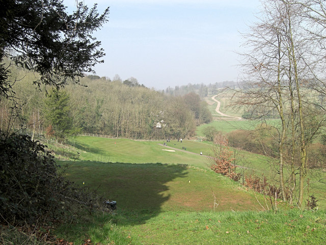
- ⛳Golf is at its best in summer here
- 🐕Dogs welcome — bring water in summer; the site has enough space to find shade on hot days
🌤️ Visiting this summer
- 🌞Midsummer — early morning visits most comfortable; look for deer fawns in quieter clearings
- ⛳Golf is at its best in summer here
- 🐕Dogs welcome — bring water in summer; the site has enough space to find shade on hot days
Good to know
- 🐕Dogs welcome
Best for
Golf
Very strong match
Golf course
Wildlife
Very strong match
Multi-group wildlife — Amphibians, Birds, Mammals, Reptiles; Multi-group wildlife — Amphibians, Birds, Mammals, Reptiles
Bird watching
Very strong match
Birds — Robin, Green Woodpecker, Wren +67 more · last seen 2025; Birds — Robin, Green Woodpecker, Wren +67 more · last seen 2025
Seasonal nature
Strong match
Plants — Hawthorn, Bramble, Hazel +33 more · last seen 2026; Plants — Hawthorn, Bramble, Hazel +33 more · last seen 2026
Foraging
Good match
Plants — Hawthorn, Bramble, Hazel +5 more foraging species; Deciduous woodland — fungi, berries and wild garlic
Dog walks
Good match
Dogs allowed with public access
Trails nearby
Within roughly 5 km🚶Walking
8 signed routes nearby · 4 public paths nearby
Signed route nearbyPublic paths
Walking
Oxfordshire WayWalking route110 km
a traverse of Oxfordshire from the Cotswolds to the Chilterns
The Chiltern Way Berkshire LoopWalking route28 km
Long distance path
European walking route E2 west, UK, South East EnglandWalking route
Westroute: Stranraer (UK) - Birminhgham (UK) - Calais (FR) - Zoersel (BE) / Eastroute: Stranraer (UK) - Harwich (UK) - Rotterdam (NL) - Zoersel (BE) / Both Routes: Zoersel (BE) - Maastrich (NL) - Luxembourg (LUX) - Lake Geneva (CH) - Nice (FR)
The Wokingham WayWalking route
Thames PathWalking route296 km
14public footpath · 374 m
Willow Lanepublic footpath · 654 m
14public footpath · 7 m
🚴Cycling
28 signed routes nearby
Signed route nearby
Cycling
Link to NCN 4Cycling route
Round Berkshire Cycle RouteCycling route
EuroVelo 2 - Capitals Route - part United Kingdom 5Cycling route
Chilterns CyclewayCycling route
Route 4Cycling route
Round Berkshire Cycle RouteCycling route
Wildlife to spot
Photos
Weather for this location
Loading local forecast…
Nearby places
Useful places within 5 km
Own or manage this place?
Claim this listing to keep details accurate, add photos, and highlight what makes it special — free.
Claim this pageHow was your visit?
How useful was the information on this page?
id: 9fd79cde-4397-4b13-9368-c5d7330f6000