Plan your visit
🦉 Wildlife🦅 Birds🎠 Play
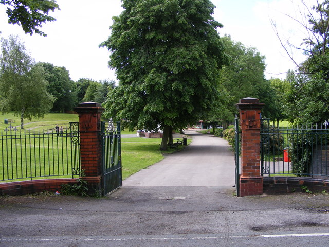
Public access Free entry Dogs welcome 9 ha
Places › England › West Midlands › Wolverhampton Getting here
52.56741, -2.08412
Open directionsv Visiting this summer
Seasonal nature notes and what to look for now
▾ 🌞 Midsummer — early morning visits most comfortable; look for deer fawns in quieter clearings ☀️ Summer family visits work well here — arrive early and plan for a longer stay 🛝 Playground 104m away — built-in entertainment for younger visitors alongside the wider site 🌤️ Visiting this summer
🌞 Midsummer — early morning visits most comfortable; look for deer fawns in quieter clearings ☀️ Summer family visits work well here — arrive early and plan for a longer stay 🛝 Playground 104m away — built-in entertainment for younger visitors alongside the wider site £ Free to visit — no entry charge🐕 Dogs welcome🚲 Bike parking🅿️ Parking· Free 🛝 Playground
🦉 Wildlife
Very strong match
Multi-group wildlife — Amphibians, Birds, Mammals; Multi-group wildlife — Amphibians, Birds, Mammals
Free
🦅 Bird watching
Very strong match
Birds — Woodpigeon, Coot, Blackbird +75 more · last seen 2026; Birds — Woodpigeon, Coot, Blackbird +75 more · last seen 2026
Free
🛝 Family friendly
Strong match
playground; Urban park — family destination
Free
Dogs allowed with public access
Free
🦋 Insect spotting
Strong match
Insects — Syrphus, Alder Leaf Beetle, Epistrophe eligans +30 more · last seen 2025; Insects — Syrphus, Alder Leaf Beetle, Epistrophe eligans +30 more · last seen 2025
Free
Trails nearby Within roughly 5 km 23 signed routes nearby
Signed route nearby
Monarch's Way Walking route 990 km ▾
approximate route of Charles II's escape
Named route Ref MW Length 990 km Regional walking route
Show on map Alder Coppice: Yellow Path Walking route ▾
The shortest of three trails created alongside the designation of Alder Coppice into a Nature Reserve
Named route Ref AC-Y Local walking route
Show on map Sheepwash Park Circular Health Walk Walking route 900 m ▾
Self-guided health walk through Black Country Millenium Urban Forest site. Route circles the largest forest park in the Black Country- being a reclaimed former brick works and waste tip.
Difficulty: Medium due to unsurfaced paths
Duration: 45-60 mins
Named route Ref HW1 WB/O Length 900 m Round trip Local walking route
Show on map Bilston to Loxdale Health Walk Walking route 2.8 km ▾
Self-guided health walk through Black Country Millenium Urban Forest sites. Route passes 15th century Greyhound & Punchbowl pub and Bradley Arm which is topped up by pumping water out of disused mines.
Difficulty: Medium due to slopes
Duration: 45-60 mins
Named route Ref HW1 BTW Length 2.8 km Point-to-point Local walking route
Show on map Sedgley Heritage Trail 1 Walking route 2 km ▾
The Sedgley Heritage Trails introduce some of the present-day and historical features of Sedgley. Walk 1 (Short Walk – red) begins at All Saints’ Church and is about 2km (1.25 miles) on flat ground and pavements.
Named route Ref SHT1 Length 2 km Local walking route
Show on map 108 signed routes nearby
Signed route nearby
Route 54 Cycling route ▾
Named route Ref 54 National Cycle Network
Show on map SCWIP Cycle Route 9 Cycling route ▾
Named route Ref SCWIP CR9 Local cycle route
Show on map SCWIP Cycle Route 12 Cycling route ▾
Named route Ref SCWIP CR12 Local cycle route
Show on map [PROPOSED]Starley Regional Cycle Network Cycling route 804 km ▾
Starley (TfWM) Regional Cycle Network (Proposed route)
Named route Ref Starley Network Length 804 km Regional cycle route
Show on map Sneyd Junction to Cannock Extension Canal Cycling route 8.8 km ▾
A semi-rural route following the curves of the canal, until it opens out into parkland at the Cannock Extension.
Distance: 5.5 miles/8.8 km (approx)
Duration: 45 min (approx)
Named route Length 8.8 km Point-to-point Local cycle route
Show on map Parkway Cycle Route: Midland Metro Cycling route ▾
Named route Local cycle route
Show on map
Weather for this location Next 14 days Nearby places Useful places within 5 km
Own or manage this place?
Claim this listing to keep details accurate, add photos, and highlight what makes it special — free.
Claim this page→ How useful was the information on this page?
id: 341a8e32-7734-492f-bf65-21891ba4b6c7
UK green spaces mapped from open public data — so anyone can find the woodland, trail, or nature reserve closest to them.
© 2026 Glade · Made with care for UK green spaces
Wildlife to spot
13,059 records · National Biodiversity Network
▾
Wildlife to spot 13,059 records · National Biodiversity Network 🐦 Birds 36 species
spring autumn
2026 ▾
Swift · Woodpigeon · Peregrine · Blackbird · Blackcap +31
Swift Apus apus2025 Woodpigeon Columba palumbus Peregrine Falco peregrinus2025 Blackbird Turdus merula2025 Blackcap Sylvia atricapilla2025 Mallard Anas platyrhynchos2025 Long-tailed Tit Aegithalos caudatus2025 House Sparrow Passer domesticus2025 Great Spotted Woodpecker Dendrocopos major2025 Starling Sturnus vulgaris2025 Blue Tit Cyanistes caeruleus Greenfinch Chloris chloris2025 Collared Dove Streptopelia decaocto2025 Herring Gull Larus argentatus2025 Robin Erithacus rubecula2025 Little Grebe Tachybaptus ruficollis2025 Rock Dove Columba livia2025 Magpie Pica pica2025 Great Tit Parus major2025 Dunnock Prunella modularis2025 Chiffchaff Phylloscopus collybita2025 Raven Corvus corax2025 Green Woodpecker Picus viridis2025 Grey Wagtail Motacilla cinerea2025 Jay Garrulus glandarius2025 Moorhen Gallinula chloropus2025 Goldcrest Regulus regulus2025 Coot Fulica atra2025 Crossbill Loxia curvirostra2025 Canada Goose Branta canadensis2025 Reed Warbler Acrocephalus scirpaceus2025 Whitethroat Curruca communis2025 Lesser Black-backed Gull Larus fuscus2025 Song Thrush Turdus philomelos2025 Treecreeper Certhia familiaris2025 Carrion Crow Corvus corone2025 🦌 Mammals 3 species
winter summer autumn
2026 ▾
Grey Squirrel · Bat · Badger
Grey Squirrel Sciurus carolinensis Bat Chiroptera2025 Badger Meles meles2025 🐸 Amphibians 1 species
summer
2025 ▾
Smooth Newt
Smooth Newt Lissotriton vulgaris Bramble · Mugwort · Butterfly-bush · Bilbao Fleabane · Hawthorn +71
Bramble Rubus fruticosus Mugwort Artemisia vulgaris Butterfly-bush Buddleja davidii Bilbao Fleabane Erigeron floribundus Hawthorn Crataegus monogyna Elder Sambucus nigra Great Willowherb Epilobium hirsutum Species observations from the last 10 years via NBN Atlas
Ivy Hedera helix
Ivy Hedera helix
Eastern Rocket Sisymbrium orientale
Eastern Rocket Sisymbrium orientale
Nipplewort Lapsana communis
Nipplewort Lapsana communis
Hybrid Black-poplar Populus deltoides x nigra = P. x canadensis
Hybrid Black-poplar Populus deltoides x nigra = P. x canadensis
Sycamore Acer pseudoplatanus
Sycamore Acer pseudoplatanus
Large Bindweed Calystegia silvatica
Large Bindweed Calystegia silvatica
Herb-Robert Geranium robertianum
Herb-Robert Geranium robertianum
Hazel Corylus avellana
Hazel Corylus avellana
Common Toadflax Linaria vulgaris
Common Toadflax Linaria vulgaris
Creeping Thistle Cirsium arvense
Creeping Thistle Cirsium arvense
Autumn Hawkbit Scorzoneroides autumnalis
Autumn Hawkbit Scorzoneroides autumnalis
Common Nettle Urtica dioica
Common Nettle Urtica dioica
Common Orache Atriplex patula
Common Orache Atriplex patula
Silver Birch Betula pendula
Silver Birch Betula pendula
Clustered Dock Rumex conglomeratus
Clustered Dock Rumex conglomeratus
Germander Speedwell Veronica chamaedrys
Germander Speedwell Veronica chamaedrys
Salix caprea subsp. caprea Salix caprea subsp. caprea
Salix caprea subsp. caprea Salix caprea subsp. caprea
Yarrow Achillea millefolium
Yarrow Achillea millefolium
Ribwort Plantain Plantago lanceolata
Ribwort Plantain Plantago lanceolata
Opium Poppy Papaver somniferum
Opium Poppy Papaver somniferum
Blackthorn Prunus spinosa
Blackthorn Prunus spinosa
Black Medick Medicago lupulina
Black Medick Medicago lupulina
Ash Fraxinus excelsior
Ash Fraxinus excelsior
Yorkshire-fog Holcus lanatus
Yorkshire-fog Holcus lanatus
Wild Carrot Daucus carota subsp. carota
Wild Carrot Daucus carota subsp. carota
Field Horsetail Equisetum arvense
Field Horsetail Equisetum arvense
Common Mouse-ear Cerastium fontanum
Common Mouse-ear Cerastium fontanum
Smooth Sow-thistle Sonchus oleraceus
Smooth Sow-thistle Sonchus oleraceus
Coltsfoot Tussilago farfara
Coltsfoot Tussilago farfara
Dove's-foot Crane's-bill Geranium molle
Dove's-foot Crane's-bill Geranium molle
Smooth Hawk's-beard Crepis capillaris
Smooth Hawk's-beard Crepis capillaris
Common Chickweed Stellaria media
Common Chickweed Stellaria media
American Willowherb Epilobium ciliatum
American Willowherb Epilobium ciliatum
False Oat-grass Arrhenatherum elatius
False Oat-grass Arrhenatherum elatius
Rosebay Willowherb Chamaenerion angustifolium
Rosebay Willowherb Chamaenerion angustifolium
White Bryony Bryonia dioica
White Bryony Bryonia dioica
Hogweed Heracleum sphondylium
Hogweed Heracleum sphondylium
Dense-flowered Fumitory Fumaria densiflora
Dense-flowered Fumitory Fumaria densiflora
Papaver dubium Papaver dubium
Papaver dubium Papaver dubium
Groundsel Senecio vulgaris
Groundsel Senecio vulgaris
Upright Hedge-parsley Torilis japonica
Upright Hedge-parsley Torilis japonica
Japanese Rose Rosa rugosa
Japanese Rose Rosa rugosa
Franchet's Cotoneaster Cotoneaster franchetii
Franchet's Cotoneaster Cotoneaster franchetii
Lesser Burdock Arctium minus
Lesser Burdock Arctium minus
Reed Sweet-grass Glyceria maxima
Reed Sweet-grass Glyceria maxima
Fennel Pondweed Stuckenia pectinata
Fennel Pondweed Stuckenia pectinata
Spear-leaved Orache Atriplex prostrata
Spear-leaved Orache Atriplex prostrata
Curled Dock Rumex crispus
Curled Dock Rumex crispus
Knotgrass Polygonum aviculare
Knotgrass Polygonum aviculare
Hedge Woundwort Stachys sylvatica
Hedge Woundwort Stachys sylvatica
Black Spleenwort Asplenium adiantum-nigrum
Black Spleenwort Asplenium adiantum-nigrum
Purple Toadflax Linaria purpurea
Purple Toadflax Linaria purpurea
Narrow-leaved Pepperwort Lepidium ruderale
Narrow-leaved Pepperwort Lepidium ruderale
Red Clover Trifolium pratense
Red Clover Trifolium pratense
Dogwood Cornus sanguinea
Dogwood Cornus sanguinea
Snowberry Symphoricarpos albus
Snowberry Symphoricarpos albus
Red Oak Quercus rubra
Red Oak Quercus rubra
White Dogwood Cornus alba
White Dogwood Cornus alba
Field Maple Acer campestre
Field Maple Acer campestre
Prickly Lettuce Lactuca serriola
Prickly Lettuce Lactuca serriola
Hoary Willowherb Epilobium parviflorum
Hoary Willowherb Epilobium parviflorum
Perforate St John's-wort Hypericum perforatum
Perforate St John's-wort Hypericum perforatum
Gypsywort Lycopus europaeus
Gypsywort Lycopus europaeus
Osier Salix viminalis
Osier Salix viminalis
Rowan Sorbus aucuparia
Rowan Sorbus aucuparia
Hemlock Water-dropwort Oenanthe crocata
Hemlock Water-dropwort Oenanthe crocata
Broad-leaved Willowherb Epilobium montanum
Broad-leaved Willowherb Epilobium montanum
Dog-rose Rosa canina
Dog-rose Rosa canina
Cuckooflower Cardamine pratensis
Cuckooflower Cardamine pratensis Events & activities nearby Switch provider to compare local events, tours and bookable activities.
Bookable tours GetYourGuide Promote here