Plan your visit
🦉 Wildlife🦅 Birds🦋 Insects
Public access Dogs welcome
Places › England › East Midlands › Melton Getting here
52.81503, -0.80517
Open directionsv Visiting this summer
Seasonal nature notes and what to look for now
▾ 🌞 Midsummer — early morning visits most comfortable; look for deer fawns in quieter clearings 🌿 Foraging is at its best in summer here 🐕 Dogs welcome — bring water in summer; the site has enough space to find shade on hot days 🌤️ Visiting this summer
🌞 Midsummer — early morning visits most comfortable; look for deer fawns in quieter clearings 🌿 Foraging is at its best in summer here 🐕 Dogs welcome — bring water in summer; the site has enough space to find shade on hot days 🦉 Wildlife
Very strong match
Multi-group wildlife — Amphibians, Birds, Mammals, Reptiles; Multi-group wildlife — Amphibians, Birds, Mammals, Reptiles
Free
🦅 Bird watching
Very strong match
Birds — Swift, Goldfinch, Linnet +49 more · last seen 2025; Birds — Swift, Goldfinch, Linnet +49 more · last seen 2025
Free
🦋 Insect spotting
Strong match
Insects — Common Blue, Speckled Wood, Small Heath +150 more · last seen 2025; Insects — Common Blue, Speckled Wood, Small Heath +150 more · last seen 2025
Free
🍂 Seasonal nature
Strong match
Plants — Pyramidal Orchid, White Dead-nettle, Hawthorn +231 more · last seen 2025; Plants — Pyramidal Orchid, White Dead-nettle, Hawthorn +231 more · last seen 2025
Free
Plants — White Dead-nettle, Hawthorn, Common Nettle +21 more foraging species
Varies
🍄 Mushroom foraging
Strong match
Fungi — Snowy Waxcap, Blackening Waxcap, Juniper Rust +3 more · last seen 2025; Fungi — Snowy Waxcap, Blackening Waxcap, Juniper Rust +3 more · last seen 2025
Varies
Trails nearby Within roughly 5 km 2 signed routes nearby · 4 public paths nearby
Signed route nearby Public paths
Mowbray Way Walking route 14 km ▾
Named route Length 14 km Local walking route
Show on map Jubilee Way (Leicestershire) Walking route ▾
Named route Regional walking route
Show on map 18 signed routes nearby
Signed route nearby
Route 64 Cycling route ▾
Named route Ref 64 National Cycle Network
Show on map National Byway (Rutland) Cycling route ▾
National Byway in Rutland
Named route Ref NB Regional cycle route
Show on map Main Route Cycling route 1.7 km ▾
Named route Ref 64 Length 1.7 km National Cycle Network On-road Surface asphalt
Show on map Main Route Cycling route 687 m ▾
Named route Ref 64 Length 687 m National Cycle Network On-road Surface asphalt
Show on map N/A Cycling route 24 m ▾
Named route Length 24 m National Cycle Network Traffic-free Surface asphalt
Show on map Main Route Cycling route 485 m ▾
Named route Ref 64 Length 485 m National Cycle Network On-road Surface asphalt
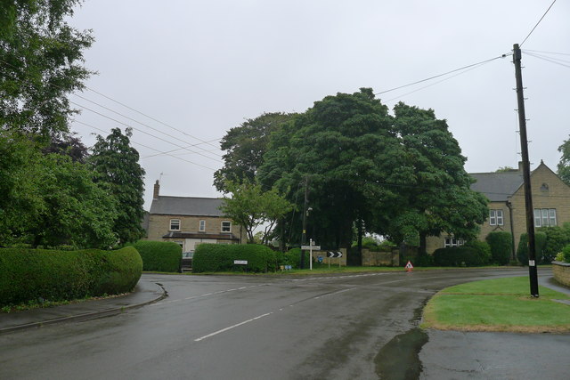
Show on map Photos Bescaby Lane leading off the High Street, Waltham On The Wolds
‹ ›
Weather for this location Next 14 days Nearby places Useful places within 5 km
All Historic
Own or manage this place?
Claim this listing to keep details accurate, add photos, and highlight what makes it special — free.
Claim this page→ How useful was the information on this page?
id: d59c5b9a-a795-4901-bdb5-da1d04e3becb
UK green spaces mapped from open public data — so anyone can find the woodland, trail, or nature reserve closest to them.
© 2026 Glade · Made with care for UK green spaces
Wildlife to spot
8,291 records · National Biodiversity Network
▾
Wildlife to spot 8,291 records · National Biodiversity Network Goldfinch · House Sparrow · Green Woodpecker · Woodpigeon · Greenfinch +27
Goldfinch Carduelis carduelis House Sparrow Passer domesticus Green Woodpecker Picus viridis Woodpigeon Columba palumbus Greenfinch Chloris chloris Linnet Linaria cannabina Chaffinch Fringilla coelebs Blue Tit Cyanistes caeruleus Blackcap Sylvia atricapilla Carrion Crow Corvus corone Blackbird Turdus merula Chiffchaff Phylloscopus collybita Wren Troglodytes troglodytes Robin Erithacus rubecula Great Tit Parus major Magpie Pica pica Dunnock Prunella modularis Willow Warbler Phylloscopus trochilus Starling Sturnus vulgaris Skylark Alauda arvensis Whitethroat Curruca communis Long-tailed Tit Aegithalos caudatus Bullfinch Pyrrhula pyrrhula Swallow Hirundo rustica Gadwall Mareca strepera Pied Wagtail Motacilla alba yarrellii Golden Plover Pluvialis apricaria Jackdaw Coloeus monedula Fieldfare Turdus pilaris Barn Owl Tyto alba2024 Lesser Black-backed Gull Larus fuscus2024 Swift Apus apus2024 🦌 Mammals 3 species
spring summer
2025 ▾
Rabbit · Roe Deer · Common Shrew
Rabbit Oryctolagus cuniculus Roe Deer Capreolus capreolus Common Shrew Sorex araneus2024 Grass Snake
Grass Snake Natrix helvetica 🐸 Amphibians 1 species
autumn
2025 ▾
Great Crested Newt
Great Crested Newt Triturus cristatus Common Blue · Speckled Wood · Field Grasshopper · Dingy Skipper · Small Heath +55
Common Blue Polyommatus icarus Speckled Wood Pararge aegeria Field Grasshopper Chorthippus brunneus2024 Dingy Skipper Erynnis tages Small Heath Coenonympha pamphilus Brimstone Gonepteryx rhamni Red-tailed Bumblebee Snowy Waxcap · Blackening Waxcap · Juniper Rust
Snowy Waxcap Cuphophyllus virgineus var. virgineus Blackening Waxcap Hygrocybe conica Juniper Rust Gymnosporangium2024 🌿 Plants 23 species
spring summer
2025 ▾
Pyramidal Orchid · Meadow Crane's-bill · Mullein · Yellow-rattle · Oxeye Daisy +18
Pyramidal Orchid Anacamptis pyramidalis Meadow Crane's-bill Geranium pratense Mullein Verbascum Yellow-rattle Rhinanthus minor Oxeye Daisy Leucanthemum vulgare Indet. Comfrey Symphytum Species observations from the last 10 years via NBN Atlas
Bombus lapidarius
Bombus lapidarius
Shaded Broad-bar Scotopteryx chenopodiata
Shaded Broad-bar Scotopteryx chenopodiata
Glow-worm Lampyris noctiluca
Glow-worm Lampyris noctiluca
Marbled White Melanargia galathea
Marbled White Melanargia galathea
Orange-tip Anthocharis cardamines
Orange-tip Anthocharis cardamines
Comma Polygonia c-album
Comma Polygonia c-album
Buff-tailed Bumblebee Bombus terrestris
Buff-tailed Bumblebee Bombus terrestris
Volucella inanis Volucella inanis2024
Volucella inanis Volucella inanis2024
Swollen-thighed Beetle Oedemera nobilis2024
Swollen-thighed Beetle Oedemera nobilis2024
Small Skipper Thymelicus sylvestris2024
Small Skipper Thymelicus sylvestris2024
Meadow Grasshopper Pseudochorthippus parallelus2024
Meadow Grasshopper Pseudochorthippus parallelus2024
Large Skipper Ochlodes sylvanus2024
Large Skipper Ochlodes sylvanus2024
Grammoptera ruficornis Grammoptera ruficornis2024
Grammoptera ruficornis Grammoptera ruficornis2024
Bean Seed Beetle Bruchus rufimanus2024
Bean Seed Beetle Bruchus rufimanus2024
Western Honey Bee Apis mellifera2024
Western Honey Bee Apis mellifera2024
Rondaniola bursaria Rondaniola bursaria
Rondaniola bursaria Rondaniola bursaria
Small Tortoiseshell Aglais urticae
Small Tortoiseshell Aglais urticae
White-barred Gold Micropterix aruncella
White-barred Gold Micropterix aruncella
Tortoise Bug Eurygaster testudinaria
Tortoise Bug Eurygaster testudinaria
Red Admiral Vanessa atalanta
Red Admiral Vanessa atalanta
Burnet Companion Euclidia glyphica
Burnet Companion Euclidia glyphica
Painted Lady Vanessa cardui
Painted Lady Vanessa cardui
Peacock Aglais io
Peacock Aglais io
Holly Blue Celastrina argiolus
Holly Blue Celastrina argiolus
Green-veined White Pieris napi
Green-veined White Pieris napi
Red-legged Shieldbug Pentatoma rufipes2024
Red-legged Shieldbug Pentatoma rufipes2024
Corizus hyoscyami Corizus hyoscyami2024
Corizus hyoscyami Corizus hyoscyami2024
Graphomya maculata Graphomya maculata2024
Graphomya maculata Graphomya maculata2024
Green Shieldbug Palomena prasina2024
Green Shieldbug Palomena prasina2024
Eristalis tenax Eristalis tenax2024
Eristalis tenax Eristalis tenax2024
Rhingia rostrata Rhingia rostrata2024
Rhingia rostrata Rhingia rostrata2024
Gorse Shieldbug Piezodorus lituratus2024
Gorse Shieldbug Piezodorus lituratus2024
Marmalade Hoverfly Episyrphus balteatus2024
Marmalade Hoverfly Episyrphus balteatus2024
Batman Hoverfly Myathropa florea2024
Batman Hoverfly Myathropa florea2024
Brown Hawker Aeshna grandis2024
Brown Hawker Aeshna grandis2024
Gatekeeper Pyronia tithonus2024
Gatekeeper Pyronia tithonus2024
Common Red Soldier Beetle Rhagonycha fulva2024
Common Red Soldier Beetle Rhagonycha fulva2024
Meadow Brown Maniola jurtina2024
Meadow Brown Maniola jurtina2024
Helophilus pendulus Helophilus pendulus2024
Helophilus pendulus Helophilus pendulus2024
Phytomyza lappae Phytomyza lappae2024
Phytomyza lappae Phytomyza lappae2024
Psyllopsis fraxini agg. Psyllopsis fraxini agg.2024
Psyllopsis fraxini agg. Psyllopsis fraxini agg.2024
Bedeguar Gall Diplolepis rosae2024
Bedeguar Gall Diplolepis rosae2024
Latticed Heath Chiasmia clathrata2024
Latticed Heath Chiasmia clathrata2024
Amauromyza flavifrons Amauromyza flavifrons2024
Amauromyza flavifrons Amauromyza flavifrons2024
Dasineura ulmaria Dasineura ulmaria2024
Dasineura ulmaria Dasineura ulmaria2024
7-spot Ladybird Coccinella septempunctata2024
7-spot Ladybird Coccinella septempunctata2024
Woundwort Shieldbug Eysarcoris venustissimus2024
Woundwort Shieldbug Eysarcoris venustissimus2024
Melanostoma scalare Melanostoma scalare2024
Melanostoma scalare Melanostoma scalare2024
Narrow-barred Fusehorn Arge melanochra2024
Narrow-barred Fusehorn Arge melanochra2024
Tiger Cranefly Nephrotoma flavescens2024
Tiger Cranefly Nephrotoma flavescens2024
Phytomyza pastinacae/spondylii Phytomyza pastinacae/spondylii2024
Phytomyza pastinacae/spondylii Phytomyza pastinacae/spondylii2024
Sciara Sciara2024
Sciara Sciara2024
Silver Y Autographa gamma2024
Silver Y Autographa gamma2024
Common Blue Damselfly Enallagma cyathigerum2024
Common Blue Damselfly Enallagma cyathigerum2024 Common Toadflax
Common Toadflax
Linaria vulgaris
Linaria vulgaris
Burnet-saxifrage Pimpinella saxifraga
Burnet-saxifrage Pimpinella saxifraga
Fox-and-cubs Pilosella aurantiaca
Fox-and-cubs Pilosella aurantiaca
Salad Burnet Poterium sanguisorba
Salad Burnet Poterium sanguisorba
Creeping Cinquefoil Potentilla reptans
Creeping Cinquefoil Potentilla reptans
Cowslip Primula veris
Cowslip Primula veris
Common Milkwort Polygala vulgaris
Common Milkwort Polygala vulgaris
Meadow Vetchling Lathyrus pratensis
Meadow Vetchling Lathyrus pratensis
Solomon's-seal Polygonatum multiflorum
Solomon's-seal Polygonatum multiflorum
False Oxlip Primula veris x vulgaris = P. x polyantha
False Oxlip Primula veris x vulgaris = P. x polyantha
Wood-sedge Carex sylvatica
Wood-sedge Carex sylvatica
Ground-ivy Glechoma hederacea
Ground-ivy Glechoma hederacea
Lesser Celandine Ficaria verna
Lesser Celandine Ficaria verna
Coltsfoot Tussilago farfara
Coltsfoot Tussilago farfara
Giant Bellflower Campanula latifolia2024
Giant Bellflower Campanula latifolia2024
Common Spotted-orchid Dactylorhiza fuchsii2024
Common Spotted-orchid Dactylorhiza fuchsii2024
Common Twayblade Neottia ovata2024
Common Twayblade Neottia ovata2024 Events & activities nearby Switch provider to compare local events, tours and bookable activities.
Bookable tours GetYourGuide Promote here