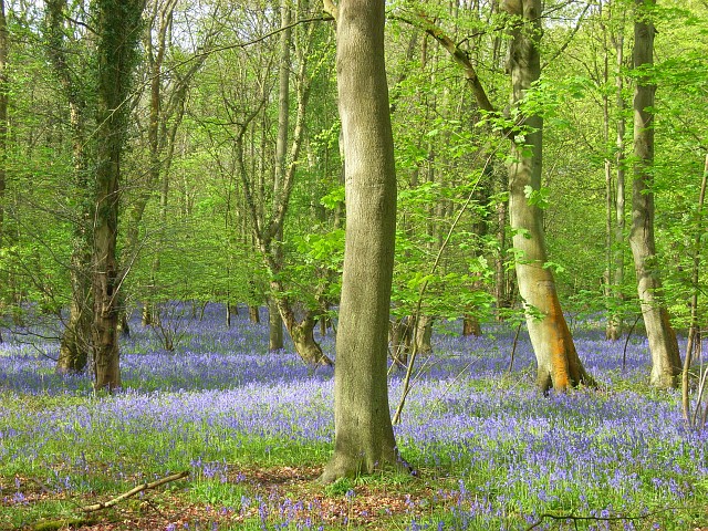
Ancient woodland — bluebells, fungi and autumn colour; Plants — Crescent-cup Liverwort · last seen 2026
Free
🦅
Bird watching
Strong match
Birds — Shoveler, Wigeon, Pochard +33 more · last seen 2026; Birds — Shoveler, Wigeon, Pochard +33 more · last seen 2026
Free
🦋
Insect spotting
Strong match
Insects — Ivy Bee, Stag Beetle, Southern Green Shieldbug +59 more · last seen 2026; Insects — Ivy Bee, Stag Beetle, Southern Green Shieldbug +59 more · last seen 2026
Free
🐶
Dog walks
Strong match
Dogs allowed — public woodland
Free
🌿
Foraging
Good match
Deciduous woodland — fungi, berries and wild garlic
Varies
Trails nearby
Within roughly 5 km
🚶
Walking
▾
11 signed routes nearby · 8 public paths nearby
Signed route nearbyPublic paths
Oxfordshire WayWalking route110 km▾
a traverse of Oxfordshire from the Cotswolds to the Chilterns
Named routeRef OWLength 110 kmRegional walking route
The Chiltern Way Southern ExtensionWalking route▾
Long distance path
Named routeRef CWSRegional walking route
The Chiltern Way Berkshire LoopWalking route28 km▾
Long distance path
Named routeRef CWBLength 28 kmRegional walking route
European walking route E2 west, UK, South East EnglandWalking route▾
Public pathpublic footpathLength 829 mSurface dirtPath type: footway
🚴
Cycling
▾
45 signed routes nearby
Signed route nearby
National Cycle Network Route 5Cycling route▾
Named routeRef 5National Cycle Network
Link to NCN 4Cycling route▾
Named routeRef NCN4 LinkLocal cycle route
Round Berkshire Cycle RouteCycling route▾
Named routeRegional cycle route
Reading R4Cycling route▾
Named routeRef R4Local cycle route
R40Cycling route▾
Named routeLocal cycle route
National Cycle Network Route 5Cycling route▾
Named routeRef 5National Cycle Network
🚵
Mountain biking
▾
1 signed route nearby
Signed route nearby
King Alfred's WayMountain bike route▾
King Alfreds Way is 350km (220 miles) off road route designed to be ridden clockwise. It starts & ends in Winchester. It is suitable for gravel or cross-country bikes.
Named routeRegional cycle route
🐴
Horse riding
▾
7 public paths nearby
Public paths
Bones Lanebridleway · 572 m▾
Public pathbridlewayLength 572 mSurface dirtPath type: bridleway
Upper Bolney Roadbridleway · 859 m▾
Public pathbridlewayLength 859 mPath type: service