Getting here
52.60138, -1.84635
Visiting this summer
Seasonal nature notes and what to look for now
Visiting this summer
Seasonal nature notes and what to look for now
- 🌞Midsummer — early morning visits most comfortable; look for deer fawns in quieter clearings
- 🐕Early mornings are best for dog walks in summer — visit before 9am to avoid the heat and find quieter trails
- ☕Café on site — makes this an easy full-day family visit without needing to pack food
🌤️ Visiting this summer
- 🌞Midsummer — early morning visits most comfortable; look for deer fawns in quieter clearings
- 🐕Early mornings are best for dog walks in summer — visit before 9am to avoid the heat and find quieter trails
- ☕Café on site — makes this an easy full-day family visit without needing to pack food
Good to know
- £Free to visit — no entry charge
- 🐕Dogs welcome
Best for
Bird watching
Strong match
Nature reserve
Wildlife
Strong match
Nature reserve
Dog walks
Strong match
Dogs allowed — nature reserve
Forest walks
Strong match
Nature reserve
Family friendly
Good match
café
Seasonal nature
Good match
Nature reserve — seasonal wildlife and habitats
Trails nearby
Within roughly 5 km🚶Walking
11 signed routes nearby · 17 public paths nearby
Signed route nearbyPublic paths
Walking
Heart of England WayWalking route
Sutton Park Archeology Walk 5: Blackroot BistroWalking route
Most of Sutton Park is a Scheduled Ancient Monument and contains archaeological remains. This trail, one of six in the park, is via an 18th-century racecourse and golf course, medieval deer park, and quarry created for an 18th-century mill pond dam.
Sutton Park Archeology Walk 6: Bracebridge PoolWalking route
Most of Sutton Park is a Scheduled Ancient Monument and contains archaeological remains. This trail, one of six in the park, is via a medieval fish pond, 16th-century wood, WWI military practice trenches, mysterious earthwork, and 19th-century estate.
E2 hiking trail BirminghamWalking route
Beacon WayWalking route40 km
Starting at Sandwell Valley via the outskirts of Birmingham and the countryside of Walsall into Staffordshire. Take in the Forest of Mercia, lakes, nature reserves, woods, and canal banks. Named after Barr Beacon, one of the highest hills in this area.
Bramble Waypublic footpath · 84 m
🚴Cycling
47 signed routes nearby
Signed route nearby
Cycling
North Birmingham Walking and Cycling RouteCycling route
Route 535 is a small cycle route from National Cycle Route 5 in Birmingham City Centre to Gravelly Hill, which carries on for a short way along the Tame Valley Canal
National Cycle Network Route 534Cycling route
New Hall Valley Cycle RouteCycling route
Connect2Cycling route
[PROPOSED]Starley Regional Cycle NetworkCycling route804 km
Starley (TfWM) Regional Cycle Network (Proposed route)
Main RouteCycling route445 m
About this nature reserve
Hill Hook is an 8-hectare Local Nature Reserve in Birmingham, West Midlands, England. It consists primarily of woodland and grassland, providing a habitat for local birds and small mammals, along with paths for hiking.
Wildlife to spot
Photos
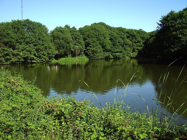
Hill Hook Mill Pond L N R, with Sutton TV mast peeping over the trees.
Weather for this location
Loading local forecast…
Nearby places
Useful places within 5 km
Own or manage this place?
Claim this listing to keep details accurate, add photos, and highlight what makes it special — free.
Claim this pageHow was your visit?
How useful was the information on this page?
id: 3ecb966f-710b-4495-8b11-d072f66163ed