Plan your visit
Getting here
50.61084, -3.68073
Visiting this summer
Seasonal nature notes and what to look for now
Visiting this summer
Seasonal nature notes and what to look for now
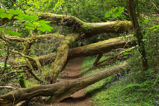
- ☀️June — canopy now fully closed, creating cool dappled shade even on warm days
- 🍄Mushroom foraging is at its best in summer here
- 🐕Dogs welcome — bring water in summer; the site has enough space to find shade on hot days
🌤️ Visiting this summer
- ☀️June — canopy now fully closed, creating cool dappled shade even on warm days
- 🍄Mushroom foraging is at its best in summer here
- 🐕Dogs welcome — bring water in summer; the site has enough space to find shade on hot days
Good to know
- £Free to visit — no entry charge
- 🐕Dogs welcome
- 🌿Ancient woodland — rare wildlife habitat
- 🌳Large woodland — room to roam
Best for
Wildlife
Very strong match
Multi-group wildlife — Amphibians, Birds, Mammals, Reptiles; Multi-group wildlife — Amphibians, Birds, Mammals, Reptiles
Bird watching
Very strong match
Birds — Robin, Blackbird, Woodpigeon +69 more · last seen 2026; Birds — Robin, Blackbird, Woodpigeon +69 more · last seen 2026
Mushroom foraging
Strong match
Fungi — Netted Crust, White Saddle, Orange Mock Oyster +22 more · last seen 2024; Fungi — Netted Crust, White Saddle, Orange Mock Oyster +22 more · last seen 2024
Seasonal nature
Strong match
Ancient woodland — bluebells, fungi and autumn colour
Dog walks
Strong match
Dogs allowed — public woodland
Insect spotting
Strong match
Insects — Carabus problematicus, Emperor Dragonfly, Red-headed Cardinal Beetle +29 more · last seen 2026; Insects — Carabus problematicus, Emperor Dragonfly, Red-headed Cardinal Beetle +29 more · last seen 2026
Trails nearby
Within roughly 5 km🚶Walking
7 signed routes nearby · 15 public paths nearby
Signed route nearbyPublic paths
Walking
Templer WayWalking route
Dartmoor WayWalking route
Yarner Wood Nature TrailWalking route
Orange WayWalking route560 km
River Teign WalkWalking route
Southbrook Lanepublic footpath · 208 m
🚴Cycling
35 signed routes nearby
Signed route nearby
Cycling
NCN272Cycling route
Route 28Cycling route
Dartmoor Way (Cycle)Cycling route
Wray Valley TrailCycling route
Main RouteCycling route189 m
Main RouteCycling route546 m
🐴Horse riding
2 public paths nearby
Public paths
Horse riding
Little John's Walkbyway open to all traffic · 708 m
Beacon Lanebridleway · 1.1 km
Wildlife to spot
Photos
Weather for this location
Loading local forecast…
Nearby places
Useful places within 5 km
Own or manage this place?
Claim this listing to keep details accurate, add photos, and highlight what makes it special — free.
Claim this pageNearby reservoirs
How was your visit?
How useful was the information on this page?
id: 9e213d7e-8c04-425c-bf59-20c8f298a07e