Honeybourne Line Open Space 250 ha
Plan your visit
🦉 Wildlife🦅 Birds🦋 Insects
Public access Free entry Dogs welcome 250 ha
Places › England › South West › Cheltenham Getting here
51.90192, -2.09014
Open directionsv Visiting this summer
Seasonal nature notes and what to look for now
▾ ☀️ June — long evenings and clear skies; one of the most rewarding months for a late visit 🐕 Early mornings are best for dog walks in summer — visit before 9am to avoid the heat and find quieter trails 🅿️ Cheltenham Spa Railway Station 21m away — 20 car parks within reach 🌤️ Visiting this summer
☀️ June — long evenings and clear skies; one of the most rewarding months for a late visit 🐕 Early mornings are best for dog walks in summer — visit before 9am to avoid the heat and find quieter trails 🅿️ Cheltenham Spa Railway Station 21m away — 20 car parks within reach £ Free to visit — no entry charge🐕 Dogs welcome🚲 Bike parking🅿️ Parking· Paid
🦉 Wildlife
Very strong match
Multi-group wildlife — Amphibians, Birds, Mammals, Reptiles; Multi-group wildlife — Amphibians, Birds, Mammals, Reptiles
Free
🦅 Bird watching
Very strong match
Birds — Mallard, Robin, Woodpigeon +54 more · last seen 2026; Birds — Mallard, Robin, Woodpigeon +54 more · last seen 2026
Free
🦋 Insect spotting
Strong match
Insects — Beautiful Demoiselle, Harlequin Ladybird, Blue-tailed Damselfly +115 more · last seen 2026; Insects — Beautiful Demoiselle, Harlequin Ladybird, Blue-tailed Damselfly +115 more · last seen 2026
Free
Dogs allowed with public access
Free
Named cycling route nearby: Route 41
Varies
Deciduous woodland — fungi, berries and wild garlic
Varies
Trails nearby Within roughly 5 km 6 signed routes nearby · 28 public paths nearby
Signed route nearby Public paths
Gloucestershire Way Walking route 161 km ▾
Named route Length 161 km Regional walking route
Show on map Winchcombe Way (West) Walking route ▾
The Winchcombe Way is a 42-mile figure-of-eight trail centred on Winchcombe
Named route Ref wiw Regional walking route
Show on map Cotswold Way Walking route 164 km ▾
Named route Ref CW Length 164 km National walking route
Show on map Gustav Holst Way (Holst Birthplace Museum to Corndean Lane) Walking route 7 km ▾
Named route Length 7 km Regional walking route
Show on map Cheltenham Circular Footpath Walking route ▾
Named route Local walking route
Show on map Hereford Place public footpath · 119 m ▾
Public path public footpath Length 119 m Surface asphalt Path type: residential
Show on map Normal Terrace public footpath · 141 m ▾
Public path public footpath Length 141 m Path type: residential
Show on map Synagogue Lane public footpath · 27 m ▾
Public path public footpath Length 27 m Surface asphalt Path type: residential
Show on map 41 signed routes nearby
Signed route nearby
Route 41 Cycling route ▾
Named route Ref 41 National Cycle Network
Show on map Bishops Cleeve Bypass Cycle Route Cycling route ▾
Named route Local cycle route
Show on map Gloucestershire Cycle Spine Cycling route ▾
Named route Local cycle route
Show on map Main Route Cycling route 437 m ▾
Named route Ref 41 Length 437 m National Cycle Network Traffic-free Surface asphalt
Show on map Main Route Cycling route 232 m ▾
Named route Ref 41 Length 232 m National Cycle Network Traffic-free Surface asphalt
Show on map Main Route Cycling route 114 m ▾
Named route Ref 41 Length 114 m National Cycle Network On-road Surface asphalt
Show on map 1 public path nearby
Public paths
Tommy Taylors Lane restricted byway · 311 m ▾
Public path restricted byway Length 311 m Path type: tertiary
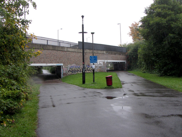
Show on map Photos Former railway line in Cheltenham
‹ ›
Weather for this location Next 14 days Nearby places Useful places within 5 km
All Historic
How useful was the information on this page?
id: 4a0ff293-9c16-473c-838b-87b813785437
UK green spaces mapped from open public data — so anyone can find the woodland, trail, or nature reserve closest to them.
© 2026 Glade · Made with care for UK green spaces
Wildlife to spot
26,017 records · National Biodiversity Network
▾
Wildlife to spot 26,017 records · National Biodiversity Network 🐦 Birds 35 species
winter spring summer autumn
2026 ▾
Mallard · Jay · Moorhen · Greylag Goose · Magpie +30
Mallard Anas platyrhynchos Jay Garrulus glandarius Moorhen Gallinula chloropus Greylag Goose Anser anser Magpie Pica pica Woodpigeon Columba palumbus Robin Erithacus rubecula Black-headed Gull Chroicocephalus ridibundus Grey Heron Ardea cinerea2025 Redwing Turdus iliacus Greenfinch Chloris chloris House Sparrow Passer domesticus Lesser Black-backed Gull Larus fuscus2025 Blackcap Sylvia atricapilla Wren Troglodytes troglodytes Kingfisher Alcedo atthis Jackdaw Coloeus monedula Green Woodpecker Picus viridis2025 Herring Gull Larus argentatus2025 Blue Tit Cyanistes caeruleus2025 Goldfinch Carduelis carduelis Long-tailed Tit Aegithalos caudatus Great Tit Parus major Blackbird Turdus merula Collared Dove Streptopelia decaocto Dunnock Prunella modularis Chaffinch Fringilla coelebs Coal Tit Periparus ater Little Egret Egretta garzetta2025 House Martin Delichon urbicum2025 Rock Dove Columba livia2025 Swift Apus apus2025 Stock Dove Columba oenas2025 Carrion Crow Corvus corone2025 Grey Wagtail Motacilla cinerea2025 Grey Squirrel
Grey Squirrel Sciurus carolinensis Slow-worm
🐸 Amphibians 2 species
winter spring
2026 ▾
Common Frog · Common Toad
Common Frog Rana temporaria Common Toad Bufo bufo 7-spot Ladybird · Harlequin Ladybird · Red-legged Shieldbug · Green Shieldbug · Black-tailed Skimmer +47
7-spot Ladybird Coccinella septempunctata2025 Harlequin Ladybird Harmonia axyridis2025 Red-legged Shieldbug Pentatoma rufipes2025 Green Shieldbug Palomena prasina2025 Black-tailed Skimmer Orthetrum cancellatum2025 Blue-tailed Damselfly Grey-cushioned Grimmia · Water Screw-moss · Lesser Screw-moss
Grey-cushioned Grimmia Grimmia pulvinata Water Screw-moss Syntrichia latifolia Lesser Screw-moss Syntrichia virescens Species observations from the last 10 years via NBN Atlas
Ischnura elegans2025
Ischnura elegans2025
Beautiful Demoiselle Calopteryx virgo2025
Beautiful Demoiselle Calopteryx virgo2025
Rhyparochromus vulgaris Rhyparochromus vulgaris
Rhyparochromus vulgaris Rhyparochromus vulgaris
Hornet Hoverfly Volucella zonaria2025
Hornet Hoverfly Volucella zonaria2025
Campyloneura virgula Campyloneura virgula2025
Campyloneura virgula Campyloneura virgula2025
Deraeocoris (Deraeocoris) flavilinea Deraeocoris (Deraeocoris) flavilinea2025
Deraeocoris (Deraeocoris) flavilinea Deraeocoris (Deraeocoris) flavilinea2025
Scarce Chaser Libellula fulva2025
Scarce Chaser Libellula fulva2025
Epistrophe eligans Epistrophe eligans
Epistrophe eligans Epistrophe eligans
Cuckoo-Spit Insect Philaenus spumarius2025
Cuckoo-Spit Insect Philaenus spumarius2025
Willow Bean-galler Euura proxima2025
Willow Bean-galler Euura proxima2025
Corizus hyoscyami Corizus hyoscyami2025
Corizus hyoscyami Corizus hyoscyami2025
Limnephilus marmoratus Limnephilus marmoratus2025
Limnephilus marmoratus Limnephilus marmoratus2025
Eremocoris fenestratus Eremocoris fenestratus2025
Eremocoris fenestratus Eremocoris fenestratus2025
Eristalis tenax Eristalis tenax2025
Eristalis tenax Eristalis tenax2025
Limnephilus lunatus Limnephilus lunatus2025
Limnephilus lunatus Limnephilus lunatus2025
Birch Catkin Bug Kleidocerys resedae2025
Birch Catkin Bug Kleidocerys resedae2025
Hairy Shieldbug Dolycoris baccarum2025
Hairy Shieldbug Dolycoris baccarum2025
Parent Bug Elasmucha grisea2025
Parent Bug Elasmucha grisea2025
Pantilius (Pantilius) tunicatus Pantilius (Pantilius) tunicatus2025
Pantilius (Pantilius) tunicatus Pantilius (Pantilius) tunicatus2025
Silver Fish Lepisma saccharinum2025
Silver Fish Lepisma saccharinum2025
Birch Shieldbug Elasmostethus interstinctus2025
Birch Shieldbug Elasmostethus interstinctus2025
Sphaerophoria Sphaerophoria2025
Sphaerophoria Sphaerophoria2025
Stag Knucklehorn Cladius pectinicornis2025
Stag Knucklehorn Cladius pectinicornis2025
Berytinus (Berytinus) minor Berytinus (Berytinus) minor2025
Berytinus (Berytinus) minor Berytinus (Berytinus) minor2025
Eupeodes corollae Eupeodes corollae2025
Eupeodes corollae Eupeodes corollae2025
Helophilus pendulus Helophilus pendulus2025
Helophilus pendulus Helophilus pendulus2025
Eupeodes Eupeodes2025
Eupeodes Eupeodes2025
Lesser Earwig Labia minor2025
Lesser Earwig Labia minor2025
Blue Shieldbug Zicrona caerulea2025
Blue Shieldbug Zicrona caerulea2025
Meadow Grasshopper Pseudochorthippus parallelus2025
Meadow Grasshopper Pseudochorthippus parallelus2025
Lesser Marsh Grasshopper Chorthippus albomarginatus2025
Lesser Marsh Grasshopper Chorthippus albomarginatus2025
Willow Emerald Damselfly Chalcolestes viridis2025
Willow Emerald Damselfly Chalcolestes viridis2025
Azure Damselfly Coenagrion puella2025
Azure Damselfly Coenagrion puella2025
Iassus lanio Iassus lanio2025
Iassus lanio Iassus lanio2025
Reptalus (Reptalus) panzeri Reptalus (Reptalus) panzeri2025
Reptalus (Reptalus) panzeri Reptalus (Reptalus) panzeri2025
Oak Mining Sawfly Profenusa pygmaea2025
Oak Mining Sawfly Profenusa pygmaea2025
Oak Bush-cricket Meconema thalassinum2025
Oak Bush-cricket Meconema thalassinum2025
Glyphotaelius pellucidus Glyphotaelius pellucidus2025
Glyphotaelius pellucidus Glyphotaelius pellucidus2025
2-spot Ladybird Adalia bipunctata2025
2-spot Ladybird Adalia bipunctata2025
Roesel's Bush-cricket Roeseliana roeselii2025
Roesel's Bush-cricket Roeseliana roeselii2025
Figwort Weevil Cionus scrophulariae2025
Figwort Weevil Cionus scrophulariae2025
Black-Kneed Apple Capsid Blepharidopterus angulatus2025
Black-Kneed Apple Capsid Blepharidopterus angulatus2025
Timothy Grassbug Stenotus binotatus2025
Timothy Grassbug Stenotus binotatus2025
Megaloceroea recticornis Megaloceroea recticornis2025
Megaloceroea recticornis Megaloceroea recticornis2025
Emperor Dragonfly Anax imperator2025
Emperor Dragonfly Anax imperator2025
Migrant Hawker Aeshna mixta2025
Migrant Hawker Aeshna mixta2025
Common Blue Damselfly Enallagma cyathigerum2025
Common Blue Damselfly Enallagma cyathigerum2025 Events & activities nearby Switch provider to compare local events, tours and bookable activities.
Bookable tours