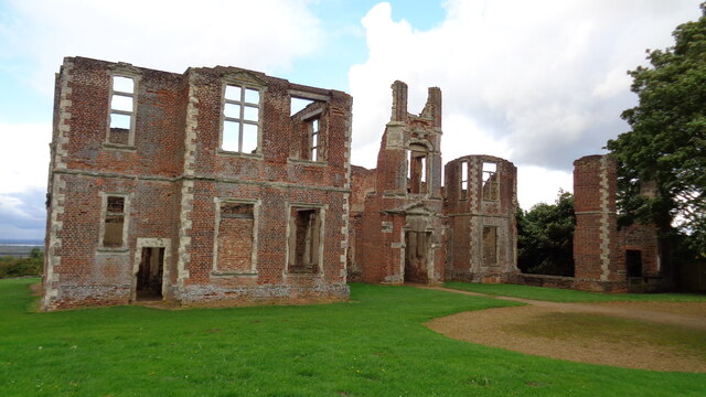
Houghton House: a 17th century mansion and associated courtyard and formal garden remains
Plan your visit
Getting here
52.04373, -0.48646
Visiting this summer
Seasonal nature notes and what to look for now
Visiting this summer
Seasonal nature notes and what to look for now
- 🌞Midsummer — early morning visits most comfortable; look for deer fawns in quieter clearings
- ✦Historic character is a year-round quality here — summer brings its own atmosphere to the setting
- 🐕Dogs welcome — bring water in summer; the site has enough space to find shade on hot days
🌤️ Visiting this summer
- 🌞Midsummer — early morning visits most comfortable; look for deer fawns in quieter clearings
- ✦Historic character is a year-round quality here — summer brings its own atmosphere to the setting
- 🐕Dogs welcome — bring water in summer; the site has enough space to find shade on hot days
Good to know
- £Free to visit — no entry charge
- 🐕Dogs welcome
Best for
Heritage
Strong match
Historic site with public access
Dog walks
Good match
Dogs allowed with public access
Hiking
Good match
Named hiking route nearby: Greensand Ridge Walk
Trails nearby
Within roughly 5 km🚶Walking
7 signed routes nearby · 9 public paths nearby
Signed route nearbyPublic paths
Walking
John Bunyan TrailWalking route
Greensand Ridge WalkWalking route64 km
Katherine’s WalkWalking route13.6 km
Marston Vale Timberland TrailWalking route21 km
A 13 mile / 21 km circular walk around the Forest of Marston Vale - https://www.marstonvale.org/Handlers/Download.ashx?IDMF=8eb96757-1ae3-4db0-a66f-830ab1081402
Jubilee WalkWalking route10.5 km
🚴Cycling
33 signed routes nearby
Signed route nearby
Cycling
National Byway (Beds)Cycling route
NCN 51Cycling route
Greensand CyclewayCycling route59 km
Main RouteCycling route243 m
Main RouteCycling route85 m
Main RouteCycling route226 m
Wildlife to spot
Photos
Weather for this location
Loading local forecast…
Nearby places
Useful places within 5 km
Own or manage this place?
Claim this listing to keep details accurate, add photos, and highlight what makes it special — free.
Claim this pageHow was your visit?
How useful was the information on this page?
id: fec4d4f3-2784-46a5-a398-e204617cd098