HUNGER HILL GARDENS, STONEPIT COPPICE GARDENS AND GORSEYCLOSE GARDENS 31 ha
Plan your visit
🦉 Wildlife🦋 Insects🦅 Birds
Dogs welcome 31 ha
Places › England › East Midlands › Nottingham Getting here
52.96892, -1.13556
Open directionsv
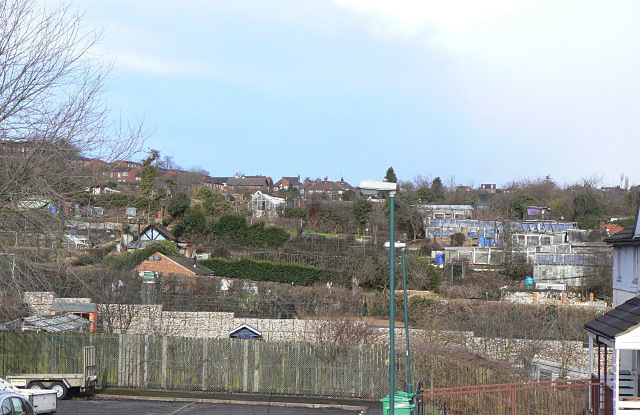
About HUNGER HILL GARDENS, STONEPIT COPPICE GARDENS AND GORSEYCLOSE GARDENS St Ann's Allotments is a group of allotments, in use since the 19th century, in St Ann's, Nottingham, England, about a mile north-east of the centre of Nottingham. It is listed Grade II* in Historic England's Register of Parks and Gardens. The entry listing remarks that this site, comprising Hungerhill Gardens, Stonepit Coppice Gardens and Gorseyclose Gardens, "represents the most extensive surviving detached town garden site in England".
Read more on Wikipedia → Allotment Grade II* listed park and garden
Visiting this summer
Seasonal nature notes and what to look for now
▾ ☀️ June — long evenings and clear skies; one of the most rewarding months for a late visit 🌿 Foraging is at its best in summer here 🐕 Dogs welcome — bring water in summer; the site has enough space to find shade on hot days 🌤️ Visiting this summer
☀️ June — long evenings and clear skies; one of the most rewarding months for a late visit 🌿 Foraging is at its best in summer here 🐕 Dogs welcome — bring water in summer; the site has enough space to find shade on hot days 🦉 Wildlife
Very strong match
Multi-group wildlife — Amphibians, Birds, Mammals; Multi-group wildlife — Amphibians, Birds, Mammals
Free
🦋 Insect spotting
Strong match
Insects — 7-spot Ladybird, Green Shieldbug, Batman Hoverfly +129 more · last seen 2026; Insects — 7-spot Ladybird, Green Shieldbug, Batman Hoverfly +129 more · last seen 2026
Free
🦅 Bird watching
Strong match
Birds — Woodpigeon, Robin, Blackbird +44 more · last seen 2026; Birds — Woodpigeon, Robin, Blackbird +44 more · last seen 2026
Free
Traditional orchard — seasonal fruit, fungi and wild plants
Varies
🍄 Mushroom foraging
Good match
Fungi — Dead Moll's Fingers · last seen 2024; Fungi — Dead Moll's Fingers · last seen 2024
Varies
Trails nearby Within roughly 5 km 22 signed routes nearby · 21 public paths nearby
Signed route nearby Public paths
The Big Track Walking route ▾
Named route Ref The Big Track Local walking route
Show on map Arboretum Route 1 Walking route ▾
Arboretum Route 2 Walking route ▾
Park Steps Walking route ▾
Named route Local walking route
Show on map The Smew Trail Walking route ▾
Named route Local walking route
Show on map Corporation Oaks public footpath · 329 m ▾
Public path public footpath Length 329 m Surface asphalt Path type: cycleway
Show on map Robin Hood Chase public footpath · 382 m ▾
Public path public footpath Length 382 m Surface asphalt Path type: path
Show on map Robin Hood Chase public footpath · 277 m ▾
Public path public footpath Length 277 m Surface asphalt Path type: cycleway
Show on map 139 signed routes nearby
Signed route nearby
Route 15 Cycling route ▾
Named route Ref 15 National Cycle Network
Show on map NTU City Campus to New Basford Avoiding Tram Lines Cycling route ▾
Named route Ref NTU - New Basford Local cycle route
Show on map Broxtowe Country Trail Cycling route ▾
Named route Regional cycle route
Show on map Lenton Lane Cycle Gateway Cycling route ▾
Named route Local cycle route
Show on map Family Cycle Route Cycling route ▾
Named route Local cycle route
Show on map River Leen Cycling route ▾
Named route Regional cycle route
Show on map 1 signed route nearby
Signed route nearby
Mountain Bike Route Mountain bike route ▾
Weather for this location Next 14 days Nearby places Useful places within 5 km
All Historic
How useful was the information on this page?
id: 4019acde-b372-4750-ad13-2f714973ca9b
UK green spaces mapped from open public data — so anyone can find the woodland, trail, or nature reserve closest to them.
© 2026 Glade · Made with care for UK green spaces
Wildlife to spot
32,435 records · National Biodiversity Network
▾
Wildlife to spot 32,435 records · National Biodiversity Network 🐦 Birds 29 species
winter spring summer autumn
2026 ▾
Robin · Woodpigeon · Blackbird · Great Tit · Blue Tit +24
Robin Erithacus rubecula Woodpigeon Columba palumbus Blackbird Turdus merula Great Tit Parus major Blue Tit Cyanistes caeruleus Dunnock Prunella modularis Magpie Pica pica Wren Troglodytes troglodytes Long-tailed Tit Aegithalos caudatus Goldfinch Carduelis carduelis Jay Garrulus glandarius Blackcap Sylvia atricapilla Great Spotted Woodpecker Dendrocopos major2025 Mallard Anas platyrhynchos2025 Nuthatch Sitta europaea2025 Goldcrest Regulus regulus2025 Rock Dove Columba livia2025 Carrion Crow Corvus corone2025 Kestrel Falco tinnunculus Coal Tit Periparus ater2025 Black-headed Gull Chroicocephalus ridibundus2025 Jackdaw Coloeus monedula2025 Pied Wagtail Motacilla alba yarrellii2025 Common Gull Larus canus2025 Pigeon Columba2025 Chiffchaff Phylloscopus collybita2025 Song Thrush Turdus philomelos2025 Treecreeper Certhia familiaris2025 Caspian Gull Larus cachinnans2025 🦌 Mammals 3 species
summer autumn
2025 ▾
Grey Squirrel · Common Pipistrelle · Pipistrelle Bat species
Grey Squirrel Sciurus carolinensis Common Pipistrelle Pipistrellus pipistrellus Pipistrelle Bat species Pipistrellus 🐸 Amphibians 1 species
autumn
2025 ▾
Common Frog
Common Frog Rana temporaria 7-spot Ladybird · Vine Weevil · Batman Hoverfly · Marmalade Hoverfly · Hawthorn Shieldbug +42
7-spot Ladybird Coccinella septempunctata Vine Weevil Otiorhynchus sulcatus Batman Hoverfly Myathropa florea2025 Marmalade Hoverfly Episyrphus balteatus2025 Hawthorn Shieldbug Acanthosoma haemorrhoidale2025 Green Shieldbug Palomena prasina 🌿 Plants 24 species
summer autumn
2025 ▾
Shaggy Soldier · Tree-of-heaven · Borage · Yarrow · White Dead-nettle +19
Shaggy Soldier Galinsoga quadriradiata Tree-of-heaven Ailanthus altissima Borage Borago officinalis Yarrow Achillea millefolium White Dead-nettle Lamium album Wild Marjoram Origanum vulgare Species observations from the last 10 years via NBN Atlas
2025
2025
22-spot Ladybird Psyllobora vigintiduopunctata2025
22-spot Ladybird Psyllobora vigintiduopunctata2025
Eristalis tenax Eristalis tenax
Eristalis tenax Eristalis tenax
Syrphus Syrphus2025
Syrphus Syrphus2025
Southern Oak Bush-cricket Meconema meridionale2025
Southern Oak Bush-cricket Meconema meridionale2025
Red-legged Shieldbug Pentatoma rufipes2025
Red-legged Shieldbug Pentatoma rufipes2025
Southern Hawker Aeshna cyanea2025
Southern Hawker Aeshna cyanea2025
Sphaerophoria Sphaerophoria2025
Sphaerophoria Sphaerophoria2025
Eristalis pertinax Eristalis pertinax2025
Eristalis pertinax Eristalis pertinax2025
Dock Bug Coreus marginatus2025
Dock Bug Coreus marginatus2025
Lesser Stag Beetle Dorcus parallelipipedus2025
Lesser Stag Beetle Dorcus parallelipipedus2025
Helophilus pendulus Helophilus pendulus2025
Helophilus pendulus Helophilus pendulus2025
Common Red Soldier Beetle Rhagonycha fulva2025
Common Red Soldier Beetle Rhagonycha fulva2025
Mystacides longicornis Mystacides longicornis2025
Mystacides longicornis Mystacides longicornis2025
Scathophaga stercoraria Scathophaga stercoraria
Scathophaga stercoraria Scathophaga stercoraria
Cream-spot Ladybird Calvia quattuordecimguttata
Cream-spot Ladybird Calvia quattuordecimguttata
Apion frumentarium Apion frumentarium
Apion frumentarium Apion frumentarium
Birch Shieldbug Elasmostethus interstinctus2025
Birch Shieldbug Elasmostethus interstinctus2025
Harlequin Ladybird Harmonia axyridis2025
Harlequin Ladybird Harmonia axyridis2025
Field Grasshopper Chorthippus brunneus2025
Field Grasshopper Chorthippus brunneus2025
Cryptosiphum artemisiae Cryptosiphum artemisiae2025
Cryptosiphum artemisiae Cryptosiphum artemisiae2025
Box Bug Gonocerus acuteangulatus2025
Box Bug Gonocerus acuteangulatus2025
Common Rose Fusehorn Arge pagana2025
Common Rose Fusehorn Arge pagana2025
Tortoise Bug Eurygaster testudinaria2025
Tortoise Bug Eurygaster testudinaria2025
Trioza centranthi Trioza centranthi2025
Trioza centranthi Trioza centranthi2025
Pine Ladybird Exochomus quadripustulatus2025
Pine Ladybird Exochomus quadripustulatus2025
Western Conifer Seed Bug Leptoglossus occidentalis2025
Western Conifer Seed Bug Leptoglossus occidentalis2025
Black Clock Pterostichus madidus2025
Black Clock Pterostichus madidus2025
Sylvicola fuscatus Sylvicola fuscatus2025
Sylvicola fuscatus Sylvicola fuscatus2025
Parent Bug Elasmucha grisea2025
Parent Bug Elasmucha grisea2025
Eupeodes Eupeodes2025
Eupeodes Eupeodes2025
Chrysotoxum bicinctum Chrysotoxum bicinctum2025
Chrysotoxum bicinctum Chrysotoxum bicinctum2025
Physocephala rufipes Physocephala rufipes2025
Physocephala rufipes Physocephala rufipes2025
Hairy Shieldbug Dolycoris baccarum2025
Hairy Shieldbug Dolycoris baccarum2025
Syrphus ribesii Syrphus ribesii2025
Syrphus ribesii Syrphus ribesii2025
Volucella Volucella2025
Volucella Volucella2025
Sphaerophoria scripta Sphaerophoria scripta2025
Sphaerophoria scripta Sphaerophoria scripta2025
Orange Ladybird Halyzia sedecimguttata2025
Orange Ladybird Halyzia sedecimguttata2025
Hornet Hoverfly Volucella zonaria2025
Hornet Hoverfly Volucella zonaria2025
Cuckoo-Spit Insect Philaenus spumarius2025
Cuckoo-Spit Insect Philaenus spumarius2025
14-spot Ladybird Propylea quattuordecimpunctata2025
14-spot Ladybird Propylea quattuordecimpunctata2025
Large Red Damselfly Pyrrhosoma nymphula2025
Large Red Damselfly Pyrrhosoma nymphula2025 Field Maple
Field Maple
Acer campestre
Acer campestre
Broad-leaved Helleborine Epipactis helleborine
Broad-leaved Helleborine Epipactis helleborine
Bilbao Fleabane Erigeron floribundus
Bilbao Fleabane Erigeron floribundus
Sticky Groundsel Senecio viscosus
Sticky Groundsel Senecio viscosus
Butterfly-bush Buddleja davidii
Butterfly-bush Buddleja davidii
Hart's-Tongue Asplenium scolopendrium
Hart's-Tongue Asplenium scolopendrium
Elder Sambucus nigra
Elder Sambucus nigra
Pedunculate Oak Quercus robur
Pedunculate Oak Quercus robur
Red Campion Silene dioica
Red Campion Silene dioica
Cockspur Echinochloa crus-galli
Cockspur Echinochloa crus-galli
Centaurea nigra Centaurea nigra
Centaurea nigra Centaurea nigra
Creeping Thistle Cirsium arvense
Creeping Thistle Cirsium arvense
Cherry Laurel Prunus laurocerasus
Cherry Laurel Prunus laurocerasus
Narrow-leaved Ragwort Senecio inaequidens
Narrow-leaved Ragwort Senecio inaequidens
Blue Fleabane Erigeron acris
Blue Fleabane Erigeron acris
Great Willowherb Epilobium hirsutum
Great Willowherb Epilobium hirsutum
Large Bindweed Calystegia silvatica
Large Bindweed Calystegia silvatica
Water Bent Polypogon viridis
Water Bent Polypogon viridis Events & activities nearby Switch provider to compare local events, tours and bookable activities.
Bookable tours