Birds — Blackbird, Woodpigeon, Blue Tit +59 more · last seen 2025; Birds — Blackbird, Woodpigeon, Blue Tit +59 more · last seen 2025
Free
🍂
Seasonal nature
Strong match
Ancient woodland — bluebells, fungi and autumn colour; Plants — Hard-fern, Betony, Sneezewort +1 more · last seen 2022
Free
🦋
Insect spotting
Strong match
Insects — Red-headed Cardinal Beetle, 7-spot Ladybird, Corizus hyoscyami +76 more · last seen 2025; Insects — Red-headed Cardinal Beetle, 7-spot Ladybird, Corizus hyoscyami +76 more · last seen 2025
Free
🐶
Dog walks
Strong match
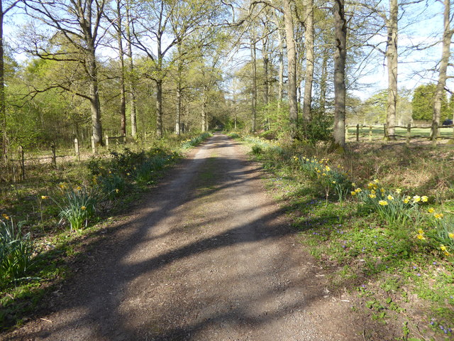
Dogs allowed — public woodland
Free
🌿
Foraging
Good match
Deciduous woodland — fungi, berries and wild garlic
Varies
Trails nearby
Within roughly 5 km
🚶
Walking
▾
10 signed routes nearby · 18 public paths nearby
Signed route nearbyPublic paths
Leith Hill Rhododendron Wood Walk, Leith HillWalking route800 m▾
A gentle walk through Rhododendron Wood; Created in 1800s by Caroline Wedgwood (botanist & Charles Darwin's sister) before being given to the NT in 1944. The wood suffered damage during the Great Storm (1987), so restoration work has shaped the area.
Named routeLength 800 mDuration 00:30Round tripLocal walking route
Greensand WayWalking route▾
Named routeRef GWRegional walking route
Sussex Border PathWalking route220 km▾
Named routeLength 220 kmRegional walking route
Leith Hill '50 things' Trail, Leith HillWalking route4 km▾
Two part family-friendly trail – start around the Rhododendron Wood, then head up Leith Hill, Surrey's 2nd highest. Leith Hill is a great place to learn about nature & for children to tackle the '50 things to do before you’re 11¾'. One steep section.
Named routeLength 4 kmDuration 02:30Round tripLocal walking route
Leith Hill Heathland Walk, Leith HillWalking route3 km▾
With lots of points of interest along the way, this circular heathland trail takes you through a landscape of heather, bracken, bilberry, pine and birch. Moderately flat terrain with a steep climb back to Leith Hill Tower. Potential for livestock.
Named routeLength 3 kmDuration 01:00Round tripLocal walking route
Lowerhouse Lanepublic footpath · 244 m▾
Public pathpublic footpathLength 244 mSurface asphaltPath type: unclassified
🚴
Cycling
▾
12 signed routes nearby
Signed route nearby
Surrey CyclewayCycling route▾
Leigh Hill link
Named routeRegional cycle route
Route 223Cycling route▾
Named routeRef 223National Cycle Network
Surrey CyclewayCycling route▾
Leigh Hill link
Named routeRegional cycle route
Surrey CyclewayCycling route▾
Cranleigh link
Named routeRegional cycle route
Surrey CyclewayCycling route▾
Cranleigh link
Named routeRegional cycle route
Surrey CyclewayCycling route▾
Cycle route consisting of main loop plus link routes
Named routeRound tripRegional cycle route
🚵
Mountain biking
▾
31 signed routes nearby
Signed route nearby
Barry Knows BestMountain bike route▾
Named route
Yoghurt PotsMountain bike route▾
Named routeFriends of hurtwood
Proper BoMountain bike route▾
Named routeFriends of hurtwood
T1Mountain bike route▾
Named routeFriends of hurtwood
T0Mountain bike route▾
Named routeFriends of hurtwood
CaspersMountain bike route▾
Named route
🐴
Horse riding
▾
4 public paths nearby
Public paths
Lowerhouse Lanebyway open to all traffic · 1.4 km▾
Public pathbyway open to all trafficLength 1.4 kmPath type: track
Dunpits Lanebridleway · 2.1 km▾
Public pathbridlewayLength 2.1 kmPath type: bridleway