🦉Wildlife🦅Birds🐶Dogs
Public accessFree entryDogs welcome1 ha
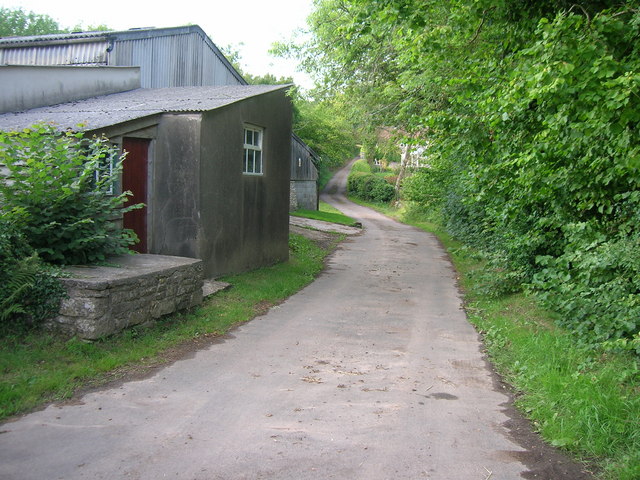
Getting here
51.31396, -2.56682
Open directionsv
Visiting this summer
Seasonal nature notes and what to look for now
- 🌞Midsummer — early morning visits most comfortable; look for deer fawns in quieter clearings
- 🐕Early mornings are best for dog walks in summer — visit before 9am to avoid the heat and find quieter trails
- 🅿️Parking 292m away — 2 car parks within reach
🌤️ Visiting this summer
- 🌞Midsummer — early morning visits most comfortable; look for deer fawns in quieter clearings
- 🐕Early mornings are best for dog walks in summer — visit before 9am to avoid the heat and find quieter trails
- 🅿️Parking 292m away — 2 car parks within reach
- £Free to visit — no entry charge
- 🐕Dogs welcome
🦉Wildlife
Very strong match
Multi-group wildlife — Amphibians, Birds, Mammals, Reptiles; Multi-group wildlife — Amphibians, Birds, Mammals, Reptiles
Free
🦅Bird watching
Very strong match
Birds — Blue Tit, Great Tit, Goldfinch +59 more · last seen 2025; Birds — Blue Tit, Great Tit, Goldfinch +59 more · last seen 2025
Free
Dogs allowed — public woodland
Free
🦋Insect spotting
Strong match
Insects — Meadow Brown, Small White, Gatekeeper +19 more · last seen 2025; Insects — Meadow Brown, Small White, Gatekeeper +19 more · last seen 2025
Free
Deciduous woodland — fungi, berries and wild garlic
Varies
Trails nearby
Within roughly 5 km7 signed routes nearby · 2 public paths nearby
Signed route nearbyPublic paths
Monarch's WayWalking route990 km▾
approximate route of Charles II's escape
Named routeRef MWLength 990 kmRegional walking route
Samaritans Way South WestWalking route166 km▾
Named routeLength 166 kmRegional walking route
The Butcombe TrailWalking route74 km▾
Named routeRef BUTLength 74 kmRegional walking route
The Mendip TrailWalking route▾
Named routeRef MTRegional walking route
Three Peaks WalkWalking route27 km▾
Named routeLength 27 kmRound tripLocal walking route
9 signed routes nearby
Signed route nearby
Route 3Cycling route527.7 km▾
Named routeRef 3Length 527.7 kmNational Cycle Network
EuroVelo 1 - Atlantic Coast Route - part United Kingdom 2Cycling route▾
Named routeRef EV1International cycle route
Avon CyclewayCycling route▾
Named routeRegional cycle route
Main RouteCycling route1.2 km▾
Named routeRef 3Length 1.2 kmNational Cycle NetworkOn-roadSurface asphalt
Main RouteCycling route743 m▾
Named routeRef 3Length 743 mNational Cycle NetworkOn-roadSurface asphalt
Main RouteCycling route1.4 km▾
Named routeRef 3Length 1.4 kmNational Cycle NetworkTraffic-freeSurface asphalt
2 public paths nearby
Public paths
Nanny Hurn's Lanebyway open to all traffic · 132 m▾
Public pathbyway open to all trafficLength 132 mSurface asphaltPath type: service
Nanny Hurn's Lanebyway open to all traffic · 243 m▾
Public pathbyway open to all trafficLength 243 mSurface gravelPath type: track
Weather for this location
Next 14 daysNearby places
Useful places within 5 km
Own or manage this place?
Claim this listing to keep details accurate, add photos, and highlight what makes it special — free.
Claim this page→How useful was the information on this page?
id: aaf32ee7-b5db-44bf-aa60-f4d5a40b6e12
Wildlife to spot
18,993 records · National Biodiversity Network
Wildlife to spot
18,993 records · National Biodiversity Network🐦Birds14 species
autumnwinter
2025▾
Jackdaw · Carrion Crow · Woodpigeon · Starling · Rook +9
- JackdawColoeus monedula
- Carrion CrowCorvus corone
- WoodpigeonColumba palumbus
- StarlingSturnus vulgaris
- RookCorvus frugilegus
- PheasantPhasianus colchicus
- MagpiePica pica
- Pied WagtailMotacilla alba
- FieldfareTurdus pilaris
- Lesser Black-backed GullLarus fuscus
- RobinErithacus rubecula
- BlackbirdTurdus merula
- Green WoodpeckerPicus viridis
- LinnetLinaria cannabina
🐸Amphibians2 species
summer
2025▾
Common Frog · Common Toad
- Common FrogRana temporaria
- Common ToadBufo bufo
Blue-tailed Damselfly · Emperor Dragonfly · Common Darter
- Blue-tailed DamselflyIschnura elegans
- Emperor DragonflyAnax imperator
- Common DarterSympetrum striolatum
Field Horsetail · False-brome · Common Bird's-foot-trefoil · Meadowsweet · False Oat-grass +142
- Field HorsetailEquisetum arvense
- False-bromeBrachypodium sylvaticum
- Common Bird's-foot-trefoilLotus corniculatus
- MeadowsweetFilipendula ulmaria
- False Oat-grassArrhenatherum elatius
- Common Mouse-earCerastium fontanum
- Bush Vetch
Species observations from the last 10 years via NBN Atlas
Vicia sepium
Vicia sepium
Meadow ButtercupRanunculus acrisMeadow ButtercupRanunculus acrisRibwort PlantainPlantago lanceolataRibwort PlantainPlantago lanceolataCrested Dog's-tailCynosurus cristatusCrested Dog's-tailCynosurus cristatusGlaucous SedgeCarex flaccaGlaucous SedgeCarex flaccaHard RushJuncus inflexusHard RushJuncus inflexusCreeping CinquefoilPotentilla reptansCreeping CinquefoilPotentilla reptansOxeye DaisyLeucanthemum vulgareOxeye DaisyLeucanthemum vulgareWood-sedgeCarex sylvaticaWood-sedgeCarex sylvaticaBrambleRubus fruticosusBrambleRubus fruticosusGreater PlantainPlantago majorGreater PlantainPlantago majorCat's-earHypochaeris radicataCat's-earHypochaeris radicataPedunculate OakQuercus roburPedunculate OakQuercus roburWood DockRumex sanguineusWood DockRumex sanguineusTufted VetchVicia craccaTufted VetchVicia craccaFestuca rubraFestuca rubraFestuca rubraFestuca rubraDyer's GreenweedGenista tinctoriaDyer's GreenweedGenista tinctoriaMale-fernDryopteris filix-masMale-fernDryopteris filix-masRed CloverTrifolium pratenseRed CloverTrifolium pratenseGreater Pond-sedgeCarex ripariaGreater Pond-sedgeCarex ripariaLesser StitchwortStellaria gramineaLesser StitchwortStellaria gramineaSweet Vernal-grassAnthoxanthum odoratumSweet Vernal-grassAnthoxanthum odoratumSaw-wortSerratula tinctoriaSaw-wortSerratula tinctoriaDandelionTaraxacumDandelionTaraxacumCock's-footDactylis glomerataCock's-footDactylis glomerataHazelCorylus avellanaHazelCorylus avellanaField-roseRosa arvensisField-roseRosa arvensisBurnet-saxifragePimpinella saxifragaBurnet-saxifragePimpinella saxifragaMeadow FescueSchedonorus pratensisMeadow FescueSchedonorus pratensisRough HawkbitLeontodon hispidusRough HawkbitLeontodon hispidusBitter-vetchLathyrus linifoliusBitter-vetchLathyrus linifoliusHawthornCrataegus monogynaHawthornCrataegus monogynaBetonyBetonica officinalisBetonyBetonica officinalisJointed RushJuncus articulatusJointed RushJuncus articulatusRosa caninaRosa caninaRosa caninaRosa caninaMeadow VetchlingLathyrus pratensisMeadow VetchlingLathyrus pratensisHedera helixHedera helixHedera helixHedera helixWhite CloverTrifolium repensWhite CloverTrifolium repensMarsh ThistleCirsium palustreMarsh ThistleCirsium palustrePerforate St John's-wortHypericum perforatumPerforate St John's-wortHypericum perforatumLady's BedstrawGalium verumLady's BedstrawGalium verumBlackthornPrunus spinosaBlackthornPrunus spinosaGermander SpeedwellVeronica chamaedrysGermander SpeedwellVeronica chamaedrysGreater Bird's-foot-trefoilLotus pedunculatusGreater Bird's-foot-trefoilLotus pedunculatusRusty WillowSalix cinerea subsp. oleifoliaRusty WillowSalix cinerea subsp. oleifoliaHeath Spotted-orchidDactylorhiza maculataHeath Spotted-orchidDactylorhiza maculataQuaking-grassBriza mediaQuaking-grassBriza mediaTall FescueSchedonorus arundinaceusTall FescueSchedonorus arundinaceusPurple Moor-grassMolinia caeruleaPurple Moor-grassMolinia caeruleaCommon ValerianValeriana officinalisCommon ValerianValeriana officinalisCommon SorrelRumex acetosaCommon SorrelRumex acetosaYellow-rattleRhinanthus minorYellow-rattleRhinanthus minorAgrimonyAgrimonia eupatoriaAgrimonyAgrimonia eupatoriaBittersweetSolanum dulcamaraBittersweetSolanum dulcamaraTufted Hair-grassDeschampsia cespitosaTufted Hair-grassDeschampsia cespitosaHemlock Water-dropwortOenanthe crocataHemlock Water-dropwortOenanthe crocataCommon BentAgrostis capillarisCommon BentAgrostis capillarisElderSambucus nigraElderSambucus nigraBugleAjuga reptansBugleAjuga reptansYorkshire-fogHolcus lanatusYorkshire-fogHolcus lanatusFool's Water-CressHelosciadium nodiflorumFool's Water-CressHelosciadium nodiflorumCompact RushJuncus conglomeratusCompact RushJuncus conglomeratusHeath-grassDanthonia decumbensHeath-grassDanthonia decumbensHairy St John's-wortHypericum hirsutumHairy St John's-wortHypericum hirsutumDevil's-bit ScabiousSuccisa pratensisDevil's-bit ScabiousSuccisa pratensisMarsh-bedstrawGalium palustreMarsh-bedstrawGalium palustreLesser Pond-sedgeCarex acutiformisLesser Pond-sedgeCarex acutiformisHoary RagwortJacobaea erucifoliaHoary RagwortJacobaea erucifoliaTormentilPotentilla erectaTormentilPotentilla erectaCommon Spotted-orchidDactylorhiza fuchsiiCommon Spotted-orchidDactylorhiza fuchsiiCentaurea nigraCentaurea nigraCentaurea nigraCentaurea nigraWater FigwortScrophularia auriculataWater FigwortScrophularia auriculataBrooklimeVeronica beccabungaBrooklimeVeronica beccabungaCowslipPrimula verisCowslipPrimula verisLuzula multiflora subsp. congestaLuzula multiflora subsp. congestaLuzula multiflora subsp. congestaLuzula multiflora subsp. congestaDogwoodCornus sanguineaDogwoodCornus sanguineaPerennial Rye-grassLolium perennePerennial Rye-grassLolium perenneCow ParsleyAnthriscus sylvestrisCow ParsleyAnthriscus sylvestrisZigzag CloverTrifolium mediumZigzag CloverTrifolium mediumWhite WillowSalix albaWhite WillowSalix albaSoft-rushJuncus effususSoft-rushJuncus effususMarsh HorsetailEquisetum palustreMarsh HorsetailEquisetum palustreClustered DockRumex conglomeratusClustered DockRumex conglomeratusCommon OracheAtriplex patulaCommon OracheAtriplex patulaCreeping ButtercupRanunculus repensCreeping ButtercupRanunculus repensSalix fragilisSalix fragilisSalix fragilisSalix fragilisTragopogon pratensis subsp. minorTragopogon pratensis subsp. minorTragopogon pratensis subsp. minorTragopogon pratensis subsp. minorWoolly ThistleCirsium eriophorumWoolly ThistleCirsium eriophorumMeadow Crane's-billGeranium pratenseMeadow Crane's-billGeranium pratenseField Forget-me-notMyosotis arvensisField Forget-me-notMyosotis arvensisHedge MustardSisymbrium officinaleHedge MustardSisymbrium officinaleSnowberrySymphoricarpos albusSnowberrySymphoricarpos albusCreeping ThistleCirsium arvenseCreeping ThistleCirsium arvenseGreater StitchwortStellaria holosteaGreater StitchwortStellaria holosteaBlack-grassAlopecurus myosuroidesBlack-grassAlopecurus myosuroidesDaisyBellis perennisDaisyBellis perennisWild StrawberryFragaria vescaWild StrawberryFragaria vescaEarly Dog-violetViola reichenbachianaEarly Dog-violetViola reichenbachianaWavy Bitter-cressCardamine flexuosaWavy Bitter-cressCardamine flexuosaDog's MercuryMercurialis perennisDog's MercuryMercurialis perennisShepherd's-purseCapsella bursa-pastorisShepherd's-purseCapsella bursa-pastorisSoft-bromeBromus hordeaceusSoft-bromeBromus hordeaceusGrey SedgeCarex divulsa subsp. divulsaGrey SedgeCarex divulsa subsp. divulsaRamsonsAllium ursinumRamsonsAllium ursinumHawkweedHieraciumHawkweedHieraciumBristly OxtongueHelminthotheca echioidesBristly OxtongueHelminthotheca echioidesAsplenium trichomanes subsp. quadrivalensAsplenium trichomanes subsp. quadrivalensAsplenium trichomanes subsp. quadrivalensAsplenium trichomanes subsp. quadrivalensMeadow FoxtailAlopecurus pratensisMeadow FoxtailAlopecurus pratensisField MapleAcer campestreField MapleAcer campestreHedge BedstrawGalium albumHedge BedstrawGalium albumLords-and-LadiesArum maculatumLords-and-LadiesArum maculatumField BindweedConvolvulus arvensisField BindweedConvolvulus arvensisPendulous SedgeCarex pendulaPendulous SedgeCarex pendulaRedshankPersicaria maculosaRedshankPersicaria maculosaNipplewortLapsana communisNipplewortLapsana communisWild BasilClinopodium vulgareWild BasilClinopodium vulgareHerb-RobertGeranium robertianumHerb-RobertGeranium robertianumSilverweedPotentilla anserinaSilverweedPotentilla anserinaRumex crispus subsp. crispusRumex crispus subsp. crispusRumex crispus subsp. crispusRumex crispus subsp. crispusSoft Shield-fernPolystichum setiferumSoft Shield-fernPolystichum setiferumSpear-leaved OracheAtriplex prostrataSpear-leaved OracheAtriplex prostrataHogweedHeracleum sphondyliumHogweedHeracleum sphondyliumCleaversGalium aparineCleaversGalium aparineRough Meadow-grassPoa trivialisRough Meadow-grassPoa trivialisWayfaring-treeViburnum lantanaWayfaring-treeViburnum lantanaCorky-fruited Water-dropwortOenanthe pimpinelloidesCorky-fruited Water-dropwortOenanthe pimpinelloidesGround-ivyGlechoma hederaceaGround-ivyGlechoma hederaceaPineappleweedMatricaria discoideaPineappleweedMatricaria discoideaAlderAlnus glutinosaAlderAlnus glutinosaRough ChervilChaerophyllum temulumRough ChervilChaerophyllum temulumFig-leaved GoosefootChenopodium ficifoliumFig-leaved GoosefootChenopodium ficifoliumUpright BromeBromopsis erectaUpright BromeBromopsis erectaCommon RagwortJacobaea vulgarisCommon RagwortJacobaea vulgarisBluebellHyacinthoides non-scriptaBluebellHyacinthoides non-scriptaGarlic MustardAlliaria petiolataGarlic MustardAlliaria petiolataPrimrosePrimula vulgarisPrimrosePrimula vulgarisAnnual Meadow-grassPoa annuaAnnual Meadow-grassPoa annuaAppleMalus domesticaAppleMalus domesticaBarren BromeAnisantha sterilisBarren BromeAnisantha sterilisLarge BindweedCalystegia silvaticaLarge BindweedCalystegia silvaticaCharlockSinapis arvensisCharlockSinapis arvensisEvents & activities nearby
Switch provider to compare local events, tours and bookable activities.