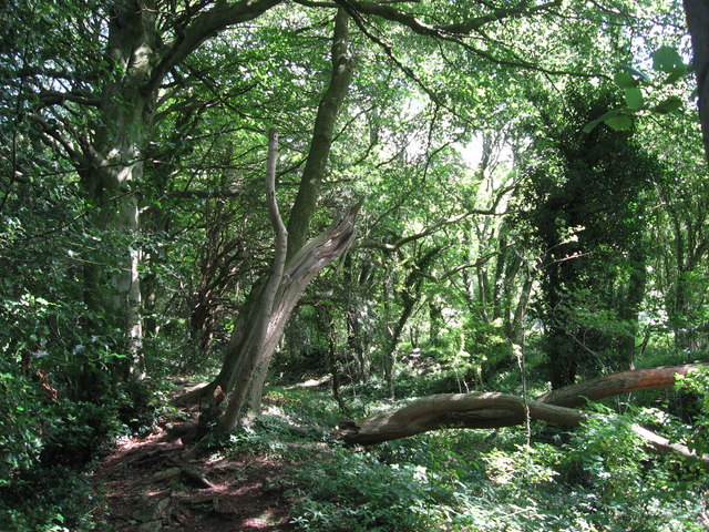
James's Thorns ✦ Ancient woodland 249 ha
🦅 Birds🦉 Wildlife🐶 Dogs
↑ Share
Public access Free entry Dogs welcome 249 ha
Places › England › South West › Forest of Dean Getting here
51.68638, -2.66334
Open directionsv Visiting this summer
Seasonal nature notes and what to look for now
▾ 🌞 Midsummer — early morning visits most comfortable; look for deer fawns in quieter clearings 🐕 Early mornings are best for dog walks in summer — visit before 9am to avoid the heat and find quieter trails 🅿️ Lancaut Lane 108m away — 20 car parks within reach 🌤️ Visiting this summer
🌞 Midsummer — early morning visits most comfortable; look for deer fawns in quieter clearings 🐕 Early mornings are best for dog walks in summer — visit before 9am to avoid the heat and find quieter trails 🅿️ Lancaut Lane 108m away — 20 car parks within reach £ Free to visit — no entry charge🐕 Dogs welcome🌿 Ancient woodland — rare wildlife habitat🌳 Large woodland — room to roam🚲 Bike parking🅿️ Parking· Paid
🦅 Bird watching
Very strong match
Mudflats — internationally important for wading birds and wildfowl; Birds — Robin, Blackbird, House Sparrow +75 more · last seen 2026
Free
🦉 Wildlife
Very strong match
Multi-group wildlife — Amphibians, Birds, Mammals, Reptiles; Multi-group wildlife — Amphibians, Birds, Mammals, Reptiles
Free
🐶 Dog walks
Very strong match
Dogs allowed — woodland with marked walking trails
Free
🌲 Forest walks
Very strong match
1 marked walking trail(s)
Free
🍂 Seasonal nature
Strong match
Ancient woodland — bluebells, fungi and autumn colour; Plants — Fox-tail Feather-moss, Dilated Scalewort, Navelwort +17 more · last seen 2026
Free
🦋 Insect spotting
Strong match
Chalk and limestone grassland — chalkhill blue, adonis blue and rare moths; Insects — Green Tiger Beetle, Minotaur Beetle, 7-spot Ladybird +66 more · last seen 2025
Free
Trails nearby Within roughly 5 km 4 signed routes nearby · 27 public paths nearby
Signed route nearby Public paths
Gloucestershire Way Walking route 161 km ▾
Named route Length 161 km Regional walking route
Show on map Offa's Dyke Path Walking route 285 km ▾
Named route Ref ODP Length 285 km National walking route
Show on map Wye Valley Walk Walking route 218 km ▾
Named route Ref WVW Length 218 km Regional walking route
Show on map Wales Coast Path (South Wales) Walking route ▾
Named route Ref WCP National walking route
Show on map Wye Valley Greenway public footpath · 659 m ▾
Public path public footpath Length 659 m Surface dirt Path type: path
Show on map Underhill public footpath · 1.4 km ▾
Public path public footpath Length 1.4 km Surface asphalt Path type: unclassified
Show on map Tintern Rail Bridge public footpath · 97 m ▾
Public path public footpath Length 97 m Surface wood Incline 0% Path type: track
Show on map 25 signed routes nearby
Signed route nearby
National Cycle Network Route 42 Cycling route ▾
Named route Ref 42 National Cycle Network
Show on map Wye Valley Greenway Cycling route ▾
Named route Local cycle route
Show on map Route 32 Cycling route ▾
Named route Ref 32 Regional cycle route
Show on map N/A Cycling route 256 m ▾
Named route Ref 31 Length 256 m National Cycle Network Traffic-free Surface asphalt
Show on map N/A Cycling route 640 m ▾
Named route Ref 31 Length 640 m National Cycle Network Traffic-free Surface asphalt
Show on map N/A Cycling route 1.1 km ▾
Named route Ref 31 Length 1.1 km National Cycle Network Traffic-free Surface asphalt
Show on map 5 public paths nearby
Public paths
No named routes yet. Public paths are shown on the map.
✦ Ancient woodland — continuously wooded since at least 1600 AD. A rare and irreplaceable habitat, rich in biodiversity and historical character.
Weather for this location Next 14 days Nearby places Useful places within 5 km
All Historic
Own or manage this place?
Claim this listing to keep details accurate, add photos, and highlight what makes it special — free.
Claim this page→ How useful was the information on this page?
Something wrong on this page?
id: 58bf8ef4-ed6a-4516-9c7e-54482e413feb
UK green spaces mapped from open public data — so anyone can find the woodland, trail, or nature reserve closest to them.
© 2026 Glade · Made with care for UK green spaces
Wildlife to spot
9,216 records · National Biodiversity Network
▾
Wildlife to spot 9,216 records · National Biodiversity Network 🐦 Birds 47 species
winter spring summer
2026 ▾
House Sparrow · Robin · Blackbird · Tree Pipit · Carrion Crow +42
House Sparrow Passer domesticus2025 Robin Erithacus rubecula2025 Blackbird Turdus merula2025 Tree Pipit Anthus trivialis2025 Carrion Crow Corvus corone2025 Chiffchaff Phylloscopus collybita2025 Jackdaw Coloeus monedula2025 Willow Warbler Phylloscopus trochilus2025 Blue Tit Cyanistes caeruleus2025 Nuthatch Sitta europaea Raven Corvus corax2025 Wren Troglodytes troglodytes2025 Great Tit Parus major2025 Treecreeper Certhia familiaris2025 Mallard Anas platyrhynchos2025 Goldcrest Regulus regulus2025 Song Thrush Turdus philomelos2025 Great Spotted Woodpecker Dendrocopos major2025 Grey Wagtail Motacilla cinerea2025 House Martin Delichon urbicum2025 Spotted Flycatcher Muscicapa striata2025 Mute Swan Cygnus olor2025 Woodpigeon Columba palumbus2025 Stonechat Saxicola rubicola2025 Siskin Spinus spinus2025 Herring Gull Larus argentatus2025 Dunnock Prunella modularis2025 Goosander Mergus merganser2025 Red-legged Partridge Alectoris rufa2025 Green Woodpecker Picus viridis2025 Blackcap Sylvia atricapilla2025 Black-headed Gull Chroicocephalus ridibundus2025 Tawny Owl Strix aluco2025 Bullfinch Pyrrhula pyrrhula2025 Rock Dove Columba livia2025 Lesser Whitethroat Curruca curruca2025 Crossbill Loxia curvirostra2025 Greenfinch Chloris chloris2025 Cormorant Phalacrocorax carbo2025 Pied Wagtail Motacilla alba yarrellii2025 Woodcock Scolopax rusticola2025 Swift Apus apus2025 Swallow Hirundo rustica2025 Garden Warbler Sylvia borin2025 Linnet Linaria cannabina2025 Magpie Pica pica2024 Coal Tit Periparus ater2024 🦌 Mammals 1 species
spring summer autumn
2025 ▾
Hazel Dormouse
Hazel Dormouse Muscardinus avellanarius 🦎 Reptiles 4 species
spring summer
2025 ▾
Grass Snake · Slow-worm · Adder · Common Lizard
Grass Snake Natrix helvetica Slow-worm Anguis fragilis Adder Vipera berus Common Lizard Zootoca vivipara 🐸 Amphibians 1 species
spring
2025 ▾
Common Frog
Common Frog Rana temporaria 🐝 Insects 29 species
spring summer autumn
2025 ▾
Green Tiger Beetle · Rugged Oil-beetle · 7-spot Ladybird · Harlequin Ladybird · Lesser Stag Beetle +24
Green Tiger Beetle Cicindela campestris Rugged Oil-beetle Meloe rugosus 7-spot Ladybird Coccinella septempunctata Harlequin Ladybird Harmonia axyridis Lesser Stag Beetle Dorcus parallelipipedus Large Red Damselfly Navelwort · Wood Spurge · Yarrow · Red Valerian · Giant Knotweed +19
Navelwort Umbilicus rupestris Wood Spurge Euphorbia amygdaloides2025 Yarrow Achillea millefolium2025 Red Valerian Centranthus ruber2025 Giant Knotweed Reynoutria sachalinensis2025 Eyebright Euphrasia Species observations from the last 10 years via NBN Atlas
Pyrrhosoma nymphula
Pyrrhosoma nymphula
Hairy Shieldbug Dolycoris baccarum
Hairy Shieldbug Dolycoris baccarum
Fannia lustrator Fannia lustrator
Fannia lustrator Fannia lustrator
Common Earwig Forficula auricularia/dentata agg.
Common Earwig Forficula auricularia/dentata agg.
Fannia canicularis Fannia canicularis
Fannia canicularis Fannia canicularis
Melanostoma mellinum Melanostoma mellinum
Melanostoma mellinum Melanostoma mellinum
Rhingia campestris Rhingia campestris
Rhingia campestris Rhingia campestris
Coenosia tigrina Coenosia tigrina
Coenosia tigrina Coenosia tigrina
Batman Hoverfly Myathropa florea
Batman Hoverfly Myathropa florea
Field Grasshopper Chorthippus brunneus
Field Grasshopper Chorthippus brunneus
Violet Ground Beetle Carabus violaceus
Violet Ground Beetle Carabus violaceus
Common Darter Sympetrum striolatum
Common Darter Sympetrum striolatum
Dor Beetle Geotrupes stercorarius
Dor Beetle Geotrupes stercorarius
Meadow Grasshopper Pseudochorthippus parallelus
Meadow Grasshopper Pseudochorthippus parallelus
Eristalis pertinax Eristalis pertinax
Eristalis pertinax Eristalis pertinax
Tortoise Bug Eurygaster testudinaria
Tortoise Bug Eurygaster testudinaria
Welsh Chafer Hoplia philanthus
Welsh Chafer Hoplia philanthus
Cheilosia Cheilosia
Cheilosia Cheilosia
Oedemera femoralis Oedemera femoralis
Oedemera femoralis Oedemera femoralis
Broad-bodied Chaser Libellula depressa
Broad-bodied Chaser Libellula depressa
Western Honey Bee Apis mellifera
Western Honey Bee Apis mellifera
Azure Damselfly Coenagrion puella
Azure Damselfly Coenagrion puella
Trioza centranthi Trioza centranthi2024
Trioza centranthi Trioza centranthi2024
Minotaur Beetle Typhaeus typhoeus2024
Minotaur Beetle Typhaeus typhoeus2024 2025
2025
Crescent-cup Liverwort Lunularia cruciata2025
Crescent-cup Liverwort Lunularia cruciata2025
Marchantia polymorpha subsp. ruderalis Marchantia polymorpha subsp. ruderalis2025
Marchantia polymorpha subsp. ruderalis Marchantia polymorpha subsp. ruderalis2025
Buckler-Fern Dryopteris affinis subsp. affinis2024
Buckler-Fern Dryopteris affinis subsp. affinis2024
Dog's Mercury Mercurialis perennis2024
Dog's Mercury Mercurialis perennis2024
False-brome Brachypodium sylvaticum2024
False-brome Brachypodium sylvaticum2024
Pendulous Sedge Carex pendula2024
Pendulous Sedge Carex pendula2024
Southern Wood-rush Luzula forsteri2024
Southern Wood-rush Luzula forsteri2024
Slender Rush Juncus tenuis2024
Slender Rush Juncus tenuis2024
Hazel Corylus avellana2024
Hazel Corylus avellana2024
Great Mullein Verbascum thapsus2024
Great Mullein Verbascum thapsus2024
Intermediate Polypody Polypodium interjectum2024
Intermediate Polypody Polypodium interjectum2024
Small-leaved Lime Tilia cordata2024
Small-leaved Lime Tilia cordata2024
Wood Melick Melica uniflora2024
Wood Melick Melica uniflora2024
Wych Elm Ulmus glabra2024
Wych Elm Ulmus glabra2024
Bramble Rubus fruticosus2024
Bramble Rubus fruticosus2024
Heath Speedwell Veronica officinalis2024
Heath Speedwell Veronica officinalis2024
Sycamore Acer pseudoplatanus2024
Sycamore Acer pseudoplatanus2024
Herb-Robert Geranium robertianum2024
Herb-Robert Geranium robertianum2024 Events & activities nearby Switch provider to compare local events, tours and bookable activities.
Bookable tours GetYourGuide Promote here