Plan your visit
🦉 Wildlife🦅 Birds🦋 Insects
Free entry Dogs welcome 13 ha
Places › England › South West › Bournemouth, Christchurch and Poole Getting here
50.79665, -1.83422
Open directionsv Visiting this summer
Seasonal nature notes and what to look for now
▾ 🌞 Midsummer — early morning visits most comfortable; look for deer fawns in quieter clearings 🐴 Horse riding listed as facility — is at its best in summer 🐕 Dogs welcome — bring water in summer; the site has enough space to find shade on hot days 🌤️ Visiting this summer
🌞 Midsummer — early morning visits most comfortable; look for deer fawns in quieter clearings 🐴 Horse riding listed as facility — is at its best in summer 🐕 Dogs welcome — bring water in summer; the site has enough space to find shade on hot days £ Free to visit — no entry charge🐕 Dogs welcome🦉 Wildlife
Very strong match
Multi-group wildlife — Amphibians, Birds, Mammals, Reptiles; Multi-group wildlife — Amphibians, Birds, Mammals, Reptiles
Free
🦅 Bird watching
Very strong match
Birds — Blackbird, Woodpigeon, Robin +66 more · last seen 2026; Birds — Blackbird, Woodpigeon, Robin +66 more · last seen 2026
Free
🦋 Insect spotting
Strong match
Lowland heathland — silver-studded blue and heath fritillary butterflies; Insects — Gatekeeper, Meadow Brown, Red Admiral +169 more · last seen 2025
Free
🍂 Seasonal nature
Strong match
Plants — Water-plantain, Himalayan Balsam, New Zealand Pigmyweed +38 more · last seen 2022; Plants — Water-plantain, Himalayan Balsam, New Zealand Pigmyweed +38 more · last seen 2022
Free
Horse riding listed as facility
Varies
Deciduous woodland — fungi, berries and wild garlic; Plants — Lesser Chickweed, Umbellate Hawkweed, Water Mint +2 more foraging species
Varies
Trails nearby Within roughly 5 km 4 signed routes nearby
Signed route nearby
Avon Valley Path Walking route 55 km ▾
Named route Ref AVP Length 55 km Regional walking route
Show on map Kingston Lacy walk at Holt Heath, Kingston Lacy Walking route 9.6 km ▾
The bridleways and footpaths can become rutted, with the eastern sector in part on elevated ground crossing the important heathland mire. Grazing of animals is part of the management of this rare habitat, so dogs should be kept under effective control. St
Named route Length 9.6 km Duration 03:00 Round trip Local walking route
Show on map Castleman Trailway Walking route 26.5 km ▾
Named route Ref CT Length 26.5 km Local walking route
Show on map Stour Valley Way Walking route 100 km ▾
Named route Ref SVW Length 100 km Regional walking route
Show on map 36 signed routes nearby
Signed route nearby
Millhams Road Cycling route ▾
Named route Local cycle route
Show on map Poole to Ferndown Proposed Cycleway Cycling route ▾
Named route Ref S5-p Local cycle route
Show on map Bournemouth to Tricketts Cross Cycling route ▾
Named route Ref C2 Local cycle route
Show on map Ferndown Schools Cycle&Walking Route Cycling route ▾
Named route Local cycle route
Show on map Leigh Road Wimborne Road Cycling route ▾
Named route Ref S5 Local cycle route
Show on map National Route 256 Cycling route ▾
Named route Ref 256 National Cycle Network
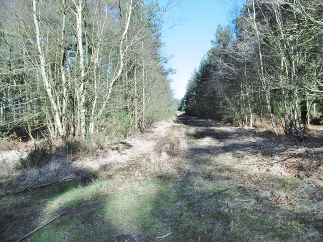
Show on map Photos Hurn Forest, forestry track
‹ ›
Weather for this location Next 14 days Nearby places Useful places within 5 km
All Historic
Own or manage this place?
Claim this listing to keep details accurate, add photos, and highlight what makes it special — free.
Claim this page→ How useful was the information on this page?
id: 5dfbca1c-6bbf-41e0-bec3-f9643bfa80f4
UK green spaces mapped from open public data — so anyone can find the woodland, trail, or nature reserve closest to them.
© 2026 Glade · Made with care for UK green spaces
Events & activities nearby Switch provider to compare local events, tours and bookable activities.
Bookable tours GetYourGuide Promote here
Wildlife to spot
10,116 records · National Biodiversity Network
▾
Wildlife to spot 10,116 records · National Biodiversity Network Stonechat · Carrion Crow · Mistle Thrush · Robin · Blackbird +38
Stonechat Saxicola rubicola2025 Carrion Crow Corvus corone2025 Mistle Thrush Turdus viscivorus2025 Robin Erithacus rubecula2025 Blackbird Turdus merula2025 Chiffchaff Phylloscopus collybita2025 Tree Pipit Anthus trivialis2025 Woodpigeon Columba palumbus2025 Starling Sturnus vulgaris2025 Swallow Hirundo rustica2025 Chaffinch Fringilla coelebs2025 Great Tit Parus major2025 Jay Garrulus glandarius2025 Great Spotted Woodpecker Dendrocopos major2025 Wren Troglodytes troglodytes2025 Magpie Pica pica2025 Stock Dove Columba oenas2025 Pied Wagtail Motacilla alba yarrellii2025 Song Thrush Turdus philomelos2025 Herring Gull Larus argentatus2025 Greenfinch Chloris chloris2025 Blackcap Sylvia atricapilla2025 Woodcock Scolopax rusticola Goldfinch Carduelis carduelis2025 Dunnock Prunella modularis2025 Blue Tit Cyanistes caeruleus2025 Linnet Linaria cannabina2025 Coal Tit Periparus ater2025 Long-tailed Tit Aegithalos caudatus2025 Whitethroat Curruca communis2025 Collared Dove Streptopelia decaocto2025 Goldcrest Regulus regulus2025 House Sparrow Passer domesticus2025 Lesser Black-backed Gull Larus fuscus2025 Mallard Anas platyrhynchos2025 Siskin Spinus spinus2025 Willow Warbler Phylloscopus trochilus2025 Bullfinch Pyrrhula pyrrhula2024 Crossbill Loxia curvirostra2024 Jackdaw Coloeus monedula2024 Wryneck Jynx torquilla2023 Nuthatch Sitta europaea2023 Kestrel Falco tinnunculus2022 🦌 Mammals 5 species
spring summer
2025 ▾
Rabbit · Roe Deer · Red Fox · Brown Rat · Otter
Rabbit Oryctolagus cuniculus Roe Deer Capreolus capreolus2024 Red Fox Vulpes vulpes2024 Brown Rat Rattus norvegicus2024 Otter Lutra lutra2024 🦎 Reptiles 2 species
spring summer
2025 ▾
Slow-worm · Common Lizard
Slow-worm Anguis fragilis Common Lizard Zootoca vivipara2023 🐝 Insects 20 species
summer autumn
2025 ▾
Southern Hawker · Minotaur Beetle · Endromopoda detrita · Schizopyga circulator · Glow-worm +15
Southern Hawker Aeshna cyanea2024 Minotaur Beetle Typhaeus typhoeus Endromopoda detrita Endromopoda detrita2023 Schizopyga circulator Schizopyga circulator2022 Glow-worm Lampyris noctiluca2022 Species observations from the last 10 years via NBN Atlas
Leucophora
Leucophora
Leucophora
Leucophora
Common Darter Sympetrum striolatum2024
Common Darter Sympetrum striolatum2024
Beautiful Demoiselle Calopteryx virgo2024
Beautiful Demoiselle Calopteryx virgo2024
Golden-ringed Dragonfly Cordulegaster boltonii2024
Golden-ringed Dragonfly Cordulegaster boltonii2024
Pimpla insignatoria Pimpla insignatoria2023
Pimpla insignatoria Pimpla insignatoria2023
Cryptopimpla errabunda Cryptopimpla errabunda2023
Cryptopimpla errabunda Cryptopimpla errabunda2023
Gelis mangeri Gelis mangeri2023
Gelis mangeri Gelis mangeri2023
Speckled Bush-cricket Leptophyes punctatissima2023
Speckled Bush-cricket Leptophyes punctatissima2023
Stag Beetle Lucanus cervus2023
Stag Beetle Lucanus cervus2023
Hyperaspis pseudopustulata Hyperaspis pseudopustulata2023
Hyperaspis pseudopustulata Hyperaspis pseudopustulata2023
Eupeodes corollae Eupeodes corollae2023
Eupeodes corollae Eupeodes corollae2023
Pleolophus brachypterus Pleolophus brachypterus2022
Pleolophus brachypterus Pleolophus brachypterus2022
Asthenolabus vitratorius Asthenolabus vitratorius2022
Asthenolabus vitratorius Asthenolabus vitratorius2022
Parmortha pleuralis Parmortha pleuralis2022
Parmortha pleuralis Parmortha pleuralis2022
Gelis agilis Gelis agilis2022
Gelis agilis Gelis agilis2022