🦉 Wildlife🦅 Birds🌿 Foraging
↑ Share
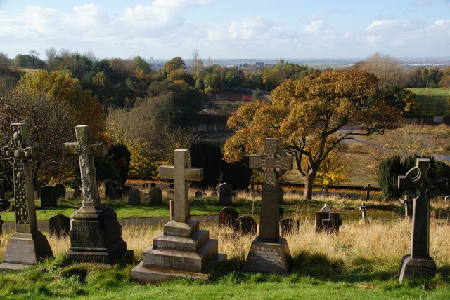
Public access Free entry Dogs welcome 7 ha
Places › England › North West › Lancaster Getting here
54.05313, -2.77787
Open directionsv Visiting this summer
Seasonal nature notes and what to look for now
▾ 🌞 Midsummer — early morning visits most comfortable; look for deer fawns in quieter clearings 🌿 Foraging is at its best in summer here 🐕 Dogs welcome — bring water in summer; the site has enough space to find shade on hot days 🌤️ Visiting this summer
🌞 Midsummer — early morning visits most comfortable; look for deer fawns in quieter clearings 🌿 Foraging is at its best in summer here 🐕 Dogs welcome — bring water in summer; the site has enough space to find shade on hot days £ Free to visit — no entry charge🐕 Dogs welcome🦉 Wildlife
Very strong match
Multi-group wildlife — Amphibians, Birds, Mammals; Multi-group wildlife — Amphibians, Birds, Mammals
Free
🦅 Bird watching
Very strong match
Birds — Blackbird, Magpie, Rock Dove +60 more · last seen 2026; Birds — Blackbird, Magpie, Rock Dove +60 more · last seen 2026
Free
Plants — Meadowsweet, Red Dead-nettle, White Dead-nettle +19 more foraging species; Deciduous woodland — fungi, berries and wild garlic
Varies
🦋 Insect spotting
Strong match
Insects — Eristalis tenax, Harlequin Ladybird, Syrphus +72 more · last seen 2026; Insects — Eristalis tenax, Harlequin Ladybird, Syrphus +72 more · last seen 2026
Free
🍂 Seasonal nature
Strong match
Plants — Great Willowherb, Lesser Celandine, Hedge Woundwort +173 more · last seen 2026; Plants — Great Willowherb, Lesser Celandine, Hedge Woundwort +173 more · last seen 2026
Free
Dogs allowed — public woodland
Free
Trails nearby Within roughly 5 km 2 signed routes nearby
Signed route nearby
Lune Valley Ramble Walking route ▾
Named route Regional walking route
Show on map Lancashire Coastal Way Walking route ▾
Named route Listed length 220km Regional walking route
Show on map 74 signed routes nearby
Signed route nearby
Route 6 Cycling route ▾
Named route Ref 6 National Cycle Network
Show on map Lancashire Cycleway (Northern Loop) Cycling route ▾
Named route Ref 90 Regional cycle route
Show on map City Loop Cycling route ▾
Named route Local cycle route
Show on map University Cycle Routes Cycling route ▾
Named route Local cycle route
Show on map Route 69 Cycling route ▾
Named route Ref 69 National Cycle Network
Show on map Way of the Roses Cycle Route Cycling route ▾
Named route Ref WoR National Cycle Network
Show on map 11 public paths nearby
Public paths
Crag Road bridleway · 215 m ▾
Public path bridleway Length 215 m Surface asphalt Path type: residential
Show on map Ridge Lane bridleway · 225 m ▾
Public path bridleway Length 225 m Surface concrete Path type: unclassified
Show on map Crag Road bridleway · 183 m ▾
Public path bridleway Length 183 m Surface asphalt Path type: residential
Show on map Ridge Lane bridleway · 490 m ▾
Public path bridleway Length 490 m Surface concrete Path type: service
Show on map Moor Lane bridleway · 409 m ▾
Public path bridleway Length 409 m Surface compacted Path type: bridleway
Show on map
Weather for this location Next 14 days Nearby places Useful places within 5 km
Own or manage this place?
Claim this listing to keep details accurate, add photos, and highlight what makes it special — free.
Claim this page→ How useful was the information on this page?
Something wrong on this page?
id: 808eab8e-d1f5-40b3-8353-097697dd0894
UK green spaces mapped from open public data — so anyone can find the woodland, trail, or nature reserve closest to them.
© 2026 Glade · Made with care for UK green spaces
Events & activities nearby Switch provider to compare local events, tours and bookable activities.
Bookable tours GetYourGuide Promote here
Wildlife to spot
21,025 records · National Biodiversity Network
▾
Wildlife to spot 21,025 records · National Biodiversity Network Blue Tit · Magpie · Wren · Blackbird · Great Tit +38
Blue Tit Cyanistes caeruleus Magpie Pica pica2025 Wren Troglodytes troglodytes Blackbird Turdus merula Great Tit Parus major2025 Robin Erithacus rubecula2025 Mallard Anas platyrhynchos2025 Carrion Crow Corvus corone2025 Rock Dove Columba livia2025 Woodpigeon Columba palumbus2025 Herring Gull Larus argentatus2025 Jackdaw Coloeus monedula2025 Black-headed Gull Chroicocephalus ridibundus2025 Long-tailed Tit Aegithalos caudatus Moorhen Gallinula chloropus2025 House Sparrow Passer domesticus2025 Chaffinch Fringilla coelebs2025 Nuthatch Sitta europaea2025 Coal Tit Periparus ater2025 Grey Wagtail Motacilla cinerea2025 Pied Wagtail Motacilla alba2025 Goldfinch Carduelis carduelis2025 Cormorant Phalacrocorax carbo2025 Mute Swan Cygnus olor2025 Treecreeper Certhia familiaris2025 Dunnock Prunella modularis2025 Jay Garrulus glandarius2025 Starling Sturnus vulgaris2025 Meadow Pipit Anthus pratensis2025 Redwing Turdus iliacus2025 Song Thrush Turdus philomelos2025 Greenfinch Chloris chloris2025 Mistle Thrush Turdus viscivorus2025 Fieldfare Turdus pilaris2025 Rook Corvus frugilegus2025 Pink-footed Goose Anser brachyrhynchus2025 Teal Anas crecca2025 Siskin Spinus spinus2025 Lesser Black-backed Gull Larus fuscus2025 Grey Heron Ardea cinerea2025 Collared Dove Streptopelia decaocto2025 Redshank Tringa totanus2025 Goldcrest Regulus regulus2025 🦌 Mammals 6 species
winter spring
2026 ▾
Grey Squirrel · Feral Cat · Rabbit · Bat · Brown Rat +1
Grey Squirrel Sciurus carolinensis Feral Cat Felis catus Rabbit Oryctolagus cuniculus Bat Chiroptera Brown Rat Rattus norvegicus Mole Talpa europaea Tawny Mining Bee · Sitona obsoletus · Eristalis tenax
Tawny Mining Bee Andrena fulva Sitona obsoletus Sitona obsoletus Eristalis tenax Eristalis tenax Lesser Celandine · Cherry Laurel · Red Campion · Ivy-leaved Toadflax · Rhododendron +32
Lesser Celandine Ficaria verna Cherry Laurel Prunus laurocerasus Red Campion Silene dioica Ivy-leaved Toadflax Cymbalaria muralis Rhododendron Rhododendron ponticum Hart's-Tongue Asplenium scolopendrium Taxus baccata f. baccata Species observations from the last 10 years via NBN Atlas
Taxus baccata f. baccata
Taxus baccata f. baccata
Portugal Laurel Prunus lusitanica
Portugal Laurel Prunus lusitanica
White Dead-nettle Lamium album
White Dead-nettle Lamium album
Flowering Currant Ribes sanguineum
Flowering Currant Ribes sanguineum
Cuckooflower Cardamine pratensis
Cuckooflower Cardamine pratensis
Slender Speedwell Veronica filiformis
Slender Speedwell Veronica filiformis
Primrose Primula vulgaris
Primrose Primula vulgaris
Fodder Burnet Poterium sanguisorba subsp. balearicum
Fodder Burnet Poterium sanguisorba subsp. balearicum
Cowslip Primula veris
Cowslip Primula veris
Lords-and-Ladies Arum maculatum
Lords-and-Ladies Arum maculatum
Butterfly-bush Buddleja davidii
Butterfly-bush Buddleja davidii
Butterbur Petasites hybridus
Butterbur Petasites hybridus
Winter Heliotrope Petasites pyrenaicus
Winter Heliotrope Petasites pyrenaicus
Sea-buckthorn Hippophae rhamnoides
Sea-buckthorn Hippophae rhamnoides
Red Dead-nettle Lamium purpureum
Red Dead-nettle Lamium purpureum
Fringecups Tellima grandiflora
Fringecups Tellima grandiflora
Evergreen Oak Quercus ilex
Evergreen Oak Quercus ilex
Holly Ilex aquifolium
Holly Ilex aquifolium
Pendulous Sedge Carex pendula
Pendulous Sedge Carex pendula
Yellow Corydalis Pseudofumaria lutea
Yellow Corydalis Pseudofumaria lutea
Spotted-laurel Aucuba japonica
Spotted-laurel Aucuba japonica
Winter Jasmine Jasminum nudiflorum
Winter Jasmine Jasminum nudiflorum
Green Alkanet Pentaglottis sempervirens
Green Alkanet Pentaglottis sempervirens
Creeping Buttercup Ranunculus repens
Creeping Buttercup Ranunculus repens
Smooth Hawk's-beard Crepis capillaris
Smooth Hawk's-beard Crepis capillaris
Trailing Bellflower Campanula poscharskyana
Trailing Bellflower Campanula poscharskyana
Daisy Bellis perennis
Daisy Bellis perennis
Lawson Cypress Cupressus lawsoniana2025
Lawson Cypress Cupressus lawsoniana2025
Italian Lords-and-Ladies Arum italicum2025
Italian Lords-and-Ladies Arum italicum2025
Butcher's-broom Ruscus aculeatus2025
Butcher's-broom Ruscus aculeatus2025
Rock Crane's-bill Geranium macrorrhizum2025
Rock Crane's-bill Geranium macrorrhizum2025