Launcherley Wood ✦ Ancient woodland 32 ha
🦉 Wildlife🦅 Birds🍂 Seasonal
↑ Share
Public access Free entry Dogs welcome 32 ha
Places › England › South West › Somerset Getting here
51.18600, -2.63064
Open directionsv Visiting this summer
Seasonal nature notes and what to look for now
▾ 🌞 Midsummer — early morning visits most comfortable; look for deer fawns in quieter clearings 🐕 Early mornings are best for dog walks in summer — visit before 9am to avoid the heat and find quieter trails 📍 Open access throughout summer — no booking required 🌤️ Visiting this summer
🌞 Midsummer — early morning visits most comfortable; look for deer fawns in quieter clearings 🐕 Early mornings are best for dog walks in summer — visit before 9am to avoid the heat and find quieter trails 📍 Open access throughout summer — no booking required £ Free to visit — no entry charge🐕 Dogs welcome🌿 Ancient woodland — rare wildlife habitat🦉 Wildlife
Very strong match
Multi-group wildlife — Amphibians, Birds, Mammals; Multi-group wildlife — Amphibians, Birds, Mammals
Free
🦅 Bird watching
Very strong match
Birds — Blackbird, Robin, Blue Tit +63 more · last seen 2025; Birds — Blackbird, Robin, Blue Tit +63 more · last seen 2025
Free
🍂 Seasonal nature
Strong match
Ancient woodland — bluebells, fungi and autumn colour; Plants — Rough-stalked Feather-moss, Silky Wall Feather-moss, Lateral Cryphaea +130 more · last seen 2024
Free
🦋 Insect spotting
Strong match
Chalk and limestone grassland — chalkhill blue, adonis blue and rare moths; Insects — Green-veined White, Beautiful Demoiselle, Orange-tip +81 more · last seen 2025
Free
Dogs allowed — public woodland
Free
Named cycling route nearby: Route 3
Varies
Trails nearby Within roughly 5 km 3 signed routes nearby · 26 public paths nearby
Signed route nearby Public paths
Monarch's Way Walking route 990 km ▾
approximate route of Charles II's escape
Named route Ref MW Length 990 km Regional walking route
Show on map West Mendip Way Walking route 48 km ▾
Named route Ref WMW Length 48 km Regional walking route
Show on map East Mendip Way Walking route ▾
Named route Ref EMW Regional walking route
Show on map 55 signed routes nearby
Signed route nearby
National Cycle Network Route 26 (Proposed) Cycling route ▾
Named route Ref 26 National Cycle Network
Show on map National Byway Cycling route ▾
Named route Ref NB Regional cycle route
Show on map National Byway Glastonbury Loop Cycling route ▾
Named route Ref NB Regional cycle route
Show on map Route 3 Cycling route 527.7 km ▾
Named route Ref 3 Length 527.7 km National Cycle Network
Show on map Strawberry Line Cycling route ▾
Named route Local cycle route
Show on map EuroVelo 1 - Atlantic Coast Route - part United Kingdom 2 Cycling route ▾
Named route Ref EV1 International cycle route
Show on map 1 public path nearby
Public paths
No named routes yet. Public paths are shown on the map.
✦ Ancient woodland — continuously wooded since at least 1600 AD. A rare and irreplaceable habitat, rich in biodiversity and historical character.
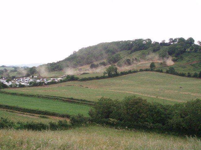
Photos Scrambling on Launcherley Hill
‹ ›
Weather for this location Next 14 days Nearby places Useful places within 5 km
All Historic
Own or manage this place?
Claim this listing to keep details accurate, add photos, and highlight what makes it special — free.
Claim this page→ How useful was the information on this page?
Something wrong on this page?
id: 45c81980-6663-43a5-940b-267ffdb66ee4
UK green spaces mapped from open public data — so anyone can find the woodland, trail, or nature reserve closest to them.
© 2026 Glade · Made with care for UK green spaces
Wildlife to spot
6,467 records · National Biodiversity Network
▾
Wildlife to spot 6,467 records · National Biodiversity Network Great Spotted Woodpecker
Great Spotted Woodpecker Dendrocopos major 🐸 Amphibians 1 species
winter
2025 ▾
Great Crested Newt
Great Crested Newt Triturus cristatus 🐝 Insects 4 species
spring summer
2025 ▾
Migrant Hawker · Beautiful Demoiselle · Emperor Dragonfly · Violet Oil-beetle
Migrant Hawker Aeshna mixta Beautiful Demoiselle Calopteryx virgo Emperor Dragonfly Anax imperator Violet Oil-beetle Meloe violaceus Bluebell · Lamiastrum galeobdolon subsp. montanum · Wood Anemone · Hogweed · Greater Stitchwort +145
Bluebell Hyacinthoides non-scripta Lamiastrum galeobdolon subsp. montanum Lamiastrum galeobdolon subsp. montanum Wood Anemone Anemone nemorosa Hogweed Heracleum sphondylium Greater Stitchwort Stellaria holostea Bush Vetch Vicia sepium Lesser Celandine Species observations from the last 10 years via NBN Atlas
Ficaria verna
Ficaria verna
Ivy Hedera helix
Ivy Hedera helix
Cleavers Galium aparine
Cleavers Galium aparine
Goldilocks Buttercup Ranunculus auricomus
Goldilocks Buttercup Ranunculus auricomus
Great Willowherb Epilobium hirsutum
Great Willowherb Epilobium hirsutum
Hedge Woundwort Stachys sylvatica
Hedge Woundwort Stachys sylvatica
Dandelion Taraxacum
Dandelion Taraxacum
Cow Parsley Anthriscus sylvestris
Cow Parsley Anthriscus sylvestris
Dog's Mercury Mercurialis perennis
Dog's Mercury Mercurialis perennis
Meadow Foxtail Alopecurus pratensis
Meadow Foxtail Alopecurus pratensis
Hemlock Water-dropwort Oenanthe crocata
Hemlock Water-dropwort Oenanthe crocata
Bramble Rubus fruticosus
Bramble Rubus fruticosus
Creeping Buttercup Ranunculus repens
Creeping Buttercup Ranunculus repens
Bugle Ajuga reptans
Bugle Ajuga reptans
Common Mouse-ear Cerastium fontanum
Common Mouse-ear Cerastium fontanum
Common Nettle Urtica dioica
Common Nettle Urtica dioica
Ribwort Plantain Plantago lanceolata
Ribwort Plantain Plantago lanceolata
Wild Strawberry Fragaria vesca
Wild Strawberry Fragaria vesca
Salad Burnet Poterium sanguisorba subsp. sanguisorba
Salad Burnet Poterium sanguisorba subsp. sanguisorba
Bracken Pteridium aquilinum
Bracken Pteridium aquilinum
Germander Speedwell Veronica chamaedrys
Germander Speedwell Veronica chamaedrys
Winter Heliotrope Petasites pyrenaicus
Winter Heliotrope Petasites pyrenaicus
Small Toadflax Chaenorhinum minus
Small Toadflax Chaenorhinum minus
Meadow Buttercup Ranunculus acris
Meadow Buttercup Ranunculus acris
Wood Millet Milium effusum
Wood Millet Milium effusum
Sycamore Acer pseudoplatanus
Sycamore Acer pseudoplatanus
Pignut Conopodium majus
Pignut Conopodium majus
Common Dog-violet Viola riviniana
Common Dog-violet Viola riviniana
Hemp-agrimony Eupatorium cannabinum
Hemp-agrimony Eupatorium cannabinum
Field Maple Acer campestre
Field Maple Acer campestre
Common Ragwort Jacobaea vulgaris
Common Ragwort Jacobaea vulgaris
Cat's-ear Hypochaeris radicata
Cat's-ear Hypochaeris radicata
Holly Ilex aquifolium
Holly Ilex aquifolium
Pendulous Sedge Carex pendula
Pendulous Sedge Carex pendula
Snowberry Symphoricarpos albus
Snowberry Symphoricarpos albus
Groundsel Senecio vulgaris
Groundsel Senecio vulgaris
Common Field-speedwell Veronica persica
Common Field-speedwell Veronica persica
Polygonum aviculare Polygonum aviculare
Polygonum aviculare Polygonum aviculare
Field-rose Rosa arvensis
Field-rose Rosa arvensis
Primrose Primula vulgaris
Primrose Primula vulgaris
Daisy Bellis perennis
Daisy Bellis perennis
Field Horsetail Equisetum arvense
Field Horsetail Equisetum arvense
Wood-sedge Carex sylvatica
Wood-sedge Carex sylvatica
Smooth Sow-thistle Sonchus oleraceus
Smooth Sow-thistle Sonchus oleraceus
Wood Dock Rumex sanguineus
Wood Dock Rumex sanguineus
Festuca rubra Festuca rubra
Festuca rubra Festuca rubra
Enchanter's-nightshade Circaea lutetiana
Enchanter's-nightshade Circaea lutetiana
Greater Plantain Plantago major
Greater Plantain Plantago major
Ash Fraxinus excelsior
Ash Fraxinus excelsior
Oxeye Daisy Leucanthemum vulgare
Oxeye Daisy Leucanthemum vulgare
Tufted Vetch Vicia cracca
Tufted Vetch Vicia cracca
Hedge Mustard Sisymbrium officinale
Hedge Mustard Sisymbrium officinale
Creeping Cinquefoil Potentilla reptans
Creeping Cinquefoil Potentilla reptans
Woodruff Galium odoratum
Woodruff Galium odoratum
Wood Speedwell Veronica montana
Wood Speedwell Veronica montana
Broad-leaved Willowherb Epilobium montanum
Broad-leaved Willowherb Epilobium montanum
Polypodium vulgare Polypodium vulgare
Polypodium vulgare Polypodium vulgare
White Clover Trifolium repens
White Clover Trifolium repens
Wild Teasel Dipsacus fullonum
Wild Teasel Dipsacus fullonum
Dewberry Rubus caesius
Dewberry Rubus caesius
Yew Taxus baccata
Yew Taxus baccata
Marsh Thistle Cirsium palustre
Marsh Thistle Cirsium palustre
White Dead-nettle Lamium album
White Dead-nettle Lamium album
False-brome Brachypodium sylvaticum
False-brome Brachypodium sylvaticum
Lime Tilia cordata x platyphyllos = T. x europaea
Lime Tilia cordata x platyphyllos = T. x europaea
Broad-leaved Dock Rumex obtusifolius
Broad-leaved Dock Rumex obtusifolius
Wild Marjoram Origanum vulgare
Wild Marjoram Origanum vulgare
Hazel Corylus avellana
Hazel Corylus avellana
Beaked Hawk's-beard Crepis vesicaria
Beaked Hawk's-beard Crepis vesicaria
Nipplewort Lapsana communis
Nipplewort Lapsana communis
Prickly Sow-thistle Sonchus asper
Prickly Sow-thistle Sonchus asper
Rough Meadow-grass Poa trivialis
Rough Meadow-grass Poa trivialis
Male-fern Dryopteris filix-mas
Male-fern Dryopteris filix-mas
Rumex crispus subsp. crispus Rumex crispus subsp. crispus
Rumex crispus subsp. crispus Rumex crispus subsp. crispus
Spear Thistle Cirsium vulgare
Spear Thistle Cirsium vulgare
Black Medick Medicago lupulina
Black Medick Medicago lupulina
Wavy Bitter-cress Cardamine flexuosa
Wavy Bitter-cress Cardamine flexuosa
Ramsons Allium ursinum
Ramsons Allium ursinum
Lords-and-Ladies Arum maculatum
Lords-and-Ladies Arum maculatum
Pedunculate Oak Quercus robur
Pedunculate Oak Quercus robur
Garlic Mustard Alliaria petiolata
Garlic Mustard Alliaria petiolata
Glaucous Sedge Carex flacca
Glaucous Sedge Carex flacca
Red Clover Trifolium pratense
Red Clover Trifolium pratense
Norway Maple Acer platanoides
Norway Maple Acer platanoides
English Elm Ulmus procera
English Elm Ulmus procera
Beech Fagus sylvatica
Beech Fagus sylvatica
Asplenium trichomanes subsp. quadrivalens Asplenium trichomanes subsp. quadrivalens
Asplenium trichomanes subsp. quadrivalens Asplenium trichomanes subsp. quadrivalens
Blackthorn Prunus spinosa
Blackthorn Prunus spinosa
Shepherd's-purse Capsella bursa-pastoris
Shepherd's-purse Capsella bursa-pastoris
Hoary Willowherb Epilobium parviflorum
Hoary Willowherb Epilobium parviflorum
Red Dead-nettle Lamium purpureum
Red Dead-nettle Lamium purpureum
Common Sorrel Rumex acetosa
Common Sorrel Rumex acetosa
Butterfly-bush Buddleja davidii
Butterfly-bush Buddleja davidii
Dogwood Cornus sanguinea
Dogwood Cornus sanguinea
Barren Brome Anisantha sterilis
Barren Brome Anisantha sterilis
Hart's-Tongue Asplenium scolopendrium
Hart's-Tongue Asplenium scolopendrium
Common Vetch Vicia sativa
Common Vetch Vicia sativa
Wood Spurge Euphorbia amygdaloides
Wood Spurge Euphorbia amygdaloides
Goat Willow Salix caprea
Goat Willow Salix caprea
Dove's-foot Crane's-bill Geranium molle
Dove's-foot Crane's-bill Geranium molle
Ground-ivy Glechoma hederacea
Ground-ivy Glechoma hederacea
Yarrow Achillea millefolium
Yarrow Achillea millefolium
Herb-Robert Geranium robertianum
Herb-Robert Geranium robertianum
Meadow Vetchling Lathyrus pratensis
Meadow Vetchling Lathyrus pratensis
Field Forget-me-not Myosotis arvensis
Field Forget-me-not Myosotis arvensis
Wild Cherry Prunus avium
Wild Cherry Prunus avium
Centaurea nigra Centaurea nigra
Centaurea nigra Centaurea nigra
Wild Privet Ligustrum vulgare
Wild Privet Ligustrum vulgare
Black Bryony Tamus communis
Black Bryony Tamus communis
Hairy St John's-wort Hypericum hirsutum
Hairy St John's-wort Hypericum hirsutum
Burnet-saxifrage Pimpinella saxifraga
Burnet-saxifrage Pimpinella saxifraga
Cut-leaved Crane's-bill Geranium dissectum
Cut-leaved Crane's-bill Geranium dissectum
Druce's Crane's-bill Geranium endressii x versicolor = G. x oxonianum
Druce's Crane's-bill Geranium endressii x versicolor = G. x oxonianum
Grey Sedge Carex divulsa subsp. divulsa
Grey Sedge Carex divulsa subsp. divulsa
Soft-brome Bromus hordeaceus
Soft-brome Bromus hordeaceus
Rosa canina Rosa canina
Rosa canina Rosa canina
Sticky Mouse-ear Cerastium glomeratum
Sticky Mouse-ear Cerastium glomeratum
Cock's-foot Dactylis glomerata
Cock's-foot Dactylis glomerata
Greater Burdock Arctium lappa
Greater Burdock Arctium lappa
Hedge Bedstraw Galium album
Hedge Bedstraw Galium album
Guelder-rose Viburnum opulus
Guelder-rose Viburnum opulus
Barren Strawberry Potentilla sterilis
Barren Strawberry Potentilla sterilis
Creeping Thistle Cirsium arvense
Creeping Thistle Cirsium arvense
Hawthorn Crataegus monogyna
Hawthorn Crataegus monogyna
Wall Speedwell Veronica arvensis
Wall Speedwell Veronica arvensis
Field Bindweed Convolvulus arvensis
Field Bindweed Convolvulus arvensis
Broad Buckler-fern Dryopteris dilatata
Broad Buckler-fern Dryopteris dilatata
Elder Sambucus nigra
Elder Sambucus nigra
Japanese Knotweed Reynoutria japonica
Japanese Knotweed Reynoutria japonica
Annual Meadow-grass Poa annua
Annual Meadow-grass Poa annua
Wood Avens Geum urbanum
Wood Avens Geum urbanum
Alder Alnus glutinosa
Alder Alnus glutinosa
Traveller's-joy Clematis vitalba
Traveller's-joy Clematis vitalba
Early-purple Orchid Orchis mascula
Early-purple Orchid Orchis mascula
Lilac Syringa vulgaris
Lilac Syringa vulgaris
Wayfaring-tree Viburnum lantana
Wayfaring-tree Viburnum lantana
Meadowsweet Filipendula ulmaria
Meadowsweet Filipendula ulmaria
Red Campion Silene dioica
Red Campion Silene dioica
Fool's Water-Cress Helosciadium nodiflorum
Fool's Water-Cress Helosciadium nodiflorum
Green Alkanet Pentaglottis sempervirens
Green Alkanet Pentaglottis sempervirens
Bristly Oxtongue Helminthotheca echioides
Bristly Oxtongue Helminthotheca echioides
Cowslip Primula veris
Cowslip Primula veris
Hairy Tare Ervilia hirsuta
Hairy Tare Ervilia hirsuta
Cuckooflower Cardamine pratensis
Cuckooflower Cardamine pratensis Events & activities nearby Switch provider to compare local events, tours and bookable activities.
Bookable tours GetYourGuide Promote here