Lichfield Golf and Country Club
Plan your visit
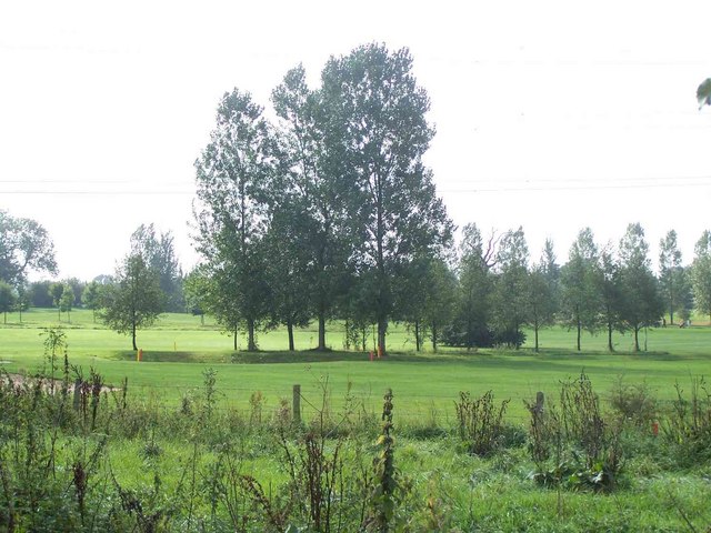
🦅 Birds🦉 Wildlife🦋 Insects
Public access Paid entry Dogs welcome
Getting here
52.71710, -1.85490
Open directionsv Visiting this summer
Seasonal nature notes and what to look for now
▾ 🐦 57+ species recorded in this area — summer evenings are best for activity; watch for Skylark and Woodpigeon 🐕 Early mornings are best for dog walks in summer — visit before 9am to avoid the heat and find quieter trails 🅿️ Parking 299m away 🌤️ Visiting this summer
🐦 57+ species recorded in this area — summer evenings are best for activity; watch for Skylark and Woodpigeon 🐕 Early mornings are best for dog walks in summer — visit before 9am to avoid the heat and find quieter trails 🅿️ Parking 299m away 🦅 Bird watching
Very strong match
Birds — Skylark, Woodpigeon, Carrion Crow +54 more · last seen 2026; Deciduous woodland — woodpeckers, warblers and woodland birds
Free
Birds — Skylark, Woodpigeon, Carrion Crow +54 more · last seen 2026; Deciduous woodland priority habitat
Free
🦋 Insect spotting
Strong match
Insects — Small White, Large White, Peacock +42 more · last seen 2024
Free
Dogs allowed with public access
Free
Deciduous woodland — fungi, berries and wild garlic
Varies
🍂 Seasonal nature
Good match
Plants — Himalayan Balsam, Lesser Celandine, Wood Dock +4 more · last seen 2026
Free
Trails nearby Within roughly 5 km 8 signed routes nearby · 8 public paths nearby
Signed route nearby Public paths
Heart of England Way Walking route ▾
Named route Listed length 161km Regional walking route
Show on map Two Saints Way Walking route 148 km ▾
Two Saints Way - Chester Cathedral to/from Lichfield Cathedral. In the late Middle Ages a steady stream of pilgrims walked this way – both housing shrines to two game-changing Mercian saints in the 7th century - St Werburgh and St Chad
Named route Ref TSW Length 148 km Point-to-point Regional walking route
Show on map National Forest Way Walking route ▾
Named route Regional walking route
Show on map Beacon Way Walking route 40 km ▾
Starting at Sandwell Valley via the outskirts of Birmingham and the countryside of Walsall into Staffordshire. Take in the Forest of Mercia, lakes, nature reserves, woods, and canal banks. Named after Barr Beacon, one of the highest hills in this area.
Named route Length 40 km Point-to-point Regional walking route
Show on map The Way for the Millennium Walking route 65 km ▾
Newport to Burton on Trent
Named route Length 65 km Regional walking route
Show on map 35 signed routes nearby
Signed route nearby
Route 54 Cycling route ▾
Named route Ref 54 National Cycle Network
Show on map McClean Way Cycling route ▾
Named route Local cycle route
Show on map National Cycle Network Route 5 Cycling route ▾
Named route Ref 5 National Cycle Network
Show on map N/A Cycling route 393 m ▾
Named route Length 393 m National Cycle Network Traffic-free Surface asphalt
Show on map Main Route Cycling route 3.1 km ▾
Named route Ref 54 Length 3.1 km National Cycle Network On-road Surface asphalt
Show on map Main Route Cycling route 420 m ▾
Named route Ref 54 Length 420 m National Cycle Network Traffic-free Surface asphalt
Show on map 1 public path nearby
Public paths
No named routes yet. Public paths are shown on the map.
Weather for this location Next 14 days Nearby places Useful places within 5 km
All Historic
UK green spaces mapped from open public data — so anyone can find the woodland, trail, or nature reserve closest to them.
© 2026 Glade · Made with care for UK green spaces
Events & activities nearby Switch provider to compare local events, tours and bookable activities.
Bookable tours GetYourGuide Tripadvisor
Wildlife to spot
1,355 records · National Biodiversity Network
▾
Wildlife to spot 1,355 records · National Biodiversity Network 🐦 Birds 38 species
summer autumn
2026 ▾
Magpie · Carrion Crow · Robin · Woodpigeon · Jackdaw +33
Magpie Pica pica2025 Carrion Crow Corvus corone2025 Robin Erithacus rubecula2025 Woodpigeon Columba palumbus2025 Jackdaw Coloeus monedula2025 Blackbird Turdus merula2025 Skylark Alauda arvensis2020 Blue Tit Cyanistes caeruleus2025 Wren Troglodytes troglodytes2025 Rook Corvus frugilegus2020 Swift Apus apus2020 Whitethroat Curruca communis2020 Lesser Black-backed Gull Larus fuscus2025 Greenfinch Chloris chloris2023 Yellowhammer Emberiza citrinella2021 Chiffchaff Phylloscopus collybita2021 Great Tit Parus major2020 Starling Sturnus vulgaris2020 Goldfinch Carduelis carduelis2020 Chaffinch Fringilla coelebs2020 Mallard Anas platyrhynchos Black-headed Gull Chroicocephalus ridibundus2025 Long-tailed Tit Aegithalos caudatus2025 Greylag Goose Anser anser2025 House Sparrow Passer domesticus2025 Rock Dove Columba livia2025 Green Woodpecker Picus viridis2023 Lapwing Vanellus vanellus2021 Fieldfare Turdus pilaris2020 Coal Tit Periparus ater2020 Bullfinch Pyrrhula pyrrhula2020 Dunnock Prunella modularis2020 Swallow Hirundo rustica2020 Song Thrush Turdus philomelos2020 Great Spotted Woodpecker Dendrocopos major2020 Pied Wagtail Motacilla alba yarrellii2020 House Martin Delichon urbicum2020 Blackcap Sylvia atricapilla2020 🦌 Mammals 6 species
spring autumn
2025 ▾
Badger · Brown Long-eared Bat · Pipistrelle Bat species · Grey Squirrel · Domestic Dog +1
Badger Meles meles Brown Long-eared Bat Plecotus auritus2024 Pipistrelle Bat species Pipistrellus2021 Grey Squirrel Sciurus carolinensis Domestic Dog Canis lupus subsp. familiaris Hedgehog Erinaceus europaeus 🐸 Amphibians 1 species
spring
2024 ▾
Common Frog
Common Frog Rana temporaria 🐝 Insects 3 species
spring summer
2024 ▾
Large Red Damselfly · Southern Hawker · Green Shieldbug
Large Red Damselfly Pyrrhosoma nymphula Southern Hawker Aeshna cyanea2023 Green Shieldbug Palomena prasina2022 Common Spotted-orchid · Lesser Celandine · American Skunk-cabbage · Common Blue-sow-thistle · Southern Marsh-orchid +56
Common Spotted-orchid Dactylorhiza fuchsii2022 Lesser Celandine Ficaria verna American Skunk-cabbage Lysichiton americanus2023 Common Blue-sow-thistle Cicerbita macrophylla2023 Southern Marsh-orchid Dactylorhiza praetermissa2022 Meadow Vetchling Species observations from the last 10 years via NBN Atlas
2020
2020
Lathyrus pratensis2020
Lathyrus pratensis2020
False Oat-grass Arrhenatherum elatius2020
False Oat-grass Arrhenatherum elatius2020
Ivy Hedera helix2020
Ivy Hedera helix2020
Common Ragwort Jacobaea vulgaris2020
Common Ragwort Jacobaea vulgaris2020
Yarrow Achillea millefolium2020
Yarrow Achillea millefolium2020
Cock's-foot Dactylis glomerata2020
Cock's-foot Dactylis glomerata2020
Ribwort Plantain Plantago lanceolata2020
Ribwort Plantain Plantago lanceolata2020
Oxeye Daisy Leucanthemum vulgare2020
Oxeye Daisy Leucanthemum vulgare2020
Red Clover Trifolium pratense2020
Red Clover Trifolium pratense2020
Curled Dock Rumex crispus2020
Curled Dock Rumex crispus2020
Yorkshire-fog Holcus lanatus2020
Yorkshire-fog Holcus lanatus2020
Upright Hedge-parsley Torilis japonica2020
Upright Hedge-parsley Torilis japonica2020
Dandelion Taraxacum2020
Dandelion Taraxacum2020
Centaurea nigra Centaurea nigra2020
Centaurea nigra Centaurea nigra2020
White Clover Trifolium repens2020
White Clover Trifolium repens2020
Bush Vetch Vicia sepium2020
Bush Vetch Vicia sepium2020
White Campion Silene latifolia2020
White Campion Silene latifolia2020
Creeping Thistle Cirsium arvense2020
Creeping Thistle Cirsium arvense2020
Meadow Buttercup Ranunculus acris2020
Meadow Buttercup Ranunculus acris2020
Selfheal Prunella vulgaris2020
Selfheal Prunella vulgaris2020
Common Mouse-ear Cerastium fontanum2020
Common Mouse-ear Cerastium fontanum2020
Autumn Hawkbit Scorzoneroides autumnalis2020
Autumn Hawkbit Scorzoneroides autumnalis2020
Tufted Vetch Vicia cracca2020
Tufted Vetch Vicia cracca2020
Common Bird's-foot-trefoil Lotus corniculatus2020
Common Bird's-foot-trefoil Lotus corniculatus2020
Wood Dock Rumex sanguineus
Wood Dock Rumex sanguineus
Cherry Laurel Prunus laurocerasus
Cherry Laurel Prunus laurocerasus
Bulrush Typha latifolia
Bulrush Typha latifolia
Caucasian Lime Tilia cordata x dasystyla = T. x euchlora2023
Caucasian Lime Tilia cordata x dasystyla = T. x euchlora2023
Adder's-tongue Ophioglossum vulgatum2022
Adder's-tongue Ophioglossum vulgatum2022
Bee Orchid Ophrys apifera2022
Bee Orchid Ophrys apifera2022
Wild Tulip Tulipa sylvestris2021
Wild Tulip Tulipa sylvestris2021
Dog's Mercury Mercurialis perennis2021
Dog's Mercury Mercurialis perennis2021
Aspen Populus tremula2020
Aspen Populus tremula2020
Broom Cytisus scoparius2020
Broom Cytisus scoparius2020
Glaucous Sedge Carex flacca2020
Glaucous Sedge Carex flacca2020
Lesser Trefoil Trifolium dubium2020
Lesser Trefoil Trifolium dubium2020
Fox-and-cubs Pilosella aurantiaca2020
Fox-and-cubs Pilosella aurantiaca2020
Great Willowherb Epilobium hirsutum2020
Great Willowherb Epilobium hirsutum2020
Crested Dog's-tail Cynosurus cristatus2020
Crested Dog's-tail Cynosurus cristatus2020
Common Chickweed Stellaria media2020
Common Chickweed Stellaria media2020
Bramble Rubus fruticosus2020
Bramble Rubus fruticosus2020
Field Horsetail Equisetum arvense2020
Field Horsetail Equisetum arvense2020
Sweet Vernal-grass Anthoxanthum odoratum2020
Sweet Vernal-grass Anthoxanthum odoratum2020
Tufted Hair-grass Deschampsia cespitosa2020
Tufted Hair-grass Deschampsia cespitosa2020
False Fox-sedge Carex otrubae2020
False Fox-sedge Carex otrubae2020
Lesser Stitchwort Stellaria graminea2020
Lesser Stitchwort Stellaria graminea2020
Marsh Thistle Cirsium palustre2020
Marsh Thistle Cirsium palustre2020
Ribbed Melilot Melilotus officinalis2020
Ribbed Melilot Melilotus officinalis2020
Perennial Rye-grass Lolium perenne2020
Perennial Rye-grass Lolium perenne2020
Hogweed Heracleum sphondylium2020
Hogweed Heracleum sphondylium2020
Common Centaury Centaurium erythraea2020
Common Centaury Centaurium erythraea2020
Hawthorn Crataegus monogyna2020
Hawthorn Crataegus monogyna2020
Pyramidal Orchid Anacamptis pyramidalis2020
Pyramidal Orchid Anacamptis pyramidalis2020
Creeping Buttercup Ranunculus repens2020
Creeping Buttercup Ranunculus repens2020
Spear Thistle Cirsium vulgare2020
Spear Thistle Cirsium vulgare2020
Black Medick Medicago lupulina2020
Black Medick Medicago lupulina2020