Plan your visit
Getting here
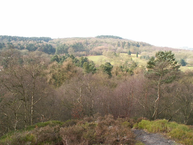
52.38186, -2.01314
Visiting this summer
Seasonal nature notes and what to look for now
Visiting this summer
Seasonal nature notes and what to look for now
- 🐦82+ species recorded in this area — summer evenings are best for activity; watch for Blue Tit and Magpie
- 🐕Early mornings are best for dog walks in summer — visit before 9am to avoid the heat and find quieter trails
- 🅿️Parking 329m away — 2 car parks within reach
🌤️ Visiting this summer
- 🐦82+ species recorded in this area — summer evenings are best for activity; watch for Blue Tit and Magpie
- 🐕Early mornings are best for dog walks in summer — visit before 9am to avoid the heat and find quieter trails
- 🅿️Parking 329m away — 2 car parks within reach
Good to know
- £Free to visit — no entry charge
- 🐕Dogs welcome
Best for
Bird watching
Very strong match
Birds — Blue Tit, Magpie, Robin +79 more · last seen 2026; Deciduous woodland — woodpeckers, warblers and woodland birds
Wildlife
Strong match
Birds — Blue Tit, Magpie, Robin +79 more · last seen 2026; Deciduous woodland priority habitat
Insect spotting
Strong match
Insects — 7-spot Ladybird, Harlequin Ladybird, Orange Ladybird +77 more · last seen 2026; Acid grassland — heathland butterflies and rare invertebrates
Dog walks
Strong match
Dogs allowed with public access
Foraging
Good match
Deciduous woodland — fungi, berries and wild garlic
Hiking
Good match
Named hiking route nearby: North Worcestershire Path; Named hiking route nearby: North Worcestershire Path
Trails nearby
Within roughly 5 km🚶Walking
10 signed routes nearby · 58 public paths nearby
Signed route nearbyPublic paths
Walking
Monarch's WayWalking route990 km
approximate route of Charles II's escape
Woodpecker TrailWalking route
Royal Hunters Walks - Foresters' walkWalking route8 km
Royal Hunters Walks - Hedgelayers' walkWalking route5 km
Royal Hunters Walks - Chartists' walkWalking route8 km
Belmont Roadpublic footpath · 72 m
Quarry Walkpublic footpath · 57 m
Judith's Waypublic footpath · 433 m
🚴Cycling
68 signed routes nearby
Signed route nearby
Cycling
National Cycle Network Route 5Cycling route
Merrits Brook GreenwayCycling route
Rea Valley RouteCycling route
NCN 5 section of Rea Valley Route
[PROPOSED]Starley Regional Cycle NetworkCycling route804 km
Starley (TfWM) Regional Cycle Network (Proposed route)
Local Cycle Network Route 1Cycling route
Local Cycle Network Route 2Cycling route
🐴Horse riding
10 public paths nearby
Public paths
Horse riding
Drovers Waybridleway · 156 m
Drovers Waybridleway · 329 m
Warren Lanebridleway · 77 m
Drovers Waybridleway · 8 m
Drovers Waybridleway · 8 m
Wildlife to spot
Photos
Weather for this location
Loading local forecast…
Nearby places
Useful places within 5 km