🦉 Wildlife🦅 Birds🍄 Fungi
↑ Share
Public access Free entry Dogs welcome 11 ha
Places › Northern Ireland › Belfast Getting here
54.62794, -5.99573
Open directionsv Visiting this summer
Seasonal nature notes and what to look for now
▾ 🌞 Midsummer — early morning visits most comfortable; look for deer fawns in quieter clearings 🍄 Mushroom foraging is at its best in summer here 🐕 Dogs welcome — bring water in summer; the site has enough space to find shade on hot days 🌤️ Visiting this summer
🌞 Midsummer — early morning visits most comfortable; look for deer fawns in quieter clearings 🍄 Mushroom foraging is at its best in summer here 🐕 Dogs welcome — bring water in summer; the site has enough space to find shade on hot days £ Free to visit — no entry charge🐕 Dogs welcome🦉 Wildlife
Very strong match
Multi-group wildlife — Amphibians, Birds, Mammals; Multi-group wildlife — Amphibians, Birds, Mammals
Free
🦅 Bird watching
Very strong match
Birds — Kestrel, Magpie, Great Tit +61 more · last seen 2025; Birds — Kestrel, Magpie, Great Tit +61 more · last seen 2025
Free
🍄 Mushroom foraging
Strong match
Fungi — Snowy Waxcap, Parrot Waxcap, Jelly Ear +54 more · last seen 2025; Fungi — Snowy Waxcap, Parrot Waxcap, Jelly Ear +54 more · last seen 2025
Varies
🦋 Insect spotting
Strong match
Insects — Green-veined White, Orange-tip, Speckled Wood +87 more · last seen 2024; Insects — Green-veined White, Orange-tip, Speckled Wood +87 more · last seen 2024
Free
Dogs allowed with public access
Free
🛝 Family friendly
Good match
Urban park — family destination
Free
Trails nearby Within roughly 5 km 10 signed routes nearby
Signed route nearby
Lough Trail, Belfast Area Walking route 1.5 km ▾
Follow the gently sloping path along its length, taking in sights such as Lough Neagh & the Sperrin Mountains to the west. Curve back on yourself through open hillside & past a viewpoint highlighting the history of the region, including a rath.
Named route Length 1.5 km Duration 00:30 Round trip Local walking route
Show on map City of Merchants Trail Walking route ▾
Named route Point-to-point Local walking route
Show on map Titanic Trail Walking route ▾
Named route Local walking route
Show on map Cave Hill Trail Walking route ▾
Named route Local walking route
Show on map Summit Trail, Belfast Area Walking route 4.8 km ▾
Walk along the Tipperary Road through open heath & blanket bog following a waymarked trail to the highest peak in the Belfast Hills, Divis Mountain. Overlooking the city below and with panoramic views of Lough Neagh, the Mournes & Strangford Lough.
Named route Length 4.8 km Duration 00:50-01:30 Round trip Local walking route
Show on map 36 signed routes nearby
Signed route nearby
National Cycle Network National Route 9 Cycling route ▾
Belfast to Newry
Named route Ref 9 National Cycle Network
Show on map Middlepath Street Cycling route ▾
Named route Point-to-point Local cycle route
Show on map Clarendon Park Cycling route ▾
Named route Local cycle route
Show on map National Cycle Network National Route 93 Cycling route ▾
"National Route 93 of the National Cycle Network is formed of sections of traffic-free route between Derry and Larne." (most of the route was de-designated in Summer 2020)
Named route Ref 93 Point-to-point National Cycle Network
Show on map Waterworks Cycling route ▾
Named route Local cycle route
Show on map Alexandra Park Cycling route ▾
Named route Local cycle route
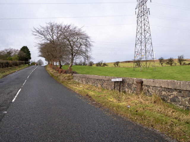
Show on map Photos J2978 : The Ligoniel Road, Belfast
‹ ›
Weather for this location Next 14 days Nearby places Useful places within 5 km
Own or manage this place?
Claim this listing to keep details accurate, add photos, and highlight what makes it special — free.
Claim this page→ How useful was the information on this page?
Something wrong on this page?
id: 6bb919f2-ecf7-4665-825f-872a8844d5b7
UK green spaces mapped from open public data — so anyone can find the woodland, trail, or nature reserve closest to them.
© 2026 Glade · Made with care for UK green spaces
Events & activities nearby Switch provider to compare local events, tours and bookable activities.
Bookable tours GetYourGuide Promote here
Wildlife to spot
1,524 records · National Biodiversity Network
▾
Wildlife to spot 1,524 records · National Biodiversity Network Kestrel · Magpie · Cuckoo · Blue Tit · Chaffinch +27
Kestrel Falco tinnunculus2023 Magpie Pica pica Cuckoo Cuculus canorus2024 Blue Tit Cyanistes caeruleus2024 Chaffinch Fringilla coelebs2024 Mute Swan Cygnus olor2023 Wren Troglodytes troglodytes2022 House Sparrow Passer domesticus Great Tit Parus major2024 Coal Tit Periparus ater2024 Jackdaw Coloeus monedula2024 Moorhen Gallinula chloropus2024 Mallard Anas platyrhynchos2024 Little Grebe Tachybaptus ruficollis2024 Herring Gull Larus argentatus2024 Great Black-backed Gull Larus marinus2024 Gadwall Mareca strepera2024 Common Gull Larus canus2024 Shelduck Tadorna tadorna2024 Curlew Numenius arquata2024 Hooded Crow Corvus cornix2024 Black-headed Gull Chroicocephalus ridibundus2024 Woodpigeon Columba palumbus2024 Snipe Gallinago gallinago2024 Coot Fulica atra2024 Teal Anas crecca2024 Lesser Black-backed Gull Larus fuscus2024 Swift Apus apus2023 Grey Heron Ardea cinerea2023 Long-eared Owl Asio otus2022 Willow Warbler Phylloscopus trochilus2020 Grey Wagtail Motacilla cinerea2018 🦌 Mammals 8 species
spring summer autumn
2025 ▾
Hedgehog · Pine Marten · Grey Squirrel · Badger · Bank Vole +3
Hedgehog Erinaceus europaeus2023 Pine Marten Martes martes Grey Squirrel Sciurus carolinensis2024 Badger Meles meles2024 Bank Vole Myodes glareolus2022 🐸 Amphibians 1 species
summer
2024 ▾
Smooth Newt
Smooth Newt Lissotriton vulgaris 🐝 Insects 51 species
summer autumn
2024 ▾
Speckled Wood · Green-veined White · Boletina trivittata · Peacock · Red Admiral +46
Speckled Wood Pararge aegeria2020 Green-veined White Pieris napi sabellicae2020 Boletina trivittata Boletina trivittata Peacock Aglais io2019 Red Admiral Vanessa atalanta2019 Orange-tip Snowy Waxcap · Parrot Waxcap · Heath Waxcap · Jelly Ear · Velvet Shank +17
Snowy Waxcap Cuphophyllus virgineus var. virgineus2022 Parrot Waxcap Gliophorus psittacinus2022 Heath Waxcap Gliophorus laetus2022 Jelly Ear Auricularia auricula-judae Velvet Shank Flammulina velutipes var. velutipes2023 Yellow Brain Raspberry · Japanese Knotweed
Raspberry Rubus idaeus Japanese Knotweed Reynoutria japonica Species observations from the last 10 years via NBN Atlas
Rabbit
Rabbit
Oryctolagus cuniculus2020
Oryctolagus cuniculus2020
Otter Lutra lutra2020
Otter Lutra lutra2020
Red Fox Vulpes vulpes2019
Red Fox Vulpes vulpes2019 Anthocharis cardamines2019
Anthocharis cardamines2019
Cryptic Wood White Leptidea juvernica2020
Cryptic Wood White Leptidea juvernica2020
Narrow-bordered Five-spot Burnet Zygaena lonicerae2019
Narrow-bordered Five-spot Burnet Zygaena lonicerae2019
Phronia tenuis Phronia tenuis
Phronia tenuis Phronia tenuis
Brevicornu sericoma Brevicornu sericoma2023
Brevicornu sericoma Brevicornu sericoma2023
Zygomyia valida Zygomyia valida2023
Zygomyia valida Zygomyia valida2023
Mycomya marginata Mycomya marginata2023
Mycomya marginata Mycomya marginata2023
Mycetophila subsigillata Mycetophila subsigillata2023
Mycetophila subsigillata Mycetophila subsigillata2023
Small Heath Coenonympha pamphilus2021
Small Heath Coenonympha pamphilus2021
Small Tortoiseshell Aglais urticae2020
Small Tortoiseshell Aglais urticae2020
Common Blue Damselfly Enallagma cyathigerum2020
Common Blue Damselfly Enallagma cyathigerum2020
Painted Lady Vanessa cardui2020
Painted Lady Vanessa cardui2020
Silver Y Autographa gamma2019
Silver Y Autographa gamma2019
Large White Pieris brassicae2018
Large White Pieris brassicae2018
Cordyla crassicornis Cordyla crassicornis
Cordyla crassicornis Cordyla crassicornis
Symmerus annulatus Symmerus annulatus
Symmerus annulatus Symmerus annulatus
Synapha fasciata Synapha fasciata
Synapha fasciata Synapha fasciata
Mycetophila fungorum Mycetophila fungorum
Mycetophila fungorum Mycetophila fungorum
Anatella unguigera Anatella unguigera
Anatella unguigera Anatella unguigera
Allodia zaitzevi Allodia zaitzevi
Allodia zaitzevi Allodia zaitzevi
Grzegorzekia collaris Grzegorzekia collaris
Grzegorzekia collaris Grzegorzekia collaris
Common Red Soldier Beetle Rhagonycha fulva
Common Red Soldier Beetle Rhagonycha fulva
Fabricius' Nomad Bee Nomada fabriciana
Fabricius' Nomad Bee Nomada fabriciana
Mycetophila pumila Mycetophila pumila2023
Mycetophila pumila Mycetophila pumila2023
Sceptonia fumipes Sceptonia fumipes2023
Sceptonia fumipes Sceptonia fumipes2023
Mycetophila unicolor Mycetophila unicolor2023
Mycetophila unicolor Mycetophila unicolor2023
Tarnania nemoralis Tarnania nemoralis2023
Tarnania nemoralis Tarnania nemoralis2023
Trichonta melanura Trichonta melanura2023
Trichonta melanura Trichonta melanura2023
Bolitophila saundersii Bolitophila saundersii2023
Bolitophila saundersii Bolitophila saundersii2023
Mycomya winnertzi Mycomya winnertzi2023
Mycomya winnertzi Mycomya winnertzi2023
Epicypta aterrima Epicypta aterrima2023
Epicypta aterrima Epicypta aterrima2023
Mycetophila signatoides Mycetophila signatoides2023
Mycetophila signatoides Mycetophila signatoides2023
Mycetophila edwardsi Mycetophila edwardsi2023
Mycetophila edwardsi Mycetophila edwardsi2023
Exechia dizona Exechia dizona2023
Exechia dizona Exechia dizona2023
Mycomya cinerascens Mycomya cinerascens2023
Mycomya cinerascens Mycomya cinerascens2023
7-spot Ladybird Coccinella septempunctata2023
7-spot Ladybird Coccinella septempunctata2023
Scaeva pyrastri Scaeva pyrastri2023
Scaeva pyrastri Scaeva pyrastri2023
St Marks Fly Bibio marci2023
St Marks Fly Bibio marci2023
Silpha tristis Silpha tristis2022
Silpha tristis Silpha tristis2022
Common Heath Ematurga atomaria2020
Common Heath Ematurga atomaria2020
Cinnabar Tyria jacobaeae2020
Cinnabar Tyria jacobaeae2020
Six-spot Burnet Zygaena filipendulae2020
Six-spot Burnet Zygaena filipendulae2020
Garden Tiger Arctia caja2020
Garden Tiger Arctia caja2020
Cuckoo-Spit Insect Philaenus spumarius2019
Cuckoo-Spit Insect Philaenus spumarius2019
Latticed Heath Chiasmia clathrata2019
Latticed Heath Chiasmia clathrata2019
Large Red Damselfly Pyrrhosoma nymphula2018
Large Red Damselfly Pyrrhosoma nymphula2018 Tremella mesenterica2023
Tremella mesenterica2023
Collared Earthstar Geastrum michelianum2023
Collared Earthstar Geastrum michelianum2023
Meadow Waxcap Cuphophyllus pratensis var. pratensis2022
Meadow Waxcap Cuphophyllus pratensis var. pratensis2022
Golden Waxcap Hygrocybe chlorophana2022
Golden Waxcap Hygrocybe chlorophana2022
Apricot Club Clavulinopsis luteoalba2022
Apricot Club Clavulinopsis luteoalba2022
Pointed Club Clavaria falcata2022
Pointed Club Clavaria falcata2022
Blackening Waxcap Hygrocybe conica2022
Blackening Waxcap Hygrocybe conica2022
Slimy Waxcap Gliophorus irrigatus2022
Slimy Waxcap Gliophorus irrigatus2022
Scarlet Waxcap Hygrocybe coccinea2022
Scarlet Waxcap Hygrocybe coccinea2022
Beige Coral Clavulinopsis umbrinella2022
Beige Coral Clavulinopsis umbrinella2022
Butter Waxcap Hygrocybe ceracea2022
Butter Waxcap Hygrocybe ceracea2022
Cedarwood Waxcap Cuphophyllus russocoriaceus2022
Cedarwood Waxcap Cuphophyllus russocoriaceus2022
Honey Waxcap Hygrocybe reidii2022
Honey Waxcap Hygrocybe reidii2022
Turf Mottlegill Panaeolus fimicola2022
Turf Mottlegill Panaeolus fimicola2022
Meadow Puffball Lycoperdon pratense2022
Meadow Puffball Lycoperdon pratense2022
Brown Puffball Bovista nigrescens2022
Brown Puffball Bovista nigrescens2022
Magic Mushroom Psilocybe semilanceata2018
Magic Mushroom Psilocybe semilanceata2018