Linear Park
Getting here
50.86520, -3.38835
Visiting this summer
Seasonal nature notes and what to look for now
Visiting this summer
Seasonal nature notes and what to look for now
- 🐦31+ species recorded in this area — summer evenings are best for activity; watch for Blue Tit and Blackbird
- ☀️Summer family visits work well here — arrive early and plan for a longer stay
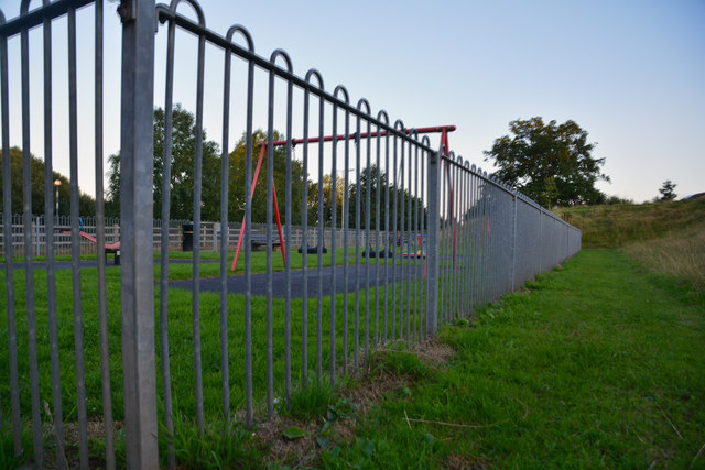
- 🛝Playground on site — built-in entertainment for younger visitors alongside the wider site
🌤️ Visiting this summer
- 🐦31+ species recorded in this area — summer evenings are best for activity; watch for Blue Tit and Blackbird
- ☀️Summer family visits work well here — arrive early and plan for a longer stay
- 🛝Playground on site — built-in entertainment for younger visitors alongside the wider site
Good to know
- £Free to visit — no entry charge
- 🐕Dogs welcome
Best for
Bird watching
Strong match
Birds — Blue Tit, Blackbird, Woodpigeon +28 more · last seen 2025; Birds — Blue Tit, Blackbird, Woodpigeon +28 more · last seen 2025
Playgrounds
Strong match
playground, parking
Family friendly
Strong match
playground; Urban park — family destination
Dog walks
Strong match
Dogs allowed with public access
Wildlife
Strong match
Birds — Blue Tit, Blackbird, Woodpigeon +28 more · last seen 2025; Birds — Blue Tit, Blackbird, Woodpigeon +28 more · last seen 2025
Picnic day out
Good match
Urban park — open green space
Trails nearby
Within roughly 5 km🚶Walking
8 signed routes nearby · 1 public path nearby
Signed route nearbyPublic paths
Walking
Two Counties WayWalking route90 km
A long distance walk of 56 miles (90km) from Taunton to Starcross on the Exe estuary.
Cullompton Honiton WalkWalking route
Bradninch Town TrailWalking route
Uffculme Village TrailWalking route
Willand Village TrailWalking route
🚴Cycling
19 signed routes nearby
Signed route nearby
Cycling
NCN 3 Link to Tiverton ParkwayCycling route
Route 3Cycling route527.7 km
Main RouteCycling route1.4 km
Main RouteCycling route200 m
N/ACycling route1 km
Main RouteCycling route406 m
🐴Horse riding
3 public paths nearby
Public paths
Horse riding
Goblin Lanebridleway · 147 m
Goblin Lanebridleway · 32 m
Wildlife to spot
Photos
Weather for this location
Loading local forecast…
Nearby places
Useful places within 5 km
Own or manage this place?
Claim this listing to keep details accurate, add photos, and highlight what makes it special — free.
Claim this pageHow was your visit?
How useful was the information on this page?
id: 2a085a41-43e0-4a21-b06d-017c654c3630