☀️June — long evenings and clear skies; one of the most rewarding months for a late visit
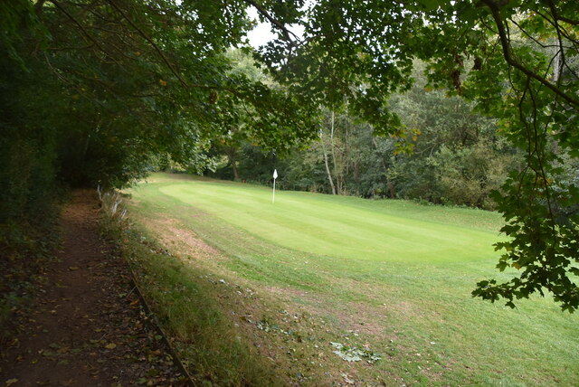
⛳Golf is at its best in summer here
🐕Dogs welcome — bring water in summer; the site has enough space to find shade on hot days
🌤️ Visiting this summer
☀️June — long evenings and clear skies; one of the most rewarding months for a late visit
⛳Golf is at its best in summer here
🐕Dogs welcome — bring water in summer; the site has enough space to find shade on hot days
Good to know
🐕Dogs welcome
Best for
1 activity
⛳
Golf
Very strong match
Golf course
Paid
Trails nearby
Within roughly 5 km
🚶
Walking
▾
12 signed routes nearby · 31 public paths nearby
Signed route nearbyPublic paths
Vanguard WayWalking route111 km▾
Named routeRef VGWLength 111 kmRegional walking route
Worth WayWalking route▾
Named routeLocal walking route
Tandridge Border PathWalking route▾
Named routeLocal walking route
Dormans Park Walk (SCC)Walking route▾
Named routeLocal walking route
Greenwich Meridian TrailWalking route440 km▾
A long-distance walk that follows the line of the Prime Meridian. Inaugurated in 2009, to coincide with the 125th anniversary of the Greenwich Meridian.
Named routeRef GMTLength 440 kmRegional walking route
Swissland Hillpublic footpath · 47 m▾
Public pathpublic footpathLength 47 mPath type: residential
Swissland Hillpublic footpath · 24 m▾
Public pathpublic footpathLength 24 mPath type: residential
Swissland Hillpublic footpath · 197 m▾
Public pathpublic footpathLength 197 mSurface asphaltPath type: residential
🚴
Cycling
▾
26 signed routes nearby
Signed route nearby
Avenue Verte London ↔ ParisCycling route▾
English part of Avenue Verte London ↔ Paris, an international cycle route that connects the two capital cities
Named routeRef AVInternational cycle route
Yew Tree WayCycling route▾
Named routeRegional cycle route
Surrey CyclewayCycling route▾
Cycle route consisting of main loop plus link routes
Named routeRound tripRegional cycle route
Route 21Cycling route▾
Named routeRef 21National Cycle Network
Main RouteCycling route283 m▾
Named routeRef 21Length 283 mNational Cycle NetworkTraffic-freeSurface asphalt
Main RouteCycling route40 m▾
Named routeRef 21Length 40 mNational Cycle NetworkTraffic-freeSurface asphalt
🐴
Horse riding
▾
7 public paths nearby
Public paths
Mill Lanebridleway · 93 m▾
Public pathbridlewayLength 93 mPath type: residential
Mill Lanebridleway · 772 m▾
Public pathbridlewayLength 772 mPath type: track
Mill Lanebridleway · 606 m▾
Public pathbridlewayLength 606 mPath type: bridleway
Mill Lanebridleway · 221 m▾
Public pathbridlewayLength 221 mPath type: bridleway
Mill Lanebridleway · 156 m▾
Public pathbridlewayLength 156 mSurface pavedPath type: service