Plan your visit
🦉Wildlife🦅Birds🦋Insects
Public accessFree entryDogs welcome
Getting here
51.35585, -0.59762
Open directionsv
Visiting this summer
Seasonal nature notes and what to look for now
- 🌞Midsummer — early morning visits most comfortable; look for deer fawns in quieter clearings
- 🐕Early mornings are best for dog walks in summer — visit before 9am to avoid the heat and find quieter trails
- 🅿️Parking 120m away — 10 car parks within reach
🌤️ Visiting this summer
- 🌞Midsummer — early morning visits most comfortable; look for deer fawns in quieter clearings
- 🐕Early mornings are best for dog walks in summer — visit before 9am to avoid the heat and find quieter trails
- 🅿️Parking 120m away — 10 car parks within reach
- £Free to visit — no entry charge
- 🐕Dogs welcome
🦉Wildlife
Very strong match
Multi-group wildlife — Amphibians, Birds, Mammals, Reptiles; Multi-group wildlife — Amphibians, Birds, Mammals, Reptiles
Free
🦅Bird watching
Very strong match
Birds — Robin, Carrion Crow, Chiffchaff +60 more · last seen 2026; Birds — Robin, Carrion Crow, Chiffchaff +60 more · last seen 2026
Free
🦋Insect spotting
Strong match
Insects — Gatekeeper, Grayling, Meadow Brown +86 more · last seen 2025; Insects — Gatekeeper, Grayling, Meadow Brown +86 more · last seen 2025
Free
Dogs allowed with public access
Free
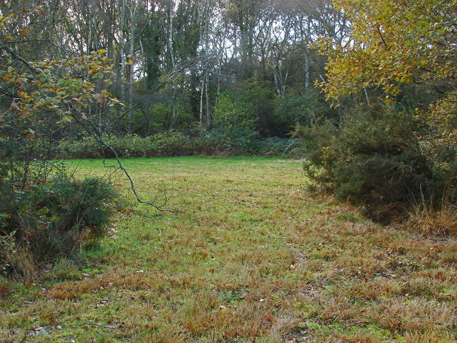
Deciduous woodland — fungi, berries and wild garlic
Varies
🛝Family friendly
Good match
Urban park — family destination
Free
Trails nearby
Within roughly 5 km1 signed route nearby · 10 public paths nearby
Signed route nearbyPublic paths
Basingstoke CanalWalking route▾
Named routeRegional walking route
Heather Waypublic footpath · 244 m▾
Public pathpublic footpathLength 244 mPath type: residential
Little Heath Roadpublic footpath · 117 m▾
Public pathpublic footpathLength 117 mSurface dirtPath type: residential
Gorse Lanepublic footpath · 44 m▾
Public pathpublic footpathLength 44 mSurface asphaltPath type: unclassified
88 signed routes nearby
Signed route nearby
Neptune TrailCycling route▾
Named routeRef Neptune (2)Local cycle route
Mars TrailCycling route▾
Named routeRef MarsLocal cycle route
Phobos TrailCycling route▾
Named routeRef PhobosLocal cycle route
Mimas TrailCycling route▾
Named routeRef MimasLocal cycle route
Route 223Cycling route▾
Named routeRef 223National Cycle Network
Oberon TrailCycling route▾
Named routeRef OberonLocal cycle route
1 signed route nearby
Signed route nearby
Basingstoke Canal TowpathMountain bike route▾
13 public paths nearby
Public paths
Sandy Lanebridleway · 77 m▾
Public pathbridlewayLength 77 mSurface gravelPath type: track
Gorse Lanebridleway · 127 m▾
Public pathbridlewayLength 127 mSurface asphaltPath type: unclassified
Sandy Lanebridleway · 80 m▾
Public pathbridlewayLength 80 mSurface gravelPath type: track
Weather for this location
Next 14 daysNearby places
Useful places within 5 km
Own or manage this place?
Claim this listing to keep details accurate, add photos, and highlight what makes it special — free.
Claim this page→How useful was the information on this page?
id: 4ac35756-144c-47f8-a67a-15768f9f1933
Events & activities nearby
Switch provider to compare local events, tours and bookable activities.
Wildlife to spot
31,512 records · National Biodiversity Network
Wildlife to spot
31,512 records · National Biodiversity NetworkCarrion Crow · Chiffchaff · Woodpigeon · Green Woodpecker · Robin +39
- Carrion CrowCorvus corone2025
- ChiffchaffPhylloscopus collybita2025
- WoodpigeonColumba palumbus2025
- Green WoodpeckerPicus viridis2025
- RobinErithacus rubecula2025
- GoldcrestRegulus regulus2025
- JackdawColoeus monedula2025
- Great TitParus major2025
- Blue TitCyanistes caeruleus2025
- Great Spotted WoodpeckerDendrocopos major2025
- GoldfinchCarduelis carduelis2025
- House MartinDelichon urbicum2025
- SwallowHirundo rustica2025
- Stock DoveColumba oenas2025
- Song ThrushTurdus philomelos2025
- DunnockPrunella modularis2025
- WrenTroglodytes troglodytes2025
- Long-tailed TitAegithalos caudatus2025
- BlackbirdTurdus merula2025
- MagpiePica pica2025
- StonechatSaxicola rubicola2025
- MoorhenGallinula chloropus2025
- Rock DoveColumba livia2025
- JayGarrulus glandarius2025
- PheasantPhasianus colchicus2025
- Coal TitPeriparus ater2025
- NuthatchSitta europaea2025
- KestrelFalco tinnunculus2025
- Tawny OwlStrix aluco
- Collared DoveStreptopelia decaocto2025
- RedwingTurdus iliacus2025
- Black-headed GullChroicocephalus ridibundus2025
- Pied WagtailMotacilla alba2025
- StarlingSturnus vulgaris2025
- CrossbillLoxia curvirostra2025
- Mistle ThrushTurdus viscivorus2025
- Willow WarblerPhylloscopus trochilus2025
- House SparrowPasser domesticus2025
- BullfinchPyrrhula pyrrhula2025
- CormorantPhalacrocorax carbo2025
- TreecreeperCerthia familiaris2025
- MallardAnas platyrhynchos2025
- BlackcapSylvia atricapilla2025
- ChaffinchFringilla coelebs2025
🦌Mammals7 species
summerautumn
2025▾
Grey Squirrel · Eurasian Serotine · Common Pipistrelle · Myotis Bat species · Soprano Pipistrelle +2
- Grey SquirrelSciurus carolinensis
- Eurasian SerotineCnephaeus serotinus
- Common PipistrellePipistrellus pipistrellus
- Myotis Bat speciesMyotis
- Soprano PipistrellePipistrellus pygmaeus
- NoctuleNyctalus noctula
Adder
🐸Amphibians1 species
winter
2026▾
Common Toad
Common Darter · Willow Emerald Damselfly · Black-tailed Skimmer · Southern Hawker · Emperor Dragonfly +21
- Common DarterSympetrum striolatum
- Willow Emerald DamselflyChalcolestes viridis
- Black-tailed SkimmerOrthetrum cancellatum
- Southern HawkerAeshna cyanea
- Emperor DragonflyAnax imperator
- Brown HawkerAeshna grandis
- Common Blue Damselfly
Broad-leaved Helleborine · Juniper Haircap · Marsh Gentian
- Broad-leaved HelleborineEpipactis helleborine2025
- Juniper HaircapPolytrichum juniperinum
- Marsh GentianGentiana pneumonanthe2025
Species observations from the last 10 years via NBN Atlas
Brown Long-eared Bat
Brown Long-eared Bat
Plecotus auritus
Plecotus auritus
Enallagma cyathigerum
Enallagma cyathigerum
Keeled SkimmerOrthetrum coerulescensKeeled SkimmerOrthetrum coerulescensBanded DemoiselleCalopteryx splendensBanded DemoiselleCalopteryx splendensBlue-tailed DamselflyIschnura elegansBlue-tailed DamselflyIschnura elegansBrilliant EmeraldSomatochlora metallicaBrilliant EmeraldSomatochlora metallicaMinotaur BeetleTyphaeus typhoeusMinotaur BeetleTyphaeus typhoeusMigrant HawkerAeshna mixtaMigrant HawkerAeshna mixtaKite-tailed RobberflyMachimus atricapillusKite-tailed RobberflyMachimus atricapillusLong-winged Cone-headConocephalus fuscusLong-winged Cone-headConocephalus fuscusRed Wood AntFormica rufaRed Wood AntFormica rufaField GrasshopperChorthippus brunneusField GrasshopperChorthippus brunneusRhododendron LeafhopperGraphocephala fennahiRhododendron LeafhopperGraphocephala fennahiXylotaXylotaXylotaXylotaAzure DamselflyCoenagrion puellaAzure DamselflyCoenagrion puellaRed-eyed DamselflyErythromma najasRed-eyed DamselflyErythromma najasSmall Red-eyed DamselflyErythromma viridulumSmall Red-eyed DamselflyErythromma viridulumWhite-legged DamselflyPlatycnemis pennipesWhite-legged DamselflyPlatycnemis pennipesShort-winged Cone-headConocephalus dorsalisShort-winged Cone-headConocephalus dorsalisBroad-bodied ChaserLibellula depressaBroad-bodied ChaserLibellula depressaCicadella viridisCicadella viridisCicadella viridisCicadella viridis