Plan your visit
🦉 Wildlife🦅 Birds🍂 Seasonal
Free entry Dogs welcome 2,326 ha
Places › Scotland › Mid Scotland and Fife › Perth and Kinross Getting here
56.71068, -3.92907
Open directionsv Visiting this summer
Seasonal nature notes and what to look for now
▾ 🌞 Midsummer — dragonfly and damselfly activity peaks along water edges 🍄 Mushroom foraging is at its best in summer here 🐕 Dogs welcome — bring water in summer; the site has enough space to find shade on hot days 🌤️ Visiting this summer
🌞 Midsummer — dragonfly and damselfly activity peaks along water edges 🍄 Mushroom foraging is at its best in summer here 🐕 Dogs welcome — bring water in summer; the site has enough space to find shade on hot days £ Free to visit — no entry charge🐕 Dogs welcome🚲 Bike parking🅿️ Parking· Paid
🦉 Wildlife
Very strong match
Multi-group wildlife — Amphibians, Birds, Mammals; Multi-group wildlife — Amphibians, Birds, Mammals
Free
🦅 Bird watching
Very strong match
Birds — Chaffinch, Blue Tit, Mistle Thrush +52 more · last seen 2025; Birds — Chaffinch, Blue Tit, Mistle Thrush +52 more · last seen 2025
Free
🍂 Seasonal nature
Strong match
Ancient woodland — bluebells, fungi and autumn colour; Plants — Common Rock-rose, Crab Apple, Bugle +263 more · last seen 2025
Free
🍄 Mushroom foraging
Strong match
Fungi — Coniocybe furfuracea, Cladonia ciliata var. tenuis, Cladonia macilenta +69 more · last seen 2016; Fungi — Coniocybe furfuracea, Cladonia ciliata var. tenuis, Cladonia macilenta +69 more · last seen 2016
Varies
Plants — Crab Apple, Marsh Hawk's-beard, Meadowsweet +22 more foraging species
Varies
🦋 Insect spotting
Strong match
Insects — Ringlet, Northern Brown Argus, Small Heath +23 more · last seen 2024; Insects — Ringlet, Northern Brown Argus, Small Heath +23 more · last seen 2024
Free
Trails nearby Within roughly 5 km 3 signed routes nearby
Signed route nearby
Public Footpath to Blair Atholl Walking route ▾
Named route Local walking route
Show on map Clachan Trail Walking route 3 km ▾
Mostly wide, firm gravel surface. Uneven grassy section with some muddy patches. Includes some fairly steep slopes. Look out for vehicles along well-used forest roads.
Named route Length 3 km Duration 1:00 Round trip Local walking route
Show on map Ring Fort Trail Walking route 4 km ▾
Firm gravel surface throughout with some uneven and slightly grassed over sections. One long steep slope. Includes a section along a well-used forest road.
Named route Length 4 km Duration 1:30 Round trip Local walking route
Show on map 3 signed routes nearby
Signed route nearby
Blue cycle route Cycling route ▾
Named route Ref Blue Local cycle route
Show on map Yellow cycle route Cycling route ▾
Named route Ref Yellow Local cycle route
Show on map White cycle route Cycling route ▾
Named route Ref White Local cycle route
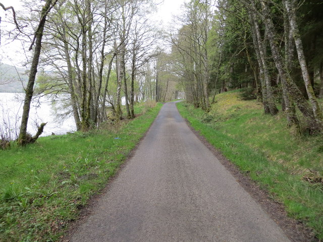
Show on map Photos Road between the south shore of Loch Tummel and Frenich Wood
‹ ›
Weather for this location Next 14 days Nearby places Useful places within 5 km
All Historic
Own or manage this place?
Claim this listing to keep details accurate, add photos, and highlight what makes it special — free.
Claim this page→ Visitor access unverified. We don't yet have confirmed information about walking routes or public access at this reservoir. If you've visited, please help us improve this page.
How useful was the information on this page?
id: 926467fd-cd11-4ffe-b9a2-95286abdf3be
UK green spaces mapped from open public data — so anyone can find the woodland, trail, or nature reserve closest to them.
© 2026 Glade · Made with care for UK green spaces
Wildlife to spot
1,995 records · National Biodiversity Network
▾
Wildlife to spot 1,995 records · National Biodiversity Network Mistle Thrush · Blackbird · Blue Tit · Greenfinch · Chaffinch +7
Mistle Thrush Turdus viscivorus Blackbird Turdus merula Blue Tit Cyanistes caeruleus Greenfinch Chloris chloris Chaffinch Fringilla coelebs Robin Erithacus rubecula Greylag Goose Anser anser Wren Troglodytes troglodytes Jay Garrulus glandarius Carrion Crow Corvus corone Collared Dove Streptopelia decaocto Bullfinch Pyrrhula pyrrhula2024 🦌 Mammals 2 species
winter autumn
2025 ▾
Red Squirrel · Wild Cat Hybrid
Red Squirrel Sciurus vulgaris Wild Cat Hybrid Felis silvestris x catus Common Rock-rose · Bugle · Common Valerian · Agrimony · Bracken +110
Common Rock-rose Helianthemum nummularium2024 Bugle Ajuga reptans Common Valerian Valeriana officinalis2024 Agrimony Agrimonia eupatoria2024 Bracken Pteridium aquilinum2024 Barren Strawberry Potentilla sterilis Species observations from the last 10 years via NBN Atlas
2024
2024
Hazel Corylus avellana2024
Hazel Corylus avellana2024
Fragrant Agrimony Agrimonia procera2024
Fragrant Agrimony Agrimonia procera2024
Slender St John's-wort Hypericum pulchrum2024
Slender St John's-wort Hypericum pulchrum2024
Hedge Woundwort Stachys sylvatica2024
Hedge Woundwort Stachys sylvatica2024
Lady's Bedstraw Galium verum2024
Lady's Bedstraw Galium verum2024
Wild Strawberry Fragaria vesca2024
Wild Strawberry Fragaria vesca2024
Ash Fraxinus excelsior2024
Ash Fraxinus excelsior2024
Creeping Buttercup Ranunculus repens2024
Creeping Buttercup Ranunculus repens2024
Wavy Hair-Grass Avenella flexuosa2024
Wavy Hair-Grass Avenella flexuosa2024
Bramble Rubus fruticosus2024
Bramble Rubus fruticosus2024
Yellow Pimpernel Lysimachia nemorum2024
Yellow Pimpernel Lysimachia nemorum2024
Rowan Sorbus aucuparia2024
Rowan Sorbus aucuparia2024
Common Figwort Scrophularia nodosa2024
Common Figwort Scrophularia nodosa2024
Norway Spruce Picea abies2024
Norway Spruce Picea abies2024
Lady-fern Athyrium filix-femina2024
Lady-fern Athyrium filix-femina2024
Broad Buckler-fern Dryopteris dilatata2024
Broad Buckler-fern Dryopteris dilatata2024
Tufted Hair-grass Deschampsia cespitosa2024
Tufted Hair-grass Deschampsia cespitosa2024
Douglas Fir Pseudotsuga menziesii2024
Douglas Fir Pseudotsuga menziesii2024
Blackthorn Prunus spinosa2024
Blackthorn Prunus spinosa2024
Greater Stitchwort Stellaria holostea2024
Greater Stitchwort Stellaria holostea2024
Raspberry Rubus idaeus2024
Raspberry Rubus idaeus2024
Upright Hedge-parsley Torilis japonica2024
Upright Hedge-parsley Torilis japonica2024
Quaking-grass Briza media2024
Quaking-grass Briza media2024
Dryopteris affinis Dryopteris affinis2024
Dryopteris affinis Dryopteris affinis2024
Wild Thyme Thymus drucei2024
Wild Thyme Thymus drucei2024
Dandelion Taraxacum2024
Dandelion Taraxacum2024
Wood-sorrel Oxalis acetosella2024
Wood-sorrel Oxalis acetosella2024
Prickly Sow-thistle Sonchus asper2024
Prickly Sow-thistle Sonchus asper2024
Remote Sedge Carex remota2024
Remote Sedge Carex remota2024
Meadowsweet Filipendula ulmaria2024
Meadowsweet Filipendula ulmaria2024
Soft-rush Juncus effusus2024
Soft-rush Juncus effusus2024
Beech Fagus sylvatica2024
Beech Fagus sylvatica2024
Daisy Bellis perennis2024
Daisy Bellis perennis2024
Harebell Campanula rotundifolia2024
Harebell Campanula rotundifolia2024
Bottle Sedge Carex rostrata2024
Bottle Sedge Carex rostrata2024
Broad-leaved Willowherb Epilobium montanum2024
Broad-leaved Willowherb Epilobium montanum2024
Aspen Populus tremula2024
Aspen Populus tremula2024
Downy Birch Betula pubescens2024
Downy Birch Betula pubescens2024
Glaucous Sedge Carex flacca2024
Glaucous Sedge Carex flacca2024
Field Horsetail Equisetum arvense2024
Field Horsetail Equisetum arvense2024
Bitter-vetch Lathyrus linifolius2024
Bitter-vetch Lathyrus linifolius2024
Heath Groundsel Senecio sylvaticus2024
Heath Groundsel Senecio sylvaticus2024
Bush Vetch Vicia sepium2024
Bush Vetch Vicia sepium2024
Herb-Robert Geranium robertianum2024
Herb-Robert Geranium robertianum2024
Foxglove Digitalis purpurea2024
Foxglove Digitalis purpurea2024
Yorkshire-fog Holcus lanatus2024
Yorkshire-fog Holcus lanatus2024
Creeping Soft-grass Holcus mollis2024
Creeping Soft-grass Holcus mollis2024
Bird Cherry Prunus padus2024
Bird Cherry Prunus padus2024
Creeping Thistle Cirsium arvense2024
Creeping Thistle Cirsium arvense2024
Rose Rosa2024
Rose Rosa2024
Bell Heather Erica cinerea2024
Bell Heather Erica cinerea2024
Bladder-sedge Carex vesicaria2024
Bladder-sedge Carex vesicaria2024
Oval Sedge Carex leporina2024
Oval Sedge Carex leporina2024
Upland Enchanter's-nightshade Circaea alpina x lutetiana = C. x intermedia2024
Upland Enchanter's-nightshade Circaea alpina x lutetiana = C. x intermedia2024
Cut-leaved Crane's-bill Geranium dissectum2024
Cut-leaved Crane's-bill Geranium dissectum2024
Goat Willow Salix caprea2024
Goat Willow Salix caprea2024
Goldenrod Solidago virgaurea2024
Goldenrod Solidago virgaurea2024
Pedunculate Oak Quercus robur2024
Pedunculate Oak Quercus robur2024
Hard-fern Blechnum spicant2024
Hard-fern Blechnum spicant2024
Nipplewort Lapsana communis2024
Nipplewort Lapsana communis2024
Eyebright Euphrasia2024
Eyebright Euphrasia2024
Primrose Primula vulgaris2024
Primrose Primula vulgaris2024
Velvet Bent Agrostis canina2024
Velvet Bent Agrostis canina2024
Common Nettle Urtica dioica2024
Common Nettle Urtica dioica2024
Heath Bedstraw Galium saxatile2024
Heath Bedstraw Galium saxatile2024
Alder Alnus glutinosa2024
Alder Alnus glutinosa2024
Cotoneaster Cotoneaster2024
Cotoneaster Cotoneaster2024
Wild Angelica Angelica sylvestris2024
Wild Angelica Angelica sylvestris2024
Alpine Bistort Bistorta vivipara2024
Alpine Bistort Bistorta vivipara2024
Crested Dog's-tail Cynosurus cristatus2024
Crested Dog's-tail Cynosurus cristatus2024
Opposite-leaved Golden-saxifrage Chrysosplenium oppositifolium2024
Opposite-leaved Golden-saxifrage Chrysosplenium oppositifolium2024
Sitka Spruce Picea sitchensis2024
Sitka Spruce Picea sitchensis2024
Marsh Speedwell Veronica scutellata2024
Marsh Speedwell Veronica scutellata2024
Common Dog-violet Viola riviniana2024
Common Dog-violet Viola riviniana2024
Selfheal Prunella vulgaris2024
Selfheal Prunella vulgaris2024
False-brome Brachypodium sylvaticum2024
False-brome Brachypodium sylvaticum2024
Bulbous Rush Juncus bulbosus2024
Bulbous Rush Juncus bulbosus2024
Male-fern Dryopteris filix-mas2024
Male-fern Dryopteris filix-mas2024
Hawkweed Hieracium2024
Hawkweed Hieracium2024
Devil's-bit Scabious Succisa pratensis2024
Devil's-bit Scabious Succisa pratensis2024
Bearded Couch Elymus caninus2024
Bearded Couch Elymus caninus2024
Wood Anemone Anemone nemorosa2024
Wood Anemone Anemone nemorosa2024
Heath-grass Danthonia decumbens2024
Heath-grass Danthonia decumbens2024
Northern Marsh-orchid Dactylorhiza purpurella2024
Northern Marsh-orchid Dactylorhiza purpurella2024
Heath Speedwell Veronica officinalis2024
Heath Speedwell Veronica officinalis2024
Meadow Buttercup Ranunculus acris2024
Meadow Buttercup Ranunculus acris2024
Coltsfoot Tussilago farfara2024
Coltsfoot Tussilago farfara2024
Lesser Spearwort Ranunculus flammula2024
Lesser Spearwort Ranunculus flammula2024
Silver Birch Betula pendula2024
Silver Birch Betula pendula2024
Sharp-flowered Rush Juncus acutiflorus2024
Sharp-flowered Rush Juncus acutiflorus2024
Marsh-bedstraw Galium palustre2024
Marsh-bedstraw Galium palustre2024
Pill Sedge Carex pilulifera2024
Pill Sedge Carex pilulifera2024
Rough Meadow-grass Poa trivialis2024
Rough Meadow-grass Poa trivialis2024
Dog's Mercury Mercurialis perennis2024
Dog's Mercury Mercurialis perennis2024
Wavy Bitter-cress Cardamine flexuosa2024
Wavy Bitter-cress Cardamine flexuosa2024
Purple Moor-grass Molinia caerulea2024
Purple Moor-grass Molinia caerulea2024
Wood Avens Geum urbanum2024
Wood Avens Geum urbanum2024
Greater Butterfly-orchid Platanthera chlorantha2024
Greater Butterfly-orchid Platanthera chlorantha2024
New Zealand Pigmyweed Crassula helmsii2024
New Zealand Pigmyweed Crassula helmsii2024
Sheep's Fescue agg. Festuca ovina2024
Sheep's Fescue agg. Festuca ovina2024
Pale Sedge Carex pallescens2024
Pale Sedge Carex pallescens2024
Cleavers Galium aparine2024
Cleavers Galium aparine2024
Cock's-foot Dactylis glomerata2024
Cock's-foot Dactylis glomerata2024
Common Chickweed Stellaria media2024
Common Chickweed Stellaria media2024
Heath Fragrant-orchid Gymnadenia borealis2024
Heath Fragrant-orchid Gymnadenia borealis2024
Flea Sedge Carex pulicaris2024
Flea Sedge Carex pulicaris2024
Great Wood-rush Luzula sylvatica2024
Great Wood-rush Luzula sylvatica2024
Honeysuckle Lonicera periclymenum2024
Honeysuckle Lonicera periclymenum2024
Cat's-ear Hypochaeris radicata2024
Cat's-ear Hypochaeris radicata2024 Events & activities nearby Switch provider to compare local events, tours and bookable activities.
Bookable tours GetYourGuide Promote here