Plan your visit
Getting here
51.28398, 0.30638
Visiting this summer
Seasonal nature notes and what to look for now
Visiting this summer
Seasonal nature notes and what to look for now
- 🌞Midsummer — early morning visits most comfortable; look for deer fawns in quieter clearings
- 🧺Good picnic destination in summer — open space and facilities for a relaxed day out
- 🐕Dogs welcome — bring water in summer; the site has enough space to find shade on hot days
🌤️ Visiting this summer
- 🌞Midsummer — early morning visits most comfortable; look for deer fawns in quieter clearings
- 🧺Good picnic destination in summer — open space and facilities for a relaxed day out
- 🐕Dogs welcome — bring water in summer; the site has enough space to find shade on hot days
Good to know
- £Free to visit — no entry charge
- 🐕Dogs welcome
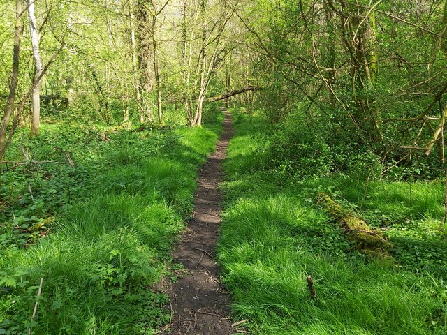
- 🌿Ancient woodland — rare wildlife habitat
Best for
Wildlife
Very strong match
Multi-group wildlife — Birds, Mammals, Reptiles; Multi-group wildlife — Birds, Mammals, Reptiles
Bird watching
Very strong match
Birds — Blue Tit, Woodpigeon, Great Tit +78 more · last seen 2025; Birds — Blue Tit, Woodpigeon, Great Tit +78 more · last seen 2025
Picnic day out
Very strong match
picnic area
Seasonal nature
Strong match
Ancient woodland — bluebells, fungi and autumn colour
Dog walks
Strong match
Dogs allowed — public woodland
Insect spotting
Good match
Insects — Harlequin Ladybird, Beautiful Demoiselle, 16-spot Ladybird +12 more · last seen 2025; Insects — Harlequin Ladybird, Beautiful Demoiselle, 16-spot Ladybird +12 more · last seen 2025
Trails nearby
Within roughly 5 km🚶Walking
9 signed routes nearby · 8 public paths nearby
Signed route nearbyPublic paths
Walking
Oftord to Canterbury CathedralWalking route
follows North Downs Way from Otford to Broughton Lees
Ightham Mote Circular Walk to Old Soar Manor, Ightham MoteWalking route11.2 km
This circular links two National Trust places, both dating back to medieval England. The trail goes through Scathes ancient woodland, into the Fairlawne Estate & onto Plaxtol Spout before returning to Ightham Mote through orchards & the Greensand Way.
North Downs Way (Eastern)Walking route
Greensand WayWalking route
WealdwayWalking route
Bellows Lanepublic footpath · 85 m
The Landwaypublic footpath · 68 m
🐴Horse riding
5 public paths nearby
Public paths
Horse riding
No named routes yet. Public paths are shown on the map.
Wildlife to spot
Photos
Weather for this location
Loading local forecast…
Nearby places
Useful places within 5 km
Own or manage this place?
Claim this listing to keep details accurate, add photos, and highlight what makes it special — free.
Claim this pageHow was your visit?
How useful was the information on this page?
id: d8dc9ee6-b26c-40b7-9767-fe46a6c67cec