Plan your visit
🦉 Wildlife🍄 Fungi🌿 Foraging
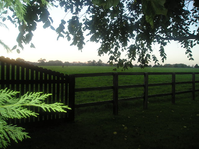
Free entry Dogs welcome 16 ha
Places › England › Eastern › East Cambridgeshire Getting here
52.22640, 0.44369
Open directionsv Visiting this summer
Seasonal nature notes and what to look for now
▾ ☀️ June — canopy now fully closed, creating cool dappled shade even on warm days 🍄 Mushroom foraging is at its best in summer here 🐕 Dogs welcome — bring water in summer; the site has enough space to find shade on hot days 🌤️ Visiting this summer
☀️ June — canopy now fully closed, creating cool dappled shade even on warm days 🍄 Mushroom foraging is at its best in summer here 🐕 Dogs welcome — bring water in summer; the site has enough space to find shade on hot days £ Free to visit — no entry charge🐕 Dogs welcome🦉 Wildlife
Very strong match
Multi-group wildlife — Birds, Mammals, Reptiles; Multi-group wildlife — Birds, Mammals, Reptiles
Free
🍄 Mushroom foraging
Strong match
Fungi — Amandinea punctata, Arthonia radiata, Melanelixia subaurifera +54 more · last seen 2016; Fungi — Amandinea punctata, Arthonia radiata, Melanelixia subaurifera +54 more · last seen 2016
Varies
Plants — Hogweed, Pedunculate Oak, Hawthorn +16 more foraging species; Deciduous woodland — fungi, berries and wild garlic
Varies
🍂 Seasonal nature
Strong match
Plants — Rough-stalked Feather-moss, Bird's-claw Beard-moss, Clustered Feather-moss +181 more · last seen 2023; Plants — Rough-stalked Feather-moss, Bird's-claw Beard-moss, Clustered Feather-moss +181 more · last seen 2023
Free
🦅 Bird watching
Strong match
Deciduous woodland — woodpeckers, warblers and woodland birds; Birds — Goldcrest, Curlew, Greenfinch +5 more · last seen 2022
Free
🦋 Insect spotting
Strong match
Insects — Small White, Large White, Red Admiral +25 more · last seen 2025; Insects — Small White, Large White, Red Admiral +25 more · last seen 2025
Free
Trails nearby Within roughly 5 km 3 signed routes nearby
Signed route nearby
Icknield Way Path Walking route 169 km ▾
long distance footpath 169 km
Named route Length 169 km Regional walking route
Show on map Stour Valley Path part 2 Walking route ▾
Named route Regional walking route
Show on map Stour Valley Path part 1 Walking route ▾
Named route Regional walking route
Show on map 38 signed routes nearby
Signed route nearby
NCN 51 Cycling route ▾
Named route Ref 51 National Cycle Network
Show on map Main Route Cycling route 196 m ▾
Named route Ref 51 Length 196 m National Cycle Network On-road Surface asphalt
Show on map Main Route Cycling route 63 m ▾
Named route Ref 51 Length 63 m National Cycle Network Traffic-free Surface concrete
Show on map Main Route Cycling route 41 m ▾
Named route Ref 51 Length 41 m National Cycle Network On-road Surface asphalt
Show on map N/A Cycling route 50 m ▾
Named route Length 50 m National Cycle Network Traffic-free Surface asphalt
Show on map Main Route Cycling route 125 m ▾
Named route Ref 51 Length 125 m National Cycle Network Traffic-free Surface pavementslabs
Show on map 1 signed route nearby
Signed route nearby
Icknield Way Cycle Trail Mountain bike route 226 km ▾
This is the off-road or mountain cycling route of the Icknield Way Trail.
Named route Length 226 km Regional cycle route
Show on map
Weather for this location Next 14 days Nearby places Useful places within 5 km
All Historic
How useful was the information on this page?
id: d9487ac5-8bda-41f9-9103-ee981e4661a7
UK green spaces mapped from open public data — so anyone can find the woodland, trail, or nature reserve closest to them.
© 2026 Glade · Made with care for UK green spaces
Events & activities nearby Switch provider to compare local events, tours and bookable activities.
Bookable tours Wildlife to spot
3,229 records · National Biodiversity Network
▾
Wildlife to spot 3,229 records · National Biodiversity Network Goldcrest · Curlew · Greenfinch · Starling
Goldcrest Regulus regulus Curlew Numenius arquata Greenfinch Chloris chloris Starling Sturnus vulgaris Hedgehog
Hedgehog Erinaceus europaeus Adder
Box Bug · Yellow Meadow Ant · Hairy Spider Weevil · Agriotes obscurus · Common Cockchafer
Box Bug Gonocerus acuteangulatus Yellow Meadow Ant Lasius flavus2023 Hairy Spider Weevil Exomias pellucidus2023 Agriotes obscurus Agriotes obscurus2023 Common Cockchafer Melolontha melolontha2021 🌿 Plants 147 species
spring summer
2023 ▾
Red Bartsia · Holly · Common Bird's-foot-trefoil · Cleavers · Hoary Plantain +142
Red Bartsia Odontites vernus2022 Holly Ilex aquifolium2022 Common Bird's-foot-trefoil Lotus corniculatus2022 Cleavers Galium aparine2022 Hoary Plantain Plantago media2022 Species observations from the last 10 years via NBN Atlas
Quaking-grass
Quaking-grass
Briza media2022
Briza media2022
Perennial Rye-grass Lolium perenne2022
Perennial Rye-grass Lolium perenne2022
Common Nettle Urtica dioica2022
Common Nettle Urtica dioica2022
Hawthorn Crataegus monogyna2022
Hawthorn Crataegus monogyna2022
Honeysuckle Lonicera periclymenum2022
Honeysuckle Lonicera periclymenum2022
Burnet-saxifrage Pimpinella saxifraga2022
Burnet-saxifrage Pimpinella saxifraga2022
Cowslip Primula veris2022
Cowslip Primula veris2022
White Clover Trifolium repens2022
White Clover Trifolium repens2022
Oregon-grape Mahonia aquifolium2022
Oregon-grape Mahonia aquifolium2022
Dwarf Thistle Cirsium acaule2022
Dwarf Thistle Cirsium acaule2022
Yellow Oat-grass Trisetum flavescens2022
Yellow Oat-grass Trisetum flavescens2022
Yorkshire-fog Holcus lanatus2022
Yorkshire-fog Holcus lanatus2022
Lady's Bedstraw Galium verum2022
Lady's Bedstraw Galium verum2022
Silver Birch Betula pendula2022
Silver Birch Betula pendula2022
Selfheal Prunella vulgaris2022
Selfheal Prunella vulgaris2022
Greater Knapweed Centaurea scabiosa2022
Greater Knapweed Centaurea scabiosa2022
Smaller Cat's-tail Phleum bertolonii2022
Smaller Cat's-tail Phleum bertolonii2022
Ground-ivy Glechoma hederacea2022
Ground-ivy Glechoma hederacea2022
Pedunculate Oak Quercus robur2022
Pedunculate Oak Quercus robur2022
Hogweed Heracleum sphondylium2022
Hogweed Heracleum sphondylium2022
Ivy Hedera helix2022
Ivy Hedera helix2022
Wild Cherry Prunus avium2022
Wild Cherry Prunus avium2022
Bristly Oxtongue Helminthotheca echioides2021
Bristly Oxtongue Helminthotheca echioides2021
False Oat-grass Arrhenatherum elatius2021
False Oat-grass Arrhenatherum elatius2021
Reflexed Saltmarsh-Grass Puccinellia distans2021
Reflexed Saltmarsh-Grass Puccinellia distans2021
Sticky Mouse-ear Cerastium glomeratum2021
Sticky Mouse-ear Cerastium glomeratum2021
Spear Thistle Cirsium vulgare2021
Spear Thistle Cirsium vulgare2021
Daisy Bellis perennis2021
Daisy Bellis perennis2021
Hairy Bitter-cress Cardamine hirsuta2021
Hairy Bitter-cress Cardamine hirsuta2021
Curled Dock Rumex crispus2021
Curled Dock Rumex crispus2021
Common Whitlowgrass Erophila verna2021
Common Whitlowgrass Erophila verna2021
Bloody Crane's-bill Geranium sanguineum
Bloody Crane's-bill Geranium sanguineum
Marchantia polymorpha subsp. ruderalis Marchantia polymorpha subsp. ruderalis
Marchantia polymorpha subsp. ruderalis Marchantia polymorpha subsp. ruderalis
Dropwort Filipendula vulgaris2022
Dropwort Filipendula vulgaris2022
Common Bent Agrostis capillaris2022
Common Bent Agrostis capillaris2022
Agrimony Agrimonia eupatoria2022
Agrimony Agrimonia eupatoria2022
Red Clover Trifolium pratense2022
Red Clover Trifolium pratense2022
Buckthorn Rhamnus cathartica2022
Buckthorn Rhamnus cathartica2022
Elm Ulmus2022
Elm Ulmus2022
Cock's-foot Dactylis glomerata2022
Cock's-foot Dactylis glomerata2022
European Larch Larix decidua2022
European Larch Larix decidua2022
Dewberry Rubus caesius2022
Dewberry Rubus caesius2022
Festuca rubra Festuca rubra2022
Festuca rubra Festuca rubra2022
Common Sorrel Rumex acetosa2022
Common Sorrel Rumex acetosa2022
Creeping Cinquefoil Potentilla reptans2022
Creeping Cinquefoil Potentilla reptans2022
Sycamore Acer pseudoplatanus2022
Sycamore Acer pseudoplatanus2022
Rough Hawkbit Leontodon hispidus2022
Rough Hawkbit Leontodon hispidus2022
Common Restharrow Ononis repens2022
Common Restharrow Ononis repens2022
Creeping Thistle Cirsium arvense2022
Creeping Thistle Cirsium arvense2022
Ash Fraxinus excelsior2022
Ash Fraxinus excelsior2022
Scots Pine Pinus sylvestris2022
Scots Pine Pinus sylvestris2022
Box Buxus sempervirens2022
Box Buxus sempervirens2022
Bulbous Buttercup Ranunculus bulbosus2022
Bulbous Buttercup Ranunculus bulbosus2022
Salad Burnet Poterium sanguisorba subsp. sanguisorba2022
Salad Burnet Poterium sanguisorba subsp. sanguisorba2022
Perforate St John's-wort Hypericum perforatum2022
Perforate St John's-wort Hypericum perforatum2022
Traveller's-joy Clematis vitalba2022
Traveller's-joy Clematis vitalba2022
Yarrow Achillea millefolium2022
Yarrow Achillea millefolium2022
Beech Fagus sylvatica2022
Beech Fagus sylvatica2022
Meadow Buttercup Ranunculus acris2022
Meadow Buttercup Ranunculus acris2022
Garlic Mustard Alliaria petiolata2022
Garlic Mustard Alliaria petiolata2022
Herb-Robert Geranium robertianum2022
Herb-Robert Geranium robertianum2022
Common Knapweed Centaurea nigra2022
Common Knapweed Centaurea nigra2022
Sweet Vernal-grass Anthoxanthum odoratum2022
Sweet Vernal-grass Anthoxanthum odoratum2022
Rowan Sorbus aucuparia2022
Rowan Sorbus aucuparia2022
Dandelion Taraxacum2022
Dandelion Taraxacum2022
Garden Privet Ligustrum ovalifolium2022
Garden Privet Ligustrum ovalifolium2022
Ribwort Plantain Plantago lanceolata2022
Ribwort Plantain Plantago lanceolata2022
Dogwood Cornus sanguinea2022
Dogwood Cornus sanguinea2022
Wild Privet Ligustrum vulgare2022
Wild Privet Ligustrum vulgare2022
Greater Plantain Plantago major2022
Greater Plantain Plantago major2022
Silverweed Potentilla anserina2022
Silverweed Potentilla anserina2022
Black Medick Medicago lupulina2022
Black Medick Medicago lupulina2022
Meadow Vetchling Lathyrus pratensis2022
Meadow Vetchling Lathyrus pratensis2022
Goat's-beard Tragopogon pratensis2022
Goat's-beard Tragopogon pratensis2022
Bramble Rubus fruticosus2022
Bramble Rubus fruticosus2022
Sweet Chestnut Castanea sativa2022
Sweet Chestnut Castanea sativa2022
Harebell Campanula rotundifolia2021
Harebell Campanula rotundifolia2021
Pineappleweed Matricaria discoidea2021
Pineappleweed Matricaria discoidea2021
Tufted Vetch Vicia cracca2021
Tufted Vetch Vicia cracca2021
Common Toadflax Linaria vulgaris2021
Common Toadflax Linaria vulgaris2021
Common Rock-rose Helianthemum nummularium2021
Common Rock-rose Helianthemum nummularium2021
Small Scabious Scabiosa columbaria2021
Small Scabious Scabiosa columbaria2021
Male-fern Dryopteris filix-mas2021
Male-fern Dryopteris filix-mas2021
Enchanter's-nightshade Circaea lutetiana2021
Enchanter's-nightshade Circaea lutetiana2021
Common Poppy Papaver rhoeas2021
Common Poppy Papaver rhoeas2021
Petty Spurge Euphorbia peplus2021
Petty Spurge Euphorbia peplus2021
Fat-hen Chenopodium album2021
Fat-hen Chenopodium album2021
Lesser Meadow-rue Thalictrum minus2021
Lesser Meadow-rue Thalictrum minus2021
Wood Meadow-grass Poa nemoralis2021
Wood Meadow-grass Poa nemoralis2021
Hoary Willowherb Epilobium parviflorum2021
Hoary Willowherb Epilobium parviflorum2021
Prickly Lettuce Lactuca serriola2021
Prickly Lettuce Lactuca serriola2021
White Bryony Bryonia dioica2021
White Bryony Bryonia dioica2021
Slender Sandwort Arenaria leptoclados2021
Slender Sandwort Arenaria leptoclados2021
Bittersweet Solanum dulcamara2021
Bittersweet Solanum dulcamara2021
Field Scabious Knautia arvensis2021
Field Scabious Knautia arvensis2021
Smooth Hawk's-beard Crepis capillaris2021
Smooth Hawk's-beard Crepis capillaris2021
American Willowherb Epilobium ciliatum2021
American Willowherb Epilobium ciliatum2021
Beaked Hawk's-beard Crepis vesicaria2021
Beaked Hawk's-beard Crepis vesicaria2021
Cherry Plum Prunus cerasifera2021
Cherry Plum Prunus cerasifera2021
Crested Hair-grass Koeleria macrantha2021
Crested Hair-grass Koeleria macrantha2021
Wild Carrot Daucus carota subsp. carota2021
Wild Carrot Daucus carota subsp. carota2021
Rosebay Willowherb Chamaenerion angustifolium2021
Rosebay Willowherb Chamaenerion angustifolium2021
Prickly Sow-thistle Sonchus asper2021
Prickly Sow-thistle Sonchus asper2021
Wych Elm Ulmus glabra2021
Wych Elm Ulmus glabra2021
Norway Maple Acer platanoides2021
Norway Maple Acer platanoides2021
Horse-chestnut Aesculus hippocastanum2021
Horse-chestnut Aesculus hippocastanum2021
Barren Brome Anisantha sterilis2021
Barren Brome Anisantha sterilis2021
Small Leaved Elm Ulmus minor2021
Small Leaved Elm Ulmus minor2021
Broad-leaved Willowherb Epilobium montanum2021
Broad-leaved Willowherb Epilobium montanum2021
Huntingdon Elm Ulmus glabra x minor = U. x vegeta2021
Huntingdon Elm Ulmus glabra x minor = U. x vegeta2021
Fern-grass Catapodium rigidum2021
Fern-grass Catapodium rigidum2021
Creeping Bent Agrostis stolonifera2021
Creeping Bent Agrostis stolonifera2021
Common Figwort Scrophularia nodosa2021
Common Figwort Scrophularia nodosa2021
Rough Chervil Chaerophyllum temulum2021
Rough Chervil Chaerophyllum temulum2021
Lesser Stitchwort Stellaria graminea2021
Lesser Stitchwort Stellaria graminea2021
Bladder Campion Silene vulgaris2021
Bladder Campion Silene vulgaris2021
Raspberry Rubus idaeus2021
Raspberry Rubus idaeus2021
Wild Mignonette Reseda lutea2021
Wild Mignonette Reseda lutea2021
Three-nerved Sandwort Moehringia trinervia2021
Three-nerved Sandwort Moehringia trinervia2021
Fig-leaved Goosefoot Chenopodium ficifolium2021
Fig-leaved Goosefoot Chenopodium ficifolium2021
Cow Parsley Anthriscus sylvestris2021
Cow Parsley Anthriscus sylvestris2021
Groundsel Senecio vulgaris2021
Groundsel Senecio vulgaris2021
Mistletoe Viscum album2021
Mistletoe Viscum album2021
Elder Sambucus nigra2021
Elder Sambucus nigra2021
Hedgerow Crane's-bill Geranium pyrenaicum2021
Hedgerow Crane's-bill Geranium pyrenaicum2021
Creeping Buttercup Ranunculus repens2021
Creeping Buttercup Ranunculus repens2021
Swine-cress Lepidium coronopus2021
Swine-cress Lepidium coronopus2021
Common Ragwort Jacobaea vulgaris2021
Common Ragwort Jacobaea vulgaris2021
Yew Taxus baccata2021
Yew Taxus baccata2021
Common Couch Elymus repens2021
Common Couch Elymus repens2021
Blackthorn Prunus spinosa2021
Blackthorn Prunus spinosa2021
Common Chickweed Stellaria media2021
Common Chickweed Stellaria media2021
Lamiastrum galeobdolon subsp. argentatum Lamiastrum galeobdolon subsp. argentatum2021
Lamiastrum galeobdolon subsp. argentatum Lamiastrum galeobdolon subsp. argentatum2021
Veronica hederifolia subsp. lucorum Veronica hederifolia subsp. lucorum2021
Veronica hederifolia subsp. lucorum Veronica hederifolia subsp. lucorum2021
daffodils Narcissus2021
daffodils Narcissus2021
Red Dead-nettle Lamium purpureum2021
Red Dead-nettle Lamium purpureum2021
Buck's-horn Plantain Plantago coronopus2021
Buck's-horn Plantain Plantago coronopus2021
Common Field-speedwell Veronica persica2021
Common Field-speedwell Veronica persica2021
Oxeye Daisy Leucanthemum vulgare2021
Oxeye Daisy Leucanthemum vulgare2021
Lords-and-Ladies Arum maculatum2021
Lords-and-Ladies Arum maculatum2021
Viola odorata var. odorata Viola odorata var. odorata2021
Viola odorata var. odorata Viola odorata var. odorata2021
Cherry Laurel Prunus laurocerasus2021
Cherry Laurel Prunus laurocerasus2021