🦅 Birds🦉 Wildlife🦋 Insects
↑ Share
Public access Free entry Dogs welcome 6 ha
Places › England › South East › West Berkshire Getting here
51.48766, -1.17896
Open directionsv Visiting this summer
Seasonal nature notes and what to look for now
▾ 🐦 53+ species recorded in this area — summer evenings are best for activity; watch for Blackbird and Blue Tit 🐕 Early mornings are best for dog walks in summer — visit before 9am to avoid the heat and find quieter trails 🅿️ Parking 368m away — 2 car parks within reach 🌤️ Visiting this summer
🐦 53+ species recorded in this area — summer evenings are best for activity; watch for Blackbird and Blue Tit 🐕 Early mornings are best for dog walks in summer — visit before 9am to avoid the heat and find quieter trails 🅿️ Parking 368m away — 2 car parks within reach £ Free to visit — no entry charge🐕 Dogs welcome🦅 Bird watching
Very strong match
Birds — Blackbird, Blue Tit, Chaffinch +50 more · last seen 2025; Birds — Blackbird, Blue Tit, Chaffinch +50 more · last seen 2025
Free
🦉 Wildlife
Very strong match
Multi-group wildlife — Birds, Mammals; Multi-group wildlife — Birds, Mammals
Free
🦋 Insect spotting
Strong match
Insects — Brimstone, Red Admiral, Comma +61 more · last seen 2025; Insects — Brimstone, Red Admiral, Comma +61 more · last seen 2025
Free
Dogs allowed — public woodland
Free
Deciduous woodland — fungi, berries and wild garlic
Varies
Trails nearby Within roughly 5 km 13 signed routes nearby
Signed route nearby
The Ridgeway Walking route 140 km ▾
Named route Ref RW Length 140 km National walking route
Show on map The Chiltern Way Southern Extension Walking route ▾
Long distance path
Named route Ref CWS Regional walking route
Show on map The Roman Way Walking route 274.5 km ▾
Named route Length 274.5 km Regional walking route
Show on map European walking route E2 west, UK, South East England Walking route ▾
Westroute: Stranraer (UK) - Birminhgham (UK) - Calais (FR) - Zoersel (BE) / Eastroute: Stranraer (UK) - Harwich (UK) - Rotterdam (NL) - Zoersel (BE) / Both Routes: Zoersel (BE) - Maastrich (NL) - Luxembourg (LUX) - Lake Geneva (CH) - Nice (FR)
Named route Ref E2 International walking route
Show on map Woodland Walk, Basildon Park Walking route 2.4 km ▾
This route goes through the woodland and across our landscape parkland. Suitable for all terrain pushchairs. Potential for livestock on route.
Named route Length 2.4 km Duration 00:45 Round trip Local walking route
Show on map 2 signed routes nearby
Signed route nearby
Round Berkshire Cycle Route Cycling route ▾
Named route Regional cycle route
Show on map Eling Way Cycling route ▾
Named route Local cycle route
Show on map 1 signed route nearby
Signed route nearby
King Alfred's Way Mountain bike route ▾
King Alfreds Way is 350km (220 miles) off road route designed to be ridden clockwise. It starts & ends in Winchester. It is suitable for gravel or cross-country bikes.
Named route Regional cycle route
Show on map 3 public paths nearby
Public paths
White Hill restricted byway · 281 m ▾
Public path restricted byway Length 281 m Path type: service
Show on map Drift Hill restricted byway · 483 m ▾
Public path restricted byway Length 483 m Path type: path
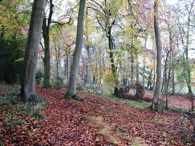
Show on map Photos Longcroft Shaw woods in autumn
‹ ›
Weather for this location Next 14 days Nearby places Useful places within 5 km
All Historic
Own or manage this place?
Claim this listing to keep details accurate, add photos, and highlight what makes it special — free.
Claim this page→ How useful was the information on this page?
Something wrong on this page?
id: 2f814136-4e4b-4c48-98e9-6fac5a0008f2
UK green spaces mapped from open public data — so anyone can find the woodland, trail, or nature reserve closest to them.
© 2026 Glade · Made with care for UK green spaces
Muntiacus reevesi
Muntiacus reevesi
Roe Deer Capreolus capreolus2022
Roe Deer Capreolus capreolus2022
Yellow-necked Mouse Apodemus flavicollis2020
Yellow-necked Mouse Apodemus flavicollis2020
Badger Meles meles2022
Badger Meles meles2022 2019
2019
Holly Blue Celastrina argiolus2019
Holly Blue Celastrina argiolus2019
Painted Lady Vanessa cardui2019
Painted Lady Vanessa cardui2019
Peacock Aglais io2019
Peacock Aglais io2019
Small Tortoiseshell Aglais urticae2019
Small Tortoiseshell Aglais urticae2019
Green-veined White Pieris napi2019
Green-veined White Pieris napi2019
Silver-washed Fritillary Argynnis paphia2019
Silver-washed Fritillary Argynnis paphia2019
Gatekeeper Pyronia tithonus2019
Gatekeeper Pyronia tithonus2019
Large Skipper Ochlodes sylvanus2019
Large Skipper Ochlodes sylvanus2019
Orange-tip Anthocharis cardamines2019
Orange-tip Anthocharis cardamines2019
Feathered Cutter Incurvaria masculella2022
Feathered Cutter Incurvaria masculella2022
Speckled Wood Pararge aegeria2019
Speckled Wood Pararge aegeria2019
Marbled White Melanargia galathea2019
Marbled White Melanargia galathea2019
Ringlet Aphantopus hyperantus2019
Ringlet Aphantopus hyperantus2019
White Admiral Limenitis camilla2019
White Admiral Limenitis camilla2019
Small Copper Lycaena phlaeas2019
Small Copper Lycaena phlaeas2019
Silver Y Autographa gamma
Silver Y Autographa gamma
Red-legged Shieldbug Pentatoma rufipes2024
Red-legged Shieldbug Pentatoma rufipes2024
Dark Bush-cricket Pholidoptera griseoaptera2024
Dark Bush-cricket Pholidoptera griseoaptera2024
Red-headed Cardinal Beetle Pyrochroa serraticornis2022
Red-headed Cardinal Beetle Pyrochroa serraticornis2022
Grammoptera ruficornis Grammoptera ruficornis2022
Grammoptera ruficornis Grammoptera ruficornis2022
Common Blue Polyommatus icarus2019
Common Blue Polyommatus icarus2019
Brown Argus Aricia agestis2018
Brown Argus Aricia agestis2018
Black-headed Cardinal Beetle Pyrochroa coccinea2024
Black-headed Cardinal Beetle Pyrochroa coccinea2024
Cantharis decipiens Cantharis decipiens2024
Cantharis decipiens Cantharis decipiens2024
Humming-bird Hawk-moth Macroglossum stellatarum2023
Humming-bird Hawk-moth Macroglossum stellatarum2023
Mordellochroa abdominalis Mordellochroa abdominalis2022
Mordellochroa abdominalis Mordellochroa abdominalis2022
Speckled Bush-cricket Leptophyes punctatissima2022
Speckled Bush-cricket Leptophyes punctatissima2022
Common Oak Leaf-miner Phyllonorycter quercifoliella2022
Common Oak Leaf-miner Phyllonorycter quercifoliella2022
Parornix Parornix2022
Parornix Parornix2022
Common Oak Purple Dyseriocrania subpurpurella2022
Common Oak Purple Dyseriocrania subpurpurella2022
Alder Mandrel Monsoma pulveratum2022
Alder Mandrel Monsoma pulveratum2022
Larch Case-bearer Coleophora laricella2022
Larch Case-bearer Coleophora laricella2022
November Moth agg. Epirrita dilutata agg.2022
November Moth agg. Epirrita dilutata agg.2022
Coleophora Coleophora2022
Coleophora Coleophora2022
Honeysuckle Blotch-miner Perittia obscurepunctella2022
Honeysuckle Blotch-miner Perittia obscurepunctella2022
Beech Leaf-miner Phyllonorycter maestingella2022
Beech Leaf-miner Phyllonorycter maestingella2022
Oak Gall Moth Pammene argyrana2022
Oak Gall Moth Pammene argyrana2022
Common Case-bearer Coleophora serratella2022
Common Case-bearer Coleophora serratella2022
Golden Dot Stigmella aurella2022
Golden Dot Stigmella aurella2022
Nettle-Tap Anthophila fabriciana2022
Nettle-Tap Anthophila fabriciana2022
White Ermine Spilosoma lubricipeda2022
White Ermine Spilosoma lubricipeda2022
Horse-Chestnut Leaf-miner Cameraria ohridella2022
Horse-Chestnut Leaf-miner Cameraria ohridella2022
Box Tree Moth Cydalima perspectalis2021
Box Tree Moth Cydalima perspectalis2021
Black Clock Pterostichus madidus2020
Black Clock Pterostichus madidus2020
Abax parallelepipedus Abax parallelepipedus2020
Abax parallelepipedus Abax parallelepipedus2020
Atomaria testacea Atomaria testacea2020
Atomaria testacea Atomaria testacea2020
Acrossus rufipes Acrossus rufipes2020
Acrossus rufipes Acrossus rufipes2020
Acrotrichis grandicollis Acrotrichis grandicollis2020
Acrotrichis grandicollis Acrotrichis grandicollis2020
Ptenidium nitidum Ptenidium nitidum2020
Ptenidium nitidum Ptenidium nitidum2020
Violet Ground Beetle Carabus violaceus2020
Violet Ground Beetle Carabus violaceus2020
Acrotrichis cognata Acrotrichis cognata2020
Acrotrichis cognata Acrotrichis cognata2020
Acupalpus parvulus Acupalpus parvulus2020
Acupalpus parvulus Acupalpus parvulus2020
Small Heath Coenonympha pamphilus2019
Small Heath Coenonympha pamphilus2019
Hornet Vespa crabro2018
Hornet Vespa crabro2018
Small Blue Cupido minimus2018
Small Blue Cupido minimus2018
Dark Green Fritillary Speyeria aglaja2018
Dark Green Fritillary Speyeria aglaja2018
White-letter Hairstreak Satyrium w-album2018
White-letter Hairstreak Satyrium w-album2018
Dingy Skipper Erynnis tages2018
Dingy Skipper Erynnis tages2018 Events & activities nearby Switch provider to compare local events, tours and bookable activities.
Bookable tours GetYourGuide Promote here