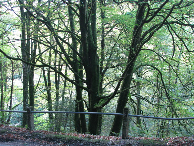
Looseall Plantation ✦ Ancient woodland 21 ha
🦉 Wildlife🦅 Birds🍂 Seasonal
↑ Share
Public access Free entry Dogs welcome 21 ha
Places › England › South West › Somerset Getting here
51.05416, -3.55642
Open directionsv Visiting this summer
Seasonal nature notes and what to look for now
▾ 🌞 Midsummer — early morning visits most comfortable; look for deer fawns in quieter clearings 🐕 Early mornings are best for dog walks in summer — visit before 9am to avoid the heat and find quieter trails 🅿️ Parking 67m away — 2 car parks within reach 🌤️ Visiting this summer
🌞 Midsummer — early morning visits most comfortable; look for deer fawns in quieter clearings 🐕 Early mornings are best for dog walks in summer — visit before 9am to avoid the heat and find quieter trails 🅿️ Parking 67m away — 2 car parks within reach £ Free to visit — no entry charge🐕 Dogs welcome🌿 Ancient woodland — rare wildlife habitat🦉 Wildlife
Very strong match
Multi-group wildlife — Amphibians, Birds, Mammals, Reptiles; Multi-group wildlife — Amphibians, Birds, Mammals, Reptiles
Free
🦅 Bird watching
Very strong match
Birds — Pied Flycatcher, Great Tit, Robin +68 more · last seen 2026; Birds — Pied Flycatcher, Great Tit, Robin +68 more · last seen 2026
Free
🍂 Seasonal nature
Strong match
Ancient woodland — bluebells, fungi and autumn colour; Plants — Himalayan Balsam, Japanese Knotweed, Montbretia +2 more · last seen 2022
Free
🦋 Insect spotting
Strong match
Insects — Anoplotrupes stercorosus, Marmalade Hoverfly, Beautiful Demoiselle +51 more · last seen 2025; Insects — Anoplotrupes stercorosus, Marmalade Hoverfly, Beautiful Demoiselle +51 more · last seen 2025
Free
Dogs allowed — public woodland
Free
Deciduous woodland — fungi, berries and wild garlic
Varies
Trails nearby Within roughly 5 km 2 signed routes nearby · 9 public paths nearby
Signed route nearby Public paths
Two Moors Way Walking route ▾
Named route Ref MW Listed length 166 Regional walking route
Show on map Exe Valley Way Walking route ▾
Named route Ref EVW Regional walking route
Show on map 11 signed routes nearby
Signed route nearby
Route 3 Cycling route 527.7 km ▾
Named route Ref 3 Length 527.7 km National Cycle Network
Show on map EuroVelo 1 - Atlantic Coast Route - part United Kingdom 2 Cycling route ▾
Named route Ref EV1 International cycle route
Show on map Main Route Cycling route 32.9 km ▾
Named route Ref 3 Length 32.9 km National Cycle Network On-road Surface asphalt
Show on map Main Route Cycling route 69 m ▾
Named route Ref 3 Length 69 m National Cycle Network On-road Surface asphalt
Show on map Main Route Cycling route 3.8 km ▾
Named route Ref 3 Length 3.8 km National Cycle Network On-road Surface asphalt
Show on map Main Route Cycling route 272 m ▾
Named route Ref 3 Length 272 m National Cycle Network On-road Surface asphalt
Show on map 9 public paths nearby
Public paths
Looseall Lane restricted byway · 806 m ▾
Public path restricted byway Length 806 m Incline steep Path type: track
Show on map Catford Lane restricted byway · 1.4 km ▾
Public path restricted byway Length 1.4 km Path type: track
Show on map ✦ Ancient woodland — continuously wooded since at least 1600 AD. A rare and irreplaceable habitat, rich in biodiversity and historical character.
Weather for this location Next 14 days Nearby places Useful places within 5 km
All Historic
Own or manage this place?
Claim this listing to keep details accurate, add photos, and highlight what makes it special — free.
Claim this page→ How useful was the information on this page?
Something wrong on this page?
id: 082fa2a0-ff9f-4db0-8f3c-d539049d779b
UK green spaces mapped from open public data — so anyone can find the woodland, trail, or nature reserve closest to them.
© 2026 Glade · Made with care for UK green spaces
Nyctalus noctula
Nyctalus noctula
Polecat Mustela putorius2016
Polecat Mustela putorius2016
Long-eared Bat species Plecotus2015
Long-eared Bat species Plecotus2015
Bat Chiroptera2014
Bat Chiroptera2014
Red Deer Cervus elaphus2014
Red Deer Cervus elaphus2014
Brown Hare Lepus europaeus2013
Brown Hare Lepus europaeus2013 2024
2024
Odontocerum albicorne Odontocerum albicorne
Odontocerum albicorne Odontocerum albicorne
Garden Chafer Phyllopertha horticola
Garden Chafer Phyllopertha horticola
Birch Shieldbug Elasmostethus interstinctus2024
Birch Shieldbug Elasmostethus interstinctus2024
Oak Bush-cricket Meconema thalassinum2024
Oak Bush-cricket Meconema thalassinum2024
Violet Ground Beetle Carabus violaceus2024
Violet Ground Beetle Carabus violaceus2024
Eupeodes corollae Eupeodes corollae2024
Eupeodes corollae Eupeodes corollae2024
Aphrophora alni Aphrophora alni2024
Aphrophora alni Aphrophora alni2024
Sericomyia superbiens Sericomyia superbiens2024
Sericomyia superbiens Sericomyia superbiens2024
Eristalis Eristalis2024
Eristalis Eristalis2024
Platycheirus scutatus Platycheirus scutatus2024
Platycheirus scutatus Platycheirus scutatus2024
Green Shieldbug Palomena prasina2024
Green Shieldbug Palomena prasina2024
Plagiognathus (Plagiognathus) arbustorum Plagiognathus (Plagiognathus) arbustorum2024
Plagiognathus (Plagiognathus) arbustorum Plagiognathus (Plagiognathus) arbustorum2024
Ecdyonurus Ecdyonurus2024
Ecdyonurus Ecdyonurus2024
Syritta pipiens Syritta pipiens2024
Syritta pipiens Syritta pipiens2024
Leucozona glaucia Leucozona glaucia2023
Leucozona glaucia Leucozona glaucia2023
Syrphus Syrphus2023
Syrphus Syrphus2023
Orange Ladybird Halyzia sedecimguttata2023
Orange Ladybird Halyzia sedecimguttata2023
Field Grasshopper Chorthippus brunneus2023
Field Grasshopper Chorthippus brunneus2023
Volucella pellucens Volucella pellucens2023
Volucella pellucens Volucella pellucens2023
Rhagium mordax Rhagium mordax2023
Rhagium mordax Rhagium mordax2023
Xylota segnis Xylota segnis2023
Xylota segnis Xylota segnis2023
Myopa testacea Myopa testacea2023
Myopa testacea Myopa testacea2023
Tipula vittata Tipula vittata2023
Tipula vittata Tipula vittata2023
Dark-edged Bee-fly Bombylius major2023
Dark-edged Bee-fly Bombylius major2023
Violet Oil-beetle Meloe violaceus2022
Violet Oil-beetle Meloe violaceus2022
Band-eyed Brown Horsefly Tabanus bromius2021
Band-eyed Brown Horsefly Tabanus bromius2021
Lily Beetle Lilioceris lilii2018
Lily Beetle Lilioceris lilii2018
Orange-tip Anthocharis cardamines2015
Orange-tip Anthocharis cardamines2015
Orange-tailed Mining Bee Andrena haemorrhoa2015
Orange-tailed Mining Bee Andrena haemorrhoa2015
Tree Bumblebee Bombus hypnorum2014
Tree Bumblebee Bombus hypnorum2014
Silver-washed Fritillary Argynnis paphia2013
Silver-washed Fritillary Argynnis paphia2013
Speckled Wood Pararge aegeria2013
Speckled Wood Pararge aegeria2013
Green-veined White Pieris napi2013
Green-veined White Pieris napi2013
Ringlet Aphantopus hyperantus2013
Ringlet Aphantopus hyperantus2013 Silene dioica2022
Silene dioica2022
Common Nettle Urtica dioica2022
Common Nettle Urtica dioica2022
Bracken Pteridium aquilinum2022
Bracken Pteridium aquilinum2022
Rubus vestitus Rubus vestitus2017
Rubus vestitus Rubus vestitus2017
Opposite-leaved Golden-saxifrage Chrysosplenium oppositifolium2022
Opposite-leaved Golden-saxifrage Chrysosplenium oppositifolium2022
Hazel Corylus avellana2022
Hazel Corylus avellana2022
Broad Buckler-fern Dryopteris dilatata2022
Broad Buckler-fern Dryopteris dilatata2022
Scaly Male-fern Dryopteris affinis2022
Scaly Male-fern Dryopteris affinis2022
Ash Fraxinus excelsior2022
Ash Fraxinus excelsior2022
Hawthorn Crataegus monogyna2022
Hawthorn Crataegus monogyna2022
Creeping Buttercup Ranunculus repens2022
Creeping Buttercup Ranunculus repens2022
Cleavers Galium aparine2022
Cleavers Galium aparine2022
Common Sorrel Rumex acetosa2022
Common Sorrel Rumex acetosa2022
Intermediate Polypody Polypodium interjectum2022
Intermediate Polypody Polypodium interjectum2022
Soft-rush Juncus effusus2022
Soft-rush Juncus effusus2022
Montbretia Crocosmia aurea x pottsii = C. x crocosmiiflora2022
Montbretia Crocosmia aurea x pottsii = C. x crocosmiiflora2022
Herb-Robert Geranium robertianum2022
Herb-Robert Geranium robertianum2022
Germander Speedwell Veronica chamaedrys2022
Germander Speedwell Veronica chamaedrys2022
Wood Avens Geum urbanum2022
Wood Avens Geum urbanum2022
Dog's Mercury Mercurialis perennis2022
Dog's Mercury Mercurialis perennis2022
Remote Sedge Carex remota2022
Remote Sedge Carex remota2022
Dryopteris lacunosa Dryopteris lacunosa2021
Dryopteris lacunosa Dryopteris lacunosa2021
Bluebell Hyacinthoides non-scripta2017
Bluebell Hyacinthoides non-scripta2017
Rubus adscitus Rubus adscitus2012
Rubus adscitus Rubus adscitus2012
Daisy Bellis perennis
Daisy Bellis perennis
Greater Plantain Plantago major2022
Greater Plantain Plantago major2022
Soft Shield-fern Polystichum setiferum2022
Soft Shield-fern Polystichum setiferum2022
Annual Meadow-grass Poa annua2022
Annual Meadow-grass Poa annua2022
Rhododendron Rhododendron ponticum2022
Rhododendron Rhododendron ponticum2022
Cat's-ear Hypochaeris radicata2022
Cat's-ear Hypochaeris radicata2022
Rusty Willow Salix cinerea subsp. oleifolia2022
Rusty Willow Salix cinerea subsp. oleifolia2022
Wood Dock Rumex sanguineus2022
Wood Dock Rumex sanguineus2022
Creeping Thistle Cirsium arvense2022
Creeping Thistle Cirsium arvense2022
White Clover Trifolium repens2022
White Clover Trifolium repens2022
Hard-fern Blechnum spicant2022
Hard-fern Blechnum spicant2022
Primrose Primula vulgaris2022
Primrose Primula vulgaris2022
Hedera helix Hedera helix2022
Hedera helix Hedera helix2022
Pendulous Sedge Carex pendula2022
Pendulous Sedge Carex pendula2022
Elder Sambucus nigra2022
Elder Sambucus nigra2022
Pedunculate Oak Quercus robur2022
Pedunculate Oak Quercus robur2022
Cock's-foot Dactylis glomerata2022
Cock's-foot Dactylis glomerata2022
Broad-leaved Dock Rumex obtusifolius2022
Broad-leaved Dock Rumex obtusifolius2022
Holly Ilex aquifolium2022
Holly Ilex aquifolium2022
Common Water-starwort Callitriche stagnalis2022
Common Water-starwort Callitriche stagnalis2022
Brooklime Veronica beccabunga2022
Brooklime Veronica beccabunga2022
Ribwort Plantain Plantago lanceolata2022
Ribwort Plantain Plantago lanceolata2022
Wavy Bitter-cress Cardamine flexuosa2022
Wavy Bitter-cress Cardamine flexuosa2022
Male-fern Dryopteris filix-mas2022
Male-fern Dryopteris filix-mas2022
Blackthorn Prunus spinosa2022
Blackthorn Prunus spinosa2022
Navelwort Umbilicus rupestris2021
Navelwort Umbilicus rupestris2021
Hedge Woundwort Stachys sylvatica2021
Hedge Woundwort Stachys sylvatica2021
Field-rose Rosa arvensis2021
Field-rose Rosa arvensis2021
Pyrenean Valerian Valeriana pyrenaica2019
Pyrenean Valerian Valeriana pyrenaica2019
Lesser Stitchwort Stellaria graminea2017
Lesser Stitchwort Stellaria graminea2017
Rubus dasyphyllus Rubus dasyphyllus2017
Rubus dasyphyllus Rubus dasyphyllus2017
Wood Sage Teucrium scorodonia2017
Wood Sage Teucrium scorodonia2017
Cow Parsley Anthriscus sylvestris2017
Cow Parsley Anthriscus sylvestris2017
Hogweed Heracleum sphondylium2017
Hogweed Heracleum sphondylium2017
Spear Thistle Cirsium vulgare2017
Spear Thistle Cirsium vulgare2017
Raspberry Rubus idaeus2012
Raspberry Rubus idaeus2012
Rubus ulmifolius Rubus ulmifolius2012
Rubus ulmifolius Rubus ulmifolius2012
Rubus rubritinctus Rubus rubritinctus2012
Rubus rubritinctus Rubus rubritinctus2012
Groundsel Senecio vulgaris
Groundsel Senecio vulgaris
Oxeye Daisy Leucanthemum vulgare
Oxeye Daisy Leucanthemum vulgare
Shepherd's-purse Capsella bursa-pastoris
Shepherd's-purse Capsella bursa-pastoris
Sow Thistle Sonchus
Sow Thistle Sonchus
Welsh Poppy Papaver cambricum
Welsh Poppy Papaver cambricum
Petty Spurge Euphorbia peplus
Petty Spurge Euphorbia peplus
Ivy-leaved Toadflax Cymbalaria muralis
Ivy-leaved Toadflax Cymbalaria muralis
Lamiastrum galeobdolon subsp. montanum Lamiastrum galeobdolon subsp. montanum2022
Lamiastrum galeobdolon subsp. montanum Lamiastrum galeobdolon subsp. montanum2022
Rosa canina Rosa canina2022
Rosa canina Rosa canina2022
Common Chickweed Stellaria media2022
Common Chickweed Stellaria media2022
Rough Meadow-grass Poa trivialis2022
Rough Meadow-grass Poa trivialis2022
Common Marsh-bedstraw Galium palustre subsp. palustre2022
Common Marsh-bedstraw Galium palustre subsp. palustre2022
Reed Canary-grass Phalaris arundinacea2022
Reed Canary-grass Phalaris arundinacea2022
Great Wood-rush Luzula sylvatica2022
Great Wood-rush Luzula sylvatica2022
Lady-fern Athyrium filix-femina2022
Lady-fern Athyrium filix-femina2022
Sanicle Sanicula europaea2022
Sanicle Sanicula europaea2022
Sycamore Acer pseudoplatanus2022
Sycamore Acer pseudoplatanus2022
Barren Strawberry Potentilla sterilis2022
Barren Strawberry Potentilla sterilis2022
Hart's-Tongue Asplenium scolopendrium2022
Hart's-Tongue Asplenium scolopendrium2022
Selfheal Prunella vulgaris2022
Selfheal Prunella vulgaris2022
Sweet Chestnut Castanea sativa2022
Sweet Chestnut Castanea sativa2022
Common Dog-violet Viola riviniana2022
Common Dog-violet Viola riviniana2022
Slender Speedwell Veronica filiformis2022
Slender Speedwell Veronica filiformis2022
Alder Alnus glutinosa2022
Alder Alnus glutinosa2022
Jointed Rush Juncus articulatus2022
Jointed Rush Juncus articulatus2022
Ground-ivy Glechoma hederacea2022
Ground-ivy Glechoma hederacea2022
Hairy Wood-rush Luzula pilosa2021
Hairy Wood-rush Luzula pilosa2021
Horse-chestnut Aesculus hippocastanum2021
Horse-chestnut Aesculus hippocastanum2021
Asplenium trichomanes subsp. quadrivalens Asplenium trichomanes subsp. quadrivalens2021
Asplenium trichomanes subsp. quadrivalens Asplenium trichomanes subsp. quadrivalens2021
Dryopteris borreri Dryopteris borreri2021
Dryopteris borreri Dryopteris borreri2021
Pink Purslane Claytonia sibirica2020
Pink Purslane Claytonia sibirica2020
Double-toothed Dandelion Taraxacum duplidentifrons2019
Double-toothed Dandelion Taraxacum duplidentifrons2019
Lacerate-leaved Dandelion Taraxacum dilaceratum2019
Lacerate-leaved Dandelion Taraxacum dilaceratum2019
Gorse Ulex europaeus2019
Gorse Ulex europaeus2019
Rubus dentatifolius Rubus dentatifolius2017
Rubus dentatifolius Rubus dentatifolius2017
Cirsium arvense x palustre = C. x celakovskianum Cirsium arvense x palustre = C. x celakovskianum2017
Cirsium arvense x palustre = C. x celakovskianum Cirsium arvense x palustre = C. x celakovskianum2017
Rosebay Willowherb Chamaenerion angustifolium2017
Rosebay Willowherb Chamaenerion angustifolium2017
Tormentil Potentilla erecta2017
Tormentil Potentilla erecta2017
Bilberry Vaccinium myrtillus2017
Bilberry Vaccinium myrtillus2017
Bog Pondweed Potamogeton polygonifolius2017
Bog Pondweed Potamogeton polygonifolius2017
Yarrow Achillea millefolium2017
Yarrow Achillea millefolium2017
Common Bird's-foot-trefoil Lotus corniculatus2017
Common Bird's-foot-trefoil Lotus corniculatus2017
Floating Sweet-grass Glyceria fluitans2017
Floating Sweet-grass Glyceria fluitans2017
Heath Bedstraw Galium saxatile2017
Heath Bedstraw Galium saxatile2017
Yorkshire-fog Holcus lanatus2017
Yorkshire-fog Holcus lanatus2017
Heather Calluna vulgaris2017
Heather Calluna vulgaris2017
Marsh Thistle Cirsium palustre2017
Marsh Thistle Cirsium palustre2017
Water Figwort Scrophularia auriculata2017
Water Figwort Scrophularia auriculata2017
Bog Stitchwort Stellaria alsine2017
Bog Stitchwort Stellaria alsine2017
Fool's Water-Cress Helosciadium nodiflorum2017
Fool's Water-Cress Helosciadium nodiflorum2017
Short-fruited Willowherb Epilobium obscurum2017
Short-fruited Willowherb Epilobium obscurum2017
Italian Rye-grass Lolium multiflorum2017
Italian Rye-grass Lolium multiflorum2017
Greater Stitchwort Stellaria holostea2017
Greater Stitchwort Stellaria holostea2017
Pignut Conopodium majus2017
Pignut Conopodium majus2017
Nipplewort Lapsana communis2017
Nipplewort Lapsana communis2017
Foxglove Digitalis purpurea2017
Foxglove Digitalis purpurea2017
Common Figwort Scrophularia nodosa2017
Common Figwort Scrophularia nodosa2017
Wild Strawberry Fragaria vesca2017
Wild Strawberry Fragaria vesca2017
Greater Butterfly-orchid Platanthera chlorantha2017
Greater Butterfly-orchid Platanthera chlorantha2017
Black Spleenwort Asplenium adiantum-nigrum2017
Black Spleenwort Asplenium adiantum-nigrum2017
Downy Birch Betula pubescens2017
Downy Birch Betula pubescens2017
Bush Vetch Vicia sepium2017
Bush Vetch Vicia sepium2017
Common Mouse-ear Cerastium fontanum2017
Common Mouse-ear Cerastium fontanum2017
Honeysuckle Lonicera periclymenum2017
Honeysuckle Lonicera periclymenum2017
Wild Angelica Angelica sylvestris2017
Wild Angelica Angelica sylvestris2017
False Oat-grass Arrhenatherum elatius2017
False Oat-grass Arrhenatherum elatius2017
Greater Bird's-foot-trefoil Lotus pedunculatus2017
Greater Bird's-foot-trefoil Lotus pedunculatus2017
Sweet Vernal-grass Anthoxanthum odoratum2017
Sweet Vernal-grass Anthoxanthum odoratum2017
Toad Rush Juncus bufonius2017
Toad Rush Juncus bufonius2017
Garden Lady's-mantle Alchemilla mollis2017
Garden Lady's-mantle Alchemilla mollis2017
Crested Dog's-tail Cynosurus cristatus2017
Crested Dog's-tail Cynosurus cristatus2017
Perennial Rye-grass Lolium perenne2017
Perennial Rye-grass Lolium perenne2017
Sheep's Sorrel Rumex acetosella2017
Sheep's Sorrel Rumex acetosella2017
Centaurea nigra Centaurea nigra2017
Centaurea nigra Centaurea nigra2017
Marsh-bedstraw Galium palustre2017
Marsh-bedstraw Galium palustre2017
Dog-rose Rosa canina2017
Dog-rose Rosa canina2017
Field Wood-rush Luzula campestris2017
Field Wood-rush Luzula campestris2017
Guelder-rose Viburnum opulus2017
Guelder-rose Viburnum opulus2017
Thyme-leaved Speedwell Veronica serpyllifolia2017
Thyme-leaved Speedwell Veronica serpyllifolia2017
Slender St John's-wort Hypericum pulchrum2017
Slender St John's-wort Hypericum pulchrum2017
Broad-leaved Willowherb Epilobium montanum2017
Broad-leaved Willowherb Epilobium montanum2017
Ragged-Robin Silene flos-cuculi2017
Ragged-Robin Silene flos-cuculi2017
Ivy Hedera helix2017
Ivy Hedera helix2017
Marklund's Dandelion Taraxacum marklundii2017
Marklund's Dandelion Taraxacum marklundii2017
daffodils Narcissus2017
daffodils Narcissus2017
Snowdrop Galanthus nivalis2016
Snowdrop Galanthus nivalis2016
Rubus troiensis Rubus troiensis2012
Rubus troiensis Rubus troiensis2012
Rubus scissus Rubus scissus2012
Rubus scissus Rubus scissus2012
Rubus nessensis Rubus nessensis2012
Rubus nessensis Rubus nessensis2012
Rubus leyanus Rubus leyanus2012
Rubus leyanus Rubus leyanus2012
Rubus botryeros Rubus botryeros2012
Rubus botryeros Rubus botryeros2012
Rubus hylocharis Rubus hylocharis2012
Rubus hylocharis Rubus hylocharis2012 Events & activities nearby Switch provider to compare local events, tours and bookable activities.
Bookable tours GetYourGuide Promote here