Lower Barn Plantation 20 ha
🦉 Wildlife🦅 Birds🦋 Insects
↑ Share
Free entry Dogs welcome 20 ha
Places › England › South West › Dorset Getting here
50.93815, -2.17588
Open directionsv Visiting this summer
Seasonal nature notes and what to look for now
▾ 🌞 Midsummer — early morning visits most comfortable; look for deer fawns in quieter clearings 🌿 Foraging is at its best in summer here 🐕 Dogs welcome — bring water in summer; the site has enough space to find shade on hot days 🌤️ Visiting this summer
🌞 Midsummer — early morning visits most comfortable; look for deer fawns in quieter clearings 🌿 Foraging is at its best in summer here 🐕 Dogs welcome — bring water in summer; the site has enough space to find shade on hot days £ Free to visit — no entry charge🐕 Dogs welcome🦉 Wildlife
Very strong match
Multi-group wildlife — Amphibians, Birds, Mammals; Multi-group wildlife — Amphibians, Birds, Mammals
Free
🦅 Bird watching
Strong match
Birds — Mute Swan, Mallard, Moorhen +38 more · last seen 2025; Birds — Mute Swan, Mallard, Moorhen +38 more · last seen 2025
Free
🦋 Insect spotting
Strong match
Insects — Meadow Brown, Speckled Wood, Brimstone +69 more · last seen 2026; Insects — Meadow Brown, Speckled Wood, Brimstone +69 more · last seen 2026
Free
Deciduous woodland — fungi, berries and wild garlic
Varies
🍂 Seasonal nature
Good match
Plants — Crescent-cup Liverwort, Schreber's Forklet-moss, Field Forklet-moss · last seen 2023; Plants — Crescent-cup Liverwort, Schreber's Forklet-moss, Field Forklet-moss · last seen 2023
Free
🌲 Forest walks
Moderate match
Public woodland
Free
Trails nearby Within roughly 5 km 7 signed routes nearby
Signed route nearby
Fontmell Down walk, Fontmell and Melbury Downs Walking route 1.6 km ▾
The down has open access, so you can explore the whole area. The well-used paths and tracks include steep slopes, with uneven surfaces which become muddy and slippery after wet weather.
Named route Length 1.6 km Duration 00:45 Round trip Local walking route
Show on map Melbury Beacon walk, Fontmell and Melbury Downs Walking route 3.7 km ▾
The down has open access, so you can explore the whole area. The well-used paths and tracks include steep slopes, with uneven surfaces that become muddy and slippery after wet weather. Dogs are welcome under close control, as livestock grazes the down.
Named route Length 3.7 km Duration 01:30 Round trip Local walking route
Show on map Hod Hill circular walk, Hod Hill Walking route 1.6 km ▾
Hod Hill is a steep climb to the ramparts of the hillfort, followed by a moderately level walk.
Named route Length 1.6 km Duration 00:45 Round trip Local walking route
Show on map Hod Hill butterfly walk, Hod Hill Walking route 1.6 km ▾
Easiest approach involves one steep slope, alternative approach is gentler but longer. Site itself is level but uneven with little mud. Dogs welcome, but cattle are on the hill in summer and sheep in winter.
Named route Length 1.6 km Duration 00:45 Round trip
Show on map Wessex Ridgeway Walking route ▾
Named route Ref WR Regional walking route
Show on map 22 signed routes nearby
Signed route nearby
Route 25 Cycling route ▾
Named route Ref 25 National Cycle Network
Show on map National Byway Cycling route ▾
Named route Ref NB Regional cycle route
Show on map North Dorset Trailway Cycling route ▾
Named route Local cycle route
Show on map North Dorset Cycle Way Cycling route ▾
Named route Regional cycle route
Show on map National Byway Dorset Loop Cycling route ▾
Named route Ref NB Loop Local cycle route
Show on map Main Route Cycling route 47 m ▾
Named route Ref 25 Length 47 m National Cycle Network On-road Surface asphalt
Show on map 1 signed route nearby
Signed route nearby
Wessex Ridgeway Trail Mountain bike route ▾
Named route Listed length 207km
Show on map 1 public path nearby
Public paths
No named routes yet. Public paths are shown on the map.
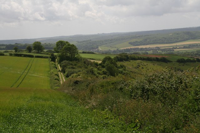
Photos Track to Satan's Square Plantation
‹ ›
Weather for this location Next 14 days Nearby places Useful places within 5 km
All Historic
Own or manage this place?
Claim this listing to keep details accurate, add photos, and highlight what makes it special — free.
Claim this page→ How useful was the information on this page?
Something wrong on this page?
id: 2dc6e034-daf6-4c2c-a2a3-f18c8d5630b8
UK green spaces mapped from open public data — so anyone can find the woodland, trail, or nature reserve closest to them.
© 2026 Glade · Made with care for UK green spaces
Wildlife to spot
13,950 records · National Biodiversity Network
▾
Wildlife to spot 13,950 records · National Biodiversity Network 🐦 Birds 39 species
winter spring
2025 ▾
Red Kite · Mute Swan · Mallard · Moorhen · Canada Goose +34
Red Kite Milvus milvus2024 Mute Swan Cygnus olor2024 Mallard Anas platyrhynchos2024 Moorhen Gallinula chloropus2024 Canada Goose Branta canadensis2024 Tufted Duck Aythya fuligula2024 Woodpigeon Columba palumbus Tawny Owl Strix aluco2024 Greenfinch Chloris chloris2024 Yellowhammer Emberiza citrinella2024 Gadwall Mareca strepera2023 Swift Apus apus2021 Barn Owl Tyto alba Buzzard Buteo buteo Bullfinch Pyrrhula pyrrhula Sparrowhawk Accipiter nisus2024 Firecrest Regulus ignicapilla2024 Wheatear Oenanthe oenanthe2023 Teal Anas crecca2023 Blackcap Sylvia atricapilla2023 Green Woodpecker Picus viridis2023 Long-tailed Tit Aegithalos caudatus2023 Fieldfare Turdus pilaris2023 Goldcrest Regulus regulus2023 Blue Tit Cyanistes caeruleus2023 Great Tit Parus major2023 Carrion Crow Corvus corone2023 Blackbird Turdus merula2023 Chaffinch Fringilla coelebs2023 Wren Troglodytes troglodytes2023 Nuthatch Sitta europaea2023 Treecreeper Certhia familiaris2023 Robin Erithacus rubecula2023 White-tailed Eagle Haliaeetus albicilla2022 Chiffchaff Phylloscopus collybita2021 Goldfinch Carduelis carduelis2021 Collared Dove Streptopelia decaocto2021 Stonechat Saxicola rubicola2021 Siskin Spinus spinus2021 Hedgehog · Rabbit · Brown Rat · Mole · Brown Hare +3
Hedgehog Erinaceus europaeus2022 Rabbit Oryctolagus cuniculus Brown Rat Rattus norvegicus2022 Mole Talpa europaea2022 Brown Hare Lepus europaeus2022 Bank Vole Myodes glareolus2022 🐸 Amphibians 1 species
winter spring
2024 ▾
Common Frog
Common Frog Rana temporaria Meadow Brown · Speckled Wood · Brimstone · Red Admiral · Large White +59
Meadow Brown Maniola jurtina2024 Speckled Wood Pararge aegeria2024 Brimstone Gonepteryx rhamni2024 Red Admiral Vanessa atalanta2024 Large White Pieris brassicae2024 Gatekeeper Pyronia tithonus Mistletoe · Ribwort Plantain · Cowslip · Cock's-foot · Salad Burnet +66
Mistletoe Viscum album2022 Ribwort Plantain Plantago lanceolata2022 Cowslip Primula veris2021 Cock's-foot Dactylis glomerata2022 Salad Burnet Poterium sanguisorba2021 Rough Hawkbit Leontodon hispidus Species observations from the last 10 years via NBN Atlas
Red Fox Vulpes vulpes2022
Red Fox Vulpes vulpes2022
Polecat Mustela putorius2022
Polecat Mustela putorius2022 2024
2024
Small White Pieris rapae2024
Small White Pieris rapae2024
Common Blue Polyommatus icarus2024
Common Blue Polyommatus icarus2024
Ringlet Aphantopus hyperantus2024
Ringlet Aphantopus hyperantus2024
Marbled White Melanargia galathea2024
Marbled White Melanargia galathea2024
Holly Blue Celastrina argiolus2024
Holly Blue Celastrina argiolus2024
Peacock Aglais io2024
Peacock Aglais io2024
Small Skipper Thymelicus sylvestris2024
Small Skipper Thymelicus sylvestris2024
Orange-tip Anthocharis cardamines2024
Orange-tip Anthocharis cardamines2024
Green-veined White Pieris napi2024
Green-veined White Pieris napi2024
Painted Lady Vanessa cardui2024
Painted Lady Vanessa cardui2024
Dark Green Fritillary Speyeria aglaja2024
Dark Green Fritillary Speyeria aglaja2024
Small Tortoiseshell Aglais urticae2023
Small Tortoiseshell Aglais urticae2023
Large Skipper Ochlodes sylvanus2024
Large Skipper Ochlodes sylvanus2024
Dark-edged Bee-fly Bombylius major
Dark-edged Bee-fly Bombylius major
Dotted Bee-fly Bombylius discolor2025
Dotted Bee-fly Bombylius discolor2025
Comma Polygonia c-album2024
Comma Polygonia c-album2024
Small Copper Lycaena phlaeas2023
Small Copper Lycaena phlaeas2023
Dingy Skipper Erynnis tages2024
Dingy Skipper Erynnis tages2024
Brown Argus Aricia agestis2023
Brown Argus Aricia agestis2023
Conops quadrifasciatus Conops quadrifasciatus2024
Conops quadrifasciatus Conops quadrifasciatus2024
Green Hairstreak Callophrys rubi2024
Green Hairstreak Callophrys rubi2024
Downland Villa Villa cingulata2025
Downland Villa Villa cingulata2025
Four-barred Major Oxycera rara2025
Four-barred Major Oxycera rara2025
Southern Hawker Aeshna cyanea2025
Southern Hawker Aeshna cyanea2025
Common Darter Sympetrum striolatum2025
Common Darter Sympetrum striolatum2025
Black Snipefly Chrysopilus cristatus2025
Black Snipefly Chrysopilus cristatus2025
Golden-ringed Dragonfly Cordulegaster boltonii2024
Golden-ringed Dragonfly Cordulegaster boltonii2024
Grizzled Skipper Pyrgus malvae2023
Grizzled Skipper Pyrgus malvae2023
Black Oil-beetle Meloe proscarabaeus2023
Black Oil-beetle Meloe proscarabaeus2023
Locust Blowfly Stomorhina lunata2023
Locust Blowfly Stomorhina lunata2023
Tachina fera Tachina fera2023
Tachina fera Tachina fera2023
Small Heath Coenonympha pamphilus2023
Small Heath Coenonympha pamphilus2023
Oil Beetle Meloe2023
Oil Beetle Meloe2023
Cordyla crassicornis Cordyla crassicornis2021
Cordyla crassicornis Cordyla crassicornis2021
Emperor Dragonfly Anax imperator2025
Emperor Dragonfly Anax imperator2025
Simulium Simulium2024
Simulium Simulium2024
Thecophora atra Thecophora atra2024
Thecophora atra Thecophora atra2024
Anthomyia Anthomyia2024
Anthomyia Anthomyia2024
Broad-bodied Chaser Libellula depressa2024
Broad-bodied Chaser Libellula depressa2024
Sepsis Sepsis2023
Sepsis Sepsis2023
Sicus ferrugineus Sicus ferrugineus2023
Sicus ferrugineus Sicus ferrugineus2023
Black-horned Gem Microchrysa polita2023
Black-horned Gem Microchrysa polita2023
Tawny Mining Bee Andrena fulva2023
Tawny Mining Bee Andrena fulva2023
Twin-spot Centurion Sargus bipunctatus2022
Twin-spot Centurion Sargus bipunctatus2022
Hill Cuckoo Bee Bombus rupestris2022
Hill Cuckoo Bee Bombus rupestris2022
Lonchaea Lonchaea2022
Lonchaea Lonchaea2022
Clouded Yellow Colias croceus2022
Clouded Yellow Colias croceus2022
Ectemnius Ectemnius2022
Ectemnius Ectemnius2022
Tipula maxima Tipula maxima2022
Tipula maxima Tipula maxima2022
Phasia pusilla Phasia pusilla2022
Phasia pusilla Phasia pusilla2022
Anthomyia pluvialis Anthomyia pluvialis2022
Anthomyia pluvialis Anthomyia pluvialis2022
Ashy Mining Bee Andrena cineraria2022
Ashy Mining Bee Andrena cineraria2022
Orange Ladybird Halyzia sedecimguttata2022
Orange Ladybird Halyzia sedecimguttata2022
Oedemera femoralis Oedemera femoralis2022
Oedemera femoralis Oedemera femoralis2022
Leopoldius calceatus Leopoldius calceatus2021
Leopoldius calceatus Leopoldius calceatus2021
Golden-haired Robberfly Choerades marginatus2021
Golden-haired Robberfly Choerades marginatus2021
Common Burying Beetle Nicrophorus vespillo2021
Common Burying Beetle Nicrophorus vespillo2021
Essex Skipper Thymelicus lineola2021
Essex Skipper Thymelicus lineola2021 2021
2021
Red Fescue Festuca rubra2022
Red Fescue Festuca rubra2022
Dandelion Taraxacum2022
Dandelion Taraxacum2022
Meadow Oat Helictochloa pratensis2021
Meadow Oat Helictochloa pratensis2021
Red Clover Trifolium pratense2022
Red Clover Trifolium pratense2022
Germander Speedwell Veronica chamaedrys2022
Germander Speedwell Veronica chamaedrys2022
Meadow Buttercup Ranunculus acris2022
Meadow Buttercup Ranunculus acris2022
Yorkshire-fog Holcus lanatus2022
Yorkshire-fog Holcus lanatus2022
Sweet Vernal-grass Anthoxanthum odoratum2021
Sweet Vernal-grass Anthoxanthum odoratum2021
Quaking-grass Briza media2021
Quaking-grass Briza media2021
Bulbous Buttercup Ranunculus bulbosus2021
Bulbous Buttercup Ranunculus bulbosus2021
Creeping Bent Agrostis stolonifera2021
Creeping Bent Agrostis stolonifera2021
Common Ragwort Jacobaea vulgaris2021
Common Ragwort Jacobaea vulgaris2021
Common Bird's-foot-trefoil Lotus corniculatus2021
Common Bird's-foot-trefoil Lotus corniculatus2021
Glaucous Sedge Carex flacca2021
Glaucous Sedge Carex flacca2021
Yellow-rattle Rhinanthus minor2021
Yellow-rattle Rhinanthus minor2021
False Oat-grass Arrhenatherum elatius2022
False Oat-grass Arrhenatherum elatius2022
Centaurea nigra Centaurea nigra2022
Centaurea nigra Centaurea nigra2022
Crested Hair-grass Koeleria macrantha2021
Crested Hair-grass Koeleria macrantha2021
Common Spotted-orchid Dactylorhiza fuchsii2021
Common Spotted-orchid Dactylorhiza fuchsii2021
Selfheal Prunella vulgaris2021
Selfheal Prunella vulgaris2021
Fairy Flax Linum catharticum2021
Fairy Flax Linum catharticum2021
Meadow Vetchling Lathyrus pratensis2021
Meadow Vetchling Lathyrus pratensis2021
Lady's Bedstraw Galium verum2021
Lady's Bedstraw Galium verum2021
Perennial Rye-grass Lolium perenne2022
Perennial Rye-grass Lolium perenne2022
Cut-leaved Crane's-bill Geranium dissectum2022
Cut-leaved Crane's-bill Geranium dissectum2022
Ash Fraxinus excelsior2022
Ash Fraxinus excelsior2022
Sheep's-fescue Festuca ovina2021
Sheep's-fescue Festuca ovina2021
White Clover Trifolium repens2021
White Clover Trifolium repens2021
Yellow Oat-grass Trisetum flavescens2021
Yellow Oat-grass Trisetum flavescens2021
Common Sorrel Rumex acetosa2021
Common Sorrel Rumex acetosa2021
Black Medick Medicago lupulina2021
Black Medick Medicago lupulina2021
Field Wood-rush Luzula campestris2021
Field Wood-rush Luzula campestris2021
Tuberous Comfrey Symphytum tuberosum
Tuberous Comfrey Symphytum tuberosum
Trifolium incarnatum Trifolium incarnatum2023
Trifolium incarnatum Trifolium incarnatum2023
Crescent-cup Liverwort Lunularia cruciata2023
Crescent-cup Liverwort Lunularia cruciata2023
Sheep's Sorrel Rumex acetosella2022
Sheep's Sorrel Rumex acetosella2022
Curled Dock Rumex crispus2022
Curled Dock Rumex crispus2022
Blackthorn Prunus spinosa2022
Blackthorn Prunus spinosa2022
Cleavers Galium aparine2022
Cleavers Galium aparine2022
Red Campion Silene dioica2022
Red Campion Silene dioica2022
Cat's-ear Hypochaeris radicata2022
Cat's-ear Hypochaeris radicata2022
Bugle Ajuga reptans2022
Bugle Ajuga reptans2022
Lesser Stitchwort Stellaria graminea2022
Lesser Stitchwort Stellaria graminea2022
Hogweed Heracleum sphondylium2022
Hogweed Heracleum sphondylium2022
Meadow Foxtail Alopecurus pratensis2022
Meadow Foxtail Alopecurus pratensis2022
Yarrow Achillea millefolium2022
Yarrow Achillea millefolium2022
Elder Sambucus nigra2022
Elder Sambucus nigra2022
Hazel Corylus avellana2022
Hazel Corylus avellana2022
Hawthorn Crataegus monogyna2022
Hawthorn Crataegus monogyna2022
Bramble Rubus fruticosus2022
Bramble Rubus fruticosus2022
Dog-rose Rosa canina2022
Dog-rose Rosa canina2022
Common Chickweed Stellaria media2022
Common Chickweed Stellaria media2022
Field Maple Acer campestre2022
Field Maple Acer campestre2022
Common Nettle Urtica dioica2022
Common Nettle Urtica dioica2022
Dwarf Thistle Cirsium acaule2021
Dwarf Thistle Cirsium acaule2021
Pyramidal Orchid Anacamptis pyramidalis2021
Pyramidal Orchid Anacamptis pyramidalis2021
Squinancywort Asperula cynanchica2021
Squinancywort Asperula cynanchica2021
Mouse-ear-hawkweed Pilosella officinarum2021
Mouse-ear-hawkweed Pilosella officinarum2021
Smaller Cat's-tail Phleum bertolonii2021
Smaller Cat's-tail Phleum bertolonii2021
Horseshoe Vetch Hippocrepis comosa2021
Horseshoe Vetch Hippocrepis comosa2021
Rough Meadow-grass Poa trivialis2021
Rough Meadow-grass Poa trivialis2021
Crested Dog's-tail Cynosurus cristatus2021
Crested Dog's-tail Cynosurus cristatus2021
Hoary Plantain Plantago media2021
Hoary Plantain Plantago media2021
Field Forklet-moss Dicranella staphylina2021
Field Forklet-moss Dicranella staphylina2021
Schreber's Forklet-moss Dicranella schreberiana2021
Schreber's Forklet-moss Dicranella schreberiana2021 Events & activities nearby Switch provider to compare local events, tours and bookable activities.
Bookable tours GetYourGuide Promote here