Plan your visit
Getting here
51.81763, -0.21605
Visiting this summer
Seasonal nature notes and what to look for now
Visiting this summer
Seasonal nature notes and what to look for now
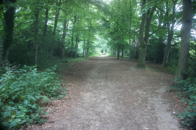
- ☀️June — canopy now fully closed, creating cool dappled shade even on warm days
- 🌿Foraging is at its best in summer here
- 🐕Dogs welcome — bring water in summer; the site has enough space to find shade on hot days
🌤️ Visiting this summer
- ☀️June — canopy now fully closed, creating cool dappled shade even on warm days
- 🌿Foraging is at its best in summer here
- 🐕Dogs welcome — bring water in summer; the site has enough space to find shade on hot days
Good to know
- £Free to visit — no entry charge
- 🐕Dogs welcome
Best for
Wildlife
Very strong match
Multi-group wildlife — Amphibians, Birds, Mammals, Reptiles; Multi-group wildlife — Amphibians, Birds, Mammals, Reptiles
Bird watching
Very strong match
Birds — Jackdaw, Woodpigeon, Magpie +68 more · last seen 2026; Birds — Jackdaw, Woodpigeon, Magpie +68 more · last seen 2026
Foraging
Strong match
Plants — Dandelion, Common Sorrel, Rough Hawkbit +10 more foraging species; Deciduous woodland — fungi, berries and wild garlic
Seasonal nature
Strong match
Plants — Yorkshire-fog, Cock's-foot, Red Fescue +64 more · last seen 2026; Plants — Yorkshire-fog, Cock's-foot, Red Fescue +64 more · last seen 2026
Dog walks
Strong match
Dogs allowed — public woodland
Insect spotting
Strong match
Insects — Large Red Damselfly, Banded Demoiselle, Azure Damselfly +33 more · last seen 2026; Insects — Large Red Damselfly, Banded Demoiselle, Azure Damselfly +33 more · last seen 2026
Trails nearby
Within roughly 5 km🚶Walking
14 signed routes nearby · 28 public paths nearby
Signed route nearbyPublic paths
Walking
Old Railway & River LeaWalking route7.9 km
After a brief visit to the remains of Wheathampstead railway station, the walk follows the Ayot Greenway (route of the Permanent Way) to Ayot Green. The return journey follows the course of the River Lea.
Lea Valley WalkWalking route
Wheathampstead to Shaw's Corner Circular Walk, Shaw's CornerWalking route12.2 km
Mostly easy walking across established footpaths and fields. There are some steps along the route, and a steep gully at section 2. Assistance dogs only at Shaw's Corner.
Hertfordshire WayWalking route267 km
Long distance path
STOOP Link Path 4 - Stevenage Outer Orbital Path LinkWalking route
A link from Stevenage to the STOOP path (at approx 6 o'clock on clockface)
Monks Walkpublic footpath · 305 m
Monks Walkpublic footpath · 30 m
🚴Cycling
76 signed routes nearby
Signed route nearby
Cycling
Ayot GreenwayCycling route
Route 12Cycling route
Route 61Cycling route34 km
Route 61 travels from Maidenhead to Hatfield, Welwyn Garden City and Hertford before arriving near Hoddesdon.
NCN National Route 57Cycling route
Main RouteCycling route52 m
Main RouteCycling route53 m
🐴Horse riding
6 public paths nearby
Public paths
Horse riding
No named routes yet. Public paths are shown on the map.
Wildlife to spot
Photos
Weather for this location
Loading local forecast…
Nearby places
Useful places within 5 km
Own or manage this place?
Claim this listing to keep details accurate, add photos, and highlight what makes it special — free.
Claim this pageHow was your visit?
How useful was the information on this page?
id: 6fc3aa29-7110-46f2-b4db-3d95c43fb69d