Plan your visit
🦅Birds🦉Wildlife🐶Dogs
Public accessFree entryDogs welcome4 ha
Getting here
51.86313, -1.61521
Open directionsv
Visiting this summer
Seasonal nature notes and what to look for now
- 🐦76+ species recorded in this area — summer evenings are best for activity; watch for Barn Owl and Robin
- 🐕Early mornings are best for dog walks in summer — visit before 9am to avoid the heat and find quieter trails
- ☕Rise and Flour — makes this an easy full-day family visit without needing to pack food
🌤️ Visiting this summer
- 🐦76+ species recorded in this area — summer evenings are best for activity; watch for Barn Owl and Robin
- 🐕Early mornings are best for dog walks in summer — visit before 9am to avoid the heat and find quieter trails
- ☕Rise and Flour — makes this an easy full-day family visit without needing to pack food
- £Free to visit — no entry charge
- 🐕Dogs welcome
🦅Bird watching
Very strong match
Birds — Barn Owl, Robin, Blackbird +73 more · last seen 2026
Free
Mammals — Bat, Muntjac, Badger +11 more · last seen 2025
Free
Dogs allowed with public access
Free
🛝Family friendly
Strong match
café; Urban park — family destination
Free
🦋Insect spotting
Good match
Insects — Eristalis pertinax, Emperor Dragonfly, Harmonia axyridis form spectabilis · last seen 2024
Free
Urban park — open green space
Free
Trails nearby
Within roughly 5 km7 signed routes nearby · 2 public paths nearby
Signed route nearbyPublic paths
Oxfordshire WayWalking route110 km▾
a traverse of Oxfordshire from the Cotswolds to the Chilterns
Named routeRef OWLength 110 kmRegional walking route
Wychwood WayWalking route59.5 km▾
Named routeLength 59.5 kmRegional walking route
Diamond WayWalking route106 km▾
Named routeRef DIALength 106 kmRegional walking route
D'Arcy Dalton WayWalking route107 km▾
Follows roughly the western boundary of Oxfordshire in unspoilt countryside.
Named routeLength 107 kmRegional walking route
European walking route E2 west, UK, South East EnglandWalking route▾
Westroute: Stranraer (UK) - Birminhgham (UK) - Calais (FR) - Zoersel (BE) / Eastroute: Stranraer (UK) - Harwich (UK) - Rotterdam (NL) - Zoersel (BE) / Both Routes: Zoersel (BE) - Maastrich (NL) - Luxembourg (LUX) - Lake Geneva (CH) - Nice (FR)
Named routeRef E2International walking route
6 signed routes nearby
Signed route nearby
Cotswold Line Cycle RouteCycling route▾
Named routeRef 442National Cycle Network
Main RouteCycling route5.3 km▾
Named routeRef 442Length 5.3 kmNational Cycle NetworkOn-roadSurface asphalt
Main RouteCycling route46 m▾
Named routeRef 442Length 46 mNational Cycle NetworkOn-roadSurface asphalt
Main RouteCycling route2.3 km▾
Named routeRef 442Length 2.3 kmNational Cycle NetworkOn-roadSurface asphalt
Main RouteCycling route925 m▾
Named routeRef 442Length 925 mNational Cycle NetworkOn-roadSurface asphalt
Main RouteCycling route4.8 km▾
Named routeRef 442Length 4.8 kmNational Cycle NetworkOn-roadSurface asphalt
Photos
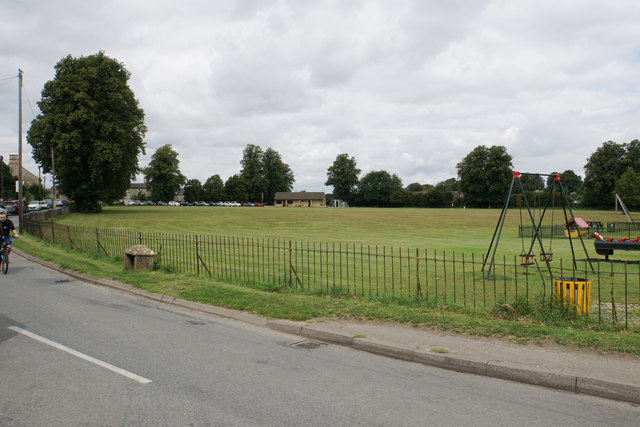
Recreation ground at Milton-under-Wychwood
Weather for this location
Next 14 daysNearby places
Useful places within 5 km
Events & activities nearby
Switch provider to compare local events, tours and bookable activities.
Wildlife to spot
9,596 records · National Biodiversity Network
Wildlife to spot
9,596 records · National Biodiversity Network🐦Birds52 species
springautumnwinter
2026▾
Barn Owl · Robin · Woodpigeon · Green Woodpecker · Wren +47
- Barn OwlTyto alba
- RobinErithacus rubecula
- WoodpigeonColumba palumbus2025
- Green WoodpeckerPicus viridis2025
- WrenTroglodytes troglodytes2025
- Blue TitCyanistes caeruleus2025
- BlackbirdTurdus merula2025
- MoorhenGallinula chloropus2025
- GoldfinchCarduelis carduelis2025
- Song ThrushTurdus philomelos2025
- PheasantPhasianus colchicus2025
- JackdawColoeus monedula2025
- ChaffinchFringilla coelebs2025
- KestrelFalco tinnunculus2025
- RedwingTurdus iliacus2025
- Great TitParus major2025
- MagpiePica pica2025
- BlackcapSylvia atricapilla2025
- YellowhammerEmberiza citrinella2025
- Collared DoveStreptopelia decaocto2025
- GoldcrestRegulus regulus2025
- Little OwlAthene noctua
- Carrion CrowCorvus corone2025
- Meadow PipitAnthus pratensis2025
- JayGarrulus glandarius2025
- RookCorvus frugilegus2025
- Great Spotted WoodpeckerDendrocopos major2025
- MallardAnas platyrhynchos2025
- SkylarkAlauda arvensis2025
- ChiffchaffPhylloscopus collybita2025
- GreenfinchChloris chloris2025
- Stock DoveColumba oenas2025
- SnipeGallinago gallinago2025
- FieldfareTurdus pilaris2025
- StarlingSturnus vulgaris2025
- LinnetLinaria cannabina2025
- Black-headed GullChroicocephalus ridibundus2025
- StonechatSaxicola rubicola2025
- DunnockPrunella modularis2025
- Coal TitPeriparus ater2025
- BramblingFringilla montifringilla2025
- BullfinchPyrrhula pyrrhula2025
- Tawny OwlStrix aluco2025
- Reed BuntingEmberiza schoeniclus2025
- RavenCorvus corax2025
- CrossbillLoxia curvirostra2025
- NuthatchSitta europaea2025
- Long-tailed TitAegithalos caudatus2025
- RedstartPhoenicurus phoenicurus2025
- Red-legged PartridgeAlectoris rufa2025
- WhitethroatCurruca communis2025
- SwiftApus apus2025
🦌Mammals11 species
springautumn
2025▾
Badger · Muntjac · Bat · Brown Hare · Red Fox +6
- BadgerMeles meles
- MuntjacMuntiacus reevesi
- BatChiroptera
- Brown HareLepus europaeus
- Red FoxVulpes vulpes
- Grey SquirrelSciurus carolinensis
- SquirrelSciurus
🐸Amphibians1 species
winter
2025▾
Frog
Species observations from the last 10 years via NBN Atlas